<< Our Photo Pages >> Gutter Tor South - Cist in England in Devon
Submitted by Anne T on Tuesday, 04 October 2016 Page Views: 1632
Neolithic and Bronze AgeSite Name: Gutter Tor South Alternative Name: Butler Gutter Tor 2; Grinsell Sheepstor 16; Dixon 2Country: England County: Devon Type: Cist
Nearest Town: Princetown Nearest Village: Sheepstor
Map Ref: SX5760966828
Latitude: 50.483919N Longitude: 4.008433W
Condition:
| 5 | Perfect |
| 4 | Almost Perfect |
| 3 | Reasonable but with some damage |
| 2 | Ruined but still recognisable as an ancient site |
| 1 | Pretty much destroyed, possibly visible as crop marks |
| 0 | No data. |
| -1 | Completely destroyed |
| 5 | Superb |
| 4 | Good |
| 3 | Ordinary |
| 2 | Not Good |
| 1 | Awful |
| 0 | No data. |
| 5 | Can be driven to, probably with disabled access |
| 4 | Short walk on a footpath |
| 3 | Requiring a bit more of a walk |
| 2 | A long walk |
| 1 | In the middle of nowhere, a nightmare to find |
| 0 | No data. |
| 5 | co-ordinates taken by GPS or official recorded co-ordinates |
| 4 | co-ordinates scaled from a detailed map |
| 3 | co-ordinates scaled from a bad map |
| 2 | co-ordinates of the nearest village |
| 1 | co-ordinates of the nearest town |
| 0 | no data |
Be the first person to rate this site - see the 'Contribute!' box in the right hand menu.
Internal Links:
External Links:
")
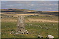
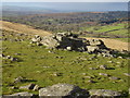
This site is featured on the Prehistoric Dartmoor Walks website which tells us that the Gutter Tor South Cist is "situated on the flat top of Gutter Tor at about 345m OD just on the north side of the crest of the hill. Two end stones and a side stone remain upright".
Further information can also be found on the Pastscape website, see Monument Number 438659, which tells us that "the slab flush with the ground on the east side may be a recumbent side stone. The height above ground is 0.4m. There is no trace of a cairn."
The Heritage Gateway for Devon & Dartmoor HER, HER number MDV3991, dates the site from the Early Neolithic to the Late Bronze Age (4000 BC to 701 BC).
See also the Portal's Gutter Tor North Cairn entry.
The cist is also scheduled as Historic England List Entry No. 1012472 (Cist south-west of Gutter Tor).
You may be viewing yesterday's version of this page. To see the most up to date information please register for a free account.
")
")
")
")
Do not use the above information on other web sites or publications without permission of the contributor.
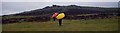
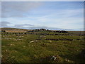
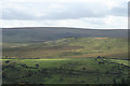
Nearby Images from Geograph Britain and Ireland:
©2008(licence)
©2011(licence)
©2011(licence)
©2009(licence)
©2011(licence)
The above images may not be of the site on this page, they are loaded from Geograph.
Please Submit an Image of this site or go out and take one for us!
Click here to see more info for this site
Nearby sites
Key: Red: member's photo, Blue: 3rd party photo, Yellow: other image, Green: no photo - please go there and take one, Grey: site destroyed
Download sites to:
KML (Google Earth)
GPX (GPS waypoints)
CSV (Garmin/Navman)
CSV (Excel)
To unlock full downloads you need to sign up as a Contributory Member. Otherwise downloads are limited to 50 sites.
Turn off the page maps and other distractions
Nearby sites listing. In the following links * = Image available
316m N 11° Gutter Tor north* Cairn (SX5767667137)
543m NNE 24° Gutter Tor Roundhouse* Ancient Village or Settlement (SX57846732)
926m N 8° Yellowmead ring cairn* Ring Cairn (SX57776774)
937m ENE 76° Whittenknowles Rocks* Ancient Village or Settlement (SX5852867024)
979m ESE 109° Eastern Tor settlement Ancient Village or Settlement (SX5852966487)
1.0km N 351° Yellowmead* Stone Circle (SX57486784)
1.0km N 351° Yellowmead row* Multiple Stone Rows / Avenue (SX5748267842)
1.0km N 354° Yellowmead cairn* Cairn (SX5753167863)
1.1km E 82° Drizzlecombe Brook* Marker Stone (SX5870966946)
1.3km S 184° Legis Tor East* Cairn (SX57496554)
1.4km S 180° Legis Tor Ossuary* Cist (SX5757365470)
1.4km SE 145° Ditsworthy Circle* Cairn (SX58376570)
1.4km WSW 240° Ringmoor Down Stone Row* Multiple Stone Rows / Avenue (SX56416617)
1.4km S 188° Legis Tor Cairns* Cist (SX57396548)
1.4km E 84° Drizzlecombe stone 4* Standing Stone (Menhir) (SX58996694)
1.4km E 92° Drizzlecombe cist 22* Cist (SX59036673)
1.4km E 87° Drizzlecombe menhir 1* Standing Stone (Menhir) (SX5905766860)
1.5km SW 222° Ringmoor Down Cairn 2* Cairn (SX56596576)
1.5km NE 45° Leeden (Sheepstor)* Cairn (SX5869267838)
1.5km NNE 13° Outholme Newtake* Cist (SX57996827)
1.5km E 83° Drizzlecombe menhir 3* Standing Stone (Menhir) (SX5913566986)
1.5km ENE 77° Drizzlecombe cairn 14* Cairn (SX5912767137)
1.6km E 84° Drizzlecombe row 1* Multiple Stone Rows / Avenue (SX5916166949)
1.6km E 84° Drizzlecombe cairn 1.* Cairn (SX5916866962)
1.6km E 84° Drizzlecombe Cist 6* Cairn (SX5918366955)
View more nearby sites and additional images


 We would like to know more about this location. Please feel free to add a brief description and any relevant information in your own language.
 Wir möchten mehr über diese Stätte erfahren. Bitte zögern Sie nicht, eine kurze Beschreibung und relevante Informationen in Deutsch hinzuzufügen.
 Nous aimerions en savoir encore un peu sur les lieux. S'il vous plaît n'hesitez pas à ajouter une courte description et tous les renseignements pertinents dans votre propre langue.
 Quisieramos informarnos un poco más de las lugares. No dude en añadir una breve descripción y otros datos relevantes en su propio idioma.