


<< Text Pages >> Erme Pound Cist - Cist in England in Devon
Submitted by Anne T on Sunday, 16 October 2016 Page Views: 1065
Neolithic and Bronze AgeSite Name: Erme Pound CistCountry: England County: Devon Type: Cist
Nearest Town: Princetown Nearest Village: Shipley Bridge / Harford
Map Ref: SX63926551
Latitude: 50.473573N Longitude: 3.919051W
Condition:
| 5 | Perfect |
| 4 | Almost Perfect |
| 3 | Reasonable but with some damage |
| 2 | Ruined but still recognisable as an ancient site |
| 1 | Pretty much destroyed, possibly visible as crop marks |
| 0 | No data. |
| -1 | Completely destroyed |
| 5 | Superb |
| 4 | Good |
| 3 | Ordinary |
| 2 | Not Good |
| 1 | Awful |
| 0 | No data. |
| 5 | Can be driven to, probably with disabled access |
| 4 | Short walk on a footpath |
| 3 | Requiring a bit more of a walk |
| 2 | A long walk |
| 1 | In the middle of nowhere, a nightmare to find |
| 0 | No data. |
| 5 | co-ordinates taken by GPS or official recorded co-ordinates |
| 4 | co-ordinates scaled from a detailed map |
| 3 | co-ordinates scaled from a bad map |
| 2 | co-ordinates of the nearest village |
| 1 | co-ordinates of the nearest town |
| 0 | no data |
Be the first person to rate this site - see the 'Contribute!' box in the right hand menu.
Internal Links:
External Links:
I have visited· I would like to visit
lauraaurora has visited here
Lying just over 220 metres to the south east of Erme Pound Settlement/Ancient Village, this site is featured on Prehistoric Dartmoor Walks as Erme Pound (Near) Cist. Their notes tell us: "noted by Hankin in July 1976, perhaps in a small cairn diameter 3.7m and height 0.3m. It is now filled in and Grinsell failed to locate it, 'it seems never to have been planned if it ever existed.'"
Pastscape Monument Number 441737 describes this site as an "alleged cist with possible cairn."
The Heritage Gateway for Devon & Dartmoor HER number MDV28585 dates the "cist(?) from the Early Neolithic to the Late Bronze Age (4000BC to 701BC)". This site, if it exists, is not scheduled.
Note: Have you visited this site? Can you give us further information to confirm exactly what exists at this grid location?
You may be viewing yesterday's version of this page. To see the most up to date information please register for a free account.
Do not use the above information on other web sites or publications without permission of the contributor.
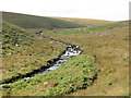
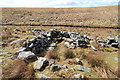
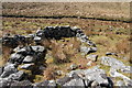
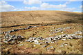
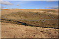
Nearby Images from Geograph Britain and Ireland:
©2014(licence)
©2013(licence)
©2013(licence)
©2013(licence)
©2009(licence)
The above images may not be of the site on this page, they are loaded from Geograph.
Please Submit an Image of this site or go out and take one for us!
Click here to see more info for this site
Nearby sites
Key: Red: member's photo, Blue: 3rd party photo, Yellow: other image, Green: no photo - please go there and take one, Grey: site destroyed
Download sites to:
KML (Google Earth)
GPX (GPS waypoints)
CSV (Garmin/Navman)
CSV (Excel)
To unlock full downloads you need to sign up as a Contributory Member. Otherwise downloads are limited to 50 sites.
Turn off the page maps and other distractions
Nearby sites listing. In the following links * = Image available
200m SE 125° Hook Lake Settlement* Ancient Village or Settlement (SX6408065390)
214m NW 310° Erme Pound* Ancient Village or Settlement (SX6375965651)
266m SE 132° Brown Heath Cairn and Cist* Chambered Cairn (SX6411465327)
271m SE 134° Hook Lake Row* Multiple Stone Rows / Avenue (SX6411265318)
554m W 277° Knackersmill Gulf North Cist Cist (SX63376559)
577m NNW 345° Redlake Foot* Cist (SX63786607)
680m SW 214° Upper Erme Cairns* Cairn (SX6352264958)
1.1km SSW 200° Upper Erme Row* Stone Row / Alignment (SX63526447)
1.1km SSW 199° Stall Moor circle* Stone Circle (SX6351764442)
1.4km E 90° Western White Barrow* Cairn (SX6535465480)
1.7km S 190° Blatchford Brook Foot Settlement* Ancient Village or Settlement (SX63566380)
1.9km ENE 72° Buckland Ford* Stone Circle (SX65746604)
1.9km ENE 68° Huntingdon Warren Clapper Bridge* Ancient Trackway (SX65706619)
1.9km S 179° Dry Lake North Settlement* Ancient Village or Settlement (SX639636)
2.2km ENE 68° Huntingdon Warren Settlement* Ancient Village or Settlement (SX660663)
2.3km N 352° Green Hill - Stall Moor* Stone Row / Alignment (SX63666779)
2.4km SSW 212° Ranny Brookhead Cist* Cist (SX62616354)
2.4km SSW 194° Stalldown North* Cairn (SX63276323)
2.4km ESE 121° Knatta Barrow Ring Cairn (SX6595464218)
2.5km SW 218° Ranny Brook Enclosure Ancient Village or Settlement (SX6232963551)
2.6km E 96° Eastern White Barrow Cairn* Cairn (SX6653865157)
2.6km SW 221° Ranny Brook North Cist* Cist (SX62156355)
2.7km ENE 57° Huntingdon Barrow* Long Barrow (SX6621266907)
2.8km WNW 285° Langcombe South* Cairn (SX61256630)
2.8km WNW 285° Langcombe Brook 4* Cairn (SX6125166313)
View more nearby sites and additional images


 We would like to know more about this location. Please feel free to add a brief description and any relevant information in your own language.
 Wir möchten mehr über diese Stätte erfahren. Bitte zögern Sie nicht, eine kurze Beschreibung und relevante Informationen in Deutsch hinzuzufügen.
 Nous aimerions en savoir encore un peu sur les lieux. S'il vous plaît n'hesitez pas à ajouter une courte description et tous les renseignements pertinents dans votre propre langue.
 Quisieramos informarnos un poco más de las lugares. No dude en añadir una breve descripción y otros datos relevantes en su propio idioma.