


<< Our Photo Pages >> Dry Lake North Settlement - Ancient Village or Settlement in England in Devon
Submitted by thecaptain on Friday, 28 July 2006 Page Views: 3758
Multi-periodSite Name: Dry Lake North SettlementCountry: England County: Devon Type: Ancient Village or Settlement
Nearest Town: Ivybridge Nearest Village: Harford
Map Ref: SX639636
Latitude: 50.456401N Longitude: 3.918638W
Condition:
| 5 | Perfect |
| 4 | Almost Perfect |
| 3 | Reasonable but with some damage |
| 2 | Ruined but still recognisable as an ancient site |
| 1 | Pretty much destroyed, possibly visible as crop marks |
| 0 | No data. |
| -1 | Completely destroyed |
| 5 | Superb |
| 4 | Good |
| 3 | Ordinary |
| 2 | Not Good |
| 1 | Awful |
| 0 | No data. |
| 5 | Can be driven to, probably with disabled access |
| 4 | Short walk on a footpath |
| 3 | Requiring a bit more of a walk |
| 2 | A long walk |
| 1 | In the middle of nowhere, a nightmare to find |
| 0 | No data. |
| 5 | co-ordinates taken by GPS or official recorded co-ordinates |
| 4 | co-ordinates scaled from a detailed map |
| 3 | co-ordinates scaled from a bad map |
| 2 | co-ordinates of the nearest village |
| 1 | co-ordinates of the nearest town |
| 0 | no data |
Internal Links:
External Links:
I have visited· I would like to visit
TheCaptain has visited here
")
To the south of the collection is a large circular pound with several huts incorporated into the walls.
Update September 2019: This settlement is featured on the Prehistoric Dartmoor Walks (PDW) website - see their entry for the Dry Lake North Enclosed Settlement.
The settlement is also recorded as Pastscape Monument No. 442196, which tells us this sub-circular settlement measures 65m by 50m and covers 0.3hectares, lying on a moderate, well-drained, clitter free, south west facing slope. The Devon and Dartmoor HER also includes an entry for this site; see MDV4295 (Settlement 200m north-west of Dry Lake).
You may be viewing yesterday's version of this page. To see the most up to date information please register for a free account.
Do not use the above information on other web sites or publications without permission of the contributor.
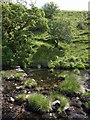
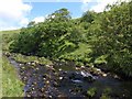
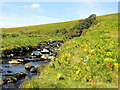
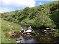
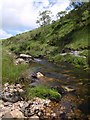
Nearby Images from Geograph Britain and Ireland:
©2009(licence)
©2009(licence)
©2014(licence)
©2009(licence)
©2009(licence)
The above images may not be of the site on this page, they are loaded from Geograph.
Please Submit an Image of this site or go out and take one for us!
Click here to see more info for this site
Nearby sites
Key: Red: member's photo, Blue: 3rd party photo, Yellow: other image, Green: no photo - please go there and take one, Grey: site destroyed
Download sites to:
KML (Google Earth)
GPX (GPS waypoints)
CSV (Garmin/Navman)
CSV (Excel)
To unlock full downloads you need to sign up as a Contributory Member. Otherwise downloads are limited to 50 sites.
Turn off the page maps and other distractions
Nearby sites listing. In the following links * = Image available
394m WNW 299° Blatchford Brook Foot Settlement* Ancient Village or Settlement (SX63566380)
729m WSW 238° Stalldown North* Cairn (SX63276323)
924m NNW 334° Stall Moor circle* Stone Circle (SX6351764442)
949m NNW 335° Upper Erme Row* Stone Row / Alignment (SX63526447)
980m SSE 150° Three Barrows West prehistoric settlement* Ancient Village or Settlement (SX6436762738)
1.3km W 266° Ranny Brookhead Cist* Cist (SX62616354)
1.3km SSW 209° Stalldon Row* Stone Row / Alignment (SX63236248)
1.3km SSW 207° Stalldown Stone Row Cairn E* Cairn (SX63286245)
1.3km SSW 210° Stalldown Encircled Cairn* Cairn (SX6320862489)
1.3km S 189° Hillson's House* Cairn (SX63666228)
1.4km SSW 195° Stalldown Ring Cairn Circle* Ring Cairn (SX63526230)
1.4km SSW 207° Stalldown Cairn Circle* Stone Circle (SX63246241)
1.4km NNW 343° Upper Erme Cairns* Cairn (SX6352264958)
1.6km W 267° Ranny Brook Enclosure Ancient Village or Settlement (SX6232963551)
1.7km SW 218° Stalldown West* Cist (SX6284462309)
1.7km N 6° Hook Lake Row* Multiple Stone Rows / Avenue (SX6411265318)
1.7km SE 124° Three Barrows (Ugborough Moor)* Cairn (SX65316259)
1.7km SW 235° Harrowthorn* Cairn (SX6244662645)
1.7km N 6° Brown Heath Cairn and Cist* Chambered Cairn (SX6411465327)
1.7km W 267° Ranny Brook North Cist* Cist (SX62156355)
1.8km N 4° Hook Lake Settlement* Ancient Village or Settlement (SX6408065390)
1.9km SSW 200° Stalldown Stone Row Cairn S* Cairn (SX63226186)
1.9km W 265° Yealm Steps* Ancient Village or Settlement (SX62016348)
1.9km N 359° Erme Pound Cist Cist (SX63926551)
2.0km SSW 200° Stalldown Southern Terminal Cairn Circle* Cairn (SX6317661737)
View more nearby sites and additional images


 We would like to know more about this location. Please feel free to add a brief description and any relevant information in your own language.
 Wir möchten mehr über diese Stätte erfahren. Bitte zögern Sie nicht, eine kurze Beschreibung und relevante Informationen in Deutsch hinzuzufügen.
 Nous aimerions en savoir encore un peu sur les lieux. S'il vous plaît n'hesitez pas à ajouter une courte description et tous les renseignements pertinents dans votre propre langue.
 Quisieramos informarnos un poco más de las lugares. No dude en añadir una breve descripción y otros datos relevantes en su propio idioma.