<< Our Photo Pages >> Ysbyty Pont Blaen Eidda Cairn - Cairn in Wales in Conwy
Submitted by TAlanJones on Monday, 16 October 2023 Page Views: 109
Neolithic and Bronze AgeSite Name: Ysbyty Pont Blaen Eidda Cairn Alternative Name: Ysbyty Ifan CairnCountry: Wales
NOTE: This site is 1.008 km away from the location you searched for.
County: Conwy Type: Cairn
Nearest Village: Ysbyty Ifan
Map Ref: SH82064895
Latitude: 53.024801N Longitude: 3.759885W
Condition:
| 5 | Perfect |
| 4 | Almost Perfect |
| 3 | Reasonable but with some damage |
| 2 | Ruined but still recognisable as an ancient site |
| 1 | Pretty much destroyed, possibly visible as crop marks |
| 0 | No data. |
| -1 | Completely destroyed |
| 5 | Superb |
| 4 | Good |
| 3 | Ordinary |
| 2 | Not Good |
| 1 | Awful |
| 0 | No data. |
| 5 | Can be driven to, probably with disabled access |
| 4 | Short walk on a footpath |
| 3 | Requiring a bit more of a walk |
| 2 | A long walk |
| 1 | In the middle of nowhere, a nightmare to find |
| 0 | No data. |
| 5 | co-ordinates taken by GPS or official recorded co-ordinates |
| 4 | co-ordinates scaled from a detailed map |
| 3 | co-ordinates scaled from a bad map |
| 2 | co-ordinates of the nearest village |
| 1 | co-ordinates of the nearest town |
| 0 | no data |
Internal Links:
External Links:
")
The cairn is about 4.5m in diameter but it lies low and could be easily overlooked because it is overgrown with grass. However, stones protrude in places suggesting a circular structure. There is some debate as to whether this is the site of a cairn, or that of a hut circle. A survey by G. Smith in 2002 noted that there is no obvious central hollow to suggest a hut rather than a cairn. However, this is a difficult site to interpret. Having visited the site I would err on this being a cairn. It's position would have made it visible from much of the Afon Eidda valley below, quite typical of cairn sites in the area.
You may be viewing yesterday's version of this page. To see the most up to date information please register for a free account.
")
")
")
")
Do not use the above information on other web sites or publications without permission of the contributor.
Nearby Images from Geograph Britain and Ireland:
©2020(licence)
©2009(licence)
©2006(licence)
©2006(licence)
©2020(licence)
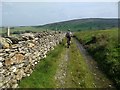
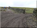
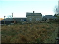
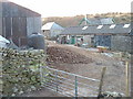
The above images may not be of the site on this page, they are loaded from Geograph.
Please Submit an Image of this site or go out and take one for us!
Click here to see more info for this site
Nearby sites
Key: Red: member's photo, Blue: 3rd party photo, Yellow: other image, Green: no photo - please go there and take one, Grey: site destroyed
Download sites to:
KML (Google Earth)
GPX (GPS waypoints)
CSV (Garmin/Navman)
CSV (Excel)
To unlock full downloads you need to sign up as a Contributory Member. Otherwise downloads are limited to 50 sites.
Turn off the page maps and other distractions
Nearby sites listing. In the following links * = Image available
2.5km NW 308° Y Foel Cairns* Cairn (SH80125056)
3.4km WNW 298° St Tudclud's Well (Penmachno)* Holy Well or Sacred Spring (SH791506)
3.5km WNW 297° St Tudclud (Penmachno)* Early Christian Sculptured Stone (SH78995059)
4.2km NNW 339° Roman Bridge (Penmachno)* Ancient Trackway (SH8067552919)
4.3km SW 232° Bryniau Duon Cairn near Llyn Conwy* Cairn (SH786464)
4.6km SW 232° Llyn Conwy Island Cairn* Cairn (SH783462)
5.2km SW 215° Migneint Mile Slate Slab* Marker Stone (SH78984480)
5.4km N 356° Capel Garmon* Chambered Tomb (SH81805432)
5.4km SW 233° Bryn Owen Cairn* Cairn (SH776458)
5.5km N 356° Ty'n-y-coed Stone* Natural Stone / Erratic / Other Natural Feature (SH81775444)
5.8km ENE 61° Lon Mynydd Hiraethog* Ancient Trackway (SH8719051650)
6.0km NE 52° Carreg Nant Y Foel* Natural Stone / Erratic / Other Natural Feature (SH8690152540)
6.9km NNE 33° Maes Merddyn Ring Cairn 2* Ring Cairn (SH85925463)
6.9km NNE 33° Maes Merddyn Ring Cairn 1* Ring Cairn (SH8600054660)
7.1km ESE 102° Caer Garn Cairn and Round Barrow* Barrow Cemetery (SH8897047270)
7.2km NE 51° Hafod Y Garreg Earthworks and Cairns* Barrow Cemetery (SH8773053360)
7.3km NE 50° Hafod y Garreg Row* Stone Row / Alignment (SH87815345)
7.3km E 91° Garn Prys* Cairn (SH89374866)
7.3km NE 51° Hafod Y Garreg Cist* Cist (SH8790053400)
7.3km NE 49° Ffridd Can Awen Cairn* Cairn (SH8774053620)
7.3km NE 51° Ffridd Can Awen Cists* Cist (SH8786053480)
7.3km S 179° Carnedd Y Bachgen* Round Cairn (SH8206041600)
7.3km S 179° Carnedd Copa Arenig Fach* Cairn (SH8203841599)
7.4km NE 51° Hafod Y Carreg Cairn Field* Barrow Cemetery (SH8793053470)
7.5km W 275° Y Ro Wen Cairn* Cairn (SH746498)
View more nearby sites and additional images


 We would like to know more about this location. Please feel free to add a brief description and any relevant information in your own language.
 Wir möchten mehr über diese Stätte erfahren. Bitte zögern Sie nicht, eine kurze Beschreibung und relevante Informationen in Deutsch hinzuzufügen.
 Nous aimerions en savoir encore un peu sur les lieux. S'il vous plaît n'hesitez pas à ajouter une courte description et tous les renseignements pertinents dans votre propre langue.
 Quisieramos informarnos un poco más de las lugares. No dude en añadir una breve descripción y otros datos relevantes en su propio idioma.