<< Our Photo Pages >> Maes Merddyn Ring Cairn 2 - Ring Cairn in Wales in Conwy
Submitted by TAlanJones on Wednesday, 01 February 2006 Page Views: 5218
Neolithic and Bronze AgeSite Name: Maes Merddyn Ring Cairn 2Country: Wales County: Conwy Type: Ring Cairn
Nearest Town: Betws y Coed Nearest Village: Nebo
Map Ref: SH85925463
Latitude: 53.076674N Longitude: 3.704376W
Condition:
| 5 | Perfect |
| 4 | Almost Perfect |
| 3 | Reasonable but with some damage |
| 2 | Ruined but still recognisable as an ancient site |
| 1 | Pretty much destroyed, possibly visible as crop marks |
| 0 | No data. |
| -1 | Completely destroyed |
| 5 | Superb |
| 4 | Good |
| 3 | Ordinary |
| 2 | Not Good |
| 1 | Awful |
| 0 | No data. |
| 5 | Can be driven to, probably with disabled access |
| 4 | Short walk on a footpath |
| 3 | Requiring a bit more of a walk |
| 2 | A long walk |
| 1 | In the middle of nowhere, a nightmare to find |
| 0 | No data. |
| 5 | co-ordinates taken by GPS or official recorded co-ordinates |
| 4 | co-ordinates scaled from a detailed map |
| 3 | co-ordinates scaled from a bad map |
| 2 | co-ordinates of the nearest village |
| 1 | co-ordinates of the nearest town |
| 0 | no data |
Internal Links:
External Links:
")
Coflein records this site as NPRN 303164.
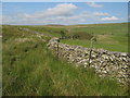
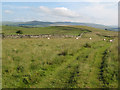
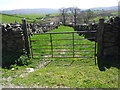
Situated on a gentle slope rising from the NE the cairn lies to the north of a narrow country lane that leads from the B5113 (Pentrefoelas to Nebo road) to Maes Merddyn farm in the Afon Cadnant valley. The cairn's location provides a panoramic view to the south and of the valley below.
The site consists of a circular ring cairn that encloses an inner cairn. The ring walls are grassed over but the underlying stones are visible in areas. The overall diameter is approximately 9+m with the walls of the ring 1.6m wide and about 0.5m high when measured from the interior. The interior of the cairn has been levelled and is slightly lower than the surrounding ground. The inner cairn may be a burial mound/cist site. It has a 3.5m diameter and is about 0.4m high. The centre has been disturbed. This is one of two ring cairns within close proximity to each other.
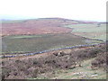
This is an undulating moorland environment, and the narrow lane is also a public footpath providing a comfortable hike into the Afon Cadnant valley.
You may be viewing yesterday's version of this page. To see the most up to date information please register for a free account.
")
")
")
")
Do not use the above information on other web sites or publications without permission of the contributor.
Nearby Images from Geograph Britain and Ireland:
©2013(licence)
©2007(licence)
©2007(licence)
©2013(licence)
©2017(licence)
The above images may not be of the site on this page, they are loaded from Geograph.
Please Submit an Image of this site or go out and take one for us!
Click here to see more info for this site
Nearby sites
Key: Red: member's photo, Blue: 3rd party photo, Yellow: other image, Green: no photo - please go there and take one, Grey: site destroyed
Download sites to:
KML (Google Earth)
GPX (GPS waypoints)
CSV (Garmin/Navman)
CSV (Excel)
To unlock full downloads you need to sign up as a Contributory Member. Otherwise downloads are limited to 50 sites.
Turn off the page maps and other distractions
Nearby sites listing. In the following links * = Image available
85m ENE 68° Maes Merddyn Ring Cairn 1* Ring Cairn (SH8600054660)
1.8km NW 324° Bryn-Cyplau Cairn Circle East Ring Cairn (SH8489756103)
1.8km NW 323° Bryn-Cyplau Cairn Circle West Ring Cairn (SH8486156102)
2.1km ESE 118° Ffridd Can Awen Cairn* Cairn (SH8774053620)
2.2km ESE 109° Cefnen Wen Cairn Field* Barrow Cemetery (SH8796053890)
2.2km SE 124° Hafod Y Garreg Earthworks and Cairns* Barrow Cemetery (SH8773053360)
2.2km ESE 121° Hafod y Garreg Row* Stone Row / Alignment (SH87815345)
2.2km ESE 119° Ffridd Can Awen Cists* Cist (SH8786053480)
2.3km E 100° Cefnen Wen Cairn and Cist* Cairn (SH8817054170)
2.3km SSE 154° Carreg Nant Y Foel* Natural Stone / Erratic / Other Natural Feature (SH8690152540)
2.3km ESE 119° Hafod Y Carreg Cairn Field* Barrow Cemetery (SH8793053470)
2.3km ESE 121° Hafod Y Garreg Cist* Cist (SH8790053400)
2.4km E 100° Cefnen Wen Cairn East* Cairn (SH8824054160)
2.4km ENE 76° Moel Rhiwlug Cairn 2* Cairn (SH88295515)
2.5km NW 321° Maen Pebyll* Long Barrow (SH844566)
2.6km ENE 72° Moel Rhiwlug Cairn 1* Cairn (SH88445538)
2.6km E 88° Bryniau Duon Cairn on Hiraethog Trail* Cairn (SH8855054670)
2.6km E 83° Moel Rhiwlug Recumbent* Natural Stone / Erratic / Other Natural Feature (SH8855954892)
2.8km ESE 108° Hafod y Dre* Stone Row / Alignment (SH88535371)
3.2km ENE 74° Pen Yr Orsedd Ring Cairn* Ring Cairn (SH8901055460)
3.2km SSE 156° Lon Mynydd Hiraethog* Ancient Trackway (SH8719051650)
4.1km W 264° Capel Garmon* Chambered Tomb (SH81805432)
4.1km W 266° Ty'n-y-coed Stone* Natural Stone / Erratic / Other Natural Feature (SH81775444)
4.4km E 97° Bwlch y Garnedd Hut Circle* Ancient Village or Settlement (SH90305401)
4.5km E 94° Bwlch y Garnedd Menhir Standing Stone (Menhir) (SH9045254194)
View more nearby sites and additional images


 We would like to know more about this location. Please feel free to add a brief description and any relevant information in your own language.
 Wir möchten mehr über diese Stätte erfahren. Bitte zögern Sie nicht, eine kurze Beschreibung und relevante Informationen in Deutsch hinzuzufügen.
 Nous aimerions en savoir encore un peu sur les lieux. S'il vous plaît n'hesitez pas à ajouter une courte description et tous les renseignements pertinents dans votre propre langue.
 Quisieramos informarnos un poco más de las lugares. No dude en añadir una breve descripción y otros datos relevantes en su propio idioma.