


<< Text Pages >> Sampford Spiney Memorial Stone - Early Christian Sculptured Stone in England in Devon
Submitted by Antonine on Sunday, 07 August 2022 Page Views: 690
Early MedievalSite Name: Sampford Spiney Memorial StoneCountry: England
NOTE: This site is 1.129 km away from the location you searched for.
County: Devon Type: Early Christian Sculptured Stone
Nearest Town: Tavistock Nearest Village: Sampford Spiney
Map Ref: SX52987168
Latitude: 50.526380N Longitude: 4.075548W
Condition:
| 5 | Perfect |
| 4 | Almost Perfect |
| 3 | Reasonable but with some damage |
| 2 | Ruined but still recognisable as an ancient site |
| 1 | Pretty much destroyed, possibly visible as crop marks |
| 0 | No data. |
| -1 | Completely destroyed |
| 5 | Superb |
| 4 | Good |
| 3 | Ordinary |
| 2 | Not Good |
| 1 | Awful |
| 0 | No data. |
| 5 | Can be driven to, probably with disabled access |
| 4 | Short walk on a footpath |
| 3 | Requiring a bit more of a walk |
| 2 | A long walk |
| 1 | In the middle of nowhere, a nightmare to find |
| 0 | No data. |
| 5 | co-ordinates taken by GPS or official recorded co-ordinates |
| 4 | co-ordinates scaled from a detailed map |
| 3 | co-ordinates scaled from a bad map |
| 2 | co-ordinates of the nearest village |
| 1 | co-ordinates of the nearest town |
| 0 | no data |
Internal Links:
External Links:
Early Christian Sculptured Stone in Devon
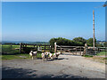
The inscribed stone was discovered at a farm in Sampford Spiney in 1997. The stone is thought to date between 600 - 800 AD.
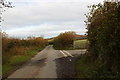
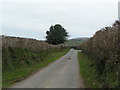
The stone is in use as a gatepost on the west side of a lane that goes from Huckworthy Cross to Tavistock.
It is 1.6m high (showing above ground)
https://historicengland.org.uk/listing/the-list/list-entry/1462653?section=official-list-entry
You may be viewing yesterday's version of this page. To see the most up to date information please register for a free account.
Do not use the above information on other web sites or publications without permission of the contributor.
Nearby Images from Geograph Britain and Ireland:
©2010(licence)
©2013(licence)
©2021(licence)

©2010(licence)

©2006(licence)
The above images may not be of the site on this page, they are loaded from Geograph.
Please Submit an Image of this site or go out and take one for us!
Click here to see more info for this site
Nearby sites
Key: Red: member's photo, Blue: 3rd party photo, Yellow: other image, Green: no photo - please go there and take one, Grey: site destroyed
Download sites to:
KML (Google Earth)
GPX (GPS waypoints)
CSV (Garmin/Navman)
CSV (Excel)
To unlock full downloads you need to sign up as a Contributory Member. Otherwise downloads are limited to 50 sites.
Turn off the page maps and other distractions
Nearby sites listing. In the following links * = Image available
895m NNE 28° Sampford Spiney Church* Standing Stones (SX53427246)
2.3km E 87° Routrundle South* Ancient Village or Settlement (SX55257172)
2.3km ESE 113° Sharpitor W Terminal Cairn* Cairn (SX5505670751)
2.3km ESE 113° Sharpitor W* Stone Row / Alignment (SX5505870748)
2.4km E 84° Routrundle North* Ancient Village or Settlement (SX55387185)
2.6km N 8° Windy Post Cross* Ancient Cross (SX53437428)
2.9km ESE 110° Sharpitor NW double row* Multiple Stone Rows / Avenue (SX5566570617)
2.9km ESE 110° Sharpitor NW single row* Stone Row / Alignment (SX5567170601)
2.9km E 80° Ingra Tor Cist* Cairn (SX5587272083)
2.9km NNE 24° Standing Stone next to Vixen Tor * Standing Stone (Menhir) (SX5424374307)
2.9km N 5° Barn Hill Cairn (SX53337458)
3.0km NNE 23° Vixen Tor* Cist (SX5424074392)
3.0km ESE 108° Sharpitor cairn circle* Cairn (SX5583870678)
3.0km E 96° Leeden Hill* Standing Stone (Menhir) (SX56017128)
3.2km ESE 122° Peek Hill Cairns* Barrow Cemetery (SX55616993)
3.3km ESE 104° Sharpitor NE* Multiple Stone Rows / Avenue (SX5613670785)
3.3km N 359° Whitchurch Common Ring Cairn (SX5301674995)
3.4km E 99° Leeden Settlement Ancient Village or Settlement (SX56327108)
3.4km ESE 102° Leeden Tor South Cairn* Cairn (SX56327089)
3.4km NE 50° King's Tor* Rock Outcrop (SX557738)
3.5km ESE 103° Sharpitor NE (2) Stone Row / Alignment (SX564708)
3.5km ESE 102° Stanlake Cist* Cist (SX5641670852)
3.5km E 92° Leeden Tor* Stone Row / Alignment (SX5652271474)
3.7km NE 37° Merrivale 6* Stone Row / Alignment (SX5534474590)
3.7km NE 38° Merrivale row 4* Stone Row / Alignment (SX5535674586)
View more nearby sites and additional images


 We would like to know more about this location. Please feel free to add a brief description and any relevant information in your own language.
 Wir möchten mehr über diese Stätte erfahren. Bitte zögern Sie nicht, eine kurze Beschreibung und relevante Informationen in Deutsch hinzuzufügen.
 Nous aimerions en savoir encore un peu sur les lieux. S'il vous plaît n'hesitez pas à ajouter une courte description et tous les renseignements pertinents dans votre propre langue.
 Quisieramos informarnos un poco más de las lugares. No dude en añadir una breve descripción y otros datos relevantes en su propio idioma.