


<< Text Pages >> Whitchurch Common - Ring Cairn in England in Devon
Submitted by Tom_Bullock on Sunday, 14 July 2002 Page Views: 4944
Neolithic and Bronze AgeSite Name: Whitchurch Common Alternative Name: Turner A41; Whitchurch Common 1Country: England County: Devon Type: Ring Cairn
Nearest Town: Tavistock
Map Ref: SX5301674995 Landranger Map Number: 191
Latitude: 50.556181N Longitude: 4.076349W
Condition:
| 5 | Perfect |
| 4 | Almost Perfect |
| 3 | Reasonable but with some damage |
| 2 | Ruined but still recognisable as an ancient site |
| 1 | Pretty much destroyed, possibly visible as crop marks |
| 0 | No data. |
| -1 | Completely destroyed |
| 5 | Superb |
| 4 | Good |
| 3 | Ordinary |
| 2 | Not Good |
| 1 | Awful |
| 0 | No data. |
| 5 | Can be driven to, probably with disabled access |
| 4 | Short walk on a footpath |
| 3 | Requiring a bit more of a walk |
| 2 | A long walk |
| 1 | In the middle of nowhere, a nightmare to find |
| 0 | No data. |
| 5 | co-ordinates taken by GPS or official recorded co-ordinates |
| 4 | co-ordinates scaled from a detailed map |
| 3 | co-ordinates scaled from a bad map |
| 2 | co-ordinates of the nearest village |
| 1 | co-ordinates of the nearest town |
| 0 | no data |
Internal Links:
External Links:
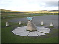
Ring cairn in Devon
Circle diameter: 10 feet, Number of stones: 5 or 6
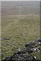
Nothing is shown on the OS Map, but an embankment is visible at these coordinates, and several stones are embedded in it. Burl provides OS coordiates of SX530749. Butler, on the other hand, provides coordinates of SX54147488, but what is at that location does not correspond to his description. I can imagine a mutilated cairn at the site, but there is such a plethora of stones at the site, that I am unable to verify it as a cairn.
Update December 2019: This site is featured on the Prehistoric Dartmoor Walks (PDW) website - see their entry for the Whitchurch Common (N) Stone Ring Cairn Circle. The cairn is also recorded as Pastscape Monument No. 1362094, and as MDV4115 (Ring cairn in the parish of Whitchurch) on the Devon and Dartmoor HER, which adds: "This feature visible on (aerial photographs) more resembles a hut circle with entrance in west."
You may be viewing yesterday's version of this page. To see the most up to date information please register for a free account.
")
Do not use the above information on other web sites or publications without permission of the contributor.
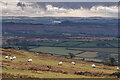
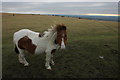
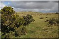
Nearby Images from Geograph Britain and Ireland:
©2022(licence)
©2011(licence)
©2012(licence)
©2006(licence)
©2013(licence)
The above images may not be of the site on this page, they are loaded from Geograph.
Please Submit an Image of this site or go out and take one for us!
Click here to see more info for this site
Nearby sites
Key: Red: member's photo, Blue: 3rd party photo, Yellow: other image, Green: no photo - please go there and take one, Grey: site destroyed
Download sites to:
KML (Google Earth)
GPX (GPS waypoints)
CSV (Garmin/Navman)
CSV (Excel)
To unlock full downloads you need to sign up as a Contributory Member. Otherwise downloads are limited to 50 sites.
Turn off the page maps and other distractions
Nearby sites listing. In the following links * = Image available
520m SE 141° Barn Hill Cairn (SX53337458)
825m SSE 148° Windy Post Cross* Ancient Cross (SX53437428)
1.0km N 357° Cocks Tor Stone Row / Alignment (SX530760)
1.2km N 1° Cox Tor Summit Cairns* Cairn (SX53067618)
1.4km ESE 115° Vixen Tor* Cist (SX5424074392)
1.6km NNE 20° Cox Tor north east* Ancient Village or Settlement (SX536765)
2.1km NE 37° Roos Tor Rocks* Rock Outcrop (SX543766)
2.3km E 95° Merrivale NW* Stone Circle (SX55307475)
2.3km E 96° Cairn south of Stone Row B (Merrivale)* Cairn (SX553747)
2.3km E 92° Merrivale N circle* Stone Circle (SX5532674841)
2.4km E 97° Merrivale circle* Stone Circle (SX55357463)
2.4km E 98° Merrivale 6* Stone Row / Alignment (SX5534474590)
2.4km E 98° Merrivale 5* Stone Row / Alignment (SX5534974592)
2.4km E 98° Merrivale row 4* Stone Row / Alignment (SX5535674586)
2.4km E 98° Merrivale Menhir* Standing Stone (Menhir) (SX55367459)
2.4km E 98° Merrivale Second Menhir and Cairn* Standing Stone (Menhir) (SX55377459)
2.4km E 94° Merrivale SW row 3* Stone Row / Alignment (SX5539474761)
2.4km E 94° Merrivale Centre S* Cairn (SX55407477)
2.4km E 94° Merrivale Centre N* Cairn (SX55437477)
2.4km E 93° Merrivale North Row* Multiple Stone Rows / Avenue (SX55457479)
2.4km E 95° Merrivale Stone Slabs 1 and 2* Stone Row / Alignment (SX55457470)
2.5km E 94° Merrivale* Multiple Stone Rows / Avenue (SX55487477)
2.5km E 94° Merrivale Cists* Burial Chamber or Dolmen (SX5549074762)
2.5km NNE 23° Roos Tor north west* Ancient Village or Settlement (SX5403977254)
2.5km E 93° Merrivale NE circle* Stone Circle (SX55547481)
View more nearby sites and additional images


 We would like to know more about this location. Please feel free to add a brief description and any relevant information in your own language.
 Wir möchten mehr über diese Stätte erfahren. Bitte zögern Sie nicht, eine kurze Beschreibung und relevante Informationen in Deutsch hinzuzufügen.
 Nous aimerions en savoir encore un peu sur les lieux. S'il vous plaît n'hesitez pas à ajouter une courte description et tous les renseignements pertinents dans votre propre langue.
 Quisieramos informarnos un poco más de las lugares. No dude en añadir una breve descripción y otros datos relevantes en su propio idioma.