


<< Our Photo Pages >> Leeden Hill - Standing Stone (Menhir) in England in Devon
Submitted by Anne T on Monday, 19 September 2016 Page Views: 1414
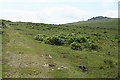
Neolithic and Bronze AgeSite Name: Leeden Hill Alternative Name: Leeden TorCountry: England County: Devon Type: Standing Stone (Menhir)
Nearest Town: Tavistock Nearest Village: Walkhampton
Map Ref: SX56017128
Latitude: 50.523539N Longitude: 4.032675W
Condition:
| 5 | Perfect |
| 4 | Almost Perfect |
| 3 | Reasonable but with some damage |
| 2 | Ruined but still recognisable as an ancient site |
| 1 | Pretty much destroyed, possibly visible as crop marks |
| 0 | No data. |
| -1 | Completely destroyed |
| 5 | Superb |
| 4 | Good |
| 3 | Ordinary |
| 2 | Not Good |
| 1 | Awful |
| 0 | No data. |
| 5 | Can be driven to, probably with disabled access |
| 4 | Short walk on a footpath |
| 3 | Requiring a bit more of a walk |
| 2 | A long walk |
| 1 | In the middle of nowhere, a nightmare to find |
| 0 | No data. |
| 5 | co-ordinates taken by GPS or official recorded co-ordinates |
| 4 | co-ordinates scaled from a detailed map |
| 3 | co-ordinates scaled from a bad map |
| 2 | co-ordinates of the nearest village |
| 1 | co-ordinates of the nearest town |
| 0 | no data |
Internal Links:
External Links:
I have visited· I would like to visit
TheCaptain would like to visit
")
Details of Leeden Hill Standing Stone can be found on the Prehistoric Dartmoor Walks website - see their entry for the Leeden Hill Standing Stone, which tells us this is: "Possibly a prehistoric standing stone but may also be a much later marker since there are at least three similar stones in a line towards Ingra Tor set out at wide intervals as if to mark a boundary." Also see their page for the Sharpitor area Stone Rows and Cists.
MDV28499 (Boundary stone standing within an enclosure attached to reave on Walkhampton Common) on the Devon and Dartmoor HER describes this as "a boundary stone standing within an enclosure attached to the great western reave on Walkhampton Common." The stone is 1.25m long, 0.55m wide and 1.3m high, within another stone 150m to the north east.
The stone is also recorded as Pastscape Monument No. 440297, and as scheduled as part of Historic England List Entry No. 1019589 (A length of the Great Western Reave, a prehistoric settlement, three cairns and two field systems on Walkhampton Common). The HE entry classes this as a "boundary stone of unknown date and function which stands in the centre of the prehistoric settlement".
You may be viewing yesterday's version of this page. To see the most up to date information please register for a free account.
Do not use the above information on other web sites or publications without permission of the contributor.
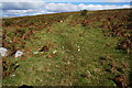
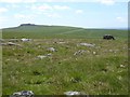
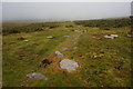
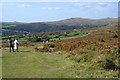
Nearby Images from Geograph Britain and Ireland:
©2014(licence)
©2016(licence)
©2014(licence)
©2009(licence)
©2011(licence)
The above images may not be of the site on this page, they are loaded from Geograph.
Please Submit an Image of this site or go out and take one for us!
Click here to see more info for this site
Nearby sites
Key: Red: member's photo, Blue: 3rd party photo, Yellow: other image, Green: no photo - please go there and take one, Grey: site destroyed
Download sites to:
KML (Google Earth)
GPX (GPS waypoints)
CSV (Garmin/Navman)
CSV (Excel)
To unlock full downloads you need to sign up as a Contributory Member. Otherwise downloads are limited to 50 sites.
Turn off the page maps and other distractions
Nearby sites listing. In the following links * = Image available
511m SSE 164° Sharpitor NE* Multiple Stone Rows / Avenue (SX5613670785)
546m ENE 68° Leeden Tor* Stone Row / Alignment (SX5652271474)
589m SE 135° Stanlake Cist* Cist (SX5641670852)
618m SE 139° Sharpitor NE (2) Stone Row / Alignment (SX564708)
626m SSW 194° Sharpitor cairn circle* Cairn (SX5583870678)
747m SSW 206° Sharpitor NW double row* Multiple Stone Rows / Avenue (SX5566570617)
758m SSW 205° Sharpitor NW single row* Stone Row / Alignment (SX5567170601)
814m NNW 349° Ingra Tor Cist* Cairn (SX5587272083)
848m NW 311° Routrundle North* Ancient Village or Settlement (SX55387185)
876m WNW 299° Routrundle South* Ancient Village or Settlement (SX55257172)
981m E 83° Black Tor Stone Row Cairns (Stanlake)* Cairn (SX5699071370)
1.0km E 96° Stanlake Settlement* Ancient Village or Settlement (SX57057115)
1.1km WSW 239° Sharpitor W* Stone Row / Alignment (SX5505870748)
1.1km WSW 239° Sharpitor W Terminal Cairn* Cairn (SX5505670751)
1.1km E 79° Black Tor (Meavy)* Multiple Stone Rows / Avenue (SX5710271463)
1.3km SE 137° Stan Lake Platform Cairn Circle Cairn (SX56917028)
1.6km E 82° Raddick Hill North* Ancient Village or Settlement (SX57657147)
1.7km ENE 74° Hart Tor north rows* Multiple Stone Rows / Avenue (SX57637169)
1.7km ENE 75° Hart Tor south row* Stone Row / Alignment (SX57687168)
1.7km NNE 23° Walkhampton Enclosed Settlement* Ancient Village or Settlement (SX56747286)
1.7km ENE 74° Hart Tor North circle* Stone Circle (SX57717171)
1.8km ENE 75° Hart Tor South Terminal Cairn* Cairn (SX57727170)
1.8km SSE 169° Leather Tor* Cist (SX5631869522)
1.9km E 92° Raddick Hill Cist* Cist (SX57937116)
2.5km ENE 60° Hart Tor North prehistoric settlement* Ancient Village or Settlement (SX5818572466)
View more nearby sites and additional images


 We would like to know more about this location. Please feel free to add a brief description and any relevant information in your own language.
 Wir möchten mehr über diese Stätte erfahren. Bitte zögern Sie nicht, eine kurze Beschreibung und relevante Informationen in Deutsch hinzuzufügen.
 Nous aimerions en savoir encore un peu sur les lieux. S'il vous plaît n'hesitez pas à ajouter une courte description et tous les renseignements pertinents dans votre propre langue.
 Quisieramos informarnos un poco más de las lugares. No dude en añadir una breve descripción y otros datos relevantes en su propio idioma.