Contributory members are able to log private notes and comments about each site
Sites SandyG has logged. View this log as a table or view the most recent logs from everyone
Holne Ridge NE
Date Added: 18th Jan 2018
Site Type: Multiple Stone Rows / Avenue
Country: England (Devon)
Visited: Yes on 4th Apr 2013. My rating: Condition 3 Ambience 4 Access 3
Holne Ridge NE submitted by SandyG on 4th Oct 2014. Double stone row leading towards the cairn. View from west.
(View photo, vote or add a comment)
Log Text: Car parking is available at SX 67544 71401. From here head south west across the open moorland for about 850m.
Holne Ridge 7
Date Added: 27th Dec 2014
Site Type: Barrow Cemetery
Country: England (Devon)
Visited: Yes on 4th Oct 2014
Holne Ridge 5 submitted by SandyG on 4th Oct 2014. Cairn 5. View from south west.
(View photo, vote or add a comment)
Log Text: None
Holne Moor
Date Added: 18th Jan 2018
Site Type: Multiple Stone Rows / Avenue
Country: England (Devon)
Visited: Yes on 14th Apr 2013. My rating: Condition 3 Ambience 4 Access 3
Holne Moor submitted by SandyG on 4th Oct 2014. This alignment is no less important because only small stones were selected by its builders. Visually it is certainly less spectacular but despite this it provides tangible evidence of prehistoric ritual. View from north west.
(View photo, vote or add a comment)
Log Text: Car parking is available at SX 67544 71401. From here head south across the open moorland for about 400m.
Hoccombe Hill (E)
Date Added: 10th Feb 2020
Site Type: Multiple Stone Rows / Avenue
Country: England (Devon)
Visited: Yes on 13th Apr 2018. My rating: Condition 3 Ambience 3 Access 2
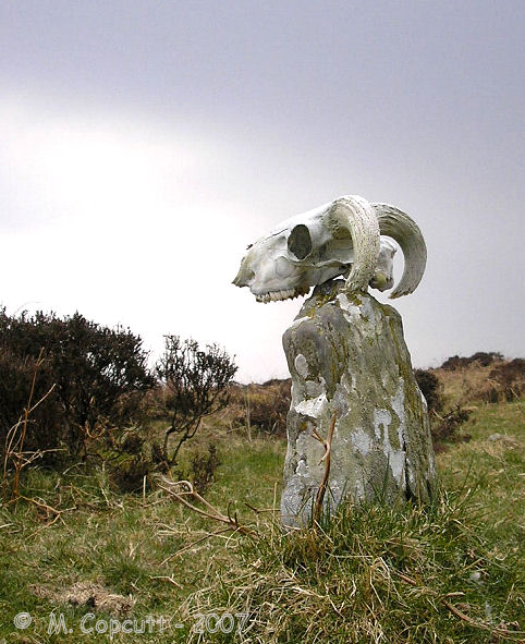
Hoccombe Hill (E) submitted by TheCaptain on 30th Jul 2007. In the deepest, darkest depths of Exmoor, can be found the remains of this stone setting, which is probably hardly ever seen or known by anybody.
(View photo, vote or add a comment)
Log Text: Plenty of car parking is available at Brendon Two Gates at SS 76510 43254. From here head north for a short distance along the road verge to SS 76505 43285 and then take the footpath leading east to SS 78024 43550. The stones are situated to the south below the slope. The footpath may be rather soft underfoot in places.
Hoccombe Coombe
Date Added: 18th Jan 2019
Site Type: Multiple Stone Rows / Avenue
Country: England (Devon)
Visited: Yes on 18th Apr 2018. My rating: Condition 3 Ambience 4 Access 1
Hoccombe Coombe submitted by SandyG on 18th Jan 2019. Stone 1 measures 0.76m long by 0.15m wide, stands up to 0.59m high and is orientated at 90°. The stone is leaning very heavily to the south and would have originally been about 0.75m high. View from south (Scale 1m).
(View photo, vote or add a comment)
Log Text: Car parking is available at SS 75924 45192. From here head east along the footpath to SS 78685 44628. The stone row is a short distance to the south.
Hobajons Cross
Date Added: 29th Jan 2019
Site Type: Standing Stone (Menhir)
Country: England (Devon)
Visited: Yes on 9th Mar 2013. My rating: Condition 4 Ambience 5 Access 3
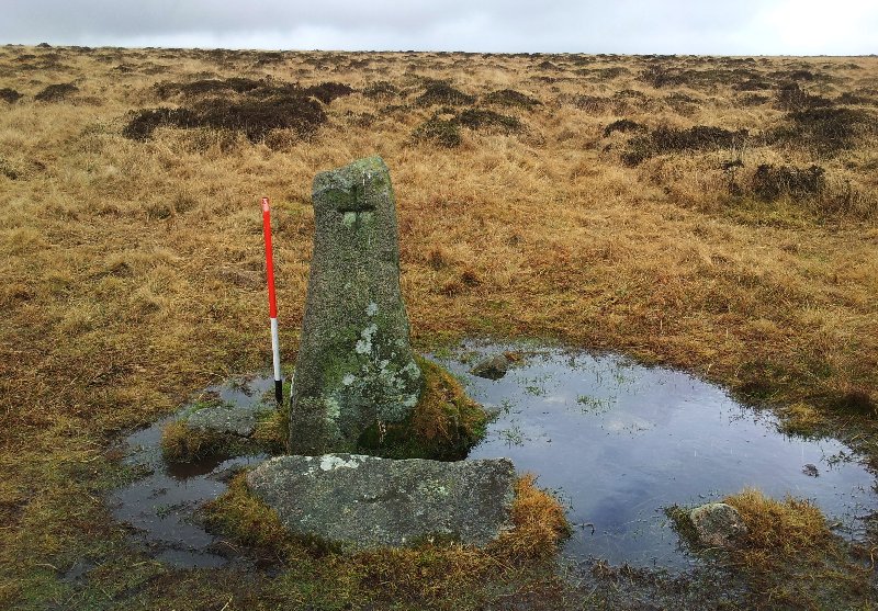
Hobajons Cross submitted by SandyG on 27th Sep 2014. Hobajons Cross may be an original terminal stone for the Butterdon Hill stone row which has been Christianised by the cutting of a simple cross on the western face.
(View photo, vote or add a comment)
Log Text: Car parking is available at SX 64338 59550.
Hoaroak 1
Date Added: 4th Feb 2020
Site Type: Multiple Stone Rows / Avenue
Country: England (Devon)
Visited: Yes on 12th Apr 2019. My rating: Condition 2 Ambience 4 Access 3
Hoaroak 1 submitted by TheCaptain on 30th May 2010. Most of the stones are less than 18 inches long, and fallen, or else just stubs of stone still fast in the ground. Only one stone really stands proudly near the centre of the setting.
(View photo, vote or add a comment)
Log Text: This row can be reached either by walking from Brendon Two Gates (SS 76507 43252) which takes you past the rows on Cheriton Ridge or from Shallowford (SS 71409 44955) which avoids a couple of steep climbs.
Hill o'Many Stanes
Date Added: 7th Jan 2019
Site Type: Multiple Stone Rows / Avenue
Country: Scotland (Caithness)
Visited: Yes on 9th Aug 2014. My rating: Condition 5 Ambience 4 Access 5
Hill o'Many Stanes submitted by SandyG on 20th Sep 2014. View from above and south.
(View photo, vote or add a comment)
Log Text: Limited roadside car parking is available at ND 29557 38464. From here it is a short signposted walk to the rows.
Higher White Tor stone row
Date Added: 16th Jan 2018
Site Type: Multiple Stone Rows / Avenue
Country: England (Devon)
Visited: Yes on 26th May 2017. My rating: Condition 3 Ambience 4 Access 3
Higher White Tor stone row submitted by cazzyjane on 9th Jan 2013. Higher White Tor Stone row. Looking down towards Longaford Tor.
(View photo, vote or add a comment)
Log Text: Car parking is available at SX 63757 77614. From here head a short distance along the B3212 towards Postbridge before crossing the road to join the Lychway. Follow the Lychway to SX 61805 77646 and then head towards Higher White Tor.
High Bridestones (Yorks)
Date Added: 8th Jan 2018
Site Type: Stone Circle
Country: England (Yorkshire (North))
Visited: Yes on 19th Sep 2017. My rating: Condition 2 Ambience 4 Access 5
High Bridestones (Yorks) submitted by JimChampion on 7th Dec 2007. August 2007. The High Bridestones, on the moor. Just one of the megaliths is still standing, with small change firmly wedged into its many crevices. A megalithic shambles indeed. The heather in bloom says that it is summer, although the temperature (and wind) on this day was more like winter!
(View photo, vote or add a comment)
Log Text: Limited car parking available next to the row at NZ 85048 04719.
Despite the problems associated with determining which stones are natural and which ones were placed it is probable that this is a stone row leading away from one of the two stone circles in this area. The presence of considerable quantities of surface stone means that without excavation it is not possible to be certain that this is a stone row.
Hawk's Tor (South)
Date Added: 4th Feb 2020
Site Type: Stone Row / Alignment
Country: England (Cornwall)
Visited: Yes on 26th Sep 2019. My rating: Condition 5 Ambience 5 Access 3
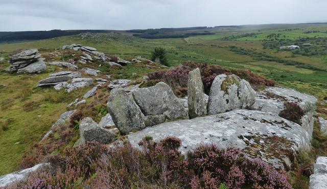
Hawk's Tor (South) submitted by SandyG on 29th Sep 2019. The Hawk's Tor (South) stone row, view from the east.
(View photo, vote or add a comment)
Log Text: Limited parking is available at SX 26006 76124. From here walk north along the bridleway to SX 25940 76282 where the left branch in the track should be followed. The lower slopes of the hill are covered in dense vegetation and it is easy to get lost in the myriad of small tracks, but experience showed that it is best to stick to the more clearly defined ones or alternatively visit in the winter or spring when the vegetation is likely to be less of a problem. It is certainly worth making the effort.
Hart Tor south row
Date Added: 18th Jan 2018
Site Type: Stone Row / Alignment
Country: England (Devon)
Visited: Yes on 20th Oct 2014. My rating: Condition 3 Ambience 4 Access 3
Hart Tor south row submitted by SandyG on 4th Oct 2014. Single row leading downslope from the cairn. View from west.
(View photo, vote or add a comment)
Log Text: Roadside car parking is available at SX 56985 71765. From here the row can be reached across open moorland. The row is situated about 600m to the east. The River Meavy needs to be crossed and it is usually possible to do this via a very narrow “footbridge”.
Hart Tor north rows
Date Added: 17th Jan 2018
Site Type: Multiple Stone Rows / Avenue
Country: England (Devon)
Visited: Yes on 20th Oct 2014. My rating: Condition 4 Ambience 4 Access 3
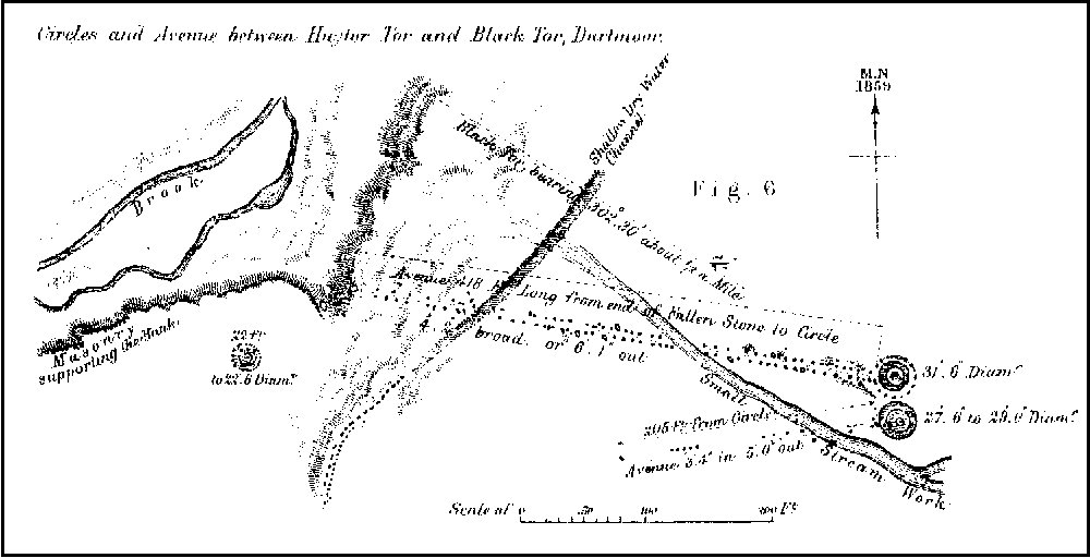
Hart Tor north rows submitted by SandyG on 4th Oct 2014. Plan of Hart Tor stone rows and cairns published by Sir J.G. Wilkinson in 1862.
(View photo, vote or add a comment)
Log Text: Roadside car parking is available at SX 56985 71765. From here the row can be reached across open moorland. The row is situated about 600m to the east. The River Meavy needs to be crossed and it is usually possible to do this via a very narrow “footbridge”.
Hart Tor North ring cairn
Date Added: 21st Jan 2015
Site Type: Ring Cairn
Country: England (Devon)
Visited: Yes on 19th Jan 2015
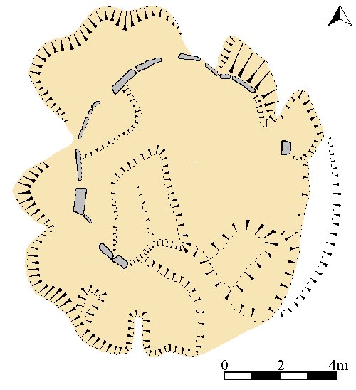
Hart Tor North ring cairn submitted by SandyG on 19th Jan 2015. Plan of the ring cairn (Gerrard, S., 1998).
(View photo, vote or add a comment)
Log Text: None
Hart Tor North prehistoric settlement
Date Added: 21st Jan 2015
Site Type: Ancient Village or Settlement
Country: England (Devon)
Visited: Yes on 19th Jan 2015
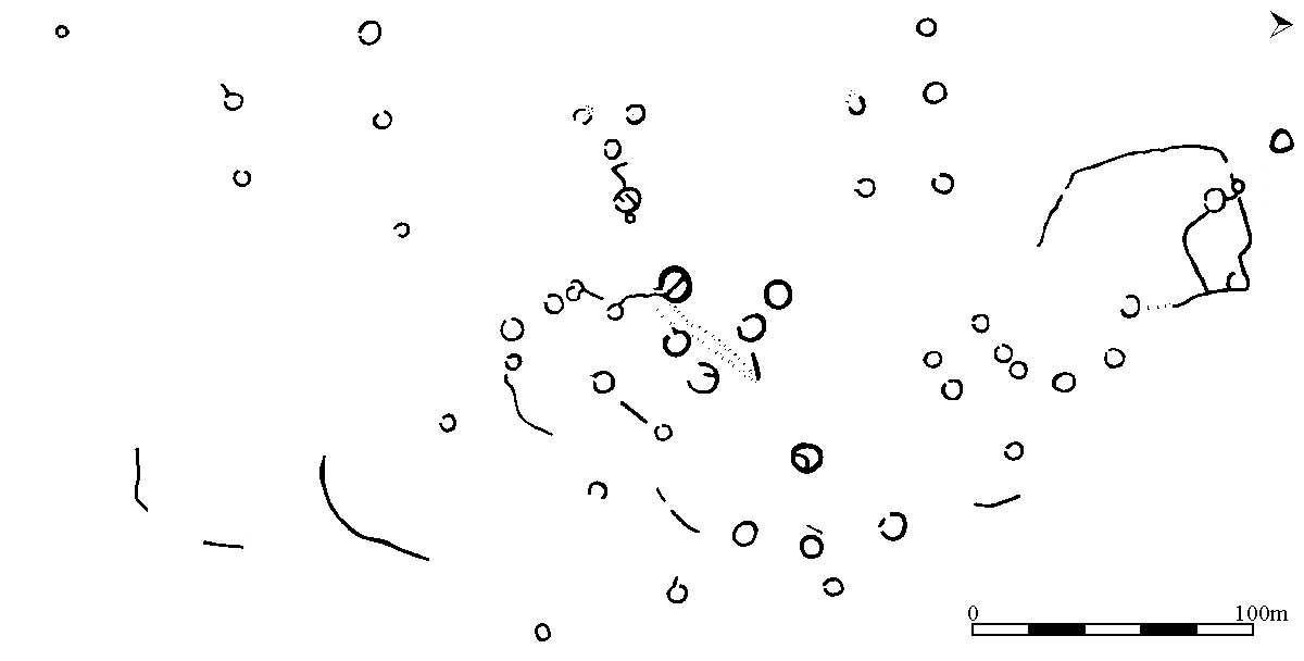
Hart Tor North prehistoric settlement submitted by SandyG on 19th Jan 2015. Overall plan of the settlement (Gerrard, S., 1998).
(View photo, vote or add a comment)
Log Text: None
Hart Tor North circle
Date Added: 18th Jan 2018
Site Type: Stone Circle
Country: England (Devon)
Visited: Yes on 20th Oct 2014. My rating: Condition 4 Ambience 4 Access 3
Hart Tor North circle submitted by SandyG on 4th Oct 2014. Kerbed cairn at the top of the double row at Hart Tor. The row leads towards the bottom right of the photograph. View from north west.
(View photo, vote or add a comment)
Log Text: Roadside car parking is available at SX 56985 71765. From here the cairn can be reached across open moorland. The cairn is situated about 600m to the east and is situated at the upper end of the double stone row. The River Meavy needs to be crossed and it is usually possible to do this via a very narrow “footbridge”.
Harolds Stones
Date Added: 6th Jan 2019
Site Type: Stone Row / Alignment
Country: Wales (Monmouthshire)
Visited: Yes on 19th May 2018. My rating: Condition 4 Ambience 3 Access 5
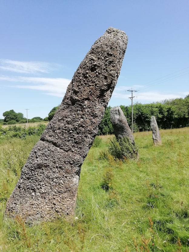
Harolds Stones submitted by TheCaptain on 5th Jul 2018. Harolds Stones, 3rd July 2018.
They are bigger than I remember them being - perhaps they have grown in this fine summer weather.
(View photo, vote or add a comment)
Log Text: Parking is available in the village at SO 50081 05283. From here walk carefully south along the road to the stones.
Harford S.
Date Added: 4th Feb 2020
Site Type: Multiple Stone Rows / Avenue
Country: England (Devon)
Visited: Yes on 29th Aug 2019. My rating: Condition 2 Ambience 4 Access 4
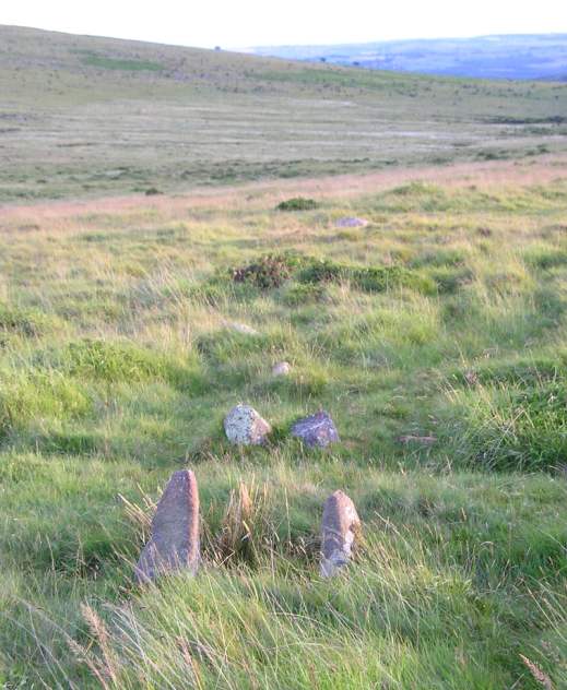
Harford S. submitted by thecaptain on 22nd Jul 2004. Harford Moor South, Dartmoor, Devon SX652599
On Harford Moor, near to the upper reaches of Butter Brook, are the remains of a couple of stone alignments, which are very close together.
The southern of the two is a short double row, which extends in a northeasterly direction away from a small cairn. There are a several pairs of very closely set stones remaining, including what is probably the end pair, which are slightly larger than the others, about 25m distant from the cairn.
This i...
(View photo, vote or add a comment)
Log Text: Car parking is available at SX 64338 59550. Follow the bridleway heading east for 850m. The row is a short distance to the north of the bridleway.
Harford Moor N
Date Added: 29th Jan 2019
Site Type: Stone Row / Alignment
Country: England (Devon)
Visited: Yes on 25th Apr 2013. My rating: Condition 2 Ambience 4 Access 4
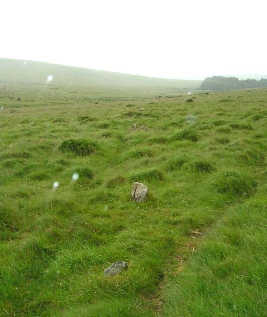
Harford Moor N submitted by thecaptain on 22nd Jul 2004. Harford Moor North, Dartmoor, Devon SX652599
At the upper reaches of Butterbrook are a double and a single row of stones, on a similar alignment. The northern single row crosses beyond the end of the double row. The stones are smaller than those of the double row, some hardly showing above the ground, and not easy to see in all the loose natural stone of the area. There is no obvious western end to the row, and the furthest stones here are more or less adjacent to the cairn of the double row...
(View photo, vote or add a comment)
Log Text: Car parking is available at SX 64338 59550. Follow the bridleway heading east for 850m. The row is a short distance to the north of the bridleway.
Hamel Down row
Date Added: 15th Jan 2018
Site Type: Stone Row / Alignment
Country: England (Devon)
Visited: Yes on 21st Jan 2017. My rating: Condition 2 Ambience 4 Access 4
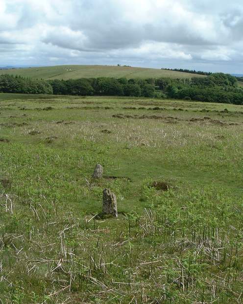
Hamel Down row submitted by Bryan Byng on 19th Oct 2004. Reportedly destroyed, but now back from the dead !
Picture recently received from Brian Byng.
Hameldown alignment or Berry Pound as Butler calls it at SX715801, viewed here looking east.
It is quite a challenge to find widely spaced & only a few stones remain
(View photo, vote or add a comment)
Log Text: Car parking is available at SX 72089 80196. Please ensure that the gate onto the moor is not blocked. From the car parking area take the path leading westward. Do not follow the path leading beside the forestry on your right. This row is best visited during the winter months because it is obscured by bracken in the summer.
