<< Our Photo Pages >> Holne Ridge NE - Multiple Stone Rows / Avenue in England in Devon
Submitted by TheCaptain on Tuesday, 05 October 2010 Page Views: 4219
Neolithic and Bronze AgeSite Name: Holne Ridge NE Alternative Name: Holne Ridge cairn 2Country: England County: Devon Type: Multiple Stone Rows / Avenue
Nearest Town: Buckfastleigh Nearest Village: Dartmeet
Map Ref: SX66757109
Latitude: 50.524378N Longitude: 3.881185W
Condition:
| 5 | Perfect |
| 4 | Almost Perfect |
| 3 | Reasonable but with some damage |
| 2 | Ruined but still recognisable as an ancient site |
| 1 | Pretty much destroyed, possibly visible as crop marks |
| 0 | No data. |
| -1 | Completely destroyed |
| 5 | Superb |
| 4 | Good |
| 3 | Ordinary |
| 2 | Not Good |
| 1 | Awful |
| 0 | No data. |
| 5 | Can be driven to, probably with disabled access |
| 4 | Short walk on a footpath |
| 3 | Requiring a bit more of a walk |
| 2 | A long walk |
| 1 | In the middle of nowhere, a nightmare to find |
| 0 | No data. |
| 5 | co-ordinates taken by GPS or official recorded co-ordinates |
| 4 | co-ordinates scaled from a detailed map |
| 3 | co-ordinates scaled from a bad map |
| 2 | co-ordinates of the nearest village |
| 1 | co-ordinates of the nearest town |
| 0 | no data |
Internal Links:
External Links:
I have visited· I would like to visit
SandyG visited on 4th Apr 2013 - their rating: Cond: 3 Amb: 4 Access: 3 Car parking is available at SX 67544 71401. From here head south west across the open moorland for about 850m.
TheCaptain have visited here
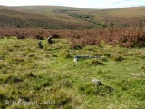
Some remains of a double stone row run away from this cairn down the slope to the west. I thought I saw a couple of stones near the edge of the cairn, and then 5 more stones about 20 metres downslope. These stones would be two from each row, two in the northern row nearest the cairn, and then two in the southern row a bit further down. The stones are quite big, about half a meter tall, and positions slab sides aligned along the row.
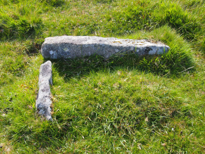
Beside the lower of the two stones in the northern row is a third stone laying on the turf, which looks to have been relatively recently cut and placed there. Perhaps it was once a stone from the row, which was cut and removed, which was I believe the fate of most of the stone hereabouts. There are several other lumps and hollows in the turf and under the long ferns which may or may not be other stones from the rows. Just how long the row would have continued for is anybody’s guess.
Update October 2019: This double stone row, recorded as being 28m long, is featured on the Stone Rows of Great Britain website - see their entry for Holne Ridge, which includes a description, a plan of the row and its associated cairn, photographs of the alignment and the individual stones, access information and a list on online resources for more information.
The row is also recorded as Pastscape Monument No. 443031, which tells us this site is: "(a) Bronze Age cairn forming part of a cairn cemetery and an unfinished stone row located west of Horns Cross on Holne Ridge". The Devon and Dartmoor HER also includes an entry for the cairn; see MDV12981 (Cairn forming part of a cairn cemetery on Holne Ridge). The site is also scheduled as part of Historic England List Entry No. 1019273 (Eight cairns forming part of a cairn cemetery on Holne Ridge and a stone alignment immediately west of Horn's Cross).
The row is also featured on the Prehistoric Dartmoor Walks (PDW) website - see their entry for the Holne Ridge Stone Row, which adds: "(the stone row and the cairns) lie in the north west facing hollow above Horse Ford on the O Brook".
You may be viewing yesterday's version of this page. To see the most up to date information please register for a free account.


Do not use the above information on other web sites or publications without permission of the contributor.
Click here to see more info for this site
Nearby sites
Key: Red: member's photo, Blue: 3rd party photo, Yellow: other image, Green: no photo - please go there and take one, Grey: site destroyed
Download sites to:
KML (Google Earth)
GPX (GPS waypoints)
CSV (Garmin/Navman)
CSV (Excel)
To unlock full downloads you need to sign up as a Contributory Member. Otherwise downloads are limited to 50 sites.
Turn off the page maps and other distractions
Nearby sites listing. In the following links * = Image available
1m NE 40° Holne Ridge 2* Cairn (SX6675171091)
119m WNW 292° Holne Ridge North* Cist (SX6664171138)
171m E 82° Holne Ridge 6* Cairn (SX66927111)
174m ESE 102° Holne Ridge 7* Barrow Cemetery (SX66927105)
237m ENE 61° Holne Ridge 5* Cairn (SX66967120)
237m ESE 103° Horn's Cross* Ancient Cross (SX66987103)
348m SSE 150° Holne Ridge 9* Cairn (SX6691970785)
681m E 93° Holne Moor* Multiple Stone Rows / Avenue (SX6743171042)
791m NNE 25° Combestone Tor* Rock Outcrop (SX671718)
1.2km ENE 59° Aller Brook* Cist (SX67807168)
1.4km ENE 67° Holne Moor North Ring Cairn (SX68097162)
1.5km NW 306° Down Ridge Outlier* Standing Stone (Menhir) (SX65577200)
1.6km NW 307° Down Ridge* Stone Circle (SX6550872068)
1.7km WSW 255° Skir Hill* Cairn (SX65097068)
1.9km SSE 155° Mardle Embanked Cairn* Stone Circle (SX67516935)
2.2km SSW 200° Ryder's Hill* Cairn (SX65976906)
2.2km ESE 120° Holne Lee* Ring Cairn (SX68666992)
2.5km NNE 19° Yar Tor Prehistoric Homestead* Ancient Village or Settlement (SX67627342)
2.7km W 259° Ter Hill Cross Ancient Cross (SX6403670623)
2.9km NNW 340° Huccaby Rings Inner* Ancient Village or Settlement (SX6585473819)
2.9km S 176° Snowdon Cairns (Dartmoor)* Barrow Cemetery (SX669682)
3.0km NE 34° Ouldsbroom Cross* Ancient Cross (SX6850173504)
3.0km NE 39° Sherril Down Multiple Stone Rows / Avenue (SX687734)
3.1km NNE 20° Yar Tor Summit* Cairn (SX67867394)
3.1km NNE 25° Money Pit Cairns* Cairn (SX68147384)
View more nearby sites and additional images


 We would like to know more about this location. Please feel free to add a brief description and any relevant information in your own language.
 Wir möchten mehr über diese Stätte erfahren. Bitte zögern Sie nicht, eine kurze Beschreibung und relevante Informationen in Deutsch hinzuzufügen.
 Nous aimerions en savoir encore un peu sur les lieux. S'il vous plaît n'hesitez pas à ajouter une courte description et tous les renseignements pertinents dans votre propre langue.
 Quisieramos informarnos un poco más de las lugares. No dude en añadir una breve descripción y otros datos relevantes en su propio idioma.