Submitted by markj99 on Thursday, 22 October 2026 (515 reads)
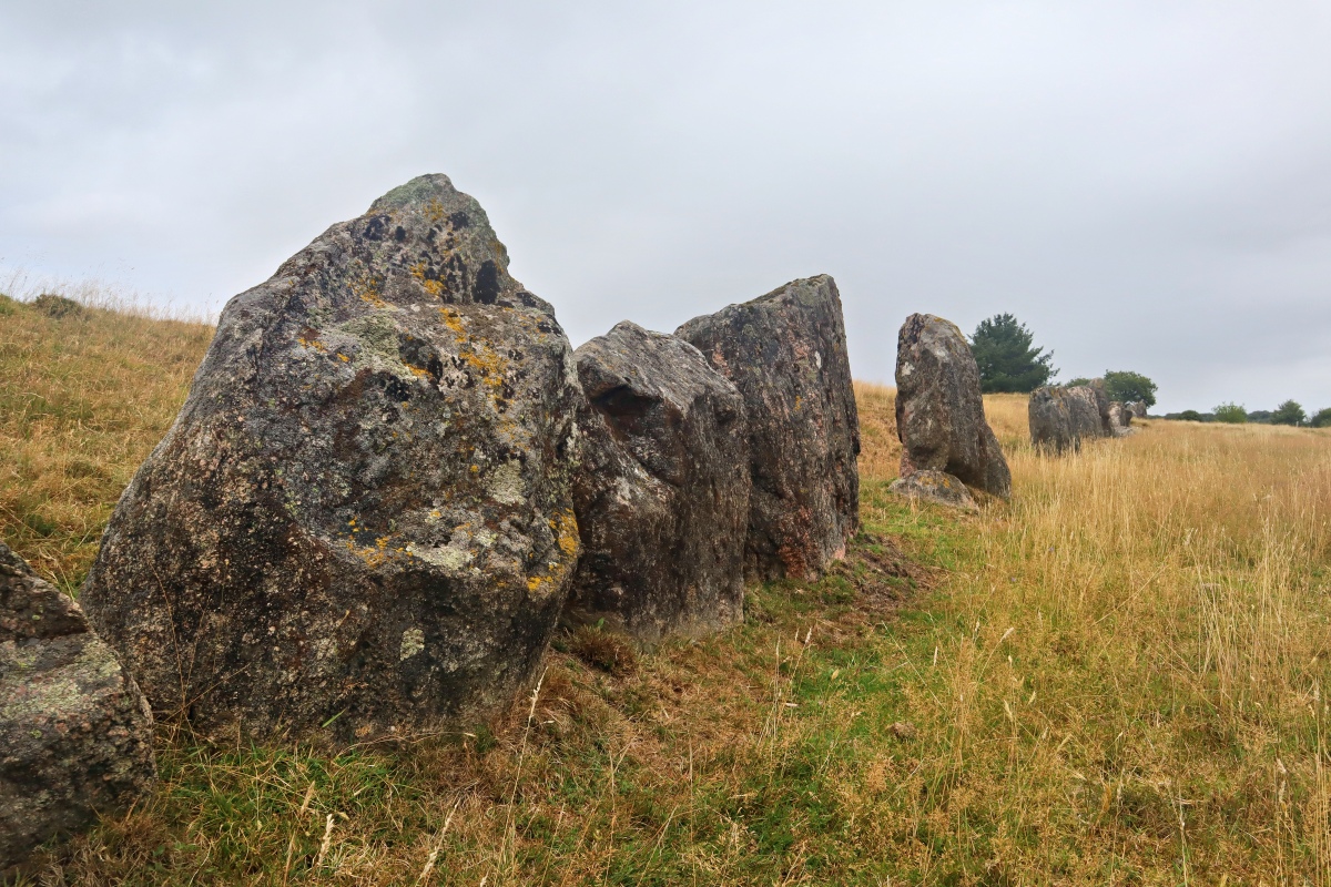
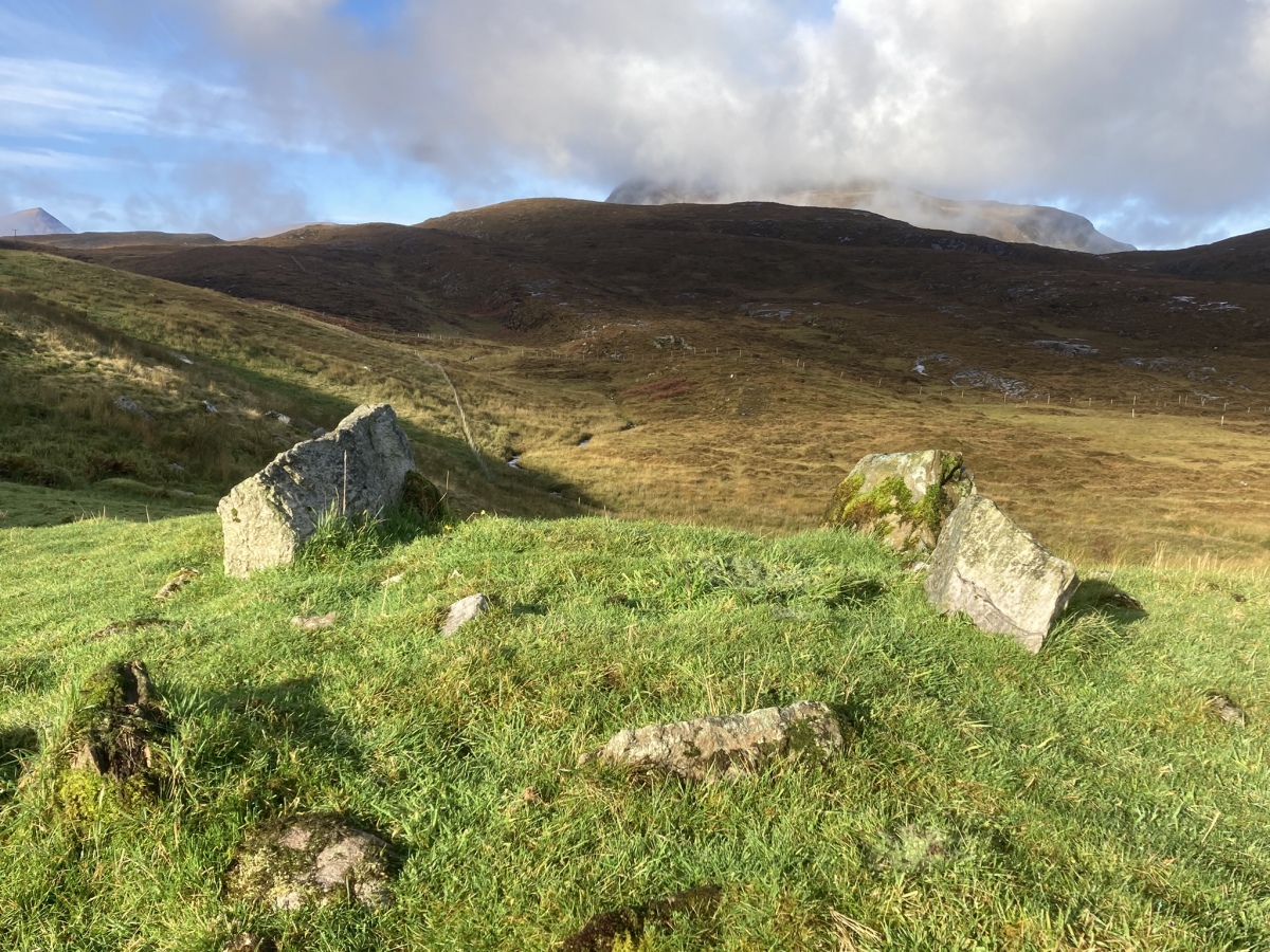
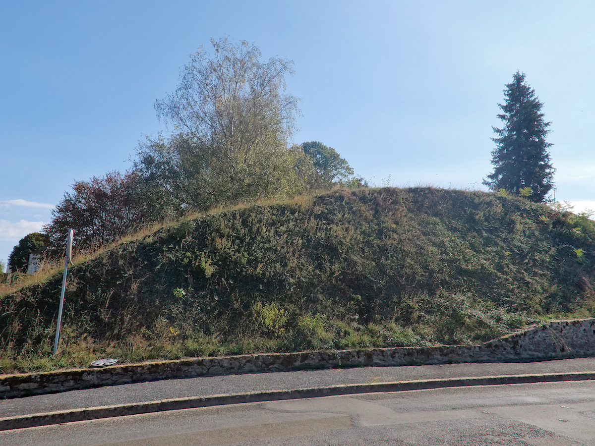
Neolithic and Bronze AgeA subcircular mound approx 12m in diameter and 2m high. Carpeted in rough grass with three stones of the chamber remaining. Located approx. 75m N of the A835 at the W edge of Elphin, a small settlement in the Highlands. There is another chambered cairn and a long cairn in the immediate vicinity, check our Nearby Sites list for the details. Image submitted by markj99
Submitted by LeRoyBreizh on Thursday, 22 October 2026 (654 reads)
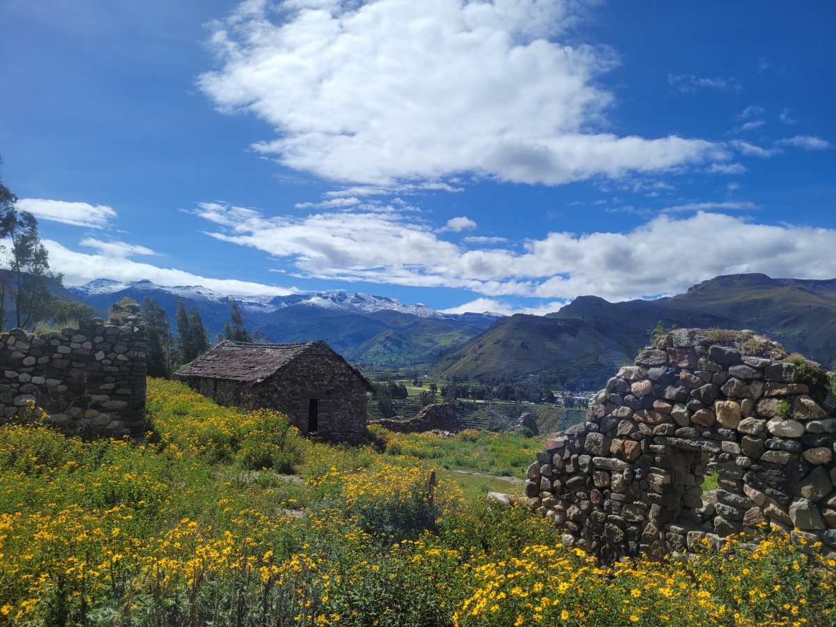
Multi-periodThis archaeological site corresponds to the Collawa culture, it is located halfway up a hill, a set of typically Collawas buildings with stuccoed walls burned by fire and painted with colours: yellow and red inside; on the outside there are rows of stones in white and gray colors, today it is farmland.
The Uyo Uyo is located within the community of Yanque Urinsaya, between the Pampaqhawana and Quesqa rivers, in the Yanque district, Caylloma province, Arequipa department, in Peruvian territory. Image submitted by LeRoyBreizh
Submitted by dmlovelock on Wednesday, 21 October 2026 (7767 reads)
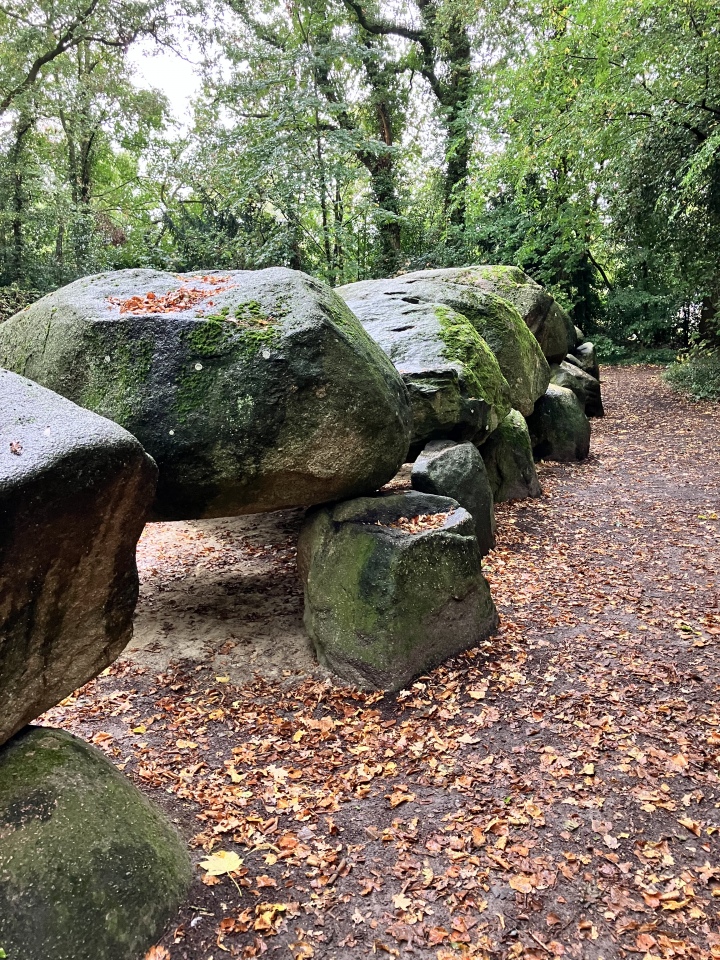
Neolithic and Bronze AgeThe largest hunbed in Holland. About 25m long, it stands beside the Hunebed Centrum (Hunebedden Information Center) in Drenthe. Image submitted by Cazkins
Submitted by vicky on Wednesday, 21 October 2026 (38499 reads)
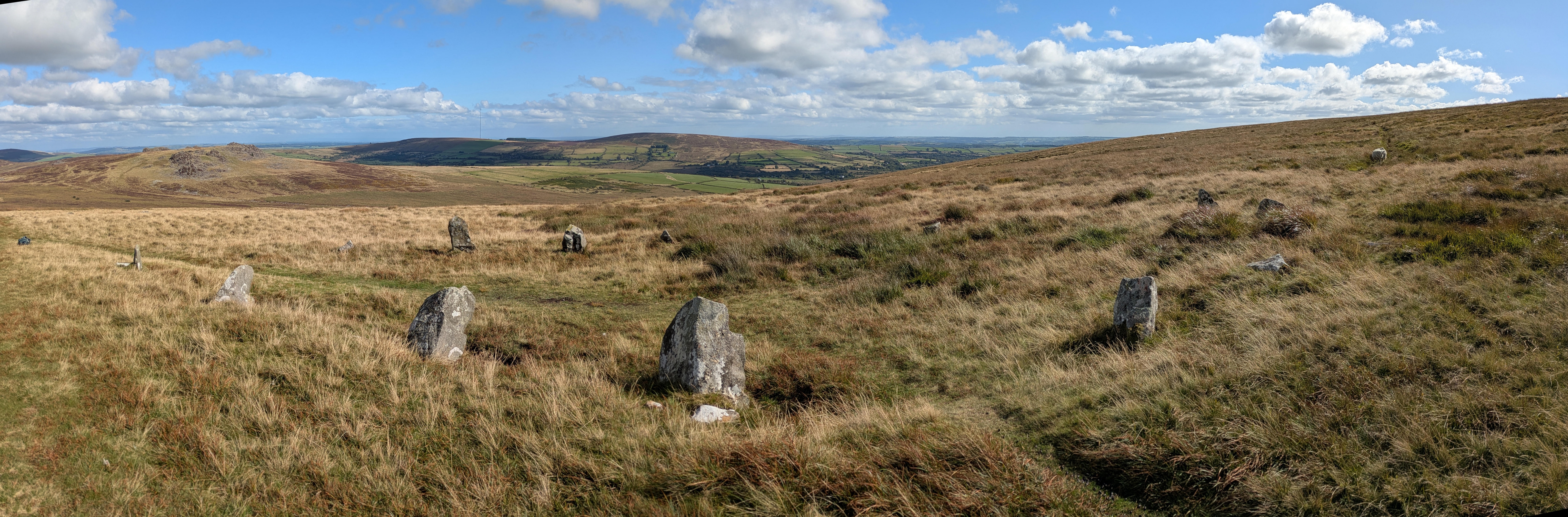
Neolithic and Bronze AgeThis so-called stone circle lies overlooking the bluestone outcrop of Carn Meini in Pembrokeshire. It is actually oval or horse-shoe shaped, leading to speculation that it may have influenced the horseshoe shape of the Bluestones at Stonehenge. Image submitted by TheCaptain
Submitted by kenntha88 on Tuesday, 20 October 2026 (635 reads)
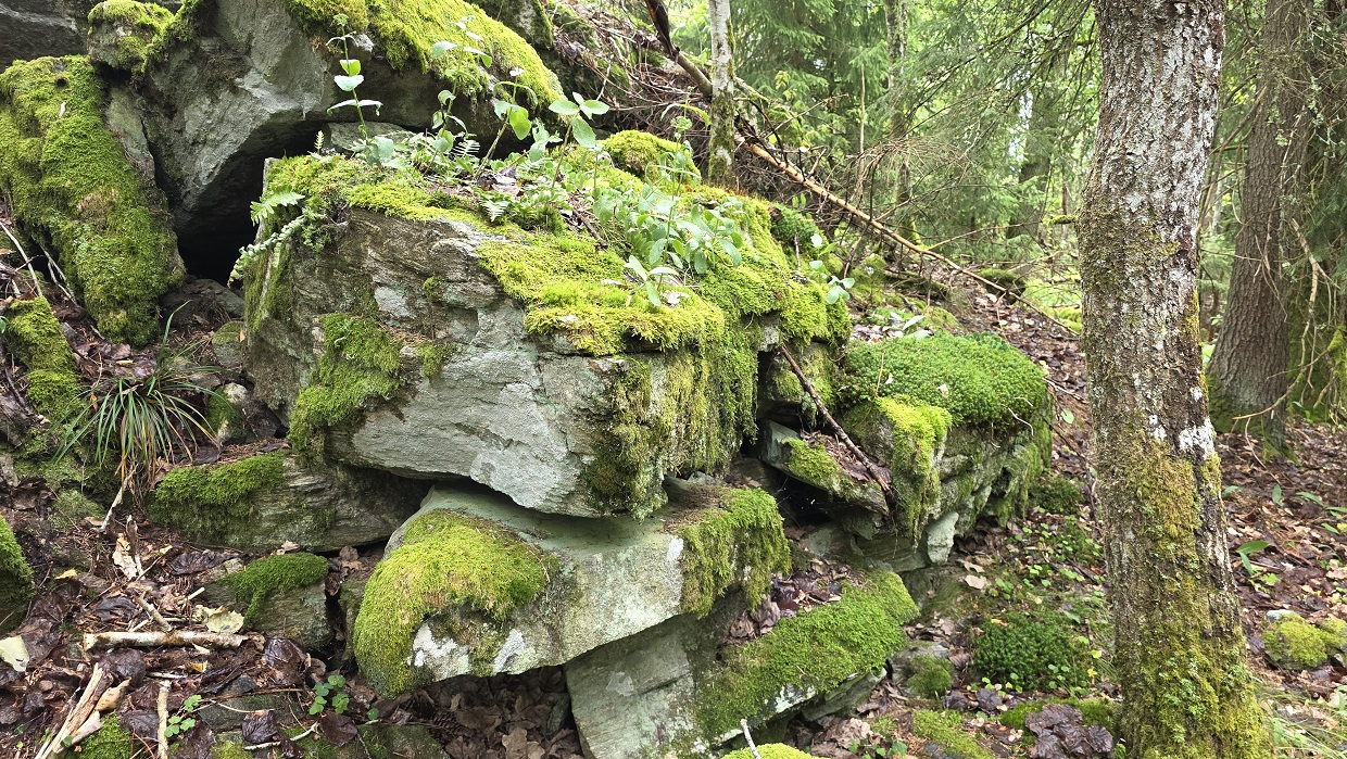
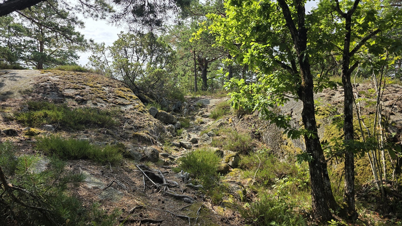
Iron Age and Later PrehistoryThis hillfort is located on a forest covered rocky hill with a great view over Glomma river to the south and west. From a small road there is a footpath up to the hillfort and top of the hill. An old information poster is located at the entrance of the fort. The path is very overgrown and hard to follow. Image submitted by kenntha88
Submitted by Coldrum on Tuesday, 20 October 2026 (14870 reads)
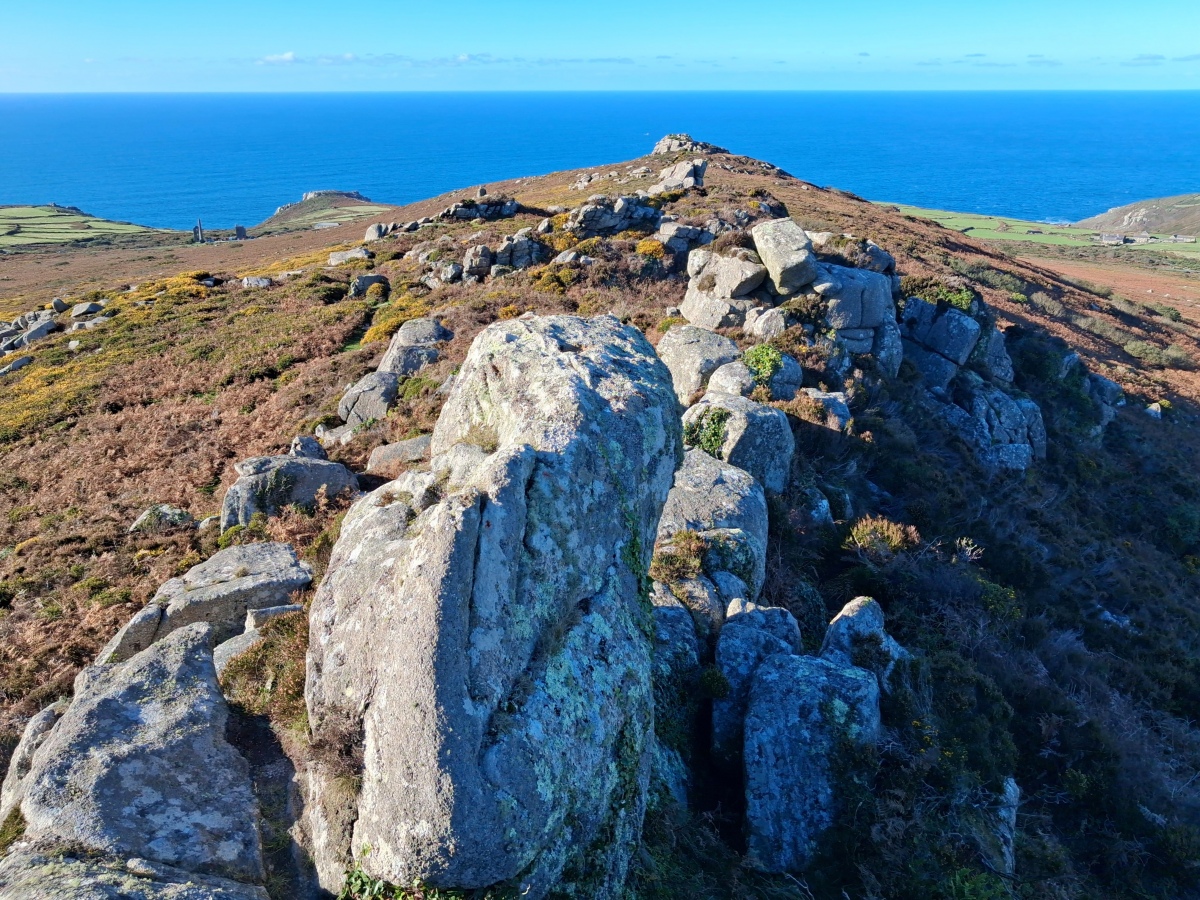
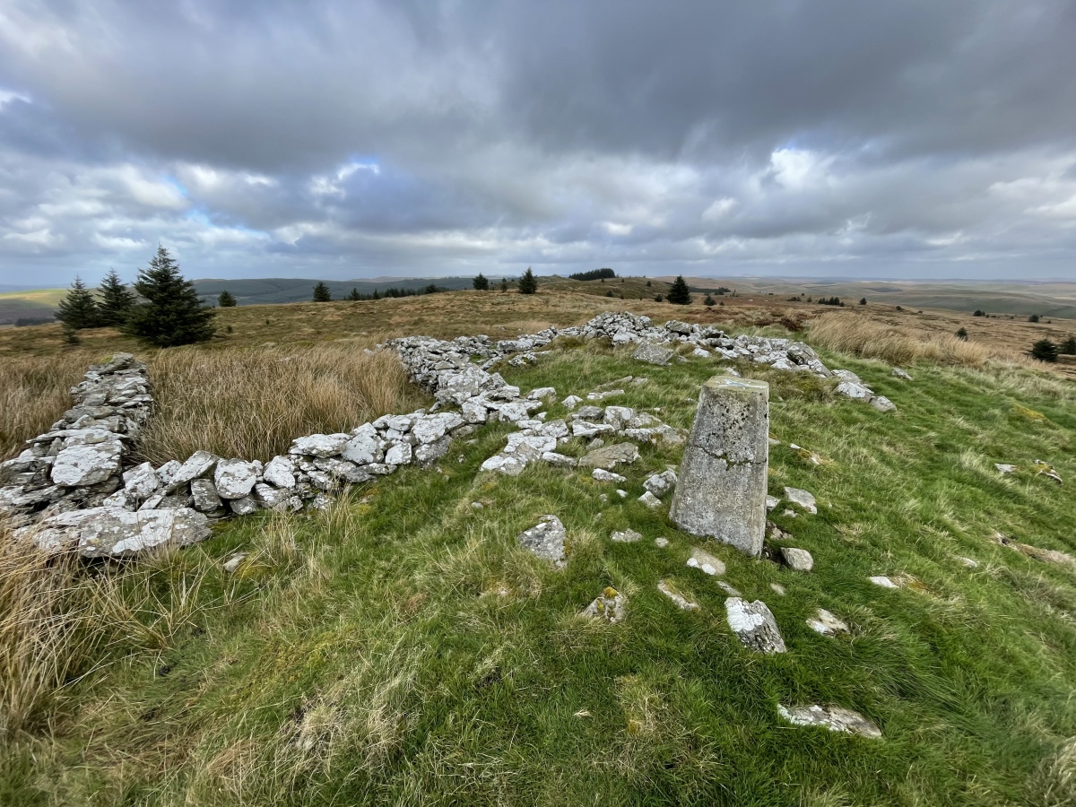
Multi-periodA possible Neolithic enclosure represented by linear arrangements of boulders and stones which incorporate one of the principle granite tors on the summit area of Carn Galver. Excavations in 2009 by Andy Jones (RIP) of Cornwall Archaeological Unit revealed a substantial tumbled wall probably of orthostatic construction but lacking dating evidence. Excavation of a terrace in the centre of the enclosure also produced no dating evidence. Image submitted by Bladup
Submitted by HistoryHikerWales on Monday, 19 October 2026 (869 reads)
Multi-periodA very disturbed Bronze Age cairn (we hope therapy is available). More interestingly it sits at the centre point in the route along the ridgeway that takes in all the historic sites in the Llanfair Mountain collection. HistoryHikerWales has visited all these out so explore via the maps and nearby sites list from our page. Image submitted by HistoryHikerWales
Submitted by DonRemo on Sunday, 18 October 2026 (782 reads)
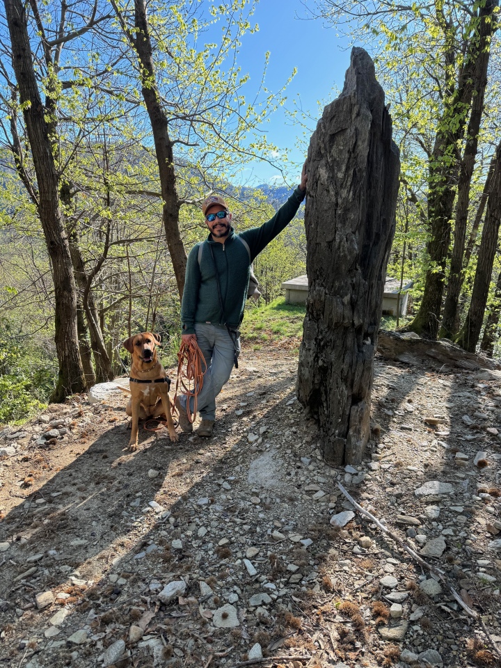
Multi-periodWelcome new contributor Don Remo (and canine friend): The Menhir of the Motto del Risc (re-erected very recently) is the thirteenth stop on the Malcantone Mining Park Trail. There is also much evidence of the presence of the (Celtic adjacent) Ligurians in these hills. Image submitted by DonRemo
Submitted by cerrig on Saturday, 17 October 2026 (902 reads)
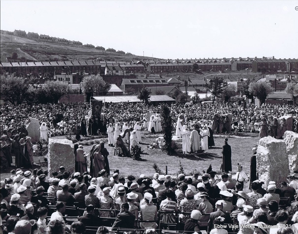
Modern SitesThe opening ceremony in 1958. This Gorsedd circle was moved from its original placement on the old steel works site to a purpose built sunken garden, just off Cemetery Road, sandwiched between a busy road and a housing estate. Image submitted by cerrig
Lots more archive photos of the Eistedfodd in 1958, the construction of the circle, and how it looks now are on our page, thanks Cerrig for arranging permission with Ebbw Vale Works museum. More Gorsedd circles to follow, do you have any photos you can share? Read More | 6 News and Comments | Category: Other Photo Pages
Submitted by kenntha88 on Saturday, 17 October 2026 (1041 reads)
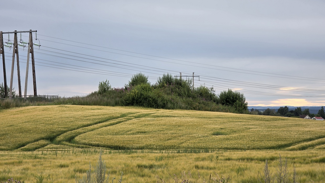
Neolithic and Bronze AgeThis pretty round barrow is easily visible from the road and it not heavily overgrown so the details are easy to see. It is around 17 metres in diameter and 2 metres in height and seems undisturbed. Image submitted by kenntha88
Barrow with heather, sunset, power lines, a beautifully composed photo, thanks Kenneth! Read More | Category: Our Photo Pages
Submitted by Aluta on Saturday, 17 October 2026 (804 reads)
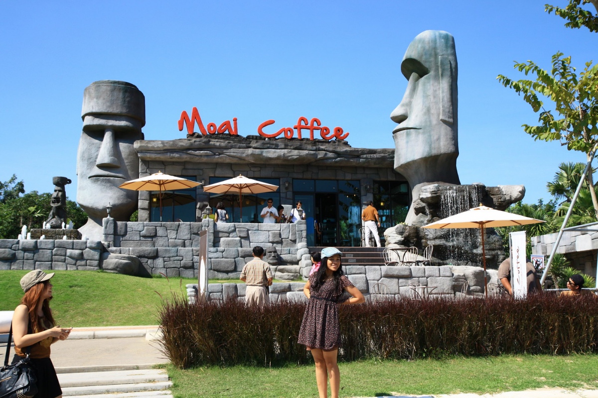
Modern SitesOK, so this doesn't show the Stonehenge replica within the grounds of this coffee shop, but they also have these incredible Moai as their name suggests, and more in their garden. You'll have to go to our page to see the "Stonehenge", which is pretty impressive too (what a tease) Image submitted by Creative Commons
Submitted by Andy B on Wednesday, 14 October 2026 (977 reads)
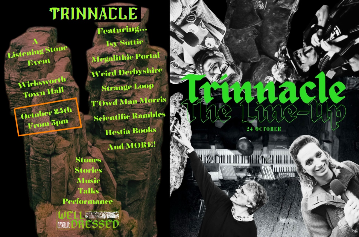
EventsNext Saturday, 24th October is Trinnacle at Wirksworth Town Hall featuring Isy Suttie, Strange Loop, Andy B from the Megalithic Portal, Richard Bradley (aka Weird Derbyshire), films by Scientific Rambles, T’Owd Man Morris and of course the enigmatic Listening Stone! Taking its name from a remote Peak District rock formation, Trinnacle is a special evening celebrating standing stones, megalithic structures and stone circles through stories, talks and performance. Image submitted by Andy B
Submitted by TAlanJones on Wednesday, 14 October 2026 (783 reads)
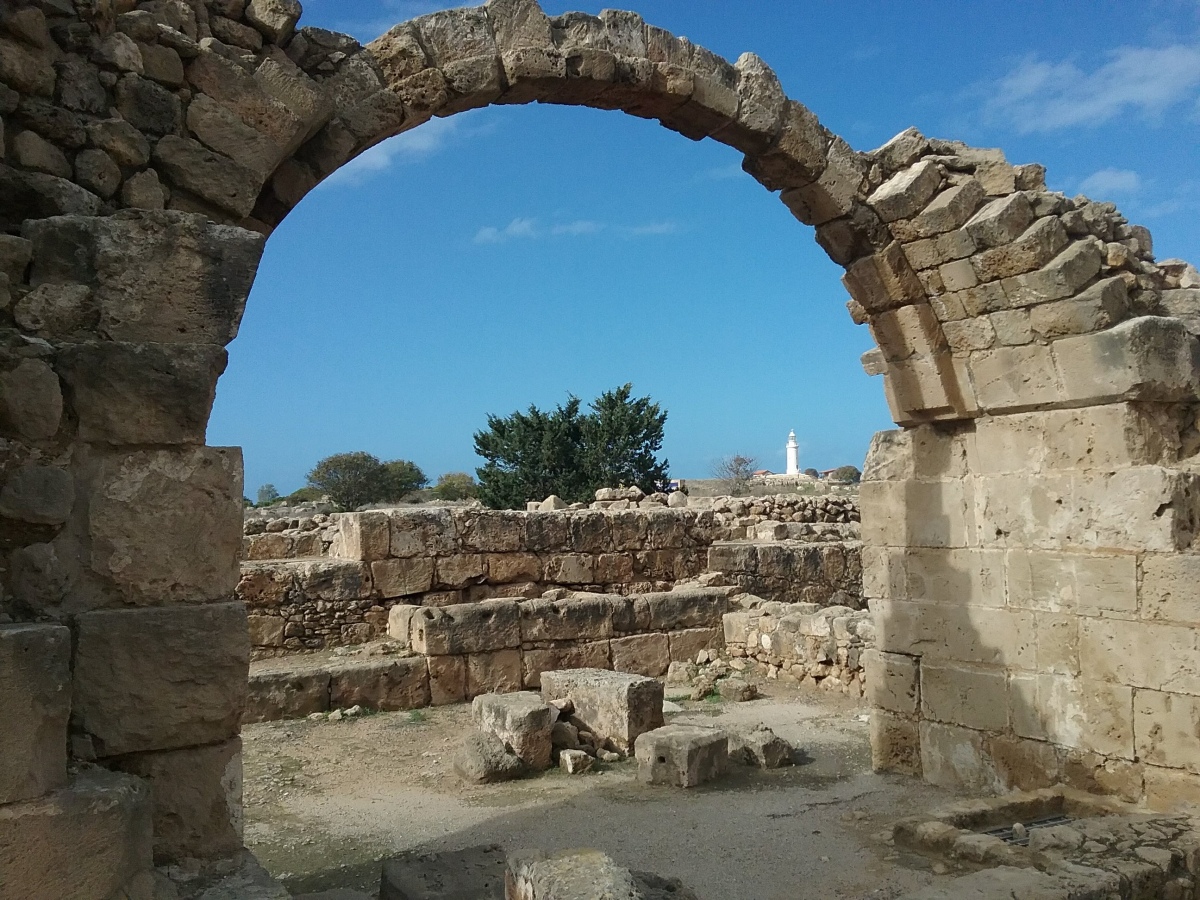
Early MedievalSituated within the Paphos Archaeological Park. Built during the Byzantine period around the 7th cent CE Saranta Kolones takes its name from the granite columns that once formed part of its impressive structure. Destroyed by an earthquake in 1223 CE it was never rebuilt but it still impressive ruins and well worth a visit. Image submitted by TAlanJones
Submitted by TAlanJones on Wednesday, 14 October 2026 (852 reads)
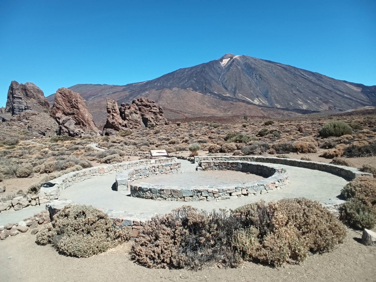
Pre-ContactThe reconstruction is on the site of an ancient Tagoror erected by the Guanches, Tenerife's original pre-colonial inhabitants who were of Berber descent. It had many purposes, an outdoor public square, a council chamber and as a court of law where the local king (Mencey) and tribal elders (Achimency) gathered to hear and decide on matters. Image submitted by TAlanJones
Submitted by coldrum on Wednesday, 14 October 2026 (9454 reads)
Neolithic and Bronze AgeThe remains of an embanked stone circle near Glandy Cross, Carmarthenshire. Just two stones remain of Meini Gwyr, once a spectacular circle (part of the Glandy Cross monument complex). Photos on our page. Image submitted by TheCaptain
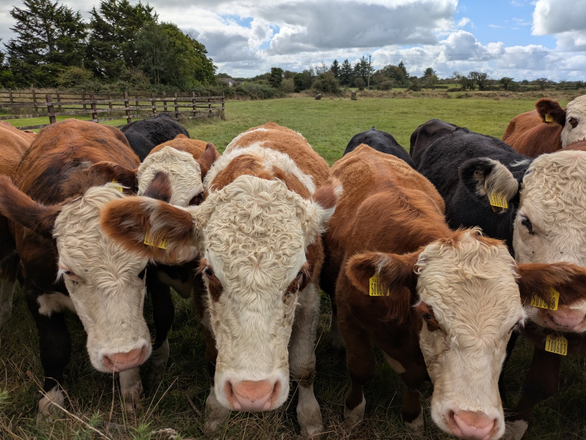
TheCaptain (in his new role of bullock-whisperer - do not try this unless you know what you are doing!): "There are other earthworks visible nearby and plenty of other stones around, a couple laying in the field and others in the surrounding hedges. Just as I am off to look at these a herd of young bullocks comes into the field and over to me, all very inquisitive, but with a couple of ringleaders leading them on. Right, its time for me to leave, keeping a close eye on them and talking to them to keep them at bay before I can exit the gate!" Read More | 5 News and Comments | Category: Our Photo Pages
Submitted by kenntha88 on Monday, 12 October 2026 (700 reads)
Iron Age and Later PrehistoryThis hillfort in Norway is located on the southern of two rocky hills. From the plateau within its walls there are expansive views to the east, south, and west; to the north, the view is blocked by the central hill. Views from the eastern section include Larviksfjorden, the Skagerrak, and the farms of Katrineborg, Torsrød, Fredriksvern, and parts of Brunla. On the eastern side of Larviksfjorden, to the north-northeast, lies the hillfort at Gon in Tjølling and Viksfjorden. Image submitted by kenntha88
Submitted by johnstone on Monday, 12 October 2026 (501 reads)
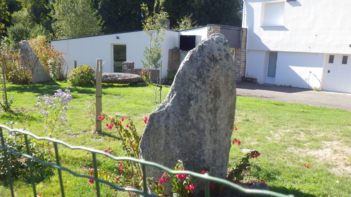
Neolithic and Bronze AgeThere are menhirs in various gardens and along the street in Lambel (Baud), SE Camors, Morbihan - would you like your own like this? Image submitted by peulven
Submitted by 4clydesdale7 on Saturday, 10 October 2026 (7642 reads)
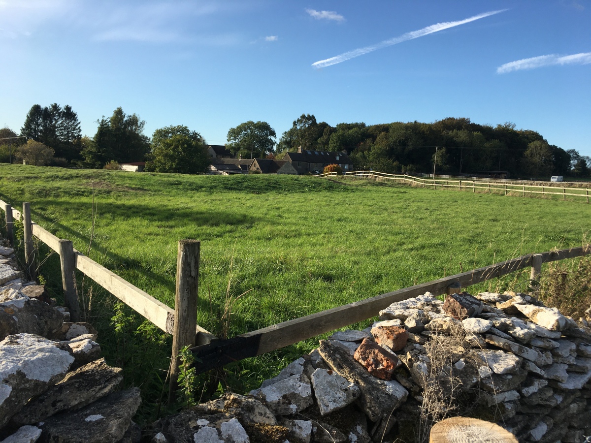
Neolithic and Bronze AgePossible Long Barrow in Gloucestershire. This is a site which has caused much conflicting discussion over the years, all of which remains unresolved even today - both the Bris. & Glos. Arch. Society and Pastscape remain unconvinced either way - is it a ruined Long Barrow or are they old quarry workings? What do you think? Image submitted by 123456789jeagles117
Submitted by Anne T on Friday, 09 October 2026 (1087 reads)
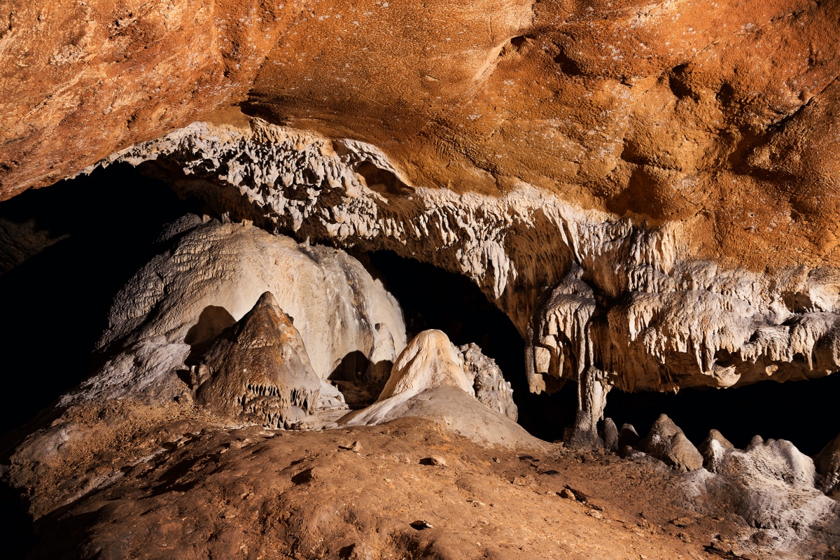
Natural PlacesThe longest known cave in Serbia, with 9.4 km of explored passages, and one of the most important prehistoric copper-working sites in the central Balkans. Excavations recovered about 50 copper objects of late Eneolithic (Copper Age) and Early Bronze Age date, including chisels, awls, needles, flat axes and ornaments, found alongside Vinča-related pottery and a complete Bronze Age belt of eight linked bronze spirals, indicating a trading network extending as far as the Aegean. If anyone can help with photographs of the copper and other artefacts found in this cave, please do submit them to our page - thanks. Image submitted by Anne T
Submitted by Aluta on Friday, 09 October 2026 (1455 reads)
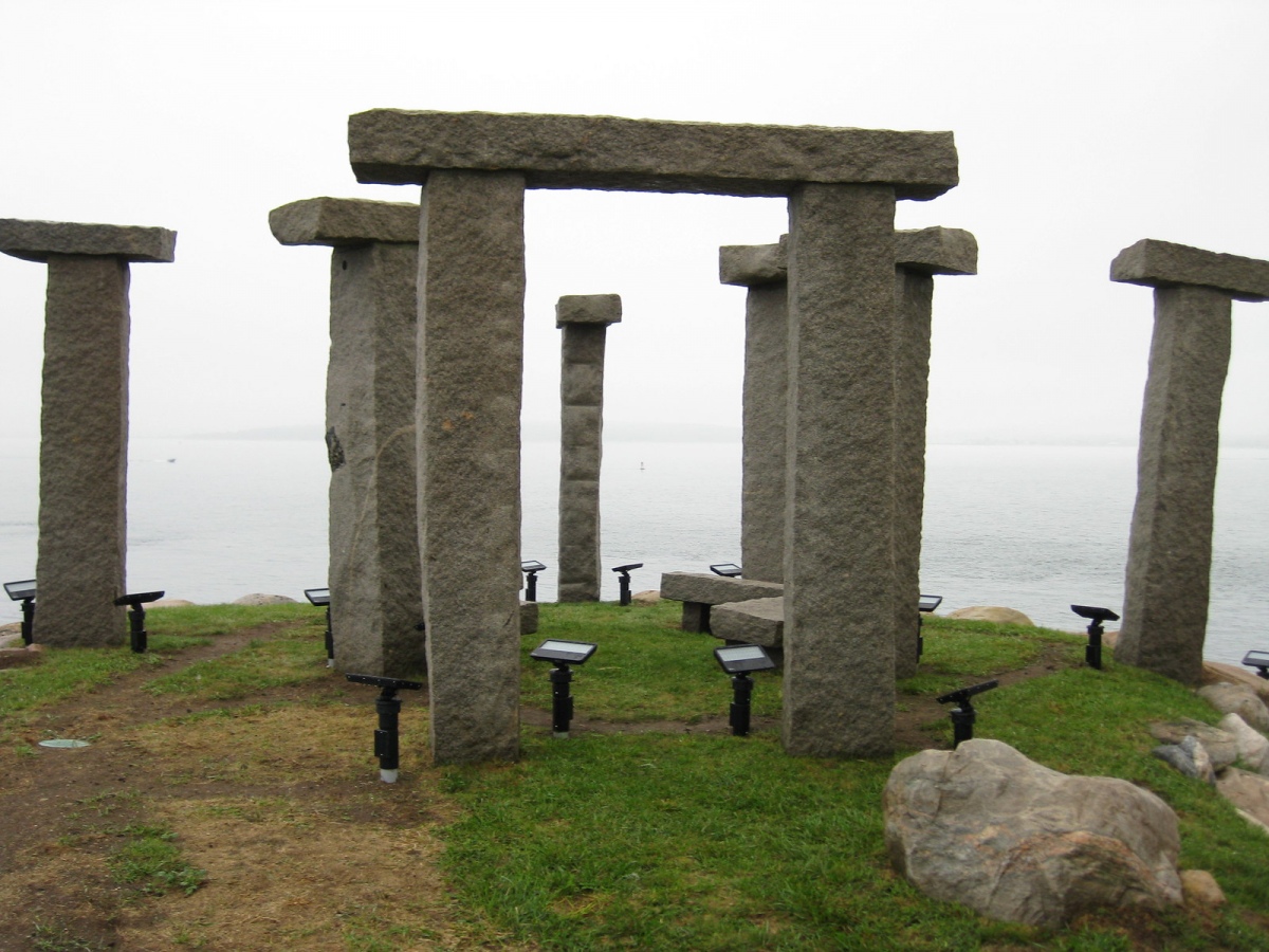
Modern SitesIn Long Island Sound between Fishers Island and the Connecticut shore (New York State), an island belonging to inventor of the Segway, Dean Kamen, who has declared it his own micronation "The Kingdom of North Dumpling" and added this rather skinny "Stonehenge" (if we can call it that). Image submitted by Creative Commons
Submitted by Aluta on Friday, 09 October 2026 (994 reads)
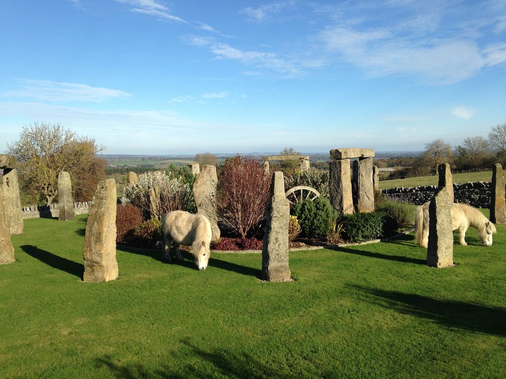
Modern SitesYes, you too, can stay in a holiday cottage with it's very own Stonehenge, at Kearton Cottage in the hamlet of Boldron, two miles from Barnard Castle. This construction has three trilithons and a scatter of single uprights, a wagon wheel set incongruously on its side as a bench in the middle of the ring, and Shetland ponies who graze right up to the stones. Lots more 'Clonehenges' are appearing on our pages as we investigate Nancy Wisser's incomparable archive for odd and interesting Stonehenge influenced sites. Image submitted by Aluta
Submitted by LongWayHome on Wednesday, 07 October 2026 (1185 reads)
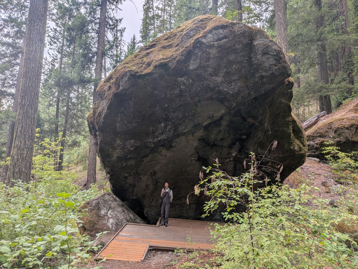
Pre-ContactLongWayHome writes: Located in the Umpqua National Forest and decorated with red and very rare and beautiful green pictograms, photos of these on our page. The staff archeologist informed me they date from 300 to potentially 9000 years ago. In order to discourage artifact hunters from digging in the ground beneath over-hang, the Forest Service has constructed a wooden viewing platform. Image submitted by LongWayHome
Submitted by Andy B on Wednesday, 07 October 2026 (852 reads)
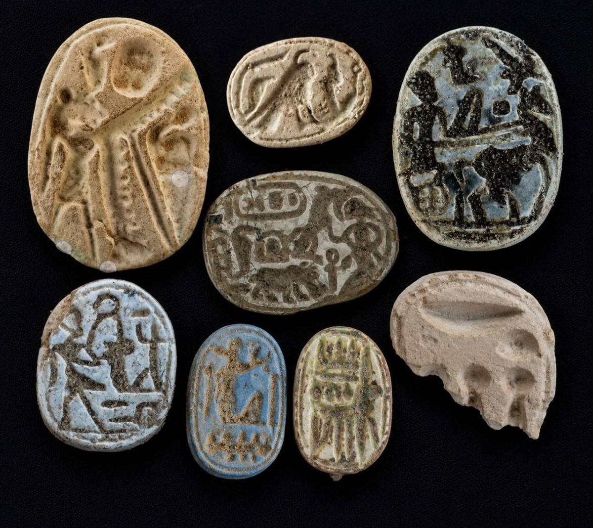
Multi-periodA horse buried with care inside a garrison, a stela of Merneptah written in hieratic (cursive Egyptian), scarabs and other amulets (pictured), all found within two streets of mudbrick living quarters and grain stores. Just some of the discoveries from the most recent dig at this fortress of Ramesses II in the western Nile Delta which is helping to illuminate the daily lives of the soldiers who held ancient Egypt's frontier against the Libyans. Image submitted by Dodomad
Submitted by Anne T on Wednesday, 07 October 2026 (1029 reads)
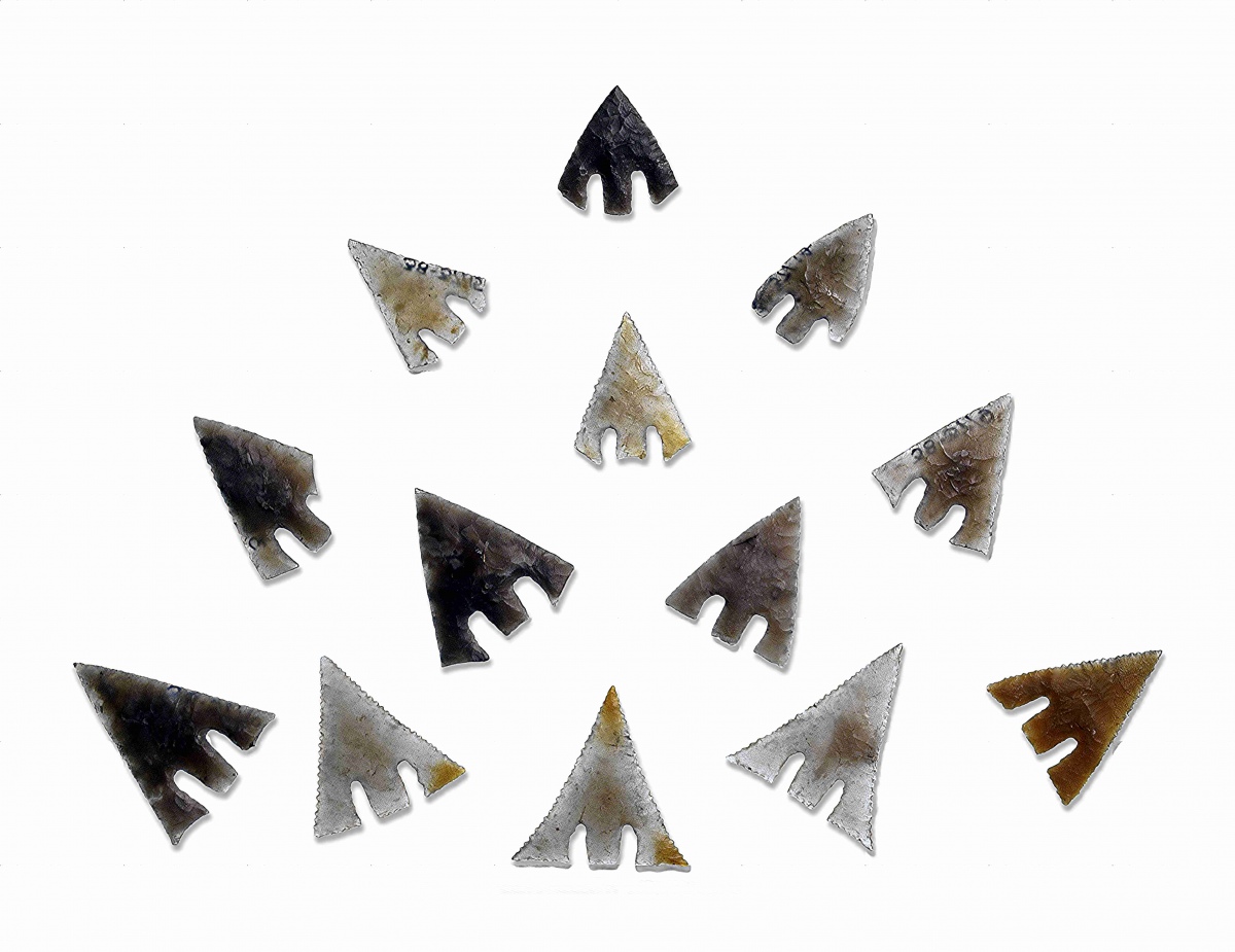
Neolithic and Bronze AgeThis Early Bronze Age round barrow produced one of the richest cremation burials known from south Wales. Pictured are some of the arrowheads found, by kind permission of Amgueddfa Cymru. Also on our page are archive photos of the 1937 excavators and details of the other five barrows which date from around 1950 to 1750 BCE, all on farmland in the Vale of Glamorgan. Image submitted by Anne T
Submitted by TheCaptain on Wednesday, 07 October 2026 (4543 reads)
Iron Age and Later PrehistoryLocated on a naturally defended granite promontory at the confluence of the Mayenne and Aron rivers. With its exceptional size and planned internal layout, Moulay is the largest known oppidum in the Armorican Massif and was probably the principal centre of the Aulerci Diablintes, the Gaulish people who lived in much of what is now northern Mayenne. Image submitted by Lemmy
Submitted by postman on Tuesday, 06 October 2026 (11140 reads)
Multi-periodThis is a weird one. About seven kilometres from Lampeter, on a saddle in the hills and right by the road sits this giant sunken doughnut of a mound with a massive slab, four or five metres long, lying across its south-west side with a cluster of smaller boulders beside it. The name means the Goblin Stone - the story goes that a seventeenth-century traveller who bedded down beside it was pinched, prodded and shrieked at by a crowd of unspeakable creatures until first light. More on this intriguing site in the comments on our page. Image submitted by Penbron
Submitted by HistoryHikerWales on Tuesday, 06 October 2026 (1053 reads)
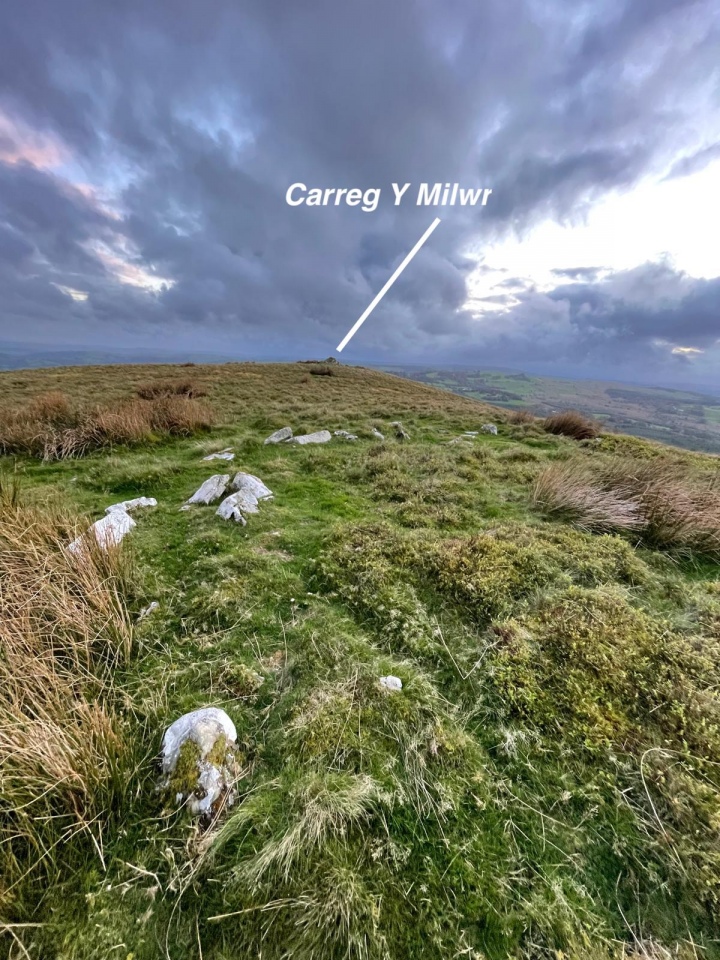
Neolithic and Bronze AgeJust along the ridge from the Soldiers Grave, Carreg Y Milwr, and near to the Carreg Y Bwci site and Roman road of Sarn Helen, is this low ring of stones. It is the kerb of a Bronze Age burial cairn, the north-eastern of the two Esgair Ffraith Round Cairns. with a well-defined kerb, 27m (89 ft) east-north-east of the larger cairn on the summit, the Soldier's Grave, which contains a cist. See the Nearby Sites list on our page for links to these. During the summer months, in the heatwave of 2026, they sat very clearly in the landscape. Image submitted by HistoryHikerWales
Submitted by TheCaptain on Monday, 05 October 2026 (6286 reads)
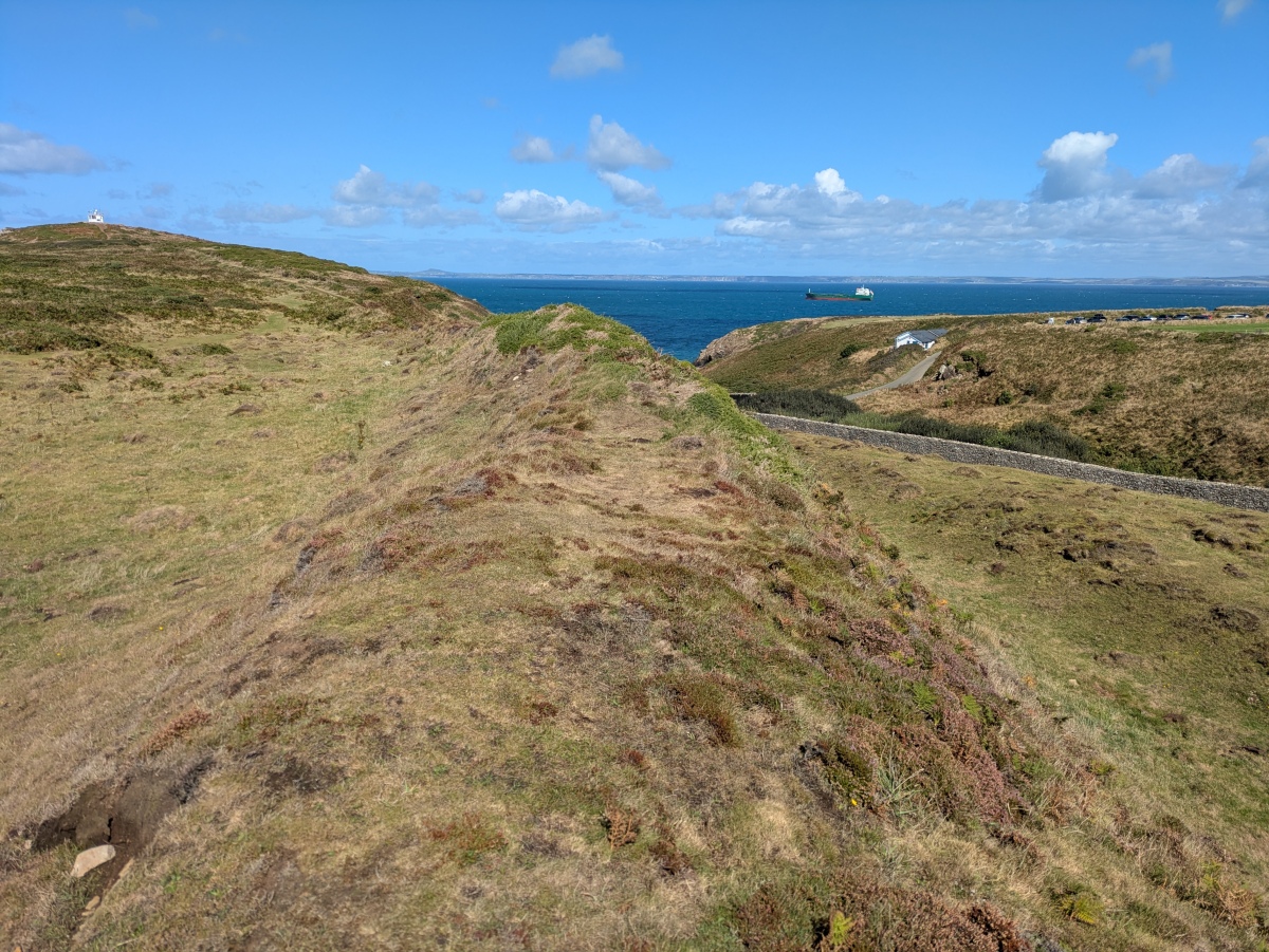
Iron Age and Later PrehistoryFortified headland at Martin`s Haven, overlooking Skomer Island and on National Trust land. An interpretive board in the National Trust hut shows the hillfort encompassing this rocky outcrop. An entrance is clearly visible with grassed over walls 3 feet high. Image submitted by TheCaptain
Submitted by ciatology on Monday, 05 October 2026 (1105 reads)
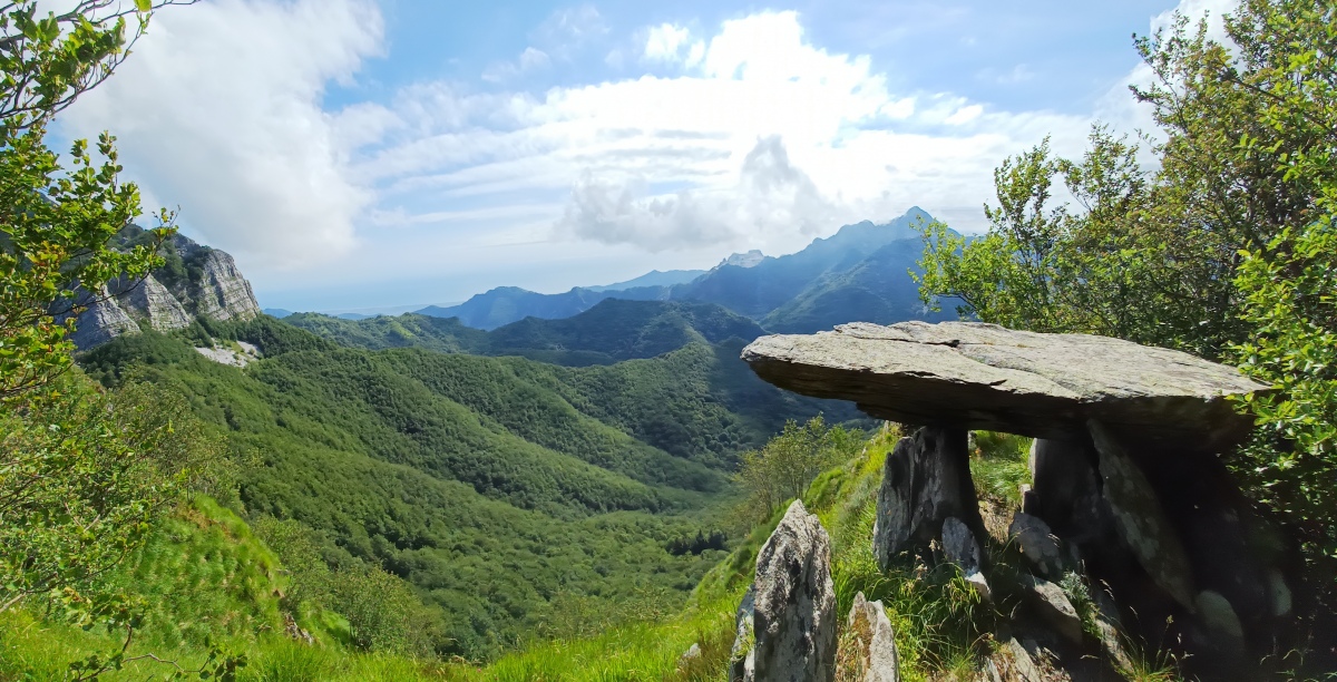
Neolithic and Bronze AgeThe most strikingly situated dolmen I have ever seen writes Ciatology. It lies in the magnificent Apuan Alps, on the ridge between Monte Paglino and Monte Freddone - though actually closer to Paglino. Enrico Calzolari has conducted various studies on its orientation (linked to the sun as well as Monte Altissimo and other nearby peaks), and researchers Paolo Debertolis, Natalia Tarabella, and Lorenzo Marcuccetti have carried out archaeoacoustic studies. Image submitted by ciatology
Submitted by Andy B on Monday, 05 October 2026 (1237 reads)
EventsAndy's next talk date is the amazing Fishbourne Roman Palace near Chichester, West Sussex this Saturday afternoon. Last few tickets available! The Old Stones - a field guide to the megalithic sites of Britain and Ireland won (as you probably know by now) Current Archaeology Book of the Year 2019 Image submitted by Andy B
Submitted by Andy B on Saturday, 03 October 2026 (1166 reads)
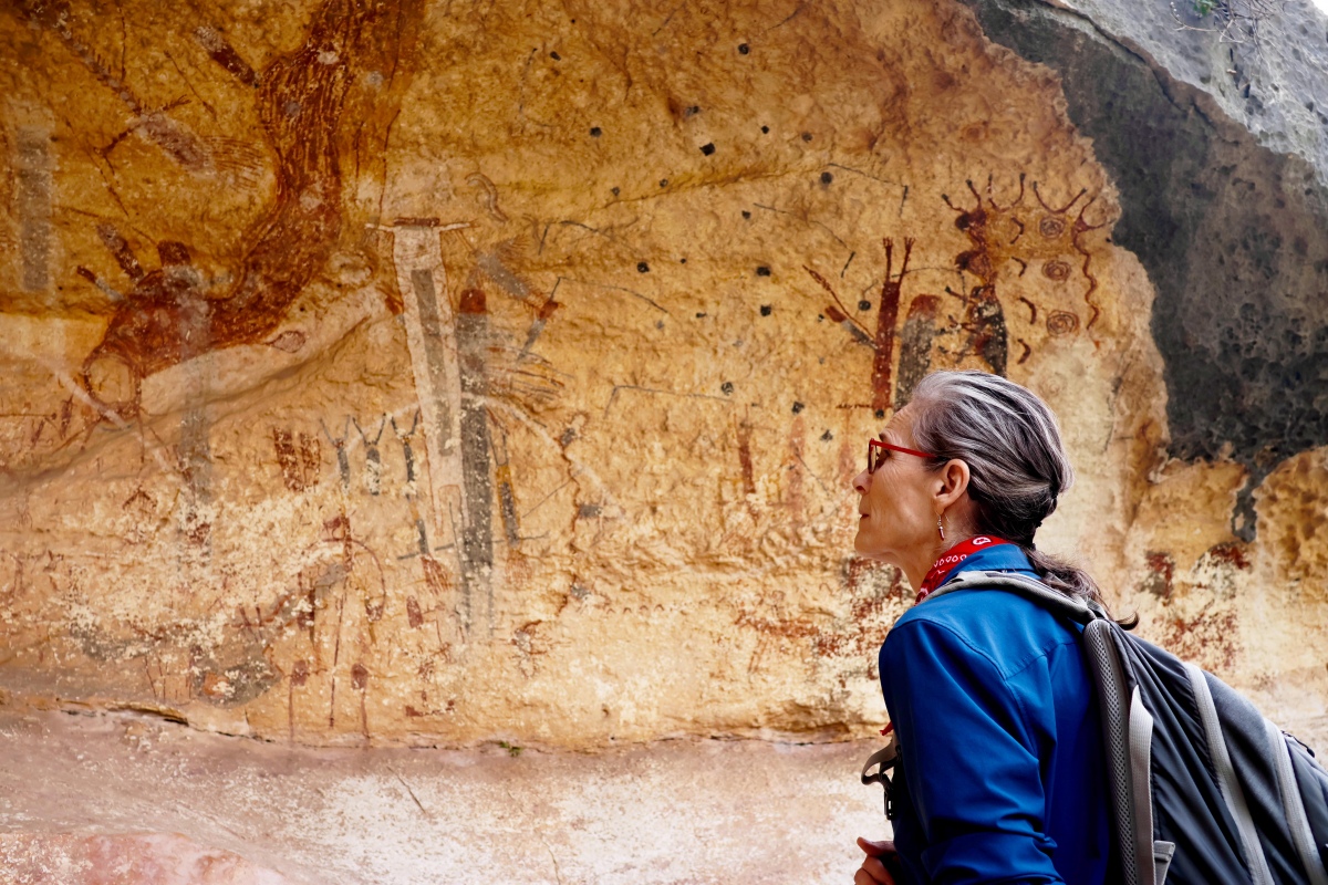
Rock ArtThe painting faces west. At sunset on the lunar standstill the light climbs the wall and stops at the neck of the headless white figure, so that the sun appears to decapitate her. The mural is a panel some 30m (100 ft) long in a rock shelter above the Pecos River, a few miles from where it meets the Rio Grande and within sight of the highway bridge. Image submitted by Dodomad
Submitted by Anne T on Saturday, 03 October 2026 (676 reads)
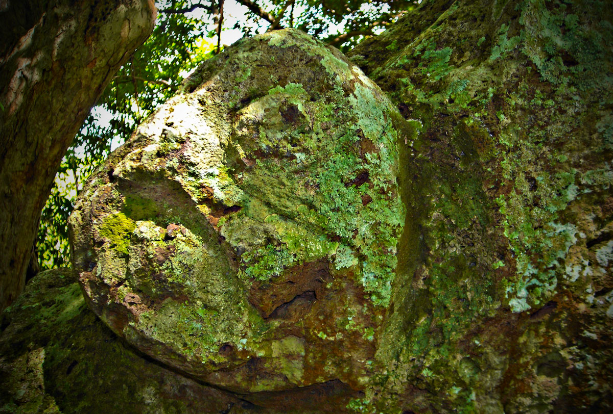
Multi-periodSeven stone coffins lie scattered across the terraces of a low hill at Pungkit, in the Lopok district of Sumbawa, Indonesia. Some of them split open and are carved with human faces and animals that local people call the Doll Stones, Batu Babung. Image submitted by Anne T
Submitted by Anne T on Saturday, 03 October 2026 (957 reads)
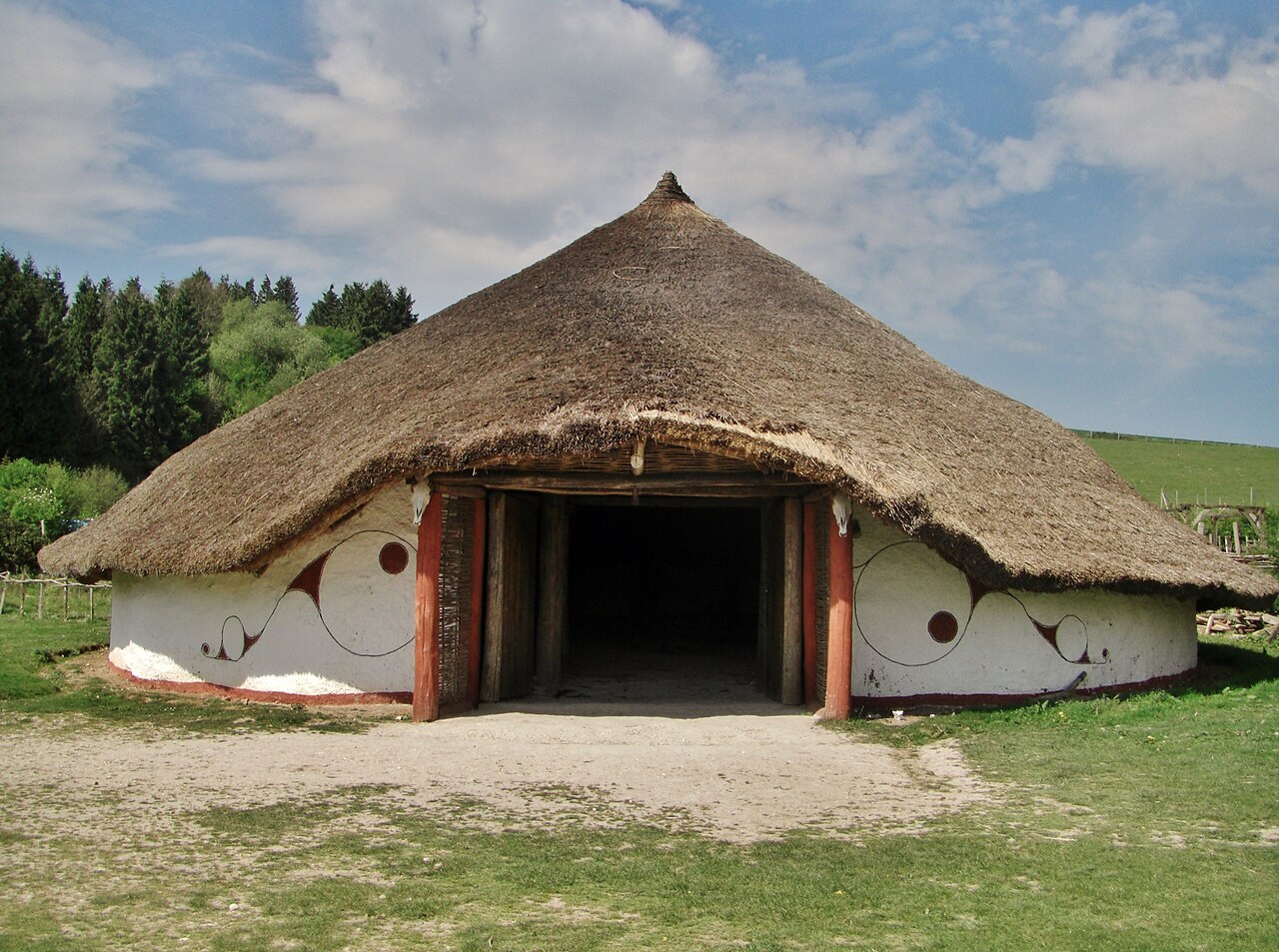
Multi-periodOne of the most important Iron Age settlements ever dug in Britain, the site that gave its name to the "Little Woodbury" type of enclosed farmstead. This reconstructed roundhouse in the style is at Butser Ancient Farm. The original location is a roughly D-shaped enclosure of about 1.5 hectares, bounded by a single ditch with an elaborate antenna-style entrance on the east, standing on a low chalk ridge in Britford parish south of Salisbury. Image submitted by Anne T
Submitted by TheCaptain on Saturday, 03 October 2026 (12588 reads)
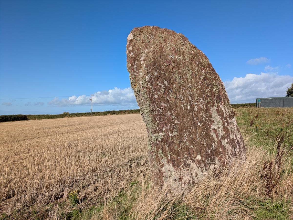
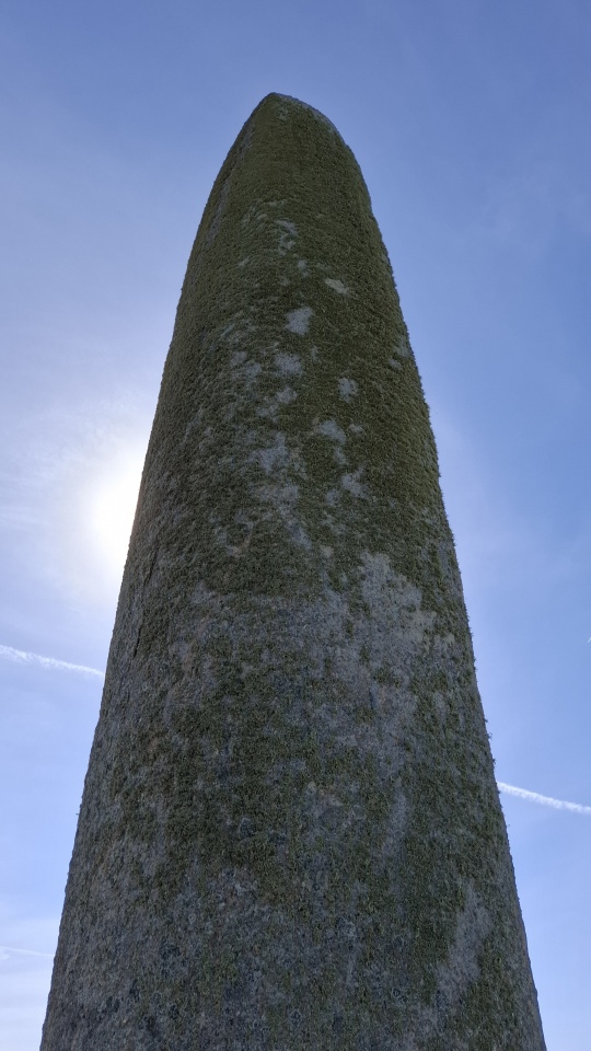
Neolithic and Bronze AgeThe two giant menhirs of Kergadiou are a fine place to visit, and fairly easily found in a field a couple of kilometres north of the Aber Ildut estuary in furthest western Brittany. Kergadiou menhir 1 (pictured) is a really magnificent monster menhir, 8.8 metres tall, and the most beautifully and perfectly smoothed and shaped menhir there is. Image submitted by stonetracker
Submitted by TAlanJones on Saturday, 03 October 2026 (716 reads)
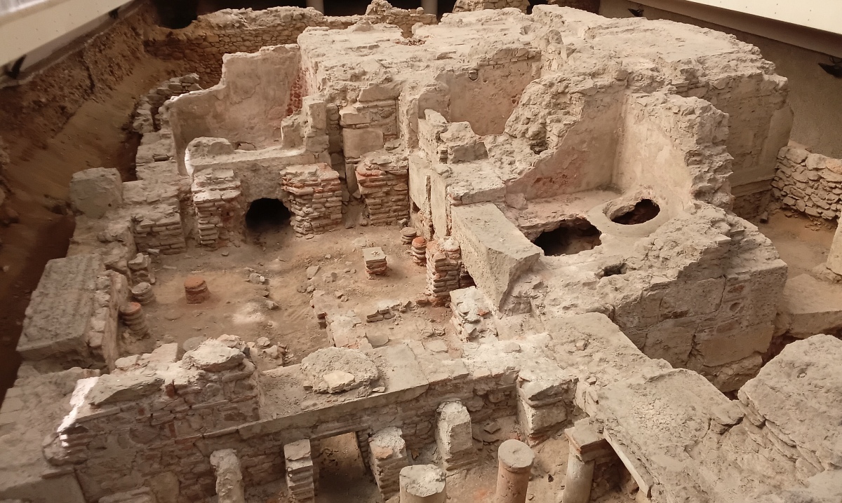
Roman, Greek and ClassicalSituated along the Amalias Ave and just to the west of the National Gardens the Zappeio Roman Baths complex was a real surprise as I meandered towards Hadrian's Arch one morning. Originating from the 3rd /4th century CE following the Herulian invasion it was redesigned and rebuilt over the following centuries. Image submitted by TAlanJones
Submitted by Aska on Thursday, 01 October 2026 (11364 reads)
Neolithic and Bronze AgeThree late Bronze Age statue-menhirs: Buccentone, Murellu, Murtola, originally from different parts of the Commune of Santo-Pietro-di-Tenda, now set up near the church in Piève. Get there early if you want to get a good shot - after 10am they are in the shadow of the church and in the afternoon the sun shines on their rear side. Image submitted by Aska
Submitted by thecaptain on Thursday, 01 October 2026 (43576 reads)
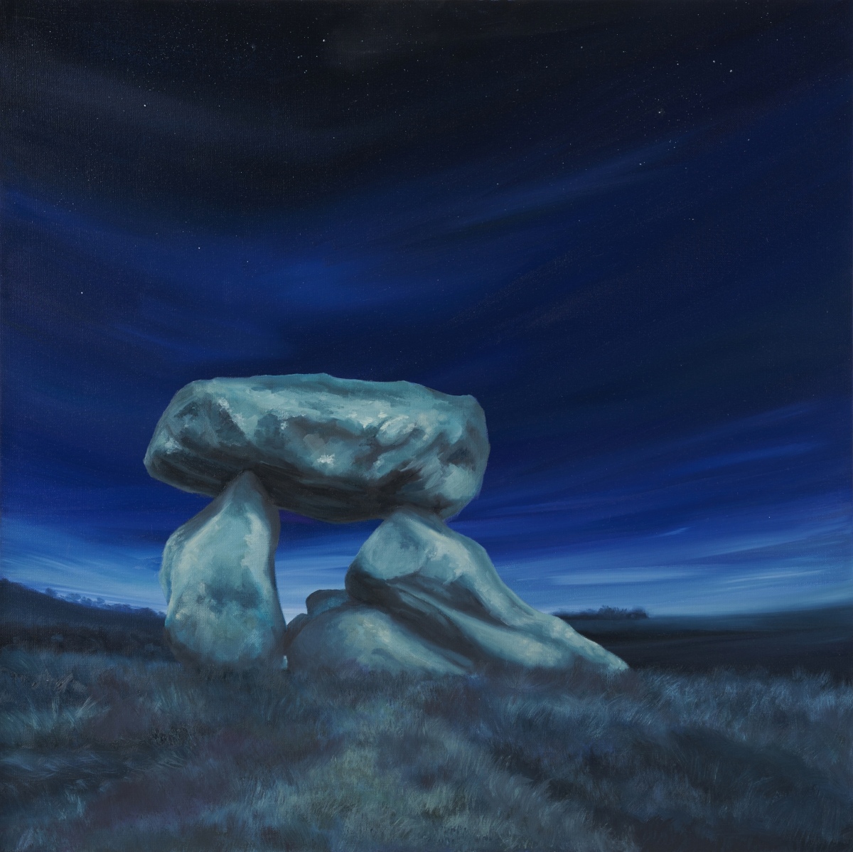
Neolithic and Bronze AgeBurial chamber in Wiltshire, reconstructed (rather badly) in 1921. All that remains are two standing stones and a capstone with two fallen stones underneath. This was originally placed in the south-eastern end of a long mound which was described in the 1920s as being around 230ft long. Image submitted by KerryW
One of two paintings by Kerry Webb inspired by a recent visit to the Devil's Den - the other is on our page. Thanks for sharing Kerry, looking forward to seeing more soon Read More | 12 News and Comments | Category: Our Photo Pages
Submitted by kristiansen on Tuesday, 29 September 2026 (3304 reads)
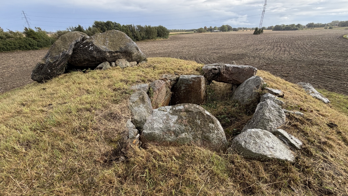
Neolithic and Bronze AgeJættestue (Passage Grave) in Holbæk. The eastern chamber is quite small, 3.1 m in length, 2.1 m wide. and 1.4 m high. The western chamber (seen at front) is similar but without a capstone, approx 3.0 by 2.5 and 1.7 metres high. Image submitted by ShamrockStone
Submitted by Anne T on Tuesday, 29 September 2026 (704 reads)
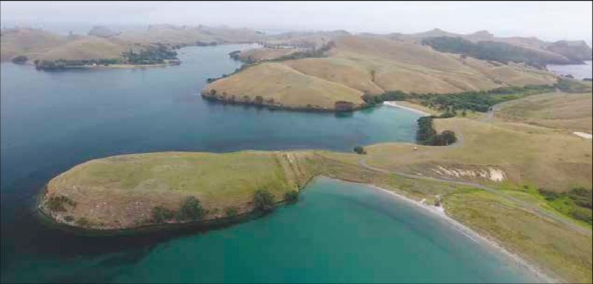
Pre-ContactSome of the earliest gardens in Aotearoa (New Zealand) were dug on this small island off the Coromandel Peninsula, within a century or two of the first Polynesian settlement. Ahuahu, also known as Great Mercury Island, carries one of the richest and best-studied early Maori landscapes: more than twenty pa, or fortified settlements, defended by ditches and banks on its headlands, together with garden soils, middens and living sites that record how people made a home here from the fourteenth century onwards. Image submitted by Anne T
Submitted by kenntha88 on Monday, 28 September 2026 (718 reads)
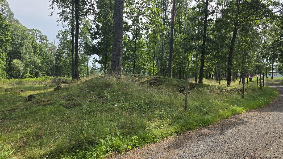
Neolithic and Bronze AgeThis small and beautiful barrow cemetery consists of approximately nine stone-mixed round barrows and three cairns. It is located in a spruce forest on a natural flat hill. Unfortunately the road Mellomgårdsveien runs directly through the site. On the west side of the road, about 16 meters away lies one large oval barrow. The other eleven barrows are located to the east of the road. Two of these are also oval in shape, oriented north-south, and both measure 12 by 6 meters. Image submitted by kenntha88
Submitted by Billythefish on Sunday, 27 September 2026 (556 reads)
Rock ArtA rock outcrop beside the access drive to Achanarnich. I am told by locals that access is unrestricted with the usual caveats of not obstructing gates or causing damage. Image submitted by Billythefish
Submitted by juamei on Saturday, 26 September 2026 (22514 reads)
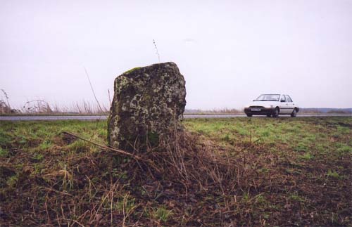
Date UncertainSituated on the edge of the A146 just before the Stockton sign as you come from Norwich. This stone is missed no doubt by 99 percent of the people hurtling past on a reasonably busy A road. Image submitted by juamei
Submitted by Andy B on Friday, 25 September 2026 (12374 reads)
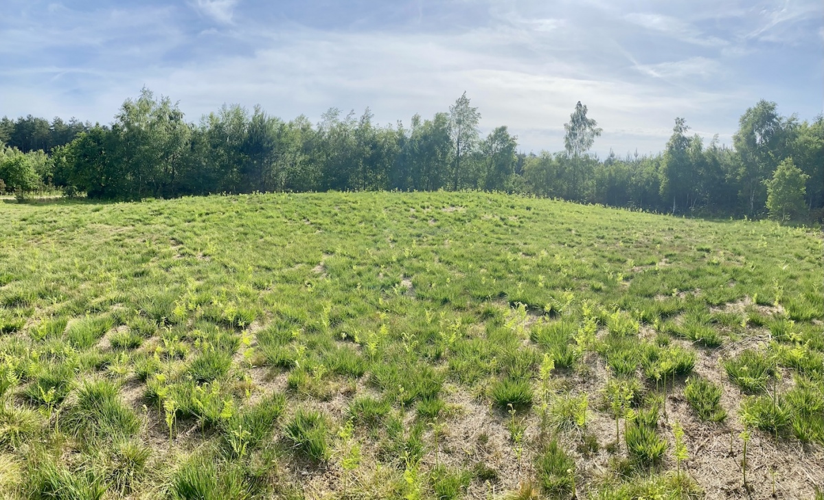
Neolithic and Bronze AgeA possible short long barrow (yes that is a thing - can you see it?) and round barrow that were in a pine plantation. This recent photo sent by Rebecca Penkett (thanks!) shows the plantation has been cleared around the long barrow. No surrounding ditch is evident at either barrow.
Image submitted by RebeccaPenkett
Submitted by GEdge on Thursday, 24 September 2026 (1040 reads)
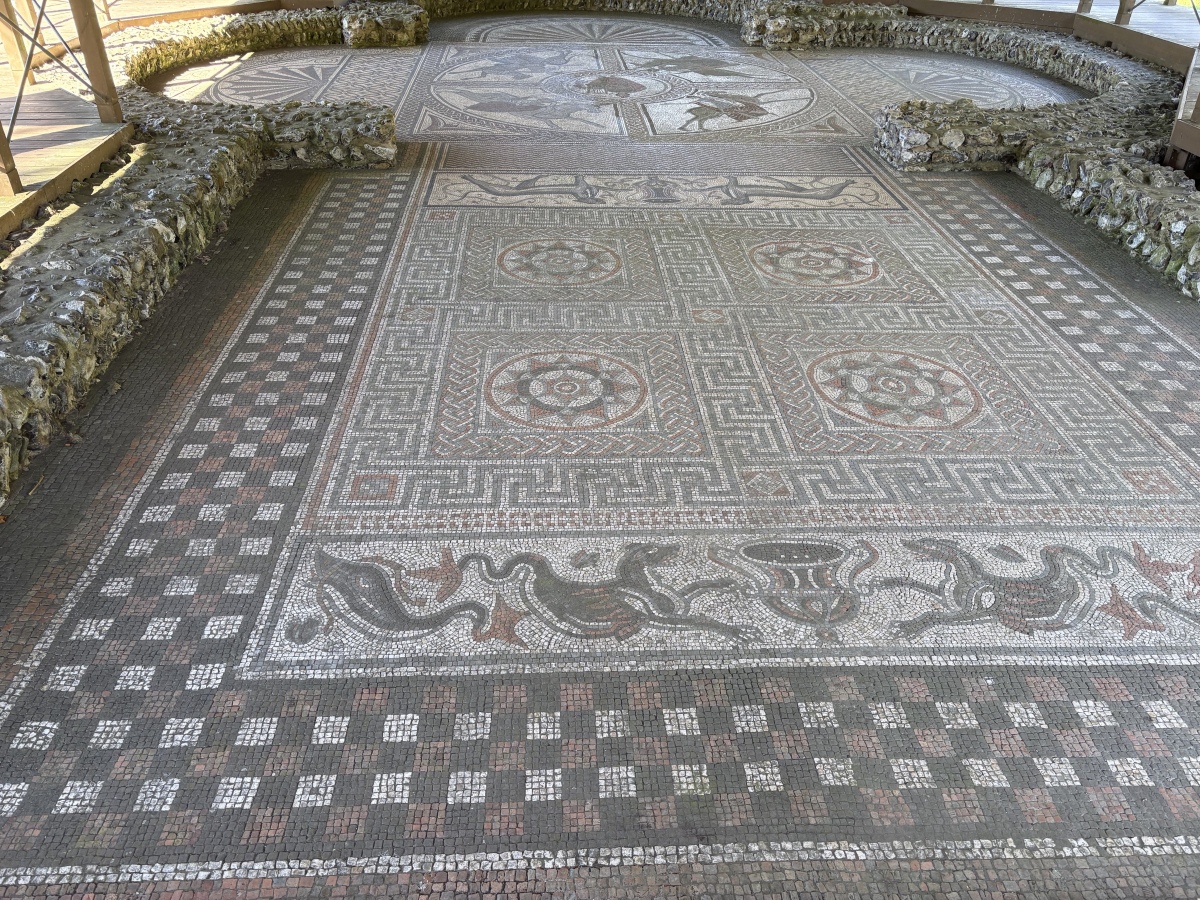
Roman, Greek and ClassicalAn extensive villa at Littlecote Park just over a mile west of Hungerford. The Orpheus mosaic (pictured) would have been in a large hall dedicated to the Greek legendary hero. The mosaic is one of the best I (GEdge) have seen in this country and the remains of the grand villa are extensive. Image submitted by GEdge
Submitted by Johnny on Wednesday, 23 September 2026 (21109 reads)
Neolithic and Bronze AgeThe roughly circular churchyard has a surrounding wall into which are set five upright stones, at least one of which is almost certainly in its original position (see separate submission). Some of the other stones are not sunk into socket holes and have masonry below implying that they may not be in their original positions. Image submitted by PAB
Is this site an embanked Bronze Age stone circle converted to be a Christian Church in later times? CoralJackz investigate in their video and article linked from our page Read More | 7 News and Comments | Category: Our Photo Pages
Submitted by Anne T on Monday, 21 September 2026 (1356 reads)
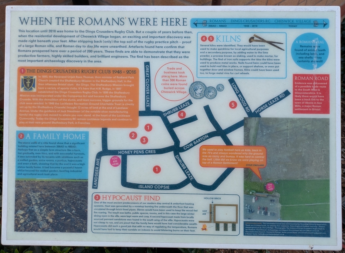
Multi-periodThe site of a Roman villa discovered on land which has now become a new housing development between Cheswick Village and Lockleaze. Martyn 'TheCaptain' took a visit and found these rather good information boards. Lots more about the site on our page. Image submitted by TheCaptain
Submitted by Anne T on Monday, 21 September 2026 (995 reads)
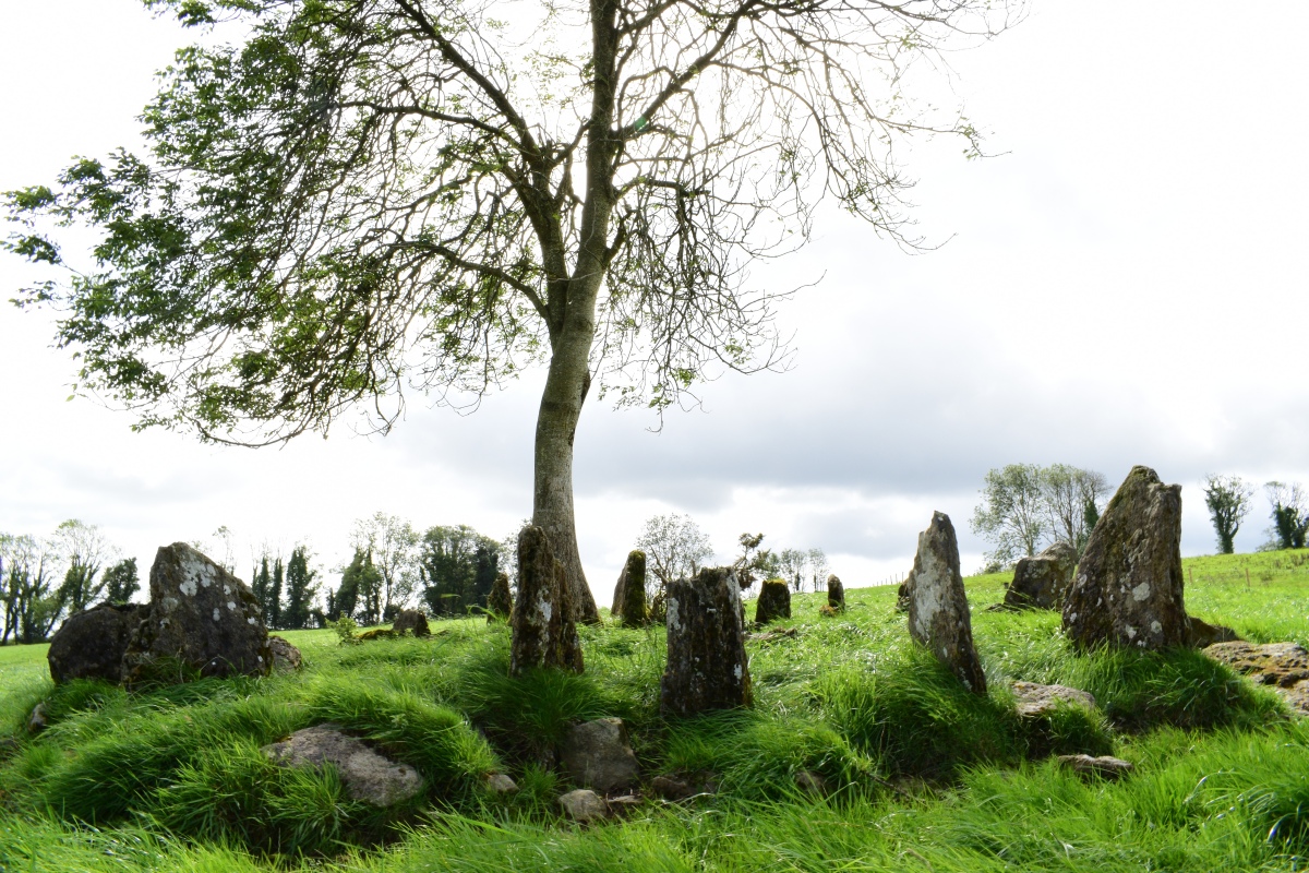
Neolithic and Bronze AgeEighteen slabs stand on end near the top of a ridge in rough pasture, set like the spokes of a wheel around a low spread of cairn stones. Radial stone cairns are rare, with only about twenty recorded in Ireland. The slabs are 0.5 to one metre long, an early account reckoned the ring had once held twenty-four. Image submitted by thelaoiscyclist
Submitted by Anne T on Monday, 21 September 2026 (931 reads)
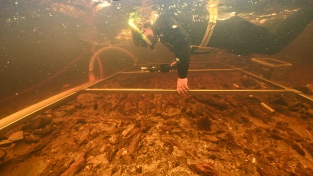
Iron Age and Later PrehistoryThis crannog in Loch Bhorgastail was built upwards from the loch bed about five thousand years ago. A recent survey using stereophotogrammetry is revealing new information. The archaeologists also found hundreds of sherds of Neolithic pottery in the water around the island, which cannot have got there by accident. More details on our page. Image submitted by Anne T
Submitted by Anthony_Weir on Saturday, 19 September 2026 (8468 reads)
Neolithic and Bronze AgeAnthony Weir writes: The townland of Glencolumbcille in Co. Donegal is famous for its "turas", or devotional pattern on the 9th of June, along a given route which is punctuated by stations. Most of the stations feature beautiful early-christian cross-slabs and cairns, but two are megalithic tombs! The ninth station, Farranmacbride, shown here, 400 metres north of the church, close to a perforated standing-stone "through which Heaven may be glimpsed" by the pure - or devout - "and barren women made fertile", is a huge ruined court-tomb, some of whose chambers have been used as livestock pens. Image submitted by Lemmy
Submitted by Andy B on Saturday, 19 September 2026 (9514 reads)
Neolithic and Bronze AgeA pair of standing stones in Pembrokeshire. The stone pictured is located at SM827263 and has the initials "J.G." carved into it with the date 1860 - details on our page, along with the other stone. It is handily located on the grass verge so you can walk right up to it or easily view from the road. The village name suggests there are three standing stones here. This is the second of two marked on the OS map. Image submitted by Anne T
Submitted by pab on Friday, 18 September 2026 (6656 reads)
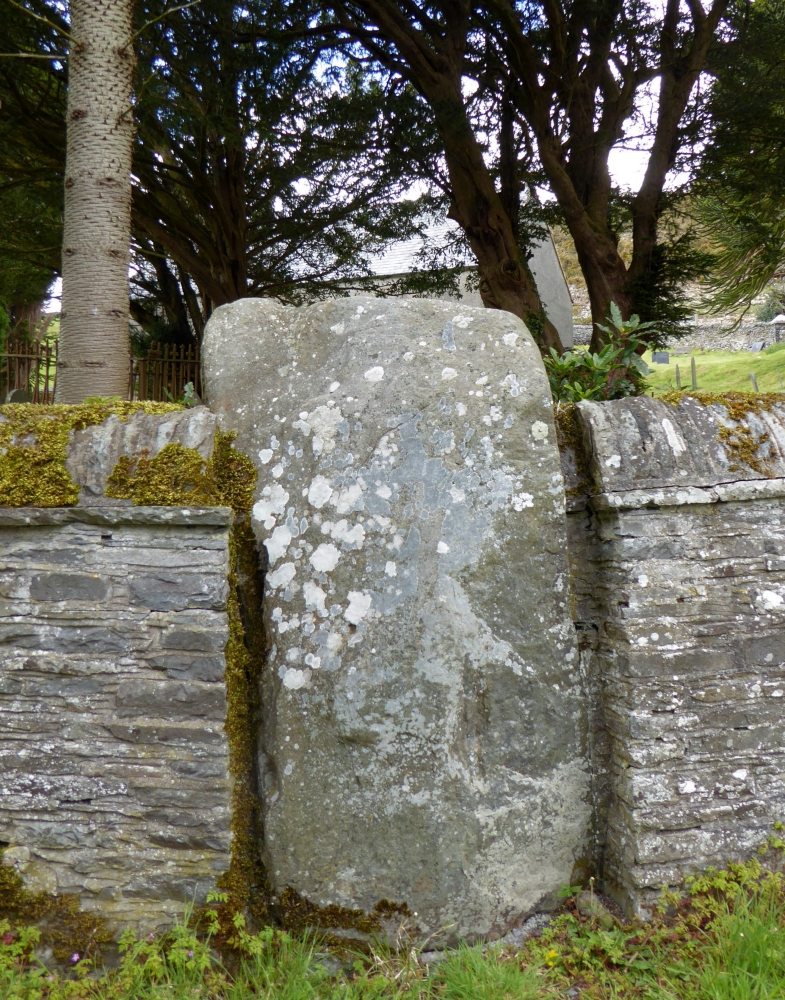
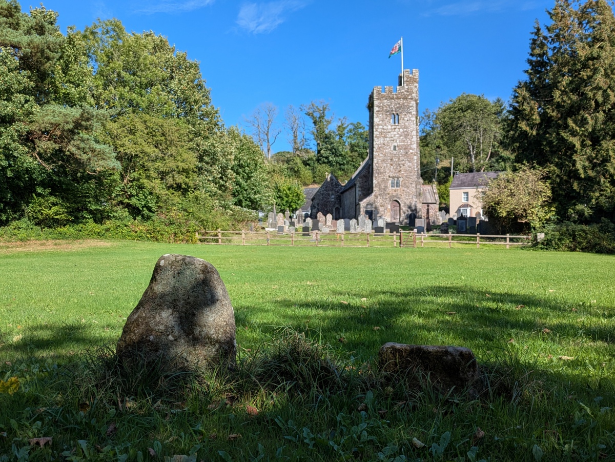
Early MedievalIn the playing field beyond the churchyard, are what looks like two stubs of once larger stones. Bearing crosses, the crosses are thought to be of 7th-9th century date. More detailed photos are on our page. Image submitted by TheCaptain
Submitted by longhintim on Thursday, 17 September 2026 (617 reads)
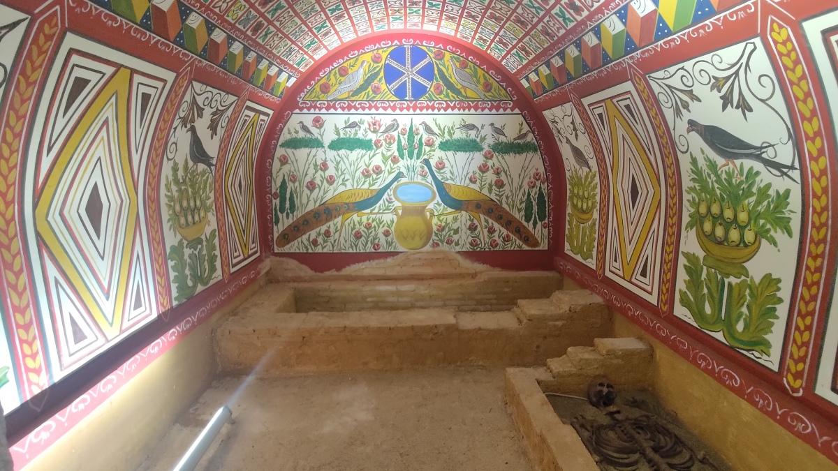
MuseumsThis spectacular reconstruction of the Elbeyli Hypogeum (the "Peacock Tomb") is in the Museum of İznik along with many artifacts which illustrate the history of the ancient city Image submitted by longhintim
Submitted by davidmorgan on Thursday, 17 September 2026 (4216 reads)
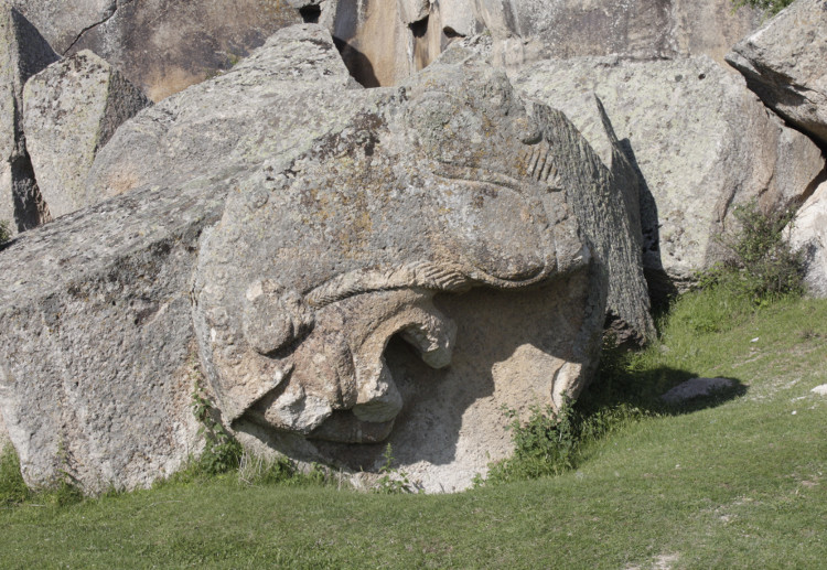
Multi-periodA collapsed Phrygian tomb in Afyon Province, Turkey. Traces of the chamber can be seen on the rock face and part of the carved lion facade has fallen. If you clamber around the rocks you can make out the various parts of the fallen tomb. Image submitted by davidmorgan
Submitted by awrc on Wednesday, 16 September 2026 (705 reads)
Events
In this issue: archaeology in Wigan, Nottinghamshire, Malta; an odd folk find in Oxon; 3rd Stone remembered; fairy doors; religious sects, a new artist feature… and lots more! Image submitted by davidmorgan
Submitted by Tonnox on Wednesday, 16 September 2026 (3681 reads)
Neolithic and Bronze Age A mighty Langdysse (Long Barrow) in Haderslev, 115 m long in the NE-SW direction and 8-12 m wide. The earth mound is from 1.50 to 2.00 m high. Part of the impressive Vedsted 'Femhøje' complex. ('Femhøje' = Five Hills / Barrows), explore via the Nearby Sites listings on our page.
Image submitted by Tonnox
Submitted by Anne T on Wednesday, 16 September 2026 (4153 reads)
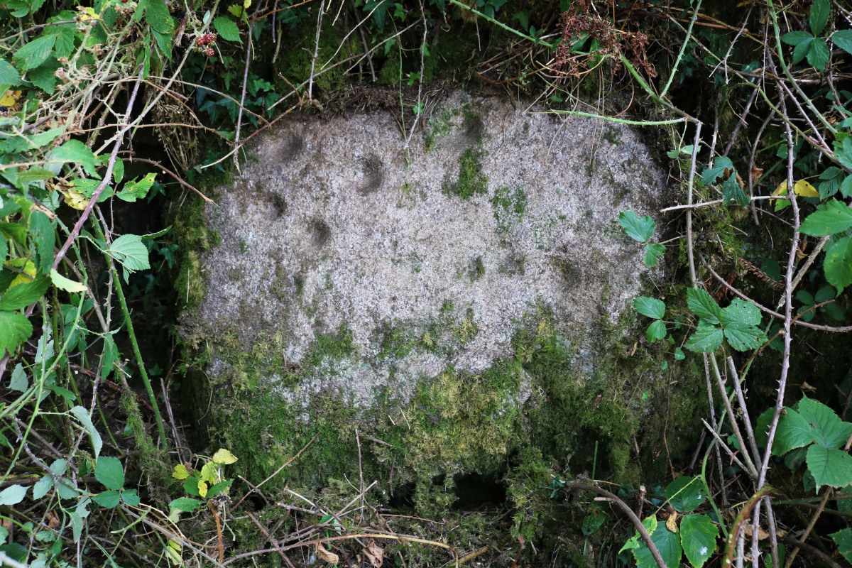
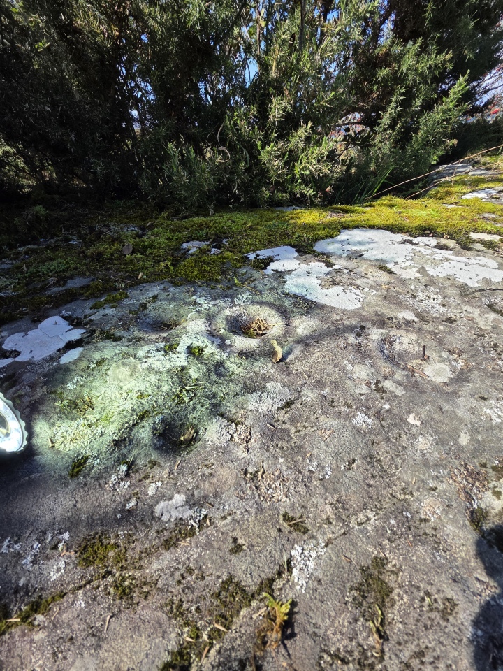
Rock ArtLithicality writes: Very pleased to have found this stone after asking permission from the landowner. [As are we to receive the first photo of it - thanks! - MegP Ed] It is located about 10 metres from the gate in the position shown on the map on our page, at the bottom of a wall corner that sticks out into the lane. Hidden by nettles and brambles and only spotted by lynx eyed S. Once cleared a bit the marks are still visible although getting harder to make out in comparison to the 1976 photo by Tom Greeves. (also on our page). We felt convinced these are cup marks as opposed to a buddle stone. Image submitted by lithicality
Submitted by Anne T on Monday, 14 September 2026 (1047 reads)
Neolithic and Bronze AgeTwo boulders bearing remarkable labyrinthine petroglyphs, in a pine wood beside the ancient Roman road connecting Viseu to Sao Pedro do Sul (known for its its thermal spa), about 300 metres from the village of Lufinha in the centre of Portugal. The two stones were probably once part of a single outcrop, broken up according to local legend by people pursuing a treasure hidden beneath the stone by a serpent. Photo Credit: Jose Neto Image submitted by Anne T
Submitted by Anne T on Monday, 14 September 2026 (1128 reads)
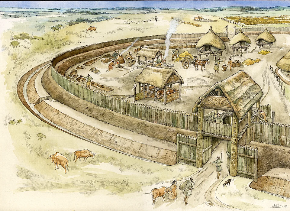
Iron Age and Later PrehistoryRecorded during excavations in 2008-2009 in advance of construction of the Weymouth Relief Road. Road construction affected only the western edge of the settlement, which may have been very much larger. The settlement was established in the 800-600 BC, the very earliest Iron Age, and appears not to have been enclosed at that time. Reconstruction image by Mark Gridley, commissioned by Oxford Archaeology Image submitted by Anne T
Submitted by Anne T on Friday, 11 September 2026 (11006 reads)
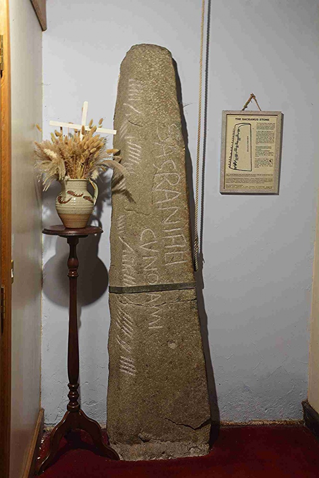
Early MedievalThe Ogham inscription has been translated as "of Sagranus son of Cunatamus?" and thought to be 5th- to early 6th-century in date. More close-ups on our page. A number of incised stones were found within the Abbey grounds; only the Sagranus Stone (pictured) is on display in the church - most are now displayed in the nearby Abbey Visitor Centre. Image submitted by Anne T
Submitted by Andy B on Thursday, 10 September 2026 (4950 reads)
FunArtists Jimmy Cauty and Jem Finer have raised two standing stones, with a "modern ley line" between them. Inspired by this, I (Andy B) have built a 'Ley Line and Alignment Finder' which draws a straight line between any two of the Portal's 65,000-plus mapped sites and shows what sits along it. This is intended as a conceptual art project highlighting how we project modern thoughts onto ancient sites but it is for everyone to use however you wish. Here we look at a some classic alignments, then a how-to section so you can use the new tool to find your own conceptual 'ley lines' or alignments between any pair of sites of your choosing. Image submitted by Andy B
Following the live premier last night at Lewes Catalyst Club here is the link to the brand new app version of the Ley Line Finder free for all to try for one week! Let us know if you find any new alignments Read More | 6 News and Comments | Category: Feature Articles
Submitted by HamGarn on Thursday, 10 September 2026 (15097 reads)
Neolithic and Bronze AgeNear Roughfort on the far outskirts of the city of Belfast. It looks like it has been cleared of a lot of vegetation that previous visitors complained of. Also known as Granny’s Grave (a corruption of Grania’s Grave which is itself a translation of Carn Greine = Cairn of the Sun), an overgrown, low, megalithic passage still roofed, 9 metres long. At the south-western end of is a sealed polygonal chamber which is roofed by a single stone 1.8 metres across. Image submitted by HamGarn
Submitted by DrewParsons on Thursday, 10 September 2026 (11860 reads)
Iron Age and Later PrehistoryThe site of the only known crannog in Wales. A dug-out canoe found some 400 metres from the site and now in Brecon Museum (pics on our page) has been radio carbon dated to between 760 AD and 1020 AD suggesting an age for the site. There is a reconstructed crannog house created on an island some 70 metres from the original crannog which has display panels and a replica of the canoe. Image submitted by GEdge
Submitted by davidmorgan on Tuesday, 08 September 2026 (3340 reads)
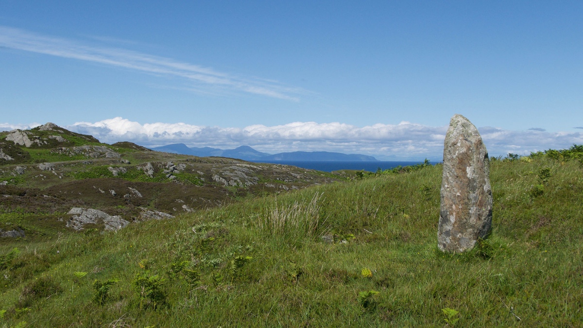
Neolithic and Bronze AgeA 1.4 metre tall standing stone on Cnoc a' Charragh (Hill of the Standing Stone) a remote, rocky location on the Isle of Colonsay. Just to the north lies another slab, 2 m by 0.8 m and at least 0.2 m thick. In 1923, S Grieve took it to be the cover of a long cist. This was examined and found to be empty. In 1984 RCAHMS thought it more likely a second, fallen standing stone. Creative Commons photo by Julian Paren, Image submitted by Creative Commons
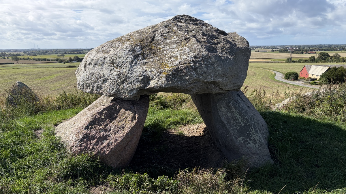
This site looks to have been well repaired, judging by previous photos we have of this central dolmen in a collapsed condition. Look at the colours of the stones too. Read More | 1 News and Comments | Category: Our Photo Pages
Submitted by BigSweetie on Sunday, 06 September 2026 (21549 reads)
Neolithic and Bronze AgeAn absolutely lovely site and well worth the visit as part of the Clunie Path. When the Clachan an Diridh stone circle was built, it would have had magnificent views to the NE across the River Tummel to Ben Vrackie and the Grampians beyond, and to the SW down the River Tay. Image submitted by dst
Submitted by bishop_pam on Thursday, 03 September 2026 (937 reads)
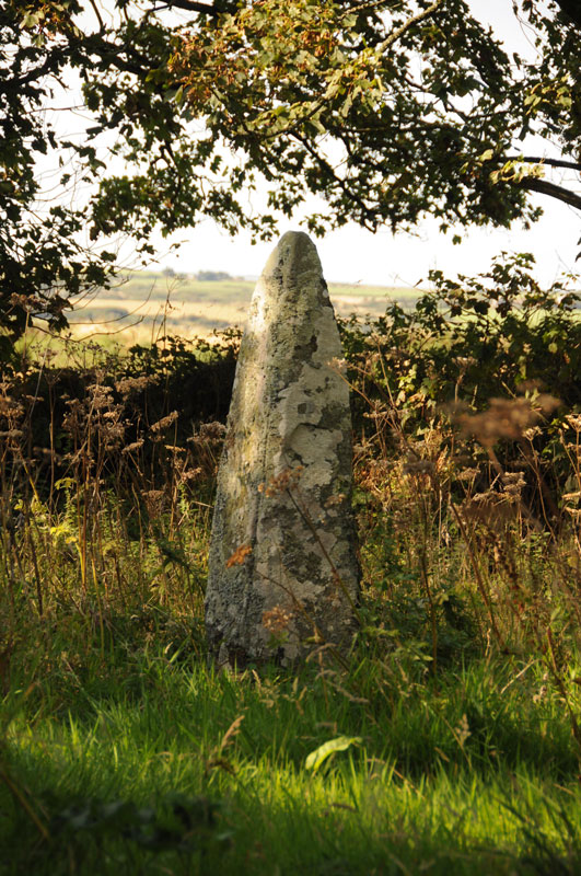
Neolithic and Bronze AgeFurther along the road to Ty-Lia allee couverte (see previous) after 100 yards a 5 foot standing stone is visible on the left. Walk through a gateway and the stone is under a tree, with three smaller stones nearby to the south on the other side of the tree and hedge. Image submitted by bishop_pam
Submitted by TheCaptain on Thursday, 03 September 2026 (10071 reads)
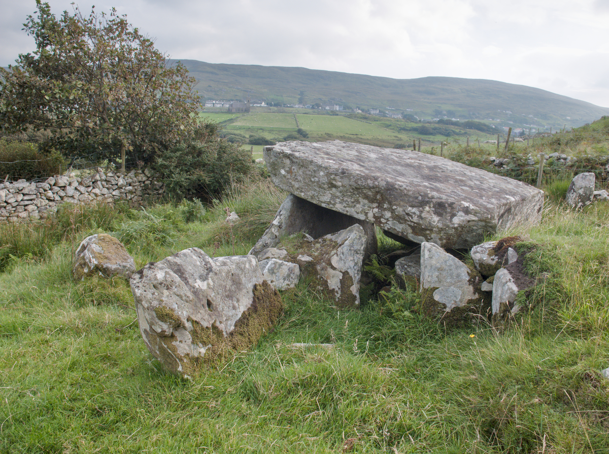
Neolithic and Bronze AgeA fairly complete allée couverte, well signposted and in a little grassy area on the island of Ile-Grande, just off the coast near Trebeurden. It is about 9 metres long by 1.5 metres wide, and oriented to 110°. There are two large capstones which cover most of the chamber. Image submitted by DrewParsons





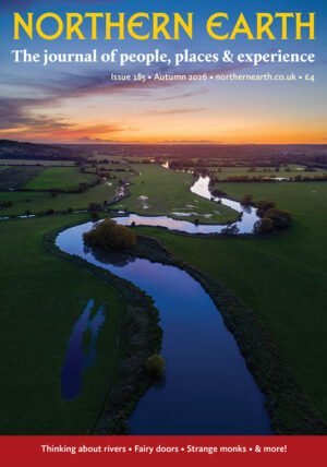 In this issue: archaeology in Wigan, Nottinghamshire, Malta; an odd folk find in Oxon; 3rd Stone remembered; fairy doors; religious sects, a new artist feature… and lots more!