

<< Our Photo Pages >> Keith Hall - Class I Pictish Symbol Stone in Scotland in Aberdeenshire
Submitted by alligator on Thursday, 26 February 2004 Page Views: 17100
Early MedievalSite Name: Keith Hall Alternative Name: Caskie BenCountry: Scotland
NOTE: This site is 0.2 km away from the location you searched for.
County: Aberdeenshire Type: Class I Pictish Symbol Stone
Map Ref: NJ78802136 Landranger Map Number: 38
Latitude: 57.282372N Longitude: 2.353284W
Condition:
| 5 | Perfect |
| 4 | Almost Perfect |
| 3 | Reasonable but with some damage |
| 2 | Ruined but still recognisable as an ancient site |
| 1 | Pretty much destroyed, possibly visible as crop marks |
| 0 | No data. |
| -1 | Completely destroyed |
| 5 | Superb |
| 4 | Good |
| 3 | Ordinary |
| 2 | Not Good |
| 1 | Awful |
| 0 | No data. |
| 5 | Can be driven to, probably with disabled access |
| 4 | Short walk on a footpath |
| 3 | Requiring a bit more of a walk |
| 2 | A long walk |
| 1 | In the middle of nowhere, a nightmare to find |
| 0 | No data. |
| 5 | co-ordinates taken by GPS or official recorded co-ordinates |
| 4 | co-ordinates scaled from a detailed map |
| 3 | co-ordinates scaled from a bad map |
| 2 | co-ordinates of the nearest village |
| 1 | co-ordinates of the nearest town |
| 0 | no data |
Be the first person to rate this site - see the 'Contribute!' box in the right hand menu.
Internal Links:
External Links:
I have visited· I would like to visit
golux visited on 29th May 2011 - their rating: Cond: 3 Amb: 3 Access: 3 Access: Keith Hall lies on the east side of Inverurie; from Inverurie take the B993 east under the railway line and over the river Ury then enter the gateway on the left; follow the drive north to Keith Hall (an impressively-fronted 16th century country house now made into apartments) then go round to the back and continue north through the trees behind the house towards the site of Caskieben (former earthwork castle); cross a fence and the large dry moat and bear right; the stone sits on a small mound.
")
For details, visit: http://www.archaeoptics.co.uk/products/ecms/124.html
You may be viewing yesterday's version of this page. To see the most up to date information please register for a free account.
")
Do not use the above information on other web sites or publications without permission of the contributor.
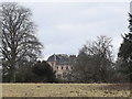
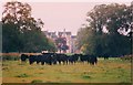
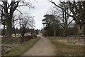
Nearby Images from Geograph Britain and Ireland:
©2020(licence)
©2008(licence)
©2020(licence)
©2008(licence)
©2020(licence)
The above images may not be of the site on this page, they are loaded from Geograph.
Please Submit an Image of this site or go out and take one for us!
Click here to see more info for this site
Nearby sites
Key: Red: member's photo, Blue: 3rd party photo, Yellow: other image, Green: no photo - please go there and take one, Grey: site destroyed
Download sites to:
KML (Google Earth)
GPX (GPS waypoints)
CSV (Garmin/Navman)
CSV (Excel)
To unlock full downloads you need to sign up as a Contributory Member. Otherwise downloads are limited to 50 sites.
Turn off the page maps and other distractions
Nearby sites listing. In the following links * = Image available
1.1km SW 227° Inverurie 1* Class I Pictish Symbol Stone (NJ78022063)
1.5km W 279° Carnegie Museum (Inverurie)* Museum (NJ773216)
1.6km WSW 253° Conyng Hillock Artificial Mound (NJ773209)
1.8km SSW 210° Broomend of Crichie North circle Stone Circle (NJ779198)
1.9km SSW 208° Broomend Of Crichie Stone Circle / Henge* Henge (NJ77911968)
1.9km SSW 207° Broomend of Crichie Pictish Symbol Stone* Class I Pictish Symbol Stone (NJ77921967)
1.9km SSW 207° Broomend of Crichie Avenue* Multiple Stone Rows / Avenue (NJ7791419653)
2.0km SSW 206° Broomend of Crichie Stone Row / Alignment (NJ7792119591)
2.1km SSW 205° Broomend of Crichie Row Mid Stone Row / Alignment (NJ7792919479)
2.3km SSW 201° Gardeners House Standing Stone Standing Stone (Menhir) (NJ7794919226)
2.4km SSW 203° Broomend Stone Seat / Cists* Cist (NJ77871917)
2.7km W 274° Blackhall Roundabout* Modern Stone Circle etc (NJ76072155)
3.0km WNW 290° Brandsbutt stone circle* Stone Circle (NJ76012240)
3.0km WNW 290° Brandsbutt* Class I Pictish Symbol Stone (NJ7599222403)
3.1km SW 219° Bruce's Camp* Hillfort (NJ76851900)
3.2km W 276° Blackhall Stones* Modern Stone Circle etc (NJ75602173)
3.4km S 187° Fullerton* Stone Circle (NJ7839517969)
3.6km NW 312° East Balhalgardy* Class I Pictish Symbol Stone (NJ76082379)
3.7km NNE 20° Kirkton Of Bourtie* Stone Circle (NJ80092488)
3.8km S 184° Cairnhall Stone Circle (NJ78501759)
3.9km NNE 25° Bourtie Pictish Stone* Class I Pictish Symbol Stone (NJ80462485)
4.0km SE 125° Peathill* Standing Stone (Menhir) (NJ8210419068)
4.1km NW 315° Balhalgardy Stone Circle* Stone Circle (NJ759243)
4.3km SE 146° Greenlands* Ancient Village or Settlement (NJ81231778)
4.6km NNE 19° Hill of Barra* Hillfort (NJ803257)
View more nearby sites and additional images


 We would like to know more about this location. Please feel free to add a brief description and any relevant information in your own language.
 Wir möchten mehr über diese Stätte erfahren. Bitte zögern Sie nicht, eine kurze Beschreibung und relevante Informationen in Deutsch hinzuzufügen.
 Nous aimerions en savoir encore un peu sur les lieux. S'il vous plaît n'hesitez pas à ajouter une courte description et tous les renseignements pertinents dans votre propre langue.
 Quisieramos informarnos un poco más de las lugares. No dude en añadir una breve descripción y otros datos relevantes en su propio idioma.