

<< Our Photo Pages >> Broomend of Crichie Avenue - Multiple Stone Rows / Avenue in Scotland in Aberdeenshire
Submitted by golux on Tuesday, 10 January 2012 Page Views: 7274
Neolithic and Bronze AgeSite Name: Broomend of Crichie AvenueCountry: Scotland County: Aberdeenshire Type: Multiple Stone Rows / Avenue
Nearest Town: Inverurie Nearest Village: Port Elphinstone
Map Ref: NJ7791419653 Landranger Map Number: 38
Latitude: 57.266996N Longitude: 2.367827W
Condition:
| 5 | Perfect |
| 4 | Almost Perfect |
| 3 | Reasonable but with some damage |
| 2 | Ruined but still recognisable as an ancient site |
| 1 | Pretty much destroyed, possibly visible as crop marks |
| 0 | No data. |
| -1 | Completely destroyed |
| 5 | Superb |
| 4 | Good |
| 3 | Ordinary |
| 2 | Not Good |
| 1 | Awful |
| 0 | No data. |
| 5 | Can be driven to, probably with disabled access |
| 4 | Short walk on a footpath |
| 3 | Requiring a bit more of a walk |
| 2 | A long walk |
| 1 | In the middle of nowhere, a nightmare to find |
| 0 | No data. |
| 5 | co-ordinates taken by GPS or official recorded co-ordinates |
| 4 | co-ordinates scaled from a detailed map |
| 3 | co-ordinates scaled from a bad map |
| 2 | co-ordinates of the nearest village |
| 1 | co-ordinates of the nearest town |
| 0 | no data |
Internal Links:
External Links:
I have visited· I would like to visit
SolarMegalith visited on 23rd Sep 2018 - their rating: Cond: 3 Amb: 3 Access: 5
SandyG visited on 21st Sep 2014 - their rating: Cond: 1 Amb: 2 Access: 5 Car parking is available at NJ 77859 19711. The northern end of row and henge are visible from the car parking area.
golux visited on 31st Dec 2011 - their rating: Cond: 2 Amb: 2 Access: 4 Finding these 4 stones is simple: start at the henge and head due S. On a fine day, visiting them all will provide a pleasant 20 minute walk through secluded woodland. The henge is located 259m E of the intersection of the Inverurie by-pass (A96) with the B993: from this junction take the B993 into Inverurie, take the first right (Mill Road) and look for the henge in the field on your left. From the henge you will see stone A due S in the middle of the field; keep going due S for another 350m to find the other 3 stones.
megalithicmatt visited on 1st Jan 2007 - their rating: Cond: 2 Amb: 3 Access: 3 Entertaining visit with Richard Bradley.
TheCaptain rldixon have visited here
Average ratings for this site from all visit loggers: Condition: 2 Ambience: 2.5 Access: 4.25
")
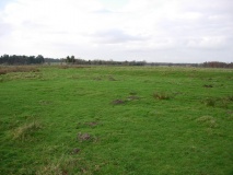
Once there were two stone circles here, joined to one another by an avenue of paired monoliths. Of this double row or "avenue" of maybe 80 stones, only four survive. According to Maitland and other authorities a double line of stones about 18m apart extended from a point 450 yards south of the circle, where a number of cist burials were discovered, up to the circle and then on to a second circle (Broomend of Crichie North circle), an overall length of about 500 yards.
The site of the second circle, a conspicuous viewpoint overlooking the confluence of the River Don with the River Urie, is shown on an estate map of 1870. The circle was described pre-1757 by Maitland as three concentric rows of erect stones with a small cairn in the middle; nearby there was said to have been a flat altar-stone, with a cavity in the upper part, raised on a rough cairn.
See below in our Nearby Sites list for more details on the other sites, particularly this page which shows Stone A.
Update October 2019: The Stone Rows of Great Britain website includes two separate entries for this site:
Broomend of Crichie, North, at NJ 77942 19746, which has now been destroyed. SRoGB notes that this was "a probable double stone row known from a 1920’s account of the archaeology of this area. The row was situated on a terrace next to the River Don and is said to have stood between a concentric stone circle which has also been destroyed, but which is known from a 1780 map and the henge which still survives. The row would have been about 46m long, composed of large stones and orientated north to south. A second stone row leading from the henge partially survives".
Broomend of Crichie, South, which tells us "(this was) A substantial double stone row (or avenue) measuring at least 457m long, originally including around 80 large stones of which only four now survive".
Both SRoGB entries include a description, plans of the rows and their inter-relationship with the stone circle/henge and cairns/cists. The Broomend of Crichie, South entry includes photographs of the surviving stones.
This site is also recorded as Canmore ID 18654 (standing stones) and Canmore ID 294046 (henge).
You may be viewing yesterday's version of this page. To see the most up to date information please register for a free account.
")
")
")
")
")
")
")
")
")
")
")
")
")
")
")
")
")
")
")
")
Do not use the above information on other web sites or publications without permission of the contributor.
Click here to see more info for this site
Nearby sites
Key: Red: member's photo, Blue: 3rd party photo, Yellow: other image, Green: no photo - please go there and take one, Grey: site destroyed
Download sites to:
KML (Google Earth)
GPX (GPS waypoints)
CSV (Garmin/Navman)
CSV (Excel)
To unlock full downloads you need to sign up as a Contributory Member. Otherwise downloads are limited to 50 sites.
![]()
Turn off the page maps and other distractions
Nearby sites listing. In the following links * = Image available
18m NNE 19° Broomend of Crichie Pictish Symbol Stone* Class I Pictish Symbol Stone (NJ77921967)
27m N 351° Broomend Of Crichie Stone Circle / Henge* Henge (NJ77911968)
62m S 173° Broomend of Crichie Stone Row / Alignment (NJ7792119591)
147m N 354° Broomend of Crichie North circle Stone Circle (NJ779198)
174m S 175° Broomend of Crichie Row Mid Stone Row / Alignment (NJ7792919479)
428m S 175° Gardeners House Standing Stone Standing Stone (Menhir) (NJ7794919226)
484m S 185° Broomend Stone Seat / Cists* Cist (NJ77871917)
982m N 6° Inverurie 1* Class I Pictish Symbol Stone (NJ78022063)
1.2km WSW 238° Bruce's Camp* Hillfort (NJ76851900)
1.4km NNW 334° Conyng Hillock Artificial Mound (NJ773209)
1.7km SSE 164° Fullerton* Stone Circle (NJ7839517969)
1.9km NNE 27° Keith Hall* Class I Pictish Symbol Stone (NJ78802136)
2.0km NNW 342° Carnegie Museum (Inverurie)* Museum (NJ773216)
2.1km SSE 164° Cairnhall Stone Circle (NJ78501759)
2.6km NW 316° Blackhall Roundabout* Modern Stone Circle etc (NJ76072155)
3.0km SSW 193° Ratch-hill Ancient Village or Settlement (NJ772167)
3.1km NW 312° Blackhall Stones* Modern Stone Circle etc (NJ75602173)
3.3km NW 325° Brandsbutt stone circle* Stone Circle (NJ76012240)
3.3km NW 325° Brandsbutt* Class I Pictish Symbol Stone (NJ7599222403)
3.6km SSE 162° Kintore 4 Class I Pictish Symbol Stone (NJ790162)
3.6km SSE 157° Kintore 1* Class I Pictish Symbol Stone (NJ79301628)
3.8km ESE 119° Greenlands* Ancient Village or Settlement (NJ81231778)
4.2km E 98° Peathill* Standing Stone (Menhir) (NJ8210419068)
4.5km NNW 336° East Balhalgardy* Class I Pictish Symbol Stone (NJ76082379)
4.5km SSE 159° Tuack* Stone Circle (NJ795154)
View more nearby sites and additional images


 We would like to know more about this location. Please feel free to add a brief description and any relevant information in your own language.
 Wir möchten mehr über diese Stätte erfahren. Bitte zögern Sie nicht, eine kurze Beschreibung und relevante Informationen in Deutsch hinzuzufügen.
 Nous aimerions en savoir encore un peu sur les lieux. S'il vous plaît n'hesitez pas à ajouter une courte description et tous les renseignements pertinents dans votre propre langue.
 Quisieramos informarnos un poco más de las lugares. No dude en añadir una breve descripción y otros datos relevantes en su propio idioma.