<< Our Photo Pages >> Wideford Hill - Chambered Cairn in Scotland in Orkney
Submitted by Steveco on Thursday, 08 December 2022 Page Views: 17716
Neolithic and Bronze AgeSite Name: Wideford HillCountry: Scotland County: Orkney Type: Chambered Cairn
Nearest Town: Kirkwall Nearest Village: Hatston
Map Ref: HY40901211 Landranger Map Number: 6
Latitude: 58.992009N Longitude: 3.030172W
Condition:
| 5 | Perfect |
| 4 | Almost Perfect |
| 3 | Reasonable but with some damage |
| 2 | Ruined but still recognisable as an ancient site |
| 1 | Pretty much destroyed, possibly visible as crop marks |
| 0 | No data. |
| -1 | Completely destroyed |
| 5 | Superb |
| 4 | Good |
| 3 | Ordinary |
| 2 | Not Good |
| 1 | Awful |
| 0 | No data. |
| 5 | Can be driven to, probably with disabled access |
| 4 | Short walk on a footpath |
| 3 | Requiring a bit more of a walk |
| 2 | A long walk |
| 1 | In the middle of nowhere, a nightmare to find |
| 0 | No data. |
| 5 | co-ordinates taken by GPS or official recorded co-ordinates |
| 4 | co-ordinates scaled from a detailed map |
| 3 | co-ordinates scaled from a bad map |
| 2 | co-ordinates of the nearest village |
| 1 | co-ordinates of the nearest town |
| 0 | no data |
Internal Links:
External Links:
I have visited· I would like to visit
coin whese001 would like to visit
mesolithica visited on 25th Dec 2023 - their rating: Cond: 4 Amb: 5 Access: 1 This is a wonderful site, set into the hillside in a stunning position looking out across Orkney. However on Christmas Day 2023 It wasn't the easiest place to get to. The trek up Wideford Hill was increasingly treacherous the further up I got due to slippery ice, and then the walk to the cairn itself was a challenging one. The path from the summit of the hill to the cairn is signposted by an info board which tells you that the ground may be uneven and boggy, and it was. On this particular Christmas there had been a storm overnight and it was also very cold, so the path was icy in parts, muddy in parts and wet/boggy in others! It's also a very up-and-down path, some of it steep, some of it on uneven stones, and I slipped on the mud and stones quite a few times. If the path was flat, even and not icy/wet/muddy it would have taken very little time to get there from the info board, but the conditions made it slow going. When you finally get there, though, it's a breathtaking vista, and the outside of the cairn is well-preserved. Due to the cold and icy conditions I didn't go inside the cairn (it can only be accessed via a trap door and ladder). However it was great seeing the monument and spending a little time there, taking in the view and the atmosphere of the cairn, while keeping warm with a cheeky swig of Christmas brandy...
drolaf visited on 8th Jun 2022 - their rating: Cond: 3 Amb: 5 Access: 3 looking west from Wideford, you see its mirror twin at Cuween and the cairns past Finstown at Binscarth (Harper howe). From the top of Wideford hill you can see most of Orkney.
rrmoser visited on 10th Jul 2017 - their rating: Amb: 5
megalithicmatt visited on 1st Jun 2011 - their rating: Cond: 5 Amb: 4 Access: 3 The cairn was waterlogged and the site torch's batteries were dead, so didn't go in. Hopefully will next time!
Richard13 visited on 1st Jul 1999 - their rating: Cond: 5 Amb: 5 Access: 2
DrewParsons jeffrep TimPrevett HaggisAction NickyD have visited here
Average ratings for this site from all visit loggers: Condition: 4.25 Ambience: 4.8 Access: 2.25
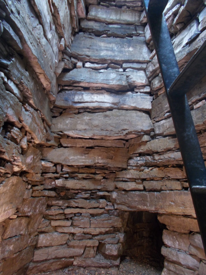
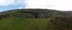
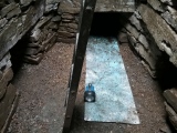
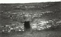
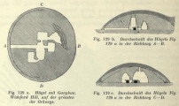
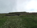
Entry today is via a roof trap door and ladder into the central chamber off of which run three side chambers and the now disused 5 metre long passage which leads to the original entrance which faced west.
The site is accessed from the road to the transmitter tower. Some two thirds of the way up there is a small car park and site sign and map from where a track leads 800 metres across the hillside to the cairn. There should be a clockwork torch in a box by the site but it was missing when I visited in September 2010 so it would pay to carry a small torch with you for the visit to this excellent site.
Additional information submitted by Drew Parsons in September 2010
Orkney discovery may be the first farm in Britain, see comment below
Note: Free ebook: Neolithic house societies in Orkney, on four Neolithic settlements discovered in the vicinity of Wideford Hill between 1994 and 2014. Edited by Colin Richards and Richard Jones, details in the comments on our page
You may be viewing yesterday's version of this page. To see the most up to date information please register for a free account.







These are just the first 25 photos of Wideford Hill. If you log in with a free user account you will be able to see our entire collection.
Do not use the above information on other web sites or publications without permission of the contributor.
Click here to see more info for this site
Nearby sites
Key: Red: member's photo, Blue: 3rd party photo, Yellow: other image, Green: no photo - please go there and take one, Grey: site destroyed
Download sites to:
KML (Google Earth)
GPX (GPS waypoints)
CSV (Garmin/Navman)
CSV (Excel)
To unlock full downloads you need to sign up as a Contributory Member. Otherwise downloads are limited to 50 sites.
Turn off the page maps and other distractions
Nearby sites listing. In the following links * = Image available
673m ESE 116° Heathfield Chambered Cairn (HY415118)
997m E 90° Wideford Hill Cairn* Cairn (HY419121)
1.1km SSW 200° Smerquoy ancient settlement* Ancient Village or Settlement (HY40501109)
1.1km NE 44° Quanterness* Chambered Cairn (HY417129)
1.3km WNW 292° Rennibister Souterrain* Souterrain (Fogou, Earth House) (HY39731260)
1.8km W 259° Nabban* Holy Well or Sacred Spring (HY391118)
2.0km WNW 289° Ingshowe* Broch or Nuraghe (HY390128)
2.3km NE 40° Ramberry Cairn Chambered Cairn (HY42401383)
2.7km NW 308° Site C Circular Feature from the Rising Tide project Standing Stones (HY3882313776)
2.7km ENE 74° Saverock (2)* Ancient Village or Settlement (HY43481280)
2.7km ENE 70° Lower Saverock* Not Known (by us) (HY43511300)
3.3km ESE 106° Pickaquoy* Ancient Village or Settlement (HY44071116)
3.3km E 96° Grain Earth House* Souterrain (Fogou, Earth House) (HY442117)
3.8km SE 140° Nevada Cott* Artificial Mound (HY433092)
4.0km NNW 328° Burness* Broch or Nuraghe (HY38821557)
4.1km ESE 108° The Orkney Museum* Museum (HY448108)
4.1km ESE 107° Tankerness House Museum* Museum (HY44851086)
4.2km SE 145° Lingrow* Chambered Tomb (HY43240863)
4.2km SE 141° Broch of Lingro* Broch or Nuraghe (HY435088)
4.2km ESE 103° Kirkwall Sculptured Stone (HY450111)
4.2km ESE 106° Kirkwall Sculptured Stone (HY44941087)
4.4km SE 134° Crantit* Souterrain (Fogou, Earth House) (HY440090)
4.5km W 278° Cuween Hill* Chambered Cairn (HY36421277)
4.9km SE 128° Scapa* Barrow Cemetery (HY447090)
5.0km WNW 303° Benziaroth* Artificial Mound (HY36781488)
View more nearby sites and additional images


 We would like to know more about this location. Please feel free to add a brief description and any relevant information in your own language.
 Wir möchten mehr über diese Stätte erfahren. Bitte zögern Sie nicht, eine kurze Beschreibung und relevante Informationen in Deutsch hinzuzufügen.
 Nous aimerions en savoir encore un peu sur les lieux. S'il vous plaît n'hesitez pas à ajouter une courte description et tous les renseignements pertinents dans votre propre langue.
 Quisieramos informarnos un poco más de las lugares. No dude en añadir una breve descripción y otros datos relevantes en su propio idioma.