<< Other Photo Pages >> Smerquoy ancient settlement - Ancient Village or Settlement in Scotland in Orkney
Submitted by Andy B on Wednesday, 03 July 2013 Page Views: 5609
Multi-periodSite Name: Smerquoy ancient settlementCountry: Scotland County: Orkney Type: Ancient Village or Settlement
Nearest Town: Kirkwall
Map Ref: HY40501109
Latitude: 58.982795N Longitude: 3.036856W
Condition:
| 5 | Perfect |
| 4 | Almost Perfect |
| 3 | Reasonable but with some damage |
| 2 | Ruined but still recognisable as an ancient site |
| 1 | Pretty much destroyed, possibly visible as crop marks |
| 0 | No data. |
| -1 | Completely destroyed |
| 5 | Superb |
| 4 | Good |
| 3 | Ordinary |
| 2 | Not Good |
| 1 | Awful |
| 0 | No data. |
| 5 | Can be driven to, probably with disabled access |
| 4 | Short walk on a footpath |
| 3 | Requiring a bit more of a walk |
| 2 | A long walk |
| 1 | In the middle of nowhere, a nightmare to find |
| 0 | No data. |
| 5 | co-ordinates taken by GPS or official recorded co-ordinates |
| 4 | co-ordinates scaled from a detailed map |
| 3 | co-ordinates scaled from a bad map |
| 2 | co-ordinates of the nearest village |
| 1 | co-ordinates of the nearest town |
| 0 | no data |
Internal Links:
External Links:
I have visited· I would like to visit
whese001 would like to visit
")
A visit to the area resulted in the discovery of several hammer stones, a saddle quern rubber, pottery and flint.
A systematic fieldwalk brought to light flint scrapers, a flint knife, a possible mace, an Iron Age glass bead(!) and a small Neolithic axe lying among the stubble. A magnetometer survey then showed up positive anomalies consistent with areas of occupation in the areas of the finds.
On their last day the diggers were stunned to discover a decorated stone unearthed at the Smerquoy “hoose” (see photo).
For the duration of the excavation, Christopher wrote regular updates, the first of which is here.
Note: Location given is quite approximate.
See also our page for the Redland settlement which is another active excavation this summer.
You may be viewing yesterday's version of this page. To see the most up to date information please register for a free account.
")
")
Do not use the above information on other web sites or publications without permission of the contributor.
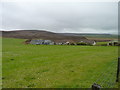
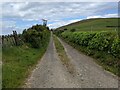
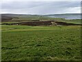
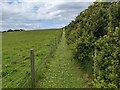
Nearby Images from Geograph Britain and Ireland:
©2017(licence)
©2023(licence)
©2023(licence)
©2023(licence)
©2013(licence)
The above images may not be of the site on this page, they are loaded from Geograph.
Please Submit an Image of this site or go out and take one for us!
Click here to see more info for this site
Nearby sites
Key: Red: member's photo, Blue: 3rd party photo, Yellow: other image, Green: no photo - please go there and take one, Grey: site destroyed
Download sites to:
KML (Google Earth)
GPX (GPS waypoints)
CSV (Garmin/Navman)
CSV (Excel)
To unlock full downloads you need to sign up as a Contributory Member. Otherwise downloads are limited to 50 sites.
Turn off the page maps and other distractions
Nearby sites listing. In the following links * = Image available
1.1km NNE 20° Wideford Hill* Chambered Cairn (HY40901211)
1.2km NE 54° Heathfield Chambered Cairn (HY415118)
1.6km WNW 296° Nabban* Holy Well or Sacred Spring (HY391118)
1.7km NNW 332° Rennibister Souterrain* Souterrain (Fogou, Earth House) (HY39731260)
1.7km NE 53° Wideford Hill Cairn* Cairn (HY419121)
2.2km NNE 33° Quanterness* Chambered Cairn (HY417129)
2.3km NW 318° Ingshowe* Broch or Nuraghe (HY390128)
3.2km NNW 327° Site C Circular Feature from the Rising Tide project Standing Stones (HY3882313776)
3.3km NE 34° Ramberry Cairn Chambered Cairn (HY42401383)
3.4km ESE 123° Nevada Cott* Artificial Mound (HY433092)
3.4km ENE 59° Saverock (2)* Ancient Village or Settlement (HY43481280)
3.6km ENE 57° Lower Saverock* Not Known (by us) (HY43511300)
3.6km E 88° Pickaquoy* Ancient Village or Settlement (HY44071116)
3.7km SE 131° Lingrow* Chambered Tomb (HY43240863)
3.7km E 80° Grain Earth House* Souterrain (Fogou, Earth House) (HY442117)
3.8km SE 127° Broch of Lingro* Broch or Nuraghe (HY435088)
4.1km ESE 120° Crantit* Souterrain (Fogou, Earth House) (HY440090)
4.3km E 93° The Orkney Museum* Museum (HY448108)
4.3km E 92° Tankerness House Museum* Museum (HY44851086)
4.4km WNW 292° Cuween Hill* Chambered Cairn (HY36421277)
4.4km E 92° Kirkwall Sculptured Stone (HY44941087)
4.5km E 89° Kirkwall Sculptured Stone (HY450111)
4.7km ESE 116° Scapa* Barrow Cemetery (HY447090)
4.8km NNW 339° Burness* Broch or Nuraghe (HY38821557)
4.9km ESE 120° Hillhead* Ancient Village or Settlement (HY44720855)
View more nearby sites and additional images


 We would like to know more about this location. Please feel free to add a brief description and any relevant information in your own language.
 Wir möchten mehr über diese Stätte erfahren. Bitte zögern Sie nicht, eine kurze Beschreibung und relevante Informationen in Deutsch hinzuzufügen.
 Nous aimerions en savoir encore un peu sur les lieux. S'il vous plaît n'hesitez pas à ajouter une courte description et tous les renseignements pertinents dans votre propre langue.
 Quisieramos informarnos un poco más de las lugares. No dude en añadir una breve descripción y otros datos relevantes en su propio idioma.