<< Our Photo Pages >> Ingshowe - Broch or Nuraghe in Scotland in Orkney
Submitted by howar on Sunday, 28 March 2004 Page Views: 4456
Iron Age and Later PrehistorySite Name: IngshoweCountry: Scotland County: Orkney Type: Broch or Nuraghe
Nearest Town: Stromness
Map Ref: HY390128 Landranger Map Number: 6
Latitude: 58.997937N Longitude: 3.06342W
Condition:
| 5 | Perfect |
| 4 | Almost Perfect |
| 3 | Reasonable but with some damage |
| 2 | Ruined but still recognisable as an ancient site |
| 1 | Pretty much destroyed, possibly visible as crop marks |
| 0 | No data. |
| -1 | Completely destroyed |
| 5 | Superb |
| 4 | Good |
| 3 | Ordinary |
| 2 | Not Good |
| 1 | Awful |
| 0 | No data. |
| 5 | Can be driven to, probably with disabled access |
| 4 | Short walk on a footpath |
| 3 | Requiring a bit more of a walk |
| 2 | A long walk |
| 1 | In the middle of nowhere, a nightmare to find |
| 0 | No data. |
| 5 | co-ordinates taken by GPS or official recorded co-ordinates |
| 4 | co-ordinates scaled from a detailed map |
| 3 | co-ordinates scaled from a bad map |
| 2 | co-ordinates of the nearest village |
| 1 | co-ordinates of the nearest town |
| 0 | no data |
Internal Links:
External Links:
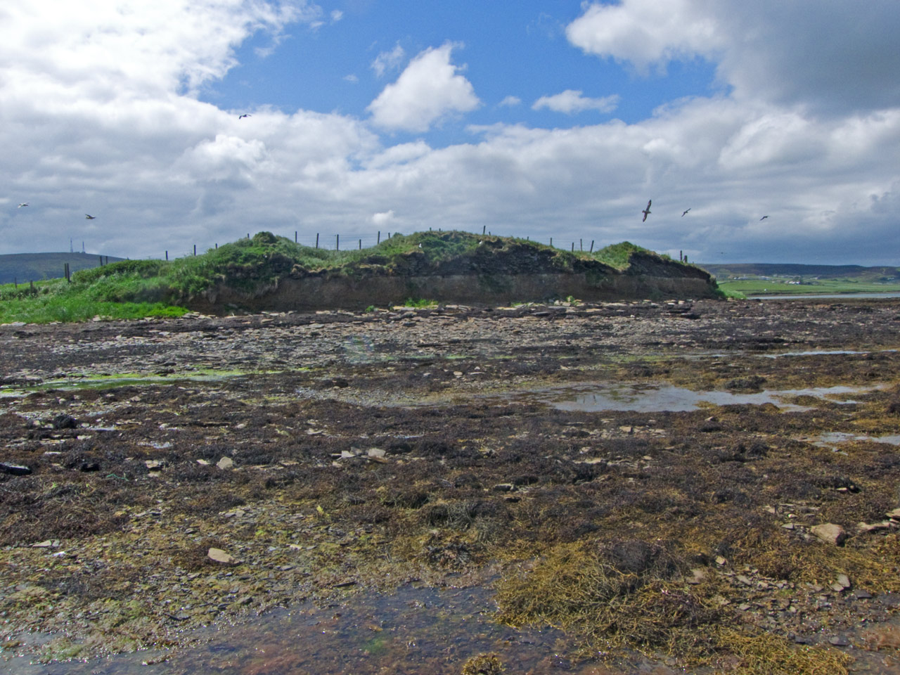
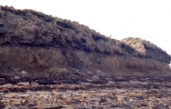
On the very tip of the little headland down from Rennibister souterrain this site is a lot better than it looks from the road. You have to go over a barred metal gate, inside which is the usual muddy rectangle where livestock have gathered. The grass-coverd mount presents a slightly horned appearance.
From the rocks by the burn to the furthest on the left rock the mound totals 52m and from this line to the seaward side maxes out at 16m as the mound rises. At its highest points I made it to be 2-2.5m structure remaining.
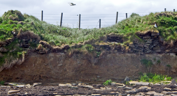
Next obstacle is two barb-wire fences under a metre apart running across the top - my little legs just made it. Most of the lower mound is before this, and as I found out the better stones are scattered across here. Coming up to the top there is an area of scattered stones, about two metres wide and encompassing 13m across, which appears to go around what remains of the central tower (the turfed horny section).
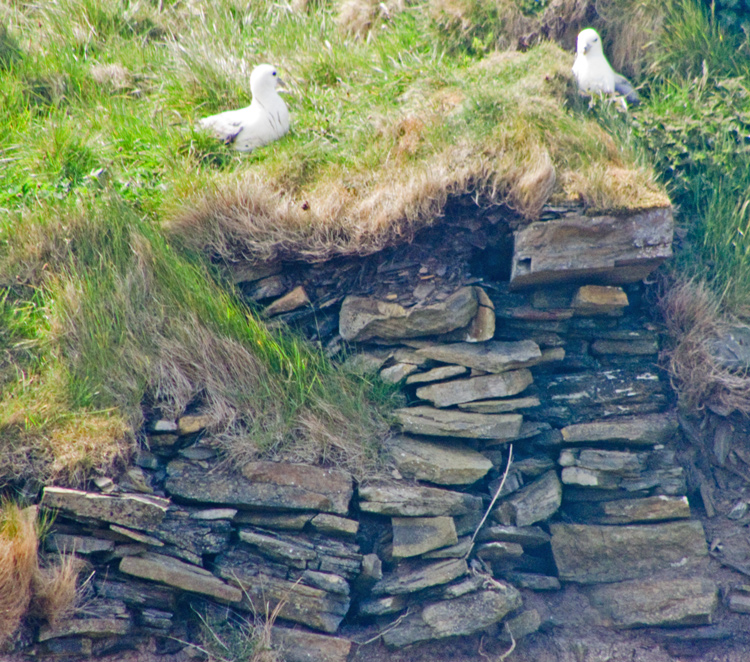
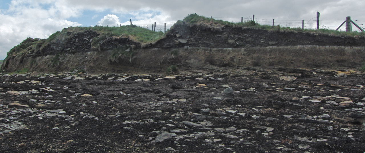
You can make out inner and outer walls. I found a spot on the left where I could get down to the shore - I must warn you that I found the seaweed around the cliff deep and slippy-slidey. From here you can follow from the left about 36m of remaining structure. Most of this wall is exposed, but alas the majority of the stonework is (now at least) small friable stuff. But the base is exceptionally well delineated a thin black and brown section ramrod staight!
You may be viewing yesterday's version of this page. To see the most up to date information please register for a free account.


Do not use the above information on other web sites or publications without permission of the contributor.
Click here to see more info for this site
Nearby sites
Key: Red: member's photo, Blue: 3rd party photo, Yellow: other image, Green: no photo - please go there and take one, Grey: site destroyed
Download sites to:
KML (Google Earth)
GPX (GPS waypoints)
CSV (Garmin/Navman)
CSV (Excel)
To unlock full downloads you need to sign up as a Contributory Member. Otherwise downloads are limited to 50 sites.
Turn off the page maps and other distractions
Nearby sites listing. In the following links * = Image available
755m ESE 104° Rennibister Souterrain* Souterrain (Fogou, Earth House) (HY39731260)
991m N 349° Site C Circular Feature from the Rising Tide project Standing Stones (HY3882313776)
1.0km S 173° Nabban* Holy Well or Sacred Spring (HY391118)
2.0km ESE 109° Wideford Hill* Chambered Cairn (HY40901211)
2.3km SE 138° Smerquoy ancient settlement* Ancient Village or Settlement (HY40501109)
2.6km W 268° Cuween Hill* Chambered Cairn (HY36421277)
2.7km ESE 111° Heathfield Chambered Cairn (HY415118)
2.7km E 87° Quanterness* Chambered Cairn (HY417129)
2.8km N 355° Burness* Broch or Nuraghe (HY38821557)
3.0km ESE 103° Wideford Hill Cairn* Cairn (HY419121)
3.0km NW 312° Benziaroth* Artificial Mound (HY36781488)
3.2km WNW 295° The Hillock* Broch or Nuraghe (HY361142)
3.5km ENE 72° Ramberry Cairn Chambered Cairn (HY42401383)
3.7km WNW 288° Rowamo Cottage* Artificial Mound (HY35451400)
4.5km E 89° Saverock (2)* Ancient Village or Settlement (HY43481280)
4.5km E 87° Lower Saverock* Not Known (by us) (HY43511300)
4.5km NNW 344° Broch of Redland* Broch or Nuraghe (HY37801715)
4.5km W 278° Hill of Heddle* Round Barrow(s) (HY345135)
4.6km WNW 288° Howe Harper* Chambered Cairn (HY346143)
4.8km WSW 240° Summersdale* Barrow Cemetery (HY34741046)
4.9km NNW 331° Redland settlement Ancient Village or Settlement (HY367171)
5.1km WNW 291° Wasdale (Orkney)* Crannog (HY343147)
5.2km N 359° Oyce of Isbister* Round Barrow(s) (HY39021802)
5.3km E 101° Grain Earth House* Souterrain (Fogou, Earth House) (HY442117)
5.3km ESE 107° Pickaquoy* Ancient Village or Settlement (HY44071116)
View more nearby sites and additional images




 We would like to know more about this location. Please feel free to add a brief description and any relevant information in your own language.
 Wir möchten mehr über diese Stätte erfahren. Bitte zögern Sie nicht, eine kurze Beschreibung und relevante Informationen in Deutsch hinzuzufügen.
 Nous aimerions en savoir encore un peu sur les lieux. S'il vous plaît n'hesitez pas à ajouter une courte description et tous les renseignements pertinents dans votre propre langue.
 Quisieramos informarnos un poco más de las lugares. No dude en añadir una breve descripción y otros datos relevantes en su propio idioma.