<< Text Pages >> Ramberry Cairn - Chambered Cairn in Scotland in Orkney
Submitted by howar on Tuesday, 17 May 2005 Page Views: 4608
Neolithic and Bronze AgeSite Name: Ramberry CairnCountry: Scotland County: Orkney Type: Chambered Cairn
Nearest Village: Crossiecrown
Map Ref: HY42401383
Latitude: 59.007658N Longitude: 3.004525W
Condition:
| 5 | Perfect |
| 4 | Almost Perfect |
| 3 | Reasonable but with some damage |
| 2 | Ruined but still recognisable as an ancient site |
| 1 | Pretty much destroyed, possibly visible as crop marks |
| 0 | No data. |
| -1 | Completely destroyed |
| 5 | Superb |
| 4 | Good |
| 3 | Ordinary |
| 2 | Not Good |
| 1 | Awful |
| 0 | No data. |
| 5 | Can be driven to, probably with disabled access |
| 4 | Short walk on a footpath |
| 3 | Requiring a bit more of a walk |
| 2 | A long walk |
| 1 | In the middle of nowhere, a nightmare to find |
| 0 | No data. |
| 5 | co-ordinates taken by GPS or official recorded co-ordinates |
| 4 | co-ordinates scaled from a detailed map |
| 3 | co-ordinates scaled from a bad map |
| 2 | co-ordinates of the nearest village |
| 1 | co-ordinates of the nearest town |
| 0 | no data |
Internal Links:
External Links:
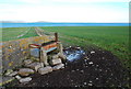
Work finished this week on what was left of a presumed chambered cairn (at HY42401383) on Quanter Ness, only a little further coastward than the Crossiecrown settlement. It appears to be a novel type of cairn.
Indications are that it was dismantled early on. - Quanterness chambered cairn is across the road and up the lower slopes of Wideford Hill. It may be a crossover between the purely domestic and the religious type of site. Though there is no dating evidence it does share an alignment with the Tomb of The Eagles. After the exploratory dig it has now been covered over.
You may be viewing yesterday's version of this page. To see the most up to date information please register for a free account.
Do not use the above information on other web sites or publications without permission of the contributor.
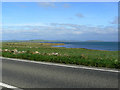
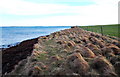
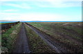
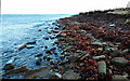
Nearby Images from Geograph Britain and Ireland:
©2006(licence)
©2009(licence)
©2009(licence)
©2009(licence)
©2009(licence)
The above images may not be of the site on this page, they are loaded from Geograph.
Please Submit an Image of this site or go out and take one for us!
Click here to see more info for this site
Nearby sites
Key: Red: member's photo, Blue: 3rd party photo, Yellow: other image, Green: no photo - please go there and take one, Grey: site destroyed
Download sites to:
KML (Google Earth)
GPX (GPS waypoints)
CSV (Garmin/Navman)
CSV (Excel)
To unlock full downloads you need to sign up as a Contributory Member. Otherwise downloads are limited to 50 sites.
Turn off the page maps and other distractions
Nearby sites listing. In the following links * = Image available
1.2km SW 216° Quanterness* Chambered Cairn (HY417129)
1.4km SE 126° Lower Saverock* Not Known (by us) (HY43511300)
1.5km SE 133° Saverock (2)* Ancient Village or Settlement (HY43481280)
1.8km SSW 195° Wideford Hill Cairn* Cairn (HY419121)
2.2km SSW 203° Heathfield Chambered Cairn (HY415118)
2.3km SW 220° Wideford Hill* Chambered Cairn (HY40901211)
2.8km SE 139° Grain Earth House* Souterrain (Fogou, Earth House) (HY442117)
2.9km WSW 244° Rennibister Souterrain* Souterrain (Fogou, Earth House) (HY39731260)
3.1km SSE 147° Pickaquoy* Ancient Village or Settlement (HY44071116)
3.3km SW 214° Smerquoy ancient settlement* Ancient Village or Settlement (HY40501109)
3.5km WSW 252° Ingshowe* Broch or Nuraghe (HY390128)
3.6km W 268° Site C Circular Feature from the Rising Tide project Standing Stones (HY3882313776)
3.8km SE 136° Kirkwall Sculptured Stone (HY450111)
3.8km SE 140° Tankerness House Museum* Museum (HY44851086)
3.9km SE 141° The Orkney Museum* Museum (HY448108)
3.9km WSW 237° Nabban* Holy Well or Sacred Spring (HY391118)
3.9km SE 139° Kirkwall Sculptured Stone (HY44941087)
4.0km WNW 295° Burness* Broch or Nuraghe (HY38821557)
4.7km SSE 168° Nevada Cott* Artificial Mound (HY433092)
5.0km ENE 60° Twi Ness* Cairn (HY46761625)
5.1km SSE 161° Crantit* Souterrain (Fogou, Earth House) (HY440090)
5.1km SSE 167° Broch of Lingro* Broch or Nuraghe (HY435088)
5.3km S 170° Lingrow* Chambered Tomb (HY43240863)
5.3km SSE 154° Scapa* Barrow Cemetery (HY447090)
5.4km NW 320° Oyce of Isbister* Round Barrow(s) (HY39021802)
View more nearby sites and additional images


 We would like to know more about this location. Please feel free to add a brief description and any relevant information in your own language.
 Wir möchten mehr über diese Stätte erfahren. Bitte zögern Sie nicht, eine kurze Beschreibung und relevante Informationen in Deutsch hinzuzufügen.
 Nous aimerions en savoir encore un peu sur les lieux. S'il vous plaît n'hesitez pas à ajouter une courte description et tous les renseignements pertinents dans votre propre langue.
 Quisieramos informarnos un poco más de las lugares. No dude en añadir una breve descripción y otros datos relevantes en su propio idioma.