


<< Text Pages >> Kirkwall - Sculptured Stone in Scotland in Orkney
Submitted by alligator on Monday, 24 March 2003 Page Views: 4836
Multi-periodSite Name: Kirkwall Alternative Name: St. Ola's Church, St. Olaf's ChurchCountry: Scotland County: Orkney Type: Sculptured Stone
Map Ref: HY450111 Landranger Map Number: 6
Latitude: 58.983488N Longitude: 2.958586W
Condition:
| 5 | Perfect |
| 4 | Almost Perfect |
| 3 | Reasonable but with some damage |
| 2 | Ruined but still recognisable as an ancient site |
| 1 | Pretty much destroyed, possibly visible as crop marks |
| 0 | No data. |
| -1 | Completely destroyed |
| 5 | Superb |
| 4 | Good |
| 3 | Ordinary |
| 2 | Not Good |
| 1 | Awful |
| 0 | No data. |
| 5 | Can be driven to, probably with disabled access |
| 4 | Short walk on a footpath |
| 3 | Requiring a bit more of a walk |
| 2 | A long walk |
| 1 | In the middle of nowhere, a nightmare to find |
| 0 | No data. |
| 5 | co-ordinates taken by GPS or official recorded co-ordinates |
| 4 | co-ordinates scaled from a detailed map |
| 3 | co-ordinates scaled from a bad map |
| 2 | co-ordinates of the nearest village |
| 1 | co-ordinates of the nearest town |
| 0 | no data |
Be the first person to rate this site - see the 'Contribute!' box in the right hand menu.
Internal Links:
External Links:
Sculptured Stone in Orkney
For details, visit: http://www.archaeoptics.co.uk/products/ecms/418.html
You may be viewing yesterday's version of this page. To see the most up to date information please register for a free account.
Do not use the above information on other web sites or publications without permission of the contributor.
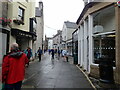
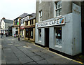
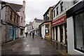
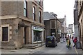
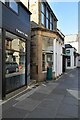
Nearby Images from Geograph Britain and Ireland:
©2023(licence)
©2013(licence)
©2018(licence)
©2015(licence)
©2024(licence)
The above images may not be of the site on this page, they are loaded from Geograph.
Please Submit an Image of this site or go out and take one for us!
Click here to see more info for this site
Nearby sites
Key: Red: member's photo, Blue: 3rd party photo, Yellow: other image, Green: no photo - please go there and take one, Grey: site destroyed
Download sites to:
KML (Google Earth)
GPX (GPS waypoints)
CSV (Garmin/Navman)
CSV (Excel)
To unlock full downloads you need to sign up as a Contributory Member. Otherwise downloads are limited to 50 sites.
Turn off the page maps and other distractions
Nearby sites listing. In the following links * = Image available
237m SSW 194° Kirkwall Sculptured Stone (HY44941087)
282m SSW 211° Tankerness House Museum* Museum (HY44851086)
360m SSW 213° The Orkney Museum* Museum (HY448108)
929m W 273° Pickaquoy* Ancient Village or Settlement (HY44071116)
997m NW 306° Grain Earth House* Souterrain (Fogou, Earth House) (HY442117)
2.1km S 187° Scapa* Barrow Cemetery (HY447090)
2.3km NW 317° Saverock (2)* Ancient Village or Settlement (HY43481280)
2.3km SSW 205° Crantit* Souterrain (Fogou, Earth House) (HY440090)
2.4km NW 321° Lower Saverock* Not Known (by us) (HY43511300)
2.5km SE 129° Tower Hill (Orkney)* Round Barrow(s) (HY469095)
2.5km SW 221° Nevada Cott* Artificial Mound (HY433092)
2.6km S 185° Hillhead* Ancient Village or Settlement (HY44720855)
2.7km ESE 113° Berstane Broch* Broch or Nuraghe (HY475100)
2.7km SSW 212° Broch of Lingro* Broch or Nuraghe (HY435088)
3.0km SW 215° Lingrow* Chambered Tomb (HY43240863)
3.2km WNW 287° Wideford Hill Cairn* Cairn (HY419121)
3.5km SE 138° Grimsquoy* Round Barrow(s) (HY473085)
3.6km W 281° Heathfield Chambered Cairn (HY415118)
3.7km WNW 298° Quanterness* Chambered Cairn (HY417129)
3.8km NW 316° Ramberry Cairn Chambered Cairn (HY42401383)
4.2km WNW 283° Wideford Hill* Chambered Cairn (HY40901211)
4.3km NE 50° Head of Work* Chambered Cairn (HY48341382)
4.5km W 269° Smerquoy ancient settlement* Ancient Village or Settlement (HY40501109)
5.3km SE 140° Staneloof* Cairn (HY48330698)
5.4km S 177° Burn of Deepdale* Ancient Village or Settlement (HY452057)
View more nearby sites and additional images


 We would like to know more about this location. Please feel free to add a brief description and any relevant information in your own language.
 Wir möchten mehr über diese Stätte erfahren. Bitte zögern Sie nicht, eine kurze Beschreibung und relevante Informationen in Deutsch hinzuzufügen.
 Nous aimerions en savoir encore un peu sur les lieux. S'il vous plaît n'hesitez pas à ajouter une courte description et tous les renseignements pertinents dans votre propre langue.
 Quisieramos informarnos un poco más de las lugares. No dude en añadir una breve descripción y otros datos relevantes en su propio idioma.