<< Our Photo Pages >> Barsloisnoch - Cist in Scotland in Argyll
Submitted by Anonymous on Thursday, 15 February 2001 Page Views: 5115
Neolithic and Bronze AgeSite Name: BarsloisnochCountry: Scotland
NOTE: This site is 0.7 km away from the location you searched for.
County: Argyll Type: Cist
Nearest Town: Lochgilphead Nearest Village: Kilmartin
Map Ref: NR813956 Landranger Map Number: 55
Latitude: 56.102957N Longitude: 5.518284W
Condition:
| 5 | Perfect |
| 4 | Almost Perfect |
| 3 | Reasonable but with some damage |
| 2 | Ruined but still recognisable as an ancient site |
| 1 | Pretty much destroyed, possibly visible as crop marks |
| 0 | No data. |
| -1 | Completely destroyed |
| 5 | Superb |
| 4 | Good |
| 3 | Ordinary |
| 2 | Not Good |
| 1 | Awful |
| 0 | No data. |
| 5 | Can be driven to, probably with disabled access |
| 4 | Short walk on a footpath |
| 3 | Requiring a bit more of a walk |
| 2 | A long walk |
| 1 | In the middle of nowhere, a nightmare to find |
| 0 | No data. |
| 5 | co-ordinates taken by GPS or official recorded co-ordinates |
| 4 | co-ordinates scaled from a detailed map |
| 3 | co-ordinates scaled from a bad map |
| 2 | co-ordinates of the nearest village |
| 1 | co-ordinates of the nearest town |
| 0 | no data |
Be the first person to rate this site - see the 'Contribute!' box in the right hand menu.
Internal Links:
External Links:
I have visited· I would like to visit
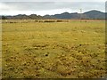
markj99 visited on 30th Apr 2010 - their rating: Cond: 3 Amb: 4 Access: 3 Barsloisnoch cists are only to be found by those looking for them. They lie in marshy pasture land adjacent to Barsloisloch Farm. Barsloisnoch SE cist has an impressive capstone, well worth a small detour while visiting the Kilmartin sites.
")
Have you visited this site? Please contribute a description or any thoughts by adding a comment.
You may be viewing yesterday's version of this page. To see the most up to date information please register for a free account.
")
")
")
")
Do not use the above information on other web sites or publications without permission of the contributor.
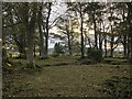
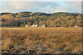
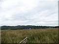
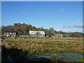
Nearby Images from Geograph Britain and Ireland:
©2023(licence)
©2010(licence)
©2013(licence)
©2024(licence)
©2006(licence)
The above images may not be of the site on this page, they are loaded from Geograph.
Please Submit an Image of this site or go out and take one for us!
Click here to see more info for this site
Nearby sites
Key: Red: member's photo, Blue: 3rd party photo, Yellow: other image, Green: no photo - please go there and take one, Grey: site destroyed
Download sites to:
KML (Google Earth)
GPX (GPS waypoints)
CSV (Garmin/Navman)
CSV (Excel)
To unlock full downloads you need to sign up as a Contributory Member. Otherwise downloads are limited to 50 sites.
![]()
Turn off the page maps and other distractions
Nearby sites listing. In the following links * = Image available
788m ENE 69° Rowanfield Cottage* Standing Stone (Menhir) (NR82059585)
799m N 357° Poltalloch House Rock Art* Rock Art (NR813964)
1.0km NNW 329° Kilchoan* Chambered Cairn (NR8083596488)
1.1km NE 52° Rowanfield Cist* Cist (NR8216096208)
1.1km WNW 282° Duntroon Stone Fort or Dun (NR802959)
1.6km SSW 192° Crinan Moss Cairn Cairn (NR80909408)
1.6km SSW 194° Crinan Moss Stones* Standing Stones (NR80839409)
1.7km NNE 23° Poltalloch Cist* Cist (NR82049714)
1.9km NE 36° Ri Cruin* Rock Art (NR825971)
1.9km NNE 22° Cnoc-an-teallaidh* Cist (NR82129735)
2.0km NE 36° Ri Cruin* Cairn (NR8254897119)
2.1km ENE 68° Ballymeanoch Henge* Henge (NR83319628)
2.1km ENE 65° Ballymeanoch Rock Art* Rock Art (NR833964)
2.2km N 354° Barr A Chuirn Cairn (NR812978)
2.2km N 5° Ballygowan Rock Art* Rock Art (NR8162097782)
2.2km ENE 66° Ballymeanoch Stone Row* Stone Row / Alignment (NR83379641)
2.2km NNE 24° Bruach-na-cuirte* Cist (NR82309760)
2.2km ENE 65° Ballymeanoch Kerb Cairn* Cairn (NR8339596429)
2.3km NE 50° Baluachraig Rock Art* Rock Art (NR8312696966)
2.3km NE 56° Dunchraigaig Cairn* Cairn (NR8330796811)
2.3km ENE 68° Ballymeanoch Cairn* Cairn (NR83529637)
2.4km N 359° Dun Ballygowan Stone Fort or Dun (NR814980)
2.5km NE 34° Nether Largie Stone Row* Stone Row / Alignment (NR8283197610)
2.6km NNE 28° Temple Wood S* Stone Circle (NR8263197830)
2.6km NNE 32° Nether Largie standing stone* Standing Stone (Menhir) (NR82799773)
View more nearby sites and additional images


 We would like to know more about this location. Please feel free to add a brief description and any relevant information in your own language.
 Wir möchten mehr über diese Stätte erfahren. Bitte zögern Sie nicht, eine kurze Beschreibung und relevante Informationen in Deutsch hinzuzufügen.
 Nous aimerions en savoir encore un peu sur les lieux. S'il vous plaît n'hesitez pas à ajouter une courte description et tous les renseignements pertinents dans votre propre langue.
 Quisieramos informarnos un poco más de las lugares. No dude en añadir una breve descripción y otros datos relevantes en su propio idioma.