<< Our Photo Pages >> Lundy John O'Groats - Round Barrow(s) in England in Devon
Submitted by Firewater on Saturday, 07 August 2004 Page Views: 20493
Neolithic and Bronze AgeSite Name: Lundy John O'GroatsCountry: England County: Devon Type: Round Barrow(s)
Nearest Town: Bideford
Map Ref: SS135473
Latitude: 51.194405N Longitude: 4.670525W
Condition:
| 5 | Perfect |
| 4 | Almost Perfect |
| 3 | Reasonable but with some damage |
| 2 | Ruined but still recognisable as an ancient site |
| 1 | Pretty much destroyed, possibly visible as crop marks |
| 0 | No data. |
| -1 | Completely destroyed |
| 5 | Superb |
| 4 | Good |
| 3 | Ordinary |
| 2 | Not Good |
| 1 | Awful |
| 0 | No data. |
| 5 | Can be driven to, probably with disabled access |
| 4 | Short walk on a footpath |
| 3 | Requiring a bit more of a walk |
| 2 | A long walk |
| 1 | In the middle of nowhere, a nightmare to find |
| 0 | No data. |
| 5 | co-ordinates taken by GPS or official recorded co-ordinates |
| 4 | co-ordinates scaled from a detailed map |
| 3 | co-ordinates scaled from a bad map |
| 2 | co-ordinates of the nearest village |
| 1 | co-ordinates of the nearest town |
| 0 | no data |
Internal Links:
External Links:
I have visited· I would like to visit
Ergler has visited here
")
The site is a post-medieval farm house at the very north end of the island but is built on top of an old burial mound.
You may be viewing yesterday's version of this page. To see the most up to date information please register for a free account.
Do not use the above information on other web sites or publications without permission of the contributor.
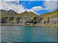
Nearby Images from Geograph Britain and Ireland:
©2018(licence)
©2015(licence)
©2015(licence)
©2018(licence)
©2019(licence)
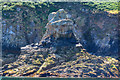
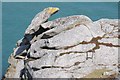
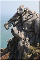
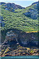
The above images may not be of the site on this page, they are loaded from Geograph.
Please Submit an Image of this site or go out and take one for us!
Click here to see more info for this site
Nearby sites
Key: Red: member's photo, Blue: 3rd party photo, Yellow: other image, Green: no photo - please go there and take one, Grey: site destroyed
Download sites to:
KML (Google Earth)
GPX (GPS waypoints)
CSV (Garmin/Navman)
CSV (Excel)
To unlock full downloads you need to sign up as a Contributory Member. Otherwise downloads are limited to 50 sites.
Turn off the page maps and other distractions
Nearby sites listing. In the following links * = Image available
600m S 178° Lundy Settlement* Ancient Village or Settlement (SS135467)
1.4km S 174° Lundy Barrow* Round Barrow(s) (SS136459)
2.9km S 182° Ackland's Moor* Standing Stones (SS1327944360)
3.1km S 183° Lundy Beacon Hill* Early Christian Sculptured Stone (SS132442)
24.7km SSE 154° Stoke Churchyard Cross* Ancient Cross (SS235247)
24.8km SSE 154° St Nectan's Well (Stoke)* Holy Well or Sacred Spring (SS2363624683)
25.6km SE 142° Windbury Head Fort* Hillfort (SS28612658)
26.0km SSE 152° St Leonard's Well (Hartland)* Holy Well or Sacred Spring (SS2486423870)
27.6km SSE 152° St Clare's Well* Holy Well or Sacred Spring (SS2582422541)
29.0km SSE 162° Embury Beacon Fort* Hillfort (SS216194)
29.6km SE 142° Clovelly Dykes* Hillfort (SS311235)
29.8km SSE 153° Bursdon Moor Barrow Cemetery* Round Barrow(s) (SS2611220257)
30.4km SSE 160° St Nectan's Well (Welcombe)* Holy Well or Sacred Spring (SS22851838)
31.6km SSE 150° Gorvin West Barrows* Round Barrow(s) (SS2859519471)
31.9km ESE 103° St Helen's Well (Croyde)* Holy Well or Sacred Spring (SS4440538970)
32.1km E 94° Woolacombe Memorial* Modern Stone Circle etc (SS45494389)
32.3km E 91° North Morte Well* Holy Well or Sacred Spring (SS459455)
32.4km SSE 167° St Morwenna's Well* Holy Well or Sacred Spring (SS1980215483)
32.6km SE 135° Buck's Mills Fort Promontory Fort / Cliff Castle (SS35892349)
32.7km E 93° The Konk Stone* Standing Stones (SS462444)
32.8km SSE 165° St John's Well (Morwenstow)* Holy Well or Sacred Spring (SS2064815298)
32.8km SSE 166° Morwenstow Churchyard Cross* Ancient Cross (SS20551527)
32.9km E 93° Greystone* Standing Stone (Menhir) (SS46354443)
33.2km SSE 155° Woolley Long Barrow* Long Barrow (SS2627516605)
33.5km E 90° Damage Barton* Standing Stones (SS47044615)
View more nearby sites and additional images


 We would like to know more about this location. Please feel free to add a brief description and any relevant information in your own language.
 Wir möchten mehr über diese Stätte erfahren. Bitte zögern Sie nicht, eine kurze Beschreibung und relevante Informationen in Deutsch hinzuzufügen.
 Nous aimerions en savoir encore un peu sur les lieux. S'il vous plaît n'hesitez pas à ajouter une courte description et tous les renseignements pertinents dans votre propre langue.
 Quisieramos informarnos un poco más de las lugares. No dude en añadir una breve descripción y otros datos relevantes en su propio idioma.