


<< Our Photo Pages >> Woolley Long Barrow - Long Barrow in England in Cornwall
Submitted by Bladup on Sunday, 28 July 2013 Page Views: 5128
Neolithic and Bronze AgeSite Name: Woolley Long BarrowCountry: England County: Cornwall Type: Long Barrow
Map Ref: SS2627516605
Latitude: 50.922679N Longitude: 4.473138W
Condition:
| 5 | Perfect |
| 4 | Almost Perfect |
| 3 | Reasonable but with some damage |
| 2 | Ruined but still recognisable as an ancient site |
| 1 | Pretty much destroyed, possibly visible as crop marks |
| 0 | No data. |
| -1 | Completely destroyed |
| 5 | Superb |
| 4 | Good |
| 3 | Ordinary |
| 2 | Not Good |
| 1 | Awful |
| 0 | No data. |
| 5 | Can be driven to, probably with disabled access |
| 4 | Short walk on a footpath |
| 3 | Requiring a bit more of a walk |
| 2 | A long walk |
| 1 | In the middle of nowhere, a nightmare to find |
| 0 | No data. |
| 5 | co-ordinates taken by GPS or official recorded co-ordinates |
| 4 | co-ordinates scaled from a detailed map |
| 3 | co-ordinates scaled from a bad map |
| 2 | co-ordinates of the nearest village |
| 1 | co-ordinates of the nearest town |
| 0 | no data |
Internal Links:
External Links:
I have visited· I would like to visit
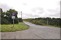
WanderingGoat visited on 15th Jan 2024 - their rating: Cond: 3 Amb: 3 Access: 4 Park in small bus stop / parking area on road junction.
")
A rare long barrow in Cornwall. It's 62m long, 21m wide and 2.5m high.
You may be viewing yesterday's version of this page. To see the most up to date information please register for a free account.
")
")
Do not use the above information on other web sites or publications without permission of the contributor.
davidmorgan has found this location on Google Street View:
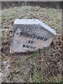
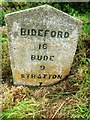
Nearby Images from Geograph Britain and Ireland:
©2015(licence)
©2015(licence)
©2020(licence)
©2017(licence)
©2014(licence)
The above images may not be of the site on this page, they are loaded from Geograph.
Please Submit an Image of this site or go out and take one for us!
Click here to see more info for this site
Nearby sites
Key: Red: member's photo, Blue: 3rd party photo, Yellow: other image, Green: no photo - please go there and take one, Grey: site destroyed
Download sites to:
KML (Google Earth)
GPX (GPS waypoints)
CSV (Garmin/Navman)
CSV (Excel)
To unlock full downloads you need to sign up as a Contributory Member. Otherwise downloads are limited to 50 sites.
Turn off the page maps and other distractions
Nearby sites listing. In the following links * = Image available
2.6km SSW 200° Wrasford Moor Barrow Cemetary* Barrow Cemetery (SS2529114170)
3.7km N 356° Bursdon Moor Barrow Cemetery* Round Barrow(s) (SS2611220257)
3.7km NE 37° Gorvin West Barrows* Round Barrow(s) (SS2859519471)
3.8km WNW 296° St Nectan's Well (Welcombe)* Holy Well or Sacred Spring (SS22851838)
4.1km S 172° Taylors Cross Tumuli* Round Barrow(s) (SS2669012535)
5.4km WNW 299° Embury Beacon Fort* Hillfort (SS216194)
5.8km WSW 255° St John's Well (Morwenstow)* Holy Well or Sacred Spring (SS2064815298)
5.9km WSW 255° Morwenstow Churchyard Cross* Ancient Cross (SS20551527)
6.0km N 354° St Clare's Well* Holy Well or Sacred Spring (SS2582422541)
6.5km WSW 258° St Morwenna's Well* Holy Well or Sacred Spring (SS1980215483)
6.8km ESE 112° St Peter's Well (Bradworthy)* Holy Well or Sacred Spring (SS325139)
7.4km NNW 347° St Leonard's Well (Hartland)* Holy Well or Sacred Spring (SS2486423870)
8.4km NNE 33° Clovelly Dykes* Hillfort (SS311235)
8.5km NNW 340° St Nectan's Well (Stoke)* Holy Well or Sacred Spring (SS2363624683)
8.6km NNW 339° Stoke Churchyard Cross* Ancient Cross (SS235247)
9.7km SSW 202° Earthquake Cist* Cist (SS22250773)
10.2km SSW 198° Stamford Hill settlement* Ancient Village or Settlement (SS22750705)
10.4km SSW 213° Northcott Mouth Tumuli* Barrow Cemetery (SS203081)
10.5km SE 130° High Barrow* Round Barrow(s) (SS3410209563)
10.9km SE 145° Ugworthy Beacon Barrows* Round Barrow(s) (SS3217607440)
11.1km S 188° St Swithin's Well (Launcells)* Holy Well or Sacred Spring (SS244057)
12.0km SSW 209° Compass Point Barrow* Round Barrow(s) (SS20040635)
12.1km E 84° Wrangworthy Cross* Barrow Cemetery (SS384174)
12.8km SSW 201° Neet Valley stone, Bude Standing Stone (Menhir) (SS21320474)
13.5km SSW 195° Marhamchurch Medieval cross* Ancient Cross (SS22300369)
View more nearby sites and additional images


 We would like to know more about this location. Please feel free to add a brief description and any relevant information in your own language.
 Wir möchten mehr über diese Stätte erfahren. Bitte zögern Sie nicht, eine kurze Beschreibung und relevante Informationen in Deutsch hinzuzufügen.
 Nous aimerions en savoir encore un peu sur les lieux. S'il vous plaît n'hesitez pas à ajouter une courte description et tous les renseignements pertinents dans votre propre langue.
 Quisieramos informarnos un poco más de las lugares. No dude en añadir una breve descripción y otros datos relevantes en su propio idioma.