<< Our Photo Pages >> The Konk Stone - Standing Stones in England in Devon
Submitted by Rockfarmer on Sunday, 16 October 2022 Page Views: 574
Neolithic and Bronze AgeSite Name: The Konk StoneCountry: England County: Devon Type: Standing Stones
Nearest Town: Woolacombe Nearest Village: Morthoe
Map Ref: SS462444
Latitude: 51.178092N Longitude: 4.201698W
Condition:
| 5 | Perfect |
| 4 | Almost Perfect |
| 3 | Reasonable but with some damage |
| 2 | Ruined but still recognisable as an ancient site |
| 1 | Pretty much destroyed, possibly visible as crop marks |
| 0 | No data. |
| -1 | Completely destroyed |
| 5 | Superb |
| 4 | Good |
| 3 | Ordinary |
| 2 | Not Good |
| 1 | Awful |
| 0 | No data. |
| 5 | Can be driven to, probably with disabled access |
| 4 | Short walk on a footpath |
| 3 | Requiring a bit more of a walk |
| 2 | A long walk |
| 1 | In the middle of nowhere, a nightmare to find |
| 0 | No data. |
| 5 | co-ordinates taken by GPS or official recorded co-ordinates |
| 4 | co-ordinates scaled from a detailed map |
| 3 | co-ordinates scaled from a bad map |
| 2 | co-ordinates of the nearest village |
| 1 | co-ordinates of the nearest town |
| 0 | no data |
Internal Links:
External Links:
")
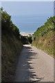
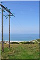
The Konk Stone can be accessed via a steep walk above Combesgate Beach inbetween Woolacombe and Morthoe. Its possible to park on The Esplanade at quieter times. The footpath begins between 2 properties google map reference 51.177447, -4.211725. The path is instantly steep then zig zags its way up the hill following the signs to Seymour. The views over the bay to Lundy are breath-taking. As the path levels out to a field The Konk Stone comes into view on your left Google Map Reference 51.179168, -4.203141 (51°10'45.0"N 4°12'11.3"W) The Konk Stone is a weathered granite stone less than 1metre high. You can see The Gospel Stone from here further East over the wall into the next field.
You may be viewing yesterday's version of this page. To see the most up to date information please register for a free account.
Do not use the above information on other web sites or publications without permission of the contributor.
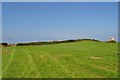
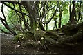
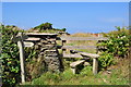
Nearby Images from Geograph Britain and Ireland:
©2010(licence)
©2010(licence)
©2010(licence)
©2010(licence)
©2010(licence)
The above images may not be of the site on this page, they are loaded from Geograph.
Please Submit an Image of this site or go out and take one for us!
Click here to see more info for this site
Nearby sites
Key: Red: member's photo, Blue: 3rd party photo, Yellow: other image, Green: no photo - please go there and take one, Grey: site destroyed
Download sites to:
KML (Google Earth)
GPX (GPS waypoints)
CSV (Garmin/Navman)
CSV (Excel)
To unlock full downloads you need to sign up as a Contributory Member. Otherwise downloads are limited to 50 sites.
Turn off the page maps and other distractions
Nearby sites listing. In the following links * = Image available
153m ENE 77° Greystone* Standing Stone (Menhir) (SS46354443)
872m SW 233° Woolacombe Memorial* Modern Stone Circle etc (SS45494389)
1.1km NNW 343° North Morte Well* Holy Well or Sacred Spring (SS459455)
1.9km NNE 24° Damage Barton* Standing Stones (SS47044615)
2.1km NNE 22° Damage Barton 2* Standing Stone (Menhir) (SS47064633)
2.3km NNE 24° Damage Barton 3* Standing Stone (Menhir) (SS47194647)
3.8km ENE 61° Whitestone (Lee)* Standing Stone (Menhir) (SS49564613)
5.7km SSW 197° St Helen's Well (Croyde)* Holy Well or Sacred Spring (SS4440538970)
6.6km SSE 155° Knowle Castle* Hillfort (SS488383)
7.4km SSE 159° St. Brannoc's Holy Well (Braunton)* Holy Well or Sacred Spring (SS487374)
7.7km ENE 63° Hillsborough* Hillfort (SS532477)
8.3km E 100° Centery Farm Tumuli* Barrow Cemetery (SS543427)
10.7km E 93° Berry Down Barrow Cemetery (SS569436)
11.3km ENE 75° Newberry Camp Hillfort (SS57164708)
11.9km SSE 164° Yelland* Multiple Stone Rows / Avenue (SS4912532889)
12.7km E 91° Mattocks Down Barrow* Long Barrow (SS589439)
12.8km ENE 72° Little Hangman Hill Misc. Earthwork (SS585480)
13.6km SE 137° Pilton Long Stone* Standing Stone (Menhir) (SS55313421)
13.8km E 90° Mattocks Down Stone Row Stone Row / Alignment (SS6004643921)
13.8km SE 136° Ladywell (Pilton)* Holy Well or Sacred Spring (SS556342)
13.8km E 90° Mattocks Down Stone* Standing Stone (Menhir) (SS60084388)
14.0km E 90° Mattocks Down circle Stone Circle (SS602439)
14.1km SE 129° Burridge Camp Ancient Village or Settlement (SS569352)
14.1km E 90° Higher Mattocks Down stone* Standing Stone (Menhir) (SS60344387)
14.2km ENE 78° Knap Down* Standing Stone (Menhir) (SS602469)
View more nearby sites and additional images


 We would like to know more about this location. Please feel free to add a brief description and any relevant information in your own language.
 Wir möchten mehr über diese Stätte erfahren. Bitte zögern Sie nicht, eine kurze Beschreibung und relevante Informationen in Deutsch hinzuzufügen.
 Nous aimerions en savoir encore un peu sur les lieux. S'il vous plaît n'hesitez pas à ajouter une courte description et tous les renseignements pertinents dans votre propre langue.
 Quisieramos informarnos un poco más de las lugares. No dude en añadir una breve descripción y otros datos relevantes en su propio idioma.