<< Our Photo Pages >> Damage Barton - Standing Stones in England in Devon
Submitted by TimPrevett on Tuesday, 30 December 2003 Page Views: 16263
Neolithic and Bronze AgeSite Name: Damage BartonCountry: England County: Devon Type: Standing Stones
Nearest Town: Ilfracombe Nearest Village: Lee Bay
Map Ref: SS47044615 Landranger Map Number: 180
Latitude: 51.194042N Longitude: 4.190436W
Condition:
| 5 | Perfect |
| 4 | Almost Perfect |
| 3 | Reasonable but with some damage |
| 2 | Ruined but still recognisable as an ancient site |
| 1 | Pretty much destroyed, possibly visible as crop marks |
| 0 | No data. |
| -1 | Completely destroyed |
| 5 | Superb |
| 4 | Good |
| 3 | Ordinary |
| 2 | Not Good |
| 1 | Awful |
| 0 | No data. |
| 5 | Can be driven to, probably with disabled access |
| 4 | Short walk on a footpath |
| 3 | Requiring a bit more of a walk |
| 2 | A long walk |
| 1 | In the middle of nowhere, a nightmare to find |
| 0 | No data. |
| 5 | co-ordinates taken by GPS or official recorded co-ordinates |
| 4 | co-ordinates scaled from a detailed map |
| 3 | co-ordinates scaled from a bad map |
| 2 | co-ordinates of the nearest village |
| 1 | co-ordinates of the nearest town |
| 0 | no data |
Internal Links:
External Links:
I have visited· I would like to visit
AngieLake TimPrevett have visited here

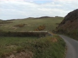
Having driven through Lee, follow the road, driving very carefully, as there are numerous blind corners and steep hills; we used the car horn on numerous occasions to give warning that a vehicle (us) was coming around the corner. On the map, there is a place marked 'Hillymouth' (476463) on the left hand side of the road; here there is a sharp bend to the left; we parked on the bridleway which is at an angle to that bend. The bridleway did not appear in use for vehicular access (no tyre tracks or ruts, and the bridleway becomes way too narrow for any 4 wheel vehicle).
We followed (on foot) the bridleway, over a small spring, through a field of very curious cows. At the top of this field, you come out onto a very good track. Just to the right there was a map of the immediate area, showing access routes and the standing stones. We followed this track to the right, and the first stone was to the left in the centre of the field. The miles of greenery were lovely; it really felt like a very romantic experience of England!
This stone was just short of 3 feet tall, at an angle, and well used by sheep as a scratch post. The next stone, we briefly retraced our steps, and went around to the adjoining field to the north; when more or less even with the first stone, we went straight north uphill, and came to the second stone, which is on a ridge. Given that the sea and Bristol Channel are not far off, this was a very windy location. The 4 foot 3 inch tall stone was set against some gorse bushes, in resplendent yellow bloom, making a pretty, if prickly backdrop!
For the final stone, we followed the top of the ridge to the east a short distance, until it was safe for us to go down, again heading north. We went through a gap in the wall, and to the far right in the field was the third stone. This was given an extra 11 inches height by sheep which had rubbed themselves for years against this stone; the stone's actual height was 3 feet 9 inches, and had a very high quartz content, if my assessment is correct.
Grid References #1 SS471462 #2 SS471464 #3 SS473466
You may be viewing yesterday's version of this page. To see the most up to date information please register for a free account.


Do not use the above information on other web sites or publications without permission of the contributor.
Click here to see more info for this site
Nearby sites
Key: Red: member's photo, Blue: 3rd party photo, Yellow: other image, Green: no photo - please go there and take one, Grey: site destroyed
Download sites to:
KML (Google Earth)
GPX (GPS waypoints)
CSV (Garmin/Navman)
CSV (Excel)
To unlock full downloads you need to sign up as a Contributory Member. Otherwise downloads are limited to 50 sites.
Turn off the page maps and other distractions
Nearby sites listing. In the following links * = Image available
181m N 5° Damage Barton 2* Standing Stone (Menhir) (SS47064633)
353m NNE 23° Damage Barton 3* Standing Stone (Menhir) (SS47194647)
1.3km WSW 239° North Morte Well* Holy Well or Sacred Spring (SS459455)
1.9km SSW 200° Greystone* Standing Stone (Menhir) (SS46354443)
1.9km SSW 204° The Konk Stone* Standing Stones (SS462444)
2.5km E 89° Whitestone (Lee)* Standing Stone (Menhir) (SS49564613)
2.7km SSW 213° Woolacombe Memorial* Modern Stone Circle etc (SS45494389)
6.3km ENE 74° Hillsborough* Hillfort (SS532477)
7.6km SSW 198° St Helen's Well (Croyde)* Holy Well or Sacred Spring (SS4440538970)
8.0km ESE 114° Centery Farm Tumuli* Barrow Cemetery (SS543427)
8.0km SSE 166° Knowle Castle* Hillfort (SS488383)
8.9km SSE 168° St. Brannoc's Holy Well (Braunton)* Holy Well or Sacred Spring (SS487374)
10.1km E 83° Newberry Camp Hillfort (SS57164708)
10.2km ESE 103° Berry Down Barrow Cemetery (SS569436)
11.6km E 79° Little Hangman Hill Misc. Earthwork (SS585480)
12.0km E 99° Mattocks Down Barrow* Long Barrow (SS589439)
13.1km E 85° Knap Down* Standing Stone (Menhir) (SS602469)
13.2km E 98° Mattocks Down Stone Row Stone Row / Alignment (SS6004643921)
13.2km E 98° Mattocks Down Stone* Standing Stone (Menhir) (SS60084388)
13.3km E 98° Mattocks Down circle Stone Circle (SS602439)
13.4km S 169° Yelland* Multiple Stone Rows / Avenue (SS4912532889)
13.5km E 98° Higher Mattocks Down stone* Standing Stone (Menhir) (SS60344387)
14.5km SE 144° Pilton Long Stone* Standing Stone (Menhir) (SS55313421)
14.7km SE 143° Ladywell (Pilton)* Holy Well or Sacred Spring (SS556342)
14.7km SE 136° Burridge Camp Ancient Village or Settlement (SS569352)
View more nearby sites and additional images


 We would like to know more about this location. Please feel free to add a brief description and any relevant information in your own language.
 Wir möchten mehr über diese Stätte erfahren. Bitte zögern Sie nicht, eine kurze Beschreibung und relevante Informationen in Deutsch hinzuzufügen.
 Nous aimerions en savoir encore un peu sur les lieux. S'il vous plaît n'hesitez pas à ajouter une courte description et tous les renseignements pertinents dans votre propre langue.
 Quisieramos informarnos un poco más de las lugares. No dude en añadir una breve descripción y otros datos relevantes en su propio idioma.