Featured: Current Archaeology Book of the Year 2019!

Current Archaeology Book of the Year 2019!

Megaliths, Stones of Memory

Megaliths, Stones of Memory

Who's Online

There are currently, 514 guests and 4 members online.

You are a guest. To join in, please register for free by clicking here

Sponsors

<< Our Photo Pages >> Hafotty Fach monolith quarry - Ancient Mine, Quarry or other Industry in Wales in Gwynedd

Submitted by Geraint1 on Monday, 08 April 2024  Page Views: 1320

Date UncertainSite Name: Hafotty Fach monolith quarry
Country: Wales County: Gwynedd Type: Ancient Mine, Quarry or other Industry
Nearest Town: Dolgellau  Nearest Village: Arthog
Map Ref: SH66721342
Latitude: 52.701997N  Longitude: 3.973911W
Condition:
5Perfect
4Almost Perfect
3Reasonable but with some damage
2Ruined but still recognisable as an ancient site
1Pretty much destroyed, possibly visible as crop marks
0No data.
-1Completely destroyed
4 Ambience:
5Superb
4Good
3Ordinary
2Not Good
1Awful
0No data.
5 Access:
5Can be driven to, probably with disabled access
4Short walk on a footpath
3Requiring a bit more of a walk
2A long walk
1In the middle of nowhere, a nightmare to find
0No data.
2 Accuracy:
5co-ordinates taken by GPS or official recorded co-ordinates
4co-ordinates scaled from a detailed map
3co-ordinates scaled from a bad map
2co-ordinates of the nearest village
1co-ordinates of the nearest town
0no data
5

Internal Links:
External Links:

Hafotty Fach monolith quarry
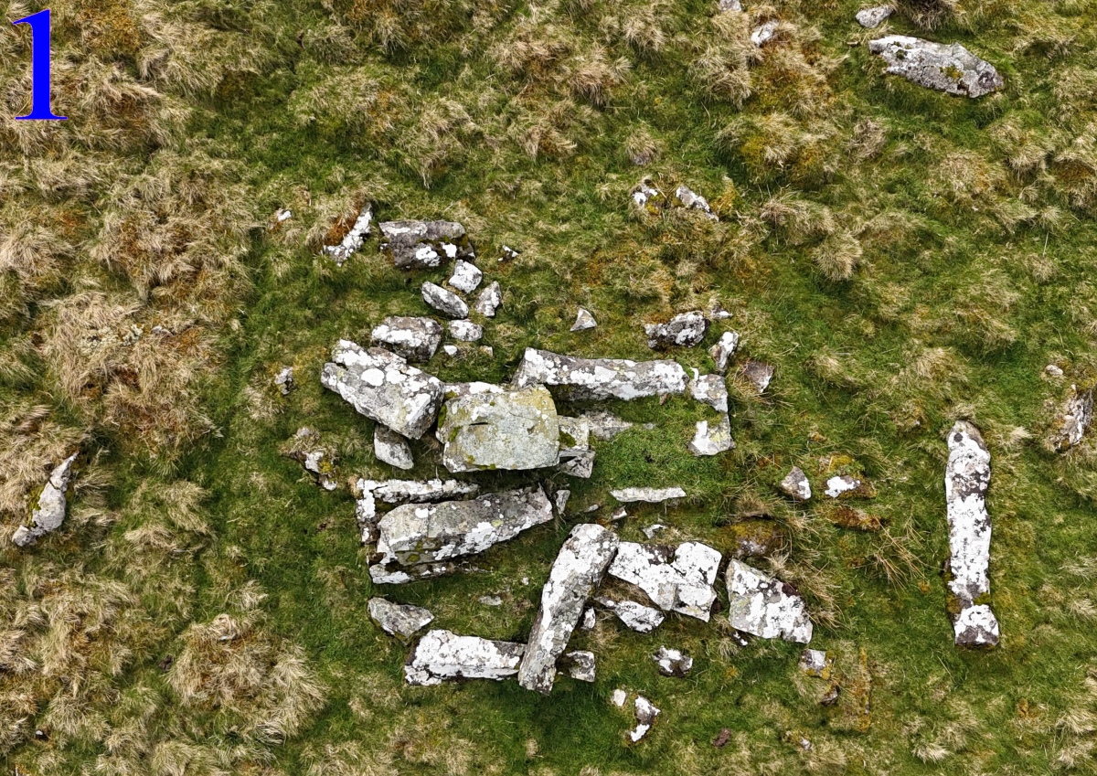
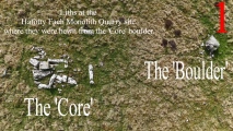
Hafotty Fach monolith quarry submitted by Geraint1 : Aerial view of site (Vote or comment on this photo)
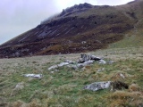
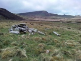
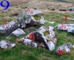
The site is a large boulder that seems to have been used as the core to extract monoliths. I noticed an 'odd' cairn whilst visiting/photographing the nearby settlement, approx 100m away. On closer inspection the cairn was seen to be a scattering of 6 or 7 stones that look like monoliths, one of which appeared finished - complete with one chisel shaped end - the others all looked to be, at least partially, unfinished.

Every lith was terminally damaged, as was the remains of the boulder core, except for the one lith that appeared finished, ready to go. Given that every stone, except one, was damaged beyond being fit for their supposed intended use as menhir, it would seem that they had been intentionally damaged.

All these liths are very closely the same size, approximately 2m long with a roughly rectangular cross-section of approximately 25cm to 40cm width/depth. There are many stone fragments of various sizes scattered at the site. There appears to be several stones - either partially obscured by the prominent stones or partially buried in vegetation. Some appear to also be of similar dimensions to the prominent stones.

There is a menhir in the nearby stone row (Rhos Hafotty Carneddau stone row), stone #5, and two others utilised as a road support over a stream below the quarry, that are all closely of the same dimensions as the liths at the quarry. I was curious as to why this particular boulder was chosen to use to hew monoliths. Following some observations, I believe I've discovered the answer - details of which will be forthcoming.

It is also curious as to why they seemingly decided not to use the liths (except possibly #5 in the row) and render them unusable (everything but the one lith). To that I'm stumped.
I am uploading 17 relevant photos giving a detailed view of the site (I have many more photos showing even greater detail than in these).

Below is a general description of the photos. Detailed descriptions accompany each photo.
Photo 1: Aerial view of site.
Photo 2: Aerial view with lith numberings.
Photo 3: Shows ground level view of the site as
approached from the north (up from the
valley).
Photo 4: Plan view of lith #1 - which appears
finished "ready to go".
Photos 5 to 13: Show more detailed views of the site from
various positions.
Photos 11 to 13: Show close ups of part of the remaining
core.
Photo 14: Stone #5 of the Rhos Hafotty Carneddau
stone row.
Photo 15: Shows the two liths across the stream -
below the quarry - to prevent road
subsidence.
Photo 16: Aerial view showing proximity of quarry to
settlement.
Photo 17: The closest settlement.
You may be viewing yesterday's version of this page. To see the most up to date information please register for a free account.
Hafotty Fach monolith quarry
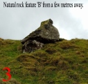
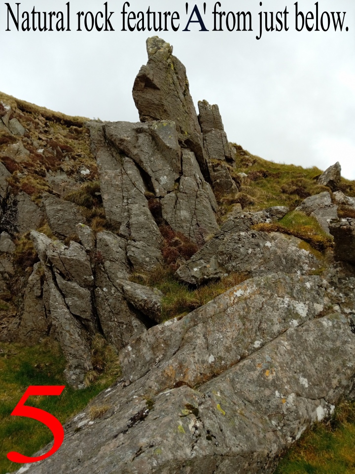
Hafotty Fach monolith quarry submitted by Geraint1 : Natural rock feature 'A' photographed from just below. THIS IS AS A REPLACEMENT FOR THE ORIGINAL PHOTO #5 . (Vote or comment on this photo)

Hafotty Fach monolith quarry
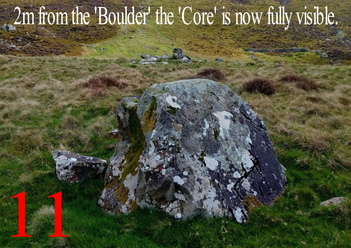
Hafotty Fach monolith quarry submitted by Geraint1 : Eleventh picture in sequence to explain the 'reveal' (Vote or comment on this photo)

Hafotty Fach monolith quarry
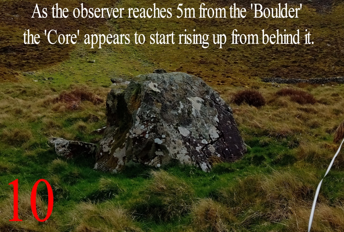
Hafotty Fach monolith quarry submitted by Geraint1 : Tenth picture in sequence to explain the 'reveal' (Vote or comment on this photo)

Hafotty Fach monolith quarry
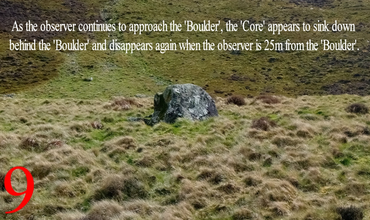
Hafotty Fach monolith quarry submitted by Geraint1 : Ninth picture in sequence to explain the 'reveal' (Vote or comment on this photo)

Hafotty Fach monolith quarry
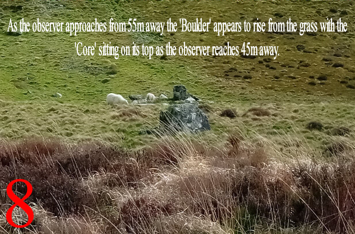
Hafotty Fach monolith quarry submitted by Geraint1 : Eighth picture in sequence to explain the 'reveal' (Vote or comment on this photo)

Hafotty Fach monolith quarry
Hafotty Fach monolith quarry submitted by Geraint1 : Seventh picture in sequence to explain the 'reveal'

Hafotty Fach monolith quarry
Hafotty Fach monolith quarry submitted by Geraint1 : Sixth picture in sequence to explain the 'reveal'

Hafotty Fach monolith quarry
Hafotty Fach monolith quarry submitted by Geraint1 : Fifth picture in sequence to explain the 'reveal'. PLEASE NOTE; This picture is of rock feature 'A' and NOT 'B' as indicated on photo. Sorry for that typo. (1 comment)

Hafotty Fach monolith quarry
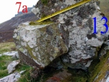
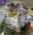
Hafotty Fach monolith quarry submitted by Geraint1 : Fourth picture in sequence to explain the 'reveal'

Hafotty Fach monolith quarry
Hafotty Fach monolith quarry submitted by Geraint1 : Third picture in sequence to explain the 'reveal'

Hafotty Fach monolith quarry
Hafotty Fach monolith quarry submitted by Geraint1 : Second picture in sequence to explain the 'reveal'

Hafotty Fach monolith quarry
Hafotty Fach monolith quarry submitted by Geraint1 : First picture in sequence to explain the 'reveal'

Hafotty Fach monolith quarry
Hafotty Fach monolith quarry submitted by TAlanJones : SE view across the site with Tyrrau Mawr towering above.

Hafotty Fach monolith quarry
Hafotty Fach monolith quarry submitted by TAlanJones : Visited today 4th April. Westerly view across the site with Mynydd Pennant in the distance.

Hafotty Fach monolith quarry
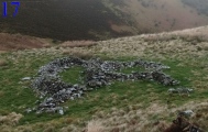
Hafotty Fach monolith quarry submitted by Geraint1 : The settlement approximately 100m away.

Hafotty Fach monolith quarry
Hafotty Fach monolith quarry submitted by Geraint1 : An aerial view showing the proximity of the quarry to the nearest settlement.

Hafotty Fach monolith quarry
Hafotty Fach monolith quarry submitted by Geraint1 : Two liths being utilised to prevent road subsidence by being placed across the stream where it goes under the road.

Hafotty Fach monolith quarry
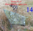
Hafotty Fach monolith quarry submitted by Geraint1 : This menhir is stone #5 of the nearby Rhos Hafotty Carneddau stone row. It is of similar dimensions as the quarry liths.

Hafotty Fach monolith quarry
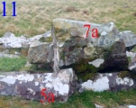
Hafotty Fach monolith quarry submitted by Geraint1 : Close up view of the remains of stone #7a, the core.

Hafotty Fach monolith quarry
Hafotty Fach monolith quarry submitted by Geraint1

Hafotty Fach monolith quarry
Hafotty Fach monolith quarry submitted by Geraint1

Hafotty Fach monolith quarry
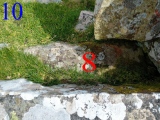
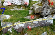
Hafotty Fach monolith quarry submitted by Geraint1 : Stone #8 sits alongside #5a and partially under #7a and vegetation. By feeling around it appears to be a rectangular cross-section of approx 30cm x 30cm. It's length at least 1m.

Hafotty Fach monolith quarry
Hafotty Fach monolith quarry submitted by Geraint1 : Another view from the SE.

Hafotty Fach monolith quarry
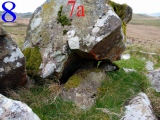
Hafotty Fach monolith quarry submitted by Geraint1 : This shows the damaged face of stone 7a, one of the remaining pieces of the core. The stones underneath do appear to be hewn for lliths judging by their size.

Hafotty Fach monolith quarry
Hafotty Fach monolith quarry submitted by Geraint1 : Another detailed view from the opposite side of the site.

These are just the first 25 photos of Hafotty Fach monolith quarry. If you log in with a free user account you will be able to see our entire collection.

Do not use the above information on other web sites or publications without permission of the contributor.
Click here to see more info for this site

Nearby sites

Click here to view sites on an interactive OS map

Key: Red: member's photo, Blue: 3rd party photo, Yellow: other image, Green: no photo - please go there and take one, Grey: site destroyed

Download sites to:
KML (Google Earth)
GPX (GPS waypoints)
CSV (Garmin/Navman)
CSV (Excel)

To unlock full downloads you need to sign up as a Contributory Member. Otherwise downloads are limited to 50 sites.


Turn off the page maps and other distractions

Nearby sites listing. In the following links * = Image available
 82m NNE 12° Settlement East of Tyrrau Mawr* Ancient Village or Settlement (SH6674013500)
 113m NE 43° Graig Las Cairn* Cairn (SH6680013500)
 208m NNE 30° Graig Las Cairn 2* Cairn (SH6682913598)
 211m NNE 30° Graig Las Round Cairn* Round Cairn (SH6683013600)
 234m NE 49° Graig Las Hut Circle* Ancient Village or Settlement (SH6690013570)
 238m NW 325° Rhos Hafotty Carneddau stone setting* Standing Stones (SH66591362)
 245m NW 326° Hafotty Fach Monument* Cairn (SH6658913627)
 297m WSW 249° Cairn East of Hafotty Fach* Cairn (SH66441332)
 329m WNW 282° Hafoty-Fach cairns* Round Cairn (SH664135)
 362m WNW 303° Rhos Hafotty Carneddau* Standing Stones (SH6642213627)
 439m NNW 328° Llynnau Cregennen Cairns* Cairn (SH665138)
 532m WSW 255° Afon Arthog Cairns* Cairn (SH662133)
 602m W 275° Hafotty Fach Cockpit Cairn* Cairn (SH6612013490)
 632m W 275° Hafotty Fach gate menhirs* Standing Stones (SH66091349)
 690m NW 306° Carreg y Big (Arthog)* Standing Stone (Menhir) (SH66171384)
 834m NW 305° Carreg y Pwyso* Standing Stone (Menhir) (SH66051392)
 938m WNW 283° Cairn Cemetery North of Hafotty Fach* Barrow Cemetery (SH65811366)
 1.1km W 262° Cairn South of Ffordd Ddu* Round Cairn (SH656133)
 1.1km WSW 253° Afon Arthog Standing Stone* Standing Stone (Menhir) (SH6561013120)
 1.3km NW 323° Cregennen standing stone* Standing Stone (Menhir) (SH65941450)
 1.5km NW 321° Llynnau Cregennau Cairn* Cairn (SH6582114574)
 1.5km N 354° Hut Circle South of Pared Y Cefn hir* Ancient Village or Settlement (SH666149)
 1.5km W 275° Burial Cairn South of Eglwys Foel* Cairn (SH652136)
 1.5km WNW 288° Arthog Standing Stones* Stone Circle (SH65261393)
 1.6km E 85° Tyrrau Mawr* Cairn (SH68281352)
View more nearby sites and additional images

<< Rillenstein Wallmow

Prod Howe BS >>

Please add your thoughts on this site

Understanding the Neolithic

Understanding the Neolithic

Sponsors

Auto-Translation (Google)

Translate from English into:

"Hafotty Fach monolith quarry" | Login/Create an Account | 3 News and Comments
  
Go back to top of page    Comments are owned by the poster. We aren't responsible for their content.
Re: Hafotty Fach monolith quarry by Geraint1 on Friday, 05 April 2024
(User Info | Send a Message)
After finding this site, I was curious why that particular boulder was chosen to hew liths.
Here I refer to the boulder used to hew liths as the 'Core'. Approximately 20m to the north of the 'Core' is a large boulder that I here refer to as the 'Boulder' (this will make sense).
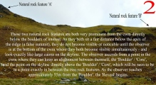
I noticed 2 very prominent cairns on the skyline. Both turned out to be natural rock features. As they are both on "false summits" they can not both be seen from anywhere else except on the approach to the quarry from below.
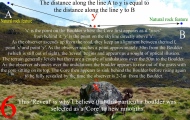
There is a "reveal" that can be observed on approaching the 'Core'/'Boulder' from the north (the road), if a particular alignment is maintained especially when walking the last 60m to the 'Core'/'Boulder'.
The alignment is made using a point on the skyline - 'y' - the 'Core'/'Boulder' and the observer (you). The point on the skyline - 'y' - is equidistant - in a straight line (see photo 6) - from both rock features.
The 'Boulder' is not really visible on the approach (the alignment is made on the 'Core' which is visible). When 55m from the 'Boulder' - where the terrain levels off - the 'Boulder' appears to rise up out of the grass with the 'Core' sitting on top. As the 'Boulder' becomes fully revealed the 'Core' sinks behind it and then rises up again to full 'reveal' when the observer is a few metres from the 'Boulder'.
This illusion is created because there are undulations in the terrain over the last 55m walking to the 'Boulder'. These undulations aren't very visually obvious due to the long vegetation.

I believe this could be why this boulder was chosen from which to hew liths.
I climbed to the two rock outcrops and lying behind the feature on the right - 'B' - is another lith of similar dimensions to those at the quarry, some 170m (560ft) vertically below, and the slope is exceedingly steep.
I've uploaded 11 photos that illustrate all this better than I can explain. NB photo #5 is of NATURAL ROCK FEATURE 'A', NOT 'B'.
[ Reply to This ]
    Re: Hafotty Fach monolith quarry by Andy B on Monday, 08 April 2024
    (User Info | Send a Message)
    Hello Geraint, This site is a really interesting discovery, I wonder if it has been recognised elsewhere? I'm going to put it on our front page. Also you are welcome to send that photo again with the correction if you like.
    [ Reply to This ]
      Re: Hafotty Fach monolith quarry by Geraint1 on Tuesday, 09 April 2024
      (User Info | Send a Message)
      TAlanJones visited the site. I understand he knows the area very well. He mentioned he'd been aware of the stones. It's not mentioned in Coflein although the settlement 100(ish)m away is.
      [ Reply to This ]

Your Name: Anonymous [ Register Now ]
Subject:


Add your comment or contribution to this page. Spam or offensive posts are deleted immediately, don't even bother

<<< What is five plus one as a number? (Please type the answer to this question in the little box on the left)
You can also embed videos and other things. For Youtube please copy and paste the 'embed code'.
For Google Street View please include Street View in the text.
Create a web link like this: <a href="https://www.megalithic.co.uk">This is a link</a>  

Allowed HTML is:
<p> <b> <i> <a> <img> <em> <br> <strong> <blockquote> <tt> <li> <ol> <ul> <object> <param> <embed> <iframe>

We would like to know more about this location. Please feel free to add a brief description and any relevant information in your own language.
Wir möchten mehr über diese Stätte erfahren. Bitte zögern Sie nicht, eine kurze Beschreibung und relevante Informationen in Deutsch hinzuzufügen.
Nous aimerions en savoir encore un peu sur les lieux. S'il vous plaît n'hesitez pas à ajouter une courte description et tous les renseignements pertinents dans votre propre langue.
Quisieramos informarnos un poco más de las lugares. No dude en añadir una breve descripción y otros datos relevantes en su propio idioma.