


<< Our Photo Pages >> Afon Arthog Standing Stone - Standing Stone (Menhir) in Wales in Gwynedd
Submitted by TAlanJones on Saturday, 19 March 2022 Page Views: 793
Neolithic and Bronze AgeSite Name: Afon Arthog Standing Stone Alternative Name: Hafotty Fach StoneCountry: Wales County: Gwynedd Type: Standing Stone (Menhir)
Nearest Town: Dolgellau Nearest Village: Arthog
Map Ref: SH6561013120
Latitude: 52.699027N Longitude: 3.990205W
Condition:
| 5 | Perfect |
| 4 | Almost Perfect |
| 3 | Reasonable but with some damage |
| 2 | Ruined but still recognisable as an ancient site |
| 1 | Pretty much destroyed, possibly visible as crop marks |
| 0 | No data. |
| -1 | Completely destroyed |
| 5 | Superb |
| 4 | Good |
| 3 | Ordinary |
| 2 | Not Good |
| 1 | Awful |
| 0 | No data. |
| 5 | Can be driven to, probably with disabled access |
| 4 | Short walk on a footpath |
| 3 | Requiring a bit more of a walk |
| 2 | A long walk |
| 1 | In the middle of nowhere, a nightmare to find |
| 0 | No data. |
| 5 | co-ordinates taken by GPS or official recorded co-ordinates |
| 4 | co-ordinates scaled from a detailed map |
| 3 | co-ordinates scaled from a bad map |
| 2 | co-ordinates of the nearest village |
| 1 | co-ordinates of the nearest town |
| 0 | no data |
Internal Links:
External Links:
")
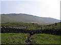
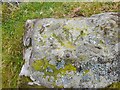
The stone is situated within marshland and close to a more modern boundary wall that runs north to south. Although (today) the stone is not in a prominent position, it certainly stood out as I approached from the north. This is a large, flat and rounded stone. My measurements found that it stood at 1.5m tall by 1.28m wide and 0.4m thick.
It is an impressive stone set in a scenic environment and it's location provides a view of the Planwydd Helyg Stone. The Ffordd Ddu cairn would also have been visible from the stone.
You may be viewing yesterday's version of this page. To see the most up to date information please register for a free account.
")
")
")
Do not use the above information on other web sites or publications without permission of the contributor.
Nearby Images from Geograph Britain and Ireland:
©2011(licence)
©2019(licence)
©2018(licence)

©2015(licence)
©2022(licence)
The above images may not be of the site on this page, they are loaded from Geograph.
Please Submit an Image of this site or go out and take one for us!
Click here to see more info for this site
Nearby sites
Key: Red: member's photo, Blue: 3rd party photo, Yellow: other image, Green: no photo - please go there and take one, Grey: site destroyed
Download sites to:
KML (Google Earth)
GPX (GPS waypoints)
CSV (Garmin/Navman)
CSV (Excel)
To unlock full downloads you need to sign up as a Contributory Member. Otherwise downloads are limited to 50 sites.
Turn off the page maps and other distractions
Nearby sites listing. In the following links * = Image available
180m N 355° Cairn South of Ffordd Ddu* Round Cairn (SH656133)
467m WNW 285° Planwydd Helyg Standing Stone* Standing Stone (Menhir) (SH65161325)
470m ENE 71° Afon Arthog Cairns* Cairn (SH66061326)
575m NNE 19° Cairn Cemetery North of Hafotty Fach* Barrow Cemetery (SH65811366)
605m NE 51° Hafotty Fach gate menhirs* Standing Stones (SH66091349)
629m NE 52° Hafotty Fach Cockpit Cairn* Cairn (SH6612013490)
630m NW 318° Burial Cairn South of Eglwys Foel* Cairn (SH652136)
851m ENE 75° Cairn East of Hafotty Fach* Cairn (SH66441332)
874m ENE 63° Hafoty-Fach cairns* Round Cairn (SH664135)
881m NNW 335° Arthog Standing Stones* Stone Circle (SH65261393)
911m NE 36° Carreg y Big (Arthog)* Standing Stone (Menhir) (SH66171384)
912m NNE 27° Carreg y Pwyso* Standing Stone (Menhir) (SH66051392)
917m NNW 335° Standing Stone West of The Arthog Standing Stones* Standing Stone (Menhir) (SH65241396)
955m ENE 56° Rhos Hafotty Carneddau* Standing Stones (SH6642213627)
1.1km ENE 61° Rhos Hafotty Carneddau stone setting* Standing Stones (SH66591362)
1.1km ENE 61° Hafotty Fach Monument* Cairn (SH6658913627)
1.1km NE 51° Llynnau Cregennen Cairns* Cairn (SH665138)
1.1km ENE 73° Hafotty Fach monolith quarry* Ancient Mine, Quarry or other Industry (SH66721342)
1.2km ENE 70° Settlement East of Tyrrau Mawr* Ancient Village or Settlement (SH6674013500)
1.2km ENE 71° Graig Las Cairn* Cairn (SH6680013500)
1.3km ENE 67° Graig Las Cairn 2* Cairn (SH6682913598)
1.3km ENE 67° Graig Las Round Cairn* Round Cairn (SH6683013600)
1.4km ENE 69° Graig Las Hut Circle* Ancient Village or Settlement (SH6690013570)
1.4km NNE 12° Cregennen standing stone* Standing Stone (Menhir) (SH65941450)
1.5km N 7° Llynnau Cregennau Cairn* Cairn (SH6582114574)
View more nearby sites and additional images


 We would like to know more about this location. Please feel free to add a brief description and any relevant information in your own language.
 Wir möchten mehr über diese Stätte erfahren. Bitte zögern Sie nicht, eine kurze Beschreibung und relevante Informationen in Deutsch hinzuzufügen.
 Nous aimerions en savoir encore un peu sur les lieux. S'il vous plaît n'hesitez pas à ajouter une courte description et tous les renseignements pertinents dans votre propre langue.
 Quisieramos informarnos un poco más de las lugares. No dude en añadir una breve descripción y otros datos relevantes en su propio idioma.