

<< Our Photo Pages >> Cooleenlemane rock scribing - Cave or Rock Shelter in Ireland (Republic of) in Co. Cork
Submitted by GaelicLaird on Wednesday, 11 October 2023 Page Views: 219
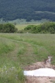
Natural PlacesSite Name: Cooleenlemane rock scribingCountry: Ireland (Republic of) County: Co. Cork Type: Cave or Rock Shelter
Nearest Village: Ballylicky
Latitude: 51.776338N Longitude: 9.472331W
Condition:
| 5 | Perfect |
| 4 | Almost Perfect |
| 3 | Reasonable but with some damage |
| 2 | Ruined but still recognisable as an ancient site |
| 1 | Pretty much destroyed, possibly visible as crop marks |
| 0 | No data. |
| -1 | Completely destroyed |
| 5 | Superb |
| 4 | Good |
| 3 | Ordinary |
| 2 | Not Good |
| 1 | Awful |
| 0 | No data. |
| 5 | Can be driven to, probably with disabled access |
| 4 | Short walk on a footpath |
| 3 | Requiring a bit more of a walk |
| 2 | A long walk |
| 1 | In the middle of nowhere, a nightmare to find |
| 0 | No data. |
| 5 | co-ordinates taken by GPS or official recorded co-ordinates |
| 4 | co-ordinates scaled from a detailed map |
| 3 | co-ordinates scaled from a bad map |
| 2 | co-ordinates of the nearest village |
| 1 | co-ordinates of the nearest town |
| 0 | no data |
Internal Links:
External Links:
")
Officially recorded as site CO091-003----
Located at the end of a U-shaped valley, on a natural rise to west of Cooleenlemane River.
The gap formed by one rock leaning against another is large enough to walk into and contains numerous rock scribings.
The scribings are similar to those found in the Glanrastel valley at the Pluais na Scríob site, although the Pluais na Scríob scribings are much more numerous (http://www.megalithic.co.uk/article.php?sid=25103).
Remains of a cashel ringfort lie approx 180 metres to the south on the same side of the river (site CO091-004----).
The site may have been used as a Mass rock in the mid-17th century as a location for Catholic Mass. Isolated locations were sought to hold religious ceremonies, as observing the Catholic Mass was a matter of difficulty and danger at the time as a result of both Cromwell's campaign against the Irish, and the Penal Law of 1695.
It is quite possible that the scribings significantly pre-date the sites use as a mass rock as many scribings are known to be pre-historic.
You may be viewing yesterday's version of this page. To see the most up to date information please register for a free account.
")
")
")
")
")
")
Do not use the above information on other web sites or publications without permission of the contributor.
Click here to see more info for this site
Nearby sites
Click here to view sites on an interactive map of the areaKey: Red: member's photo, Blue: 3rd party photo, Yellow: other image, Green: no photo - please go there and take one, Grey: site destroyed
Download sites to:
KML (Google Earth)
GPX (GPS waypoints)
CSV (Garmin/Navman)
CSV (Excel)
To unlock full downloads you need to sign up as a Contributory Member. Otherwise downloads are limited to 50 sites.
Turn off the page maps and other distractions
Nearby sites listing. In the following links * = Image available
2.6km W 279° Coonane wedge tomb* Wedge Tomb
2.7km SSE 167° Mill Little Stone Row / Alignment (V98985653)
2.7km S 169° Mill Little* Stone Circle (V989565)
2.7km W 275° Cuanán standing stone* Standing Stone (Menhir)
3.9km N 352° Coorleagh ring fort* Stone Fort or Dun
4.3km WNW 301° An Eisc Thoir wedge tomb* Wedge Tomb
4.6km WNW 299° Esk East standing stone* Standing Stone (Menhir)
4.8km SE 131° Trawnamaddree Stone Row / Alignment (W01975597)
4.9km WSW 257° Currakeal boulder burial* Burial Chamber or Dolmen
4.9km WSW 256° Currakeal Stone Row* Stone Row / Alignment
4.9km W 280° Barraboy mountain* Wedge Tomb (V9357160171)
5.0km WSW 258° Canrooska Stone Circle* Stone Circle
5.0km W 260° Ceann Rúscach standing stone* Standing Stone (Menhir)
5.0km WSW 257° Canrooska Stone Row* Stone Row / Alignment
5.1km WNW 282° Canrooska standing stone* Standing Stone (Menhir)
5.1km SSE 157° Dromkeal* Stone Circle (W00315445)
5.2km WSW 252° Kilcaskan rock art* Rock Art
5.2km WSW 251° Reenmeen West standing stone and radial stone cairn* Standing Stone (Menhir)
5.2km NNW 338° Feaghna* Rock Art (V966641)
5.7km ESE 108° Ahil More standing stone* Standing Stone (Menhir)
5.9km W 276° Crossferry east* Standing Stone (Menhir) (V9257459890)
5.9km E 96° Maughanasilly* Stone Row / Alignment (W0431958413)
6.1km E 86° Illane.* Stone Circle (W04595951)
6.6km SSE 151° Crossoge wedge tomb* Wedge Tomb
6.7km NNW 336° Dromagorteen* Stone Circle (V9586165343)
View more nearby sites and additional images


 We would like to know more about this location. Please feel free to add a brief description and any relevant information in your own language.
 Wir möchten mehr über diese Stätte erfahren. Bitte zögern Sie nicht, eine kurze Beschreibung und relevante Informationen in Deutsch hinzuzufügen.
 Nous aimerions en savoir encore un peu sur les lieux. S'il vous plaît n'hesitez pas à ajouter une courte description et tous les renseignements pertinents dans votre propre langue.
 Quisieramos informarnos un poco más de las lugares. No dude en añadir una breve descripción y otros datos relevantes en su propio idioma.