


<< Our Photo Pages >> Ceann Rúscach standing stone - Standing Stone (Menhir) in Ireland (Republic of) in Co. Cork
Submitted by GaelicLaird on Thursday, 13 July 2023 Page Views: 215
Neolithic and Bronze AgeSite Name: Ceann Rúscach standing stoneCountry: Ireland (Republic of) County: Co. Cork Type: Standing Stone (Menhir)
Nearest Village: Glengarriff
Latitude: 51.768402N Longitude: 9.543609W
Condition:
| 5 | Perfect |
| 4 | Almost Perfect |
| 3 | Reasonable but with some damage |
| 2 | Ruined but still recognisable as an ancient site |
| 1 | Pretty much destroyed, possibly visible as crop marks |
| 0 | No data. |
| -1 | Completely destroyed |
| 5 | Superb |
| 4 | Good |
| 3 | Ordinary |
| 2 | Not Good |
| 1 | Awful |
| 0 | No data. |
| 5 | Can be driven to, probably with disabled access |
| 4 | Short walk on a footpath |
| 3 | Requiring a bit more of a walk |
| 2 | A long walk |
| 1 | In the middle of nowhere, a nightmare to find |
| 0 | No data. |
| 5 | co-ordinates taken by GPS or official recorded co-ordinates |
| 4 | co-ordinates scaled from a detailed map |
| 3 | co-ordinates scaled from a bad map |
| 2 | co-ordinates of the nearest village |
| 1 | co-ordinates of the nearest town |
| 0 | no data |
Internal Links:
External Links:
")
A solitary standing stone, recorded as monument CO090-023----
In rough hill pasture, on bog, on a W-facing slope overlooking the valley of the Canrooska River. This standing stone (1.5m x 0.6m; H 1.8m) is rectangular in plan and is orientated E-W.
The above description is derived from 'The Archaeological Inventory of County Cork. Volume 5' (Dublin: Stationery Office, 2009).
You may be viewing yesterday's version of this page. To see the most up to date information please register for a free account.
")
")
Do not use the above information on other web sites or publications without permission of the contributor.
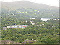
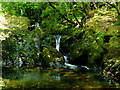
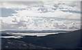
Nearby Images from Geograph Britain and Ireland:
©2006(licence)
©2015(licence)
©2015(licence)
©2017(licence)
©2009(licence)
The above images may not be of the site on this page, they are loaded from Geograph.
Please Submit an Image of this site or go out and take one for us!
Click here to see more info for this site
Nearby sites
Click here to view sites on an interactive map of the areaKey: Red: member's photo, Blue: 3rd party photo, Yellow: other image, Green: no photo - please go there and take one, Grey: site destroyed
Download sites to:
KML (Google Earth)
GPX (GPS waypoints)
CSV (Garmin/Navman)
CSV (Excel)
To unlock full downloads you need to sign up as a Contributory Member. Otherwise downloads are limited to 50 sites.
Turn off the page maps and other distractions
Nearby sites listing. In the following links * = Image available
195m SSE 165° Canrooska Stone Circle* Stone Circle
204m SSE 169° Canrooska Stone Row* Stone Row / Alignment
271m SSE 150° Currakeal boulder burial* Burial Chamber or Dolmen
296m SSE 158° Currakeal Stone Row* Stone Row / Alignment
703m S 186° Kilcaskan rock art* Rock Art
792m S 184° Reenmeen West standing stone and radial stone cairn* Standing Stone (Menhir)
1.7km NNW 327° Crossferry east* Standing Stone (Menhir) (V9257459890)
1.8km N 1° Barraboy mountain* Wedge Tomb (V9357160171)
1.9km N 358° Canrooska standing stone* Standing Stone (Menhir)
2.5km ENE 63° Cuanán standing stone* Standing Stone (Menhir)
2.6km ENE 61° Coonane wedge tomb* Wedge Tomb
2.9km NW 313° Tooreen bronze age copper mine* Ancient Mine, Quarry or other Industry
3.2km NNE 16° Esk East standing stone* Standing Stone (Menhir)
3.3km NNE 21° An Eisc Thoir wedge tomb* Wedge Tomb
5.0km E 80° Cooleenlemane rock scribing* Cave or Rock Shelter
5.7km ESE 108° Mill Little* Stone Circle (V989565)
5.8km ESE 108° Mill Little Stone Row / Alignment (V98985653)
6.5km NNE 27° Feaghna* Rock Art (V966641)
6.5km NE 42° Coorleagh ring fort* Stone Fort or Dun
7.3km N 1° Derrynacoulagh* Rock Art (V9371865698)
7.3km NNE 18° Dromagorteen* Stone Circle (V9586165343)
7.7km N 354° Derrynacaheragh Wedge Tomb (V9288166088)
7.9km ESE 119° Dromkeal* Stone Circle (W00315445)
8.5km SW 223° Kealagowlane Stone circle* Stone Circle (V876523)
8.6km NW 314° Derrysallagh* Stone Row / Alignment (V874645)
View more nearby sites and additional images


 We would like to know more about this location. Please feel free to add a brief description and any relevant information in your own language.
 Wir möchten mehr über diese Stätte erfahren. Bitte zögern Sie nicht, eine kurze Beschreibung und relevante Informationen in Deutsch hinzuzufügen.
 Nous aimerions en savoir encore un peu sur les lieux. S'il vous plaît n'hesitez pas à ajouter une courte description et tous les renseignements pertinents dans votre propre langue.
 Quisieramos informarnos un poco más de las lugares. No dude en añadir una breve descripción y otros datos relevantes en su propio idioma.