


<< Our Photo Pages >> Deadman's Bottom F - Cairn in England in Devon
Submitted by Anne T on Wednesday, 12 October 2016 Page Views: 1627
Neolithic and Bronze AgeSite Name: Deadman's Bottom F Alternative Name: Grinsell Shaugh Prior 12; Lancombe Brook 11Country: England County: Devon Type: Cairn
Nearest Town: Plymouth Nearest Village: Whitworks
Map Ref: SX61206698
Latitude: 50.486147N Longitude: 3.957905W
Condition:
| 5 | Perfect |
| 4 | Almost Perfect |
| 3 | Reasonable but with some damage |
| 2 | Ruined but still recognisable as an ancient site |
| 1 | Pretty much destroyed, possibly visible as crop marks |
| 0 | No data. |
| -1 | Completely destroyed |
| 5 | Superb |
| 4 | Good |
| 3 | Ordinary |
| 2 | Not Good |
| 1 | Awful |
| 0 | No data. |
| 5 | Can be driven to, probably with disabled access |
| 4 | Short walk on a footpath |
| 3 | Requiring a bit more of a walk |
| 2 | A long walk |
| 1 | In the middle of nowhere, a nightmare to find |
| 0 | No data. |
| 5 | co-ordinates taken by GPS or official recorded co-ordinates |
| 4 | co-ordinates scaled from a detailed map |
| 3 | co-ordinates scaled from a bad map |
| 2 | co-ordinates of the nearest village |
| 1 | co-ordinates of the nearest town |
| 0 | no data |
Be the first person to rate this site - see the 'Contribute!' box in the right hand menu.
10 photos by 2 photographers
Internal Links:


External Links:



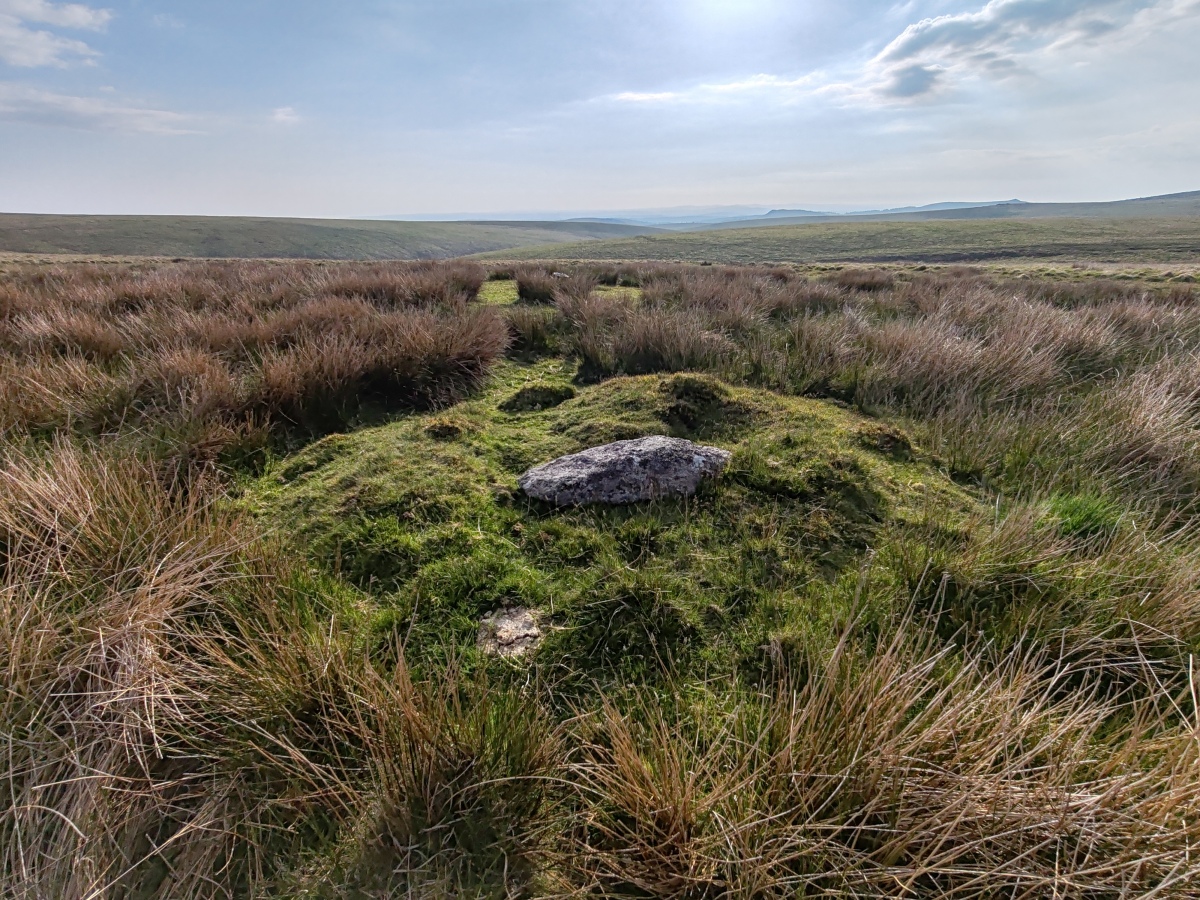
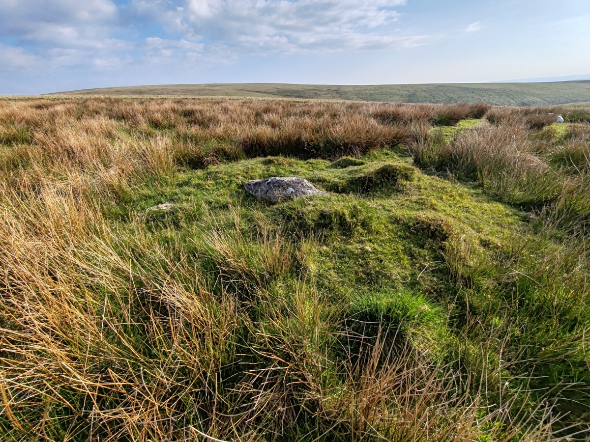
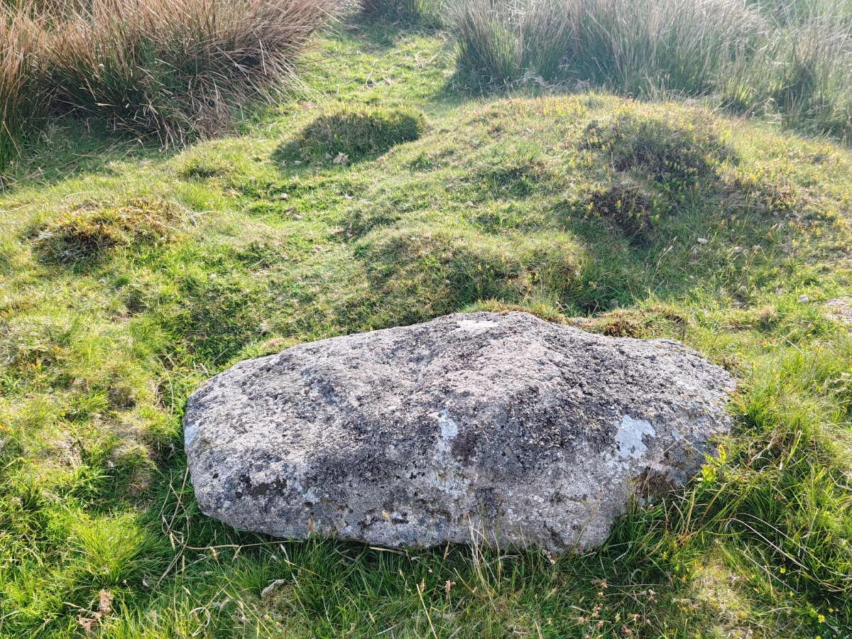
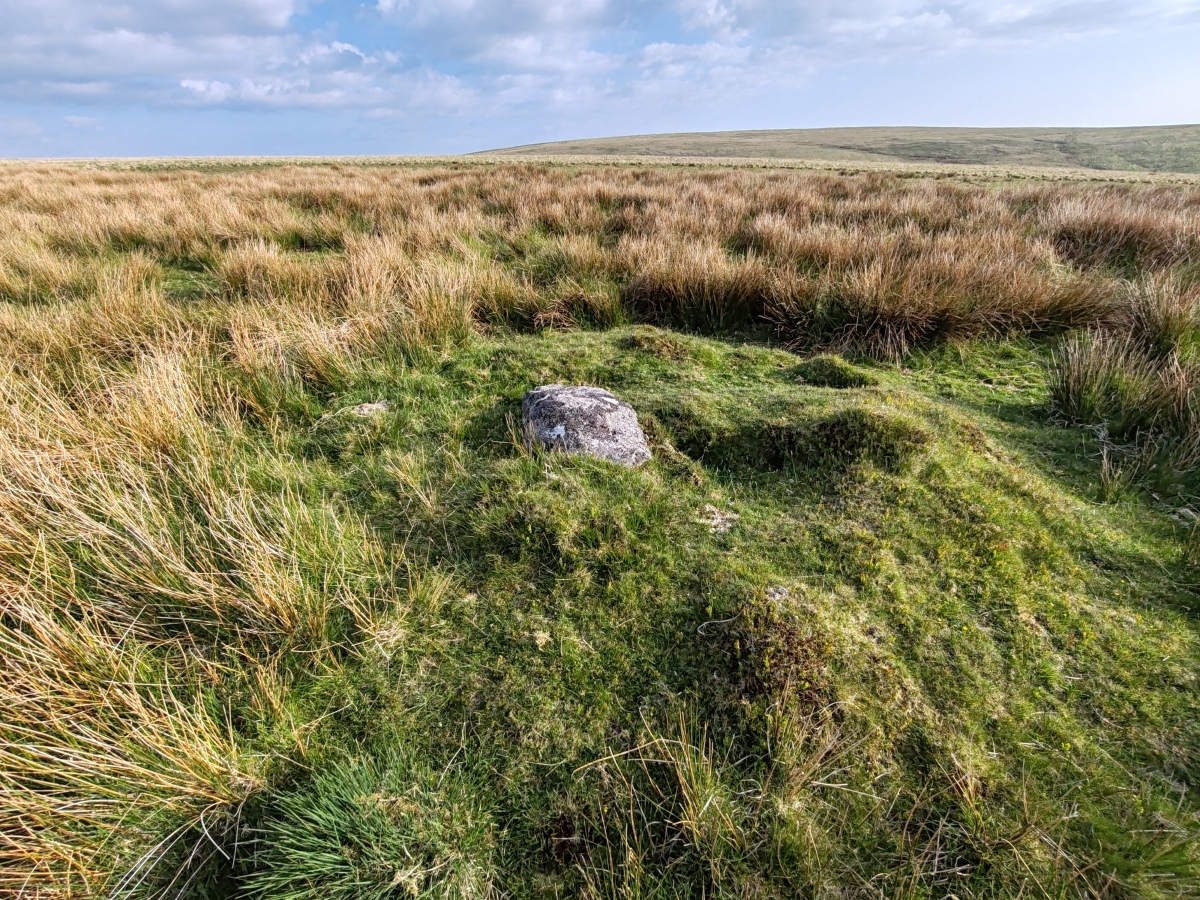
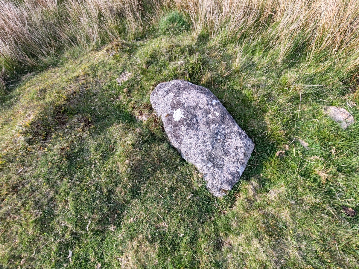
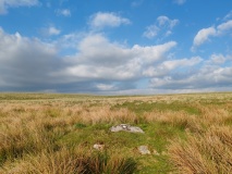
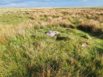
Featured on the Prehistoric Dartmoor Walks website as one of a number of cairns, cists and hut circles in the area of land between Plym Steps, Erme Head, Langcombe Head, and Shavercombe Head, Deadman's Bottom F Platform Cairn Circle and Cist is described as a "cist (Listed as 'F' by Worth) found at Deadman's Bottom, Langcombe, by Mr. Button. The cover-stone is still in position but the cist appears to have been rifled, the end and side-stones having been displaced at the north-east and southwest angles. Original length would appear to have been 2 feet 10 inches, and the width 1 foot 7 inches. The greatest length of the cover-stone is 4ft 9 inches and its greatest width 3 feet 1 1/2 inches." ... "A flat-topped cairn measuring 5.4m in diameter and standing a maximum of 0.4m high. A well-preserved cist 1.3m long, 0.6m wide and 0.15m deep is largely obscured by the coverstone".
Further information can also be found on the Pastscape website, see Monument Number 441647, which tells us this cist sits "at about 415 metres OD, on a slight west slope".
The Heritage Gateway for Devon & Dartmoor HER number MDV5125, adds that this cist is "an unusual example in that the coverstone is still over the cist. None the less it appears to have been rifled .... the edge of the cairn is denoted in at least 2 places by edge set stones which indicate the presence of a kerb." They dates the cist to the Bronze Age (2200 BC to 701 BC).
This cist is also scheduled as Historic England List ID 1015751 (Round cairn and cist 560m north of Grim's Grave).
Also see PDW's Guide to the Langcombe Brook & Deadman's Bottom Cists, which gives a list of all cairns, cists and ring settings in the area, together with links to their corresponding Portal site pages.
You may be viewing yesterday's version of this page. To see the most up to date information please register for a free account.
Do not use the above information on other web sites or publications without permission of the contributor.
Click here to see more info for this site
Log in or create a free account to see nearby ancient sites our visitors rate highly
All Nearby sites
 Click here to view sites on an interactive OS map
Download sites to:
KML (Google Earth)
GPX (GPS waypoints)
CSV (Garmin/Navman)
CSV (Excel)
To unlock full downloads you need to sign up as a Society Member. Otherwise downloads are limited to 50 sites.
Turn off the page maps and other distractions
Nearby sites listing. In the following links * = Image available
342m SW 217° Deadman's Bottom E* Cairn (SX6098466714)
346m SW 222° Deadman's Bottom D* Cairn (SX60966673)
490m W 274° Deadman's Bottom Cists* Cairn (SX6071167027)
491m W 274° Deadman's Bottom Cairn Circle* Cairn (SX60716703)
561m S 174° Grim’s Grave* Cairn (SX61246642)
620m WSW 257° Langcombe Brook Settlement* Ancient Village or Settlement (SX60596686)
654m SSW 208° Langcombe Brook 5* Cairn (SX6087566412)
662m NNW 330° Calveslake* Cairn (SX60886756)
669m S 174° Langcombe Brook 4* Cairn (SX6125166313)
787m W 277° Plym Steps* Cairn (SX60426710)
820m W 264° Langcombe Brook 7* Cist (SX60386692)
890m SSW 200° Langcombe South* Cairn (SX6086666155)
1.0km NNE 25° Great Gnat's Head Cairn* Cairn (SX6165767908)
1.0km WNW 286° Lower Hartor tor settlement.* Ancient Village or Settlement (SX602673)
1.1km N 357° Great Gnat's Head Cist* Cist (SX6117468034)
1.6km W 264° Giant's Hill North Cairn* Cairn (SX59626687)
1.6km W 259° Giant's Hill East* Cist (SX5958766717)
1.7km W 261° Giant's Hill Settlement Ancient Village or Settlement (SX59536676)
1.8km SW 230° Hentor 7* Cist (SX59816588)
1.8km W 261° Giant's Hill West* Cist (SX59446675)
1.8km W 280° Drizzlecombe Cairn 23* Cairn (SX5942367331)
1.8km W 275° Drizzlecombe Cairn 18* Cairn (SX5937667182)
1.9km W 280° Cairn At Head of Drizzlecombe Row 4* Cairn (SX5937467361)
1.9km W 280° Drizzlecombe W row* Stone Row / Alignment (SX5937067360)
1.9km W 281° Standing Stone Near Cairn at Head of Drizzlecombe Row 4* Standing Stone (Menhir) (SX5937067374)
View more nearby sites and additional images


 We would like to know more about this location. Please feel free to add a brief description and any relevant information in your own language.
 Wir möchten mehr über diese Stätte erfahren. Bitte zögern Sie nicht, eine kurze Beschreibung und relevante Informationen in Deutsch hinzuzufügen.
 Nous aimerions en savoir encore un peu sur les lieux. S'il vous plaît n'hesitez pas à ajouter une courte description et tous les renseignements pertinents dans votre propre langue.
 Quisieramos informarnos un poco más de las lugares. No dude en añadir una breve descripción y otros datos relevantes en su propio idioma.