<< Our Photo Pages >> St Martha's on the Hill Earth Circles - Misc. Earthwork in England in Surrey
Submitted by Andy B on Monday, 25 March 2013 Page Views: 19721
Multi-periodSite Name: St Martha's on the Hill Earth CirclesCountry: England County: Surrey Type: Misc. Earthwork
Nearest Town: Guildford Nearest Village: Chilworth
Map Ref: TQ027482
Latitude: 51.223765N Longitude: 0.530709W
Condition:
| 5 | Perfect |
| 4 | Almost Perfect |
| 3 | Reasonable but with some damage |
| 2 | Ruined but still recognisable as an ancient site |
| 1 | Pretty much destroyed, possibly visible as crop marks |
| 0 | No data. |
| -1 | Completely destroyed |
| 5 | Superb |
| 4 | Good |
| 3 | Ordinary |
| 2 | Not Good |
| 1 | Awful |
| 0 | No data. |
| 5 | Can be driven to, probably with disabled access |
| 4 | Short walk on a footpath |
| 3 | Requiring a bit more of a walk |
| 2 | A long walk |
| 1 | In the middle of nowhere, a nightmare to find |
| 0 | No data. |
| 5 | co-ordinates taken by GPS or official recorded co-ordinates |
| 4 | co-ordinates scaled from a detailed map |
| 3 | co-ordinates scaled from a bad map |
| 2 | co-ordinates of the nearest village |
| 1 | co-ordinates of the nearest town |
| 0 | no data |
Internal Links:
External Links:
")
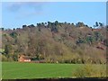
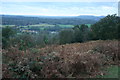
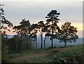
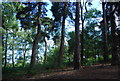
There are three circles remaining, another at SU028482. Your only chance of locating any of the earth circles is to visit in winter when the bracken has died down. St Marthas Hill used play host to have a May Day Festival of All Martyrs
There are also intriguing links to a Dragon legend, and one of competing giants that connect it with the with St Catherine's Hill to the south.
The book Three Surrey Churches - A Chapter of English History (by Rev H R Ware & P G Palmer, undated but from circa 1910) has a chapter on St Martha's including the following tantalising references.
"To the east of the hill, on the rising ground of Weston Wood, towards Sherborne Springs, lie huge boulders, foreign to this part of England, relics of a cromlech. Similar remains once existed near Albury Rectory, and a mass of rock in Colyer's Hanger, on the hillside, probably marks the site of a third."
With thanks to Eileen Grimshaw for uncovering this information.
Note: Anyone for dancing at St Martha's Hill, Good Friday is the time...
You may be viewing yesterday's version of this page. To see the most up to date information please register for a free account.
")
")
")
")
Do not use the above information on other web sites or publications without permission of the contributor.
Nearby Images from Geograph Britain and Ireland:
©2017(licence)
©2013(licence)
©2010(licence)
©2014(licence)
©2010(licence)
The above images may not be of the site on this page, they are loaded from Geograph.
Please Submit an Image of this site or go out and take one for us!
Click here to see more info for this site
Nearby sites
Key: Red: member's photo, Blue: 3rd party photo, Yellow: other image, Green: no photo - please go there and take one, Grey: site destroyed
Download sites to:
KML (Google Earth)
GPX (GPS waypoints)
CSV (Garmin/Navman)
CSV (Excel)
To unlock full downloads you need to sign up as a Contributory Member. Otherwise downloads are limited to 50 sites.
Turn off the page maps and other distractions
Nearby sites listing. In the following links * = Image available
687m NW 304° Tyting Farm Bowl Barrow* Round Barrow(s) (TQ02124857)
849m E 95° Lid Well* Holy Well or Sacred Spring (TQ03554815)
2.6km E 96° Albury Fishponds* Natural Stone / Erratic / Other Natural Feature (TQ053480)
2.8km E 87° Weston Wood Platform Mound* Round Barrow(s) (TQ055484)
2.9km E 87° Weston Woods Cromlech* Standing Stones (TQ05644839)
3.2km WNW 291° Guildford Museum* Museum (SU9968349258)
3.3km W 271° Artington Spring* Holy Well or Sacred Spring (SU994482)
3.4km E 85° The Silent Pool* Holy Well or Sacred Spring (TQ0606148582)
3.6km ESE 104° Albury Park Mound* Round Barrow(s) (TQ062474)
3.8km WNW 283° St. Edward's Well* Holy Well or Sacred Spring (SU9949)
6.1km NNW 339° Jacobs Well* Holy Well or Sacred Spring (TQ004538)
6.2km NNW 331° Whitmoor Common* Round Barrow(s) (SU996536)
8.5km SW 225° Lady Well (Tuesley)* Holy Well or Sacred Spring (SU968421)
8.8km ESE 114° Felday* Hillfort (TQ10824475)
8.8km ESE 107° Abinger Manor* Ancient Village or Settlement (TQ112458)
9.1km E 92° Deerleap Wood* Round Barrow(s) (TQ118480)
9.4km SE 125° Holmbury Camp Hillfort (TQ105430)
9.8km S 191° The Dragonstones Modern Stone Circle etc (TQ0105038489)
9.9km SSW 195° Hascombe Hill* Hillfort (TQ004386)
10.6km NW 314° Bullswater Common Barrows Barrow Cemetery (SU9487555356)
10.6km N 7° Pyrford Stone* Marker Stone (TQ0382258782)
11.6km N 356° Horsell Common E* Round Barrow(s) (TQ01615977)
11.7km W 264° Hillbury hillfort* Hillfort (SU911468)
11.7km N 355° Horsell Common W* Barrow Cemetery (TQ01405980)
11.9km N 10° Jack Temple Healing Centre* Modern Stone Circle etc (TQ045600)
View more nearby sites and additional images


 We would like to know more about this location. Please feel free to add a brief description and any relevant information in your own language.
 Wir möchten mehr über diese Stätte erfahren. Bitte zögern Sie nicht, eine kurze Beschreibung und relevante Informationen in Deutsch hinzuzufügen.
 Nous aimerions en savoir encore un peu sur les lieux. S'il vous plaît n'hesitez pas à ajouter une courte description et tous les renseignements pertinents dans votre propre langue.
 Quisieramos informarnos un poco más de las lugares. No dude en añadir una breve descripción y otros datos relevantes en su propio idioma.