
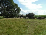

<< Our Photo Pages >> Tyting Farm Bowl Barrow - Round Barrow(s) in England in Surrey
Submitted by Andy B on Sunday, 02 January 2005 Page Views: 7345
Neolithic and Bronze AgeSite Name: Tyting Farm Bowl BarrowCountry: England County: Surrey Type: Round Barrow(s)
Nearest Town: Guildford
Map Ref: TQ02124857
Latitude: 51.227195N Longitude: 0.538906W
Condition:
| 5 | Perfect |
| 4 | Almost Perfect |
| 3 | Reasonable but with some damage |
| 2 | Ruined but still recognisable as an ancient site |
| 1 | Pretty much destroyed, possibly visible as crop marks |
| 0 | No data. |
| -1 | Completely destroyed |
| 5 | Superb |
| 4 | Good |
| 3 | Ordinary |
| 2 | Not Good |
| 1 | Awful |
| 0 | No data. |
| 5 | Can be driven to, probably with disabled access |
| 4 | Short walk on a footpath |
| 3 | Requiring a bit more of a walk |
| 2 | A long walk |
| 1 | In the middle of nowhere, a nightmare to find |
| 0 | No data. |
| 5 | co-ordinates taken by GPS or official recorded co-ordinates |
| 4 | co-ordinates scaled from a detailed map |
| 3 | co-ordinates scaled from a bad map |
| 2 | co-ordinates of the nearest village |
| 1 | co-ordinates of the nearest town |
| 0 | no data |
Internal Links:
External Links:
I have visited· I would like to visit
Andy B has visited here
")
More details here.
You may be viewing yesterday's version of this page. To see the most up to date information please register for a free account.
")
")
")
Do not use the above information on other web sites or publications without permission of the contributor.
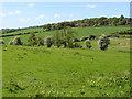
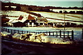
Nearby Images from Geograph Britain and Ireland:
©2017(licence)
©2016(licence)
©2016(licence)
©2014(licence)
©2012(licence)
The above images may not be of the site on this page, they are loaded from Geograph.
Please Submit an Image of this site or go out and take one for us!
Click here to see more info for this site
Nearby sites
Key: Red: member's photo, Blue: 3rd party photo, Yellow: other image, Green: no photo - please go there and take one, Grey: site destroyed
Download sites to:
KML (Google Earth)
GPX (GPS waypoints)
CSV (Garmin/Navman)
CSV (Excel)
To unlock full downloads you need to sign up as a Contributory Member. Otherwise downloads are limited to 50 sites.
Turn off the page maps and other distractions
Nearby sites listing. In the following links * = Image available
687m ESE 124° St Martha's on the Hill Earth Circles* Misc. Earthwork (TQ027482)
1.5km ESE 108° Lid Well* Holy Well or Sacred Spring (TQ03554815)
2.5km WNW 287° Guildford Museum* Museum (SU9968349258)
2.7km W 263° Artington Spring* Holy Well or Sacred Spring (SU994482)
3.1km W 279° St. Edward's Well* Holy Well or Sacred Spring (SU9949)
3.2km ESE 101° Albury Fishponds* Natural Stone / Erratic / Other Natural Feature (TQ053480)
3.4km E 94° Weston Wood Platform Mound* Round Barrow(s) (TQ055484)
3.5km E 94° Weston Woods Cromlech* Standing Stones (TQ05644839)
3.9km E 91° The Silent Pool* Holy Well or Sacred Spring (TQ0606148582)
4.2km ESE 107° Albury Park Mound* Round Barrow(s) (TQ062474)
5.5km NNW 343° Jacobs Well* Holy Well or Sacred Spring (TQ004538)
5.6km NNW 335° Whitmoor Common* Round Barrow(s) (SU996536)
8.4km SW 220° Lady Well (Tuesley)* Holy Well or Sacred Spring (SU968421)
9.5km ESE 108° Abinger Manor* Ancient Village or Settlement (TQ112458)
9.5km ESE 115° Felday* Hillfort (TQ10824475)
9.7km E 95° Deerleap Wood* Round Barrow(s) (TQ118480)
9.9km NW 314° Bullswater Common Barrows Barrow Cemetery (SU9487555356)
10.0km SE 125° Holmbury Camp Hillfort (TQ105430)
10.1km S 191° Hascombe Hill* Hillfort (TQ004386)
10.1km S 187° The Dragonstones Modern Stone Circle etc (TQ0105038489)
10.3km N 11° Pyrford Stone* Marker Stone (TQ0382258782)
11.1km W 262° Hillbury hillfort* Hillfort (SU911468)
11.2km N 359° Horsell Common E* Round Barrow(s) (TQ01615977)
11.3km N 357° Horsell Common W* Barrow Cemetery (TQ01405980)
11.5km NNW 344° Horsell Birch Natural Stone / Erratic / Other Natural Feature (SU98805956)
View more nearby sites and additional images


 We would like to know more about this location. Please feel free to add a brief description and any relevant information in your own language.
 Wir möchten mehr über diese Stätte erfahren. Bitte zögern Sie nicht, eine kurze Beschreibung und relevante Informationen in Deutsch hinzuzufügen.
 Nous aimerions en savoir encore un peu sur les lieux. S'il vous plaît n'hesitez pas à ajouter une courte description et tous les renseignements pertinents dans votre propre langue.
 Quisieramos informarnos un poco más de las lugares. No dude en añadir una breve descripción y otros datos relevantes en su propio idioma.