


<< Our Photo Pages >> Felday - Hillfort in England in Surrey
Submitted by Andy B on Saturday, 24 June 2017 Page Views: 8525
Iron Age and Later PrehistorySite Name: FeldayCountry: England County: Surrey Type: Hillfort
Nearest Town: Guildford Nearest Village: Shere
Map Ref: TQ10824475
Latitude: 51.191238N Longitude: 0.41554W
Condition:
| 5 | Perfect |
| 4 | Almost Perfect |
| 3 | Reasonable but with some damage |
| 2 | Ruined but still recognisable as an ancient site |
| 1 | Pretty much destroyed, possibly visible as crop marks |
| 0 | No data. |
| -1 | Completely destroyed |
| 5 | Superb |
| 4 | Good |
| 3 | Ordinary |
| 2 | Not Good |
| 1 | Awful |
| 0 | No data. |
| 5 | Can be driven to, probably with disabled access |
| 4 | Short walk on a footpath |
| 3 | Requiring a bit more of a walk |
| 2 | A long walk |
| 1 | In the middle of nowhere, a nightmare to find |
| 0 | No data. |
| 5 | co-ordinates taken by GPS or official recorded co-ordinates |
| 4 | co-ordinates scaled from a detailed map |
| 3 | co-ordinates scaled from a bad map |
| 2 | co-ordinates of the nearest village |
| 1 | co-ordinates of the nearest town |
| 0 | no data |
Internal Links:
External Links:
I have visited· I would like to visit
Andy B has visited here
")
Inner bank 12m wide, 1m high and ditch 5m wide and 0.5m deep. More details here.
Note: Abinger Roman Villa and Felday Hillfort Tour, July 8th 2017, see comment on our page
You may be viewing yesterday's version of this page. To see the most up to date information please register for a free account.
Do not use the above information on other web sites or publications without permission of the contributor.
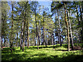
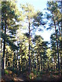
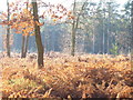
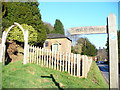
Nearby Images from Geograph Britain and Ireland:
©2009(licence)
©2008(licence)
©2008(licence)
©2008(licence)
©2008(licence)
The above images may not be of the site on this page, they are loaded from Geograph.
Please Submit an Image of this site or go out and take one for us!
Click here to see more info for this site
Nearby sites
Key: Red: member's photo, Blue: 3rd party photo, Yellow: other image, Green: no photo - please go there and take one, Grey: site destroyed
Download sites to:
KML (Google Earth)
GPX (GPS waypoints)
CSV (Garmin/Navman)
CSV (Excel)
To unlock full downloads you need to sign up as a Contributory Member. Otherwise downloads are limited to 50 sites.
Turn off the page maps and other distractions
Nearby sites listing. In the following links * = Image available
1.1km NNE 21° Abinger Manor* Ancient Village or Settlement (TQ112458)
1.8km SSW 192° Holmbury Camp Hillfort (TQ105430)
3.4km NNE 18° Deerleap Wood* Round Barrow(s) (TQ118480)
3.4km SE 136° Leith Hill Place* Natural Stone / Erratic / Other Natural Feature (TQ1324542344)
3.7km E 80° Mag's Well (Abinger Forest)* Holy Well or Sacred Spring (TQ145455)
4.6km E 101° Anstiebury Camp* Hillfort (TQ1534244008)
5.3km WNW 301° Albury Park Mound* Round Barrow(s) (TQ062474)
6.1km NE 48° Milton Heath* Round Barrow(s) (TQ15294890)
6.1km NW 310° The Silent Pool* Holy Well or Sacred Spring (TQ0606148582)
6.3km NW 306° Weston Woods Cromlech* Standing Stones (TQ05644839)
6.4km WNW 302° Albury Fishponds* Natural Stone / Erratic / Other Natural Feature (TQ053480)
6.4km NW 306° Weston Wood Platform Mound* Round Barrow(s) (TQ055484)
7.3km ENE 60° Glory Wood Bowl Barrow* Round Barrow(s) (TQ1712248542)
8.0km WNW 296° Lid Well* Holy Well or Sacred Spring (TQ03554815)
8.8km WNW 294° St Martha's on the Hill Earth Circles* Misc. Earthwork (TQ027482)
9.5km WNW 295° Tyting Farm Bowl Barrow* Round Barrow(s) (TQ02124857)
9.7km NE 49° Box Hill Bowl Barrow 1* Round Barrow(s) (TQ18065121)
10.1km NE 51° Box Hill Bowl Barrow 2* Round Barrow(s) (TQ18575132)
11.6km WSW 239° The Dragonstones Modern Stone Circle etc (TQ0105038489)
11.9km WNW 288° Artington Spring* Holy Well or Sacred Spring (SU994482)
12.0km WNW 293° Guildford Museum* Museum (SU9968349258)
12.1km WSW 241° Hascombe Hill* Hillfort (TQ004386)
12.5km NE 38° Cherkley Court Barrows* Round Barrow(s) (TQ18385467)
12.5km NNE 29° Thorncroft Spring (Leatherhead)* Holy Well or Sacred Spring (TQ167558)
12.5km WNW 291° St. Edward's Well* Holy Well or Sacred Spring (SU9949)
View more nearby sites and additional images


 We would like to know more about this location. Please feel free to add a brief description and any relevant information in your own language.
 Wir möchten mehr über diese Stätte erfahren. Bitte zögern Sie nicht, eine kurze Beschreibung und relevante Informationen in Deutsch hinzuzufügen.
 Nous aimerions en savoir encore un peu sur les lieux. S'il vous plaît n'hesitez pas à ajouter une courte description et tous les renseignements pertinents dans votre propre langue.
 Quisieramos informarnos un poco más de las lugares. No dude en añadir una breve descripción y otros datos relevantes en su propio idioma.