<< Our Photo Pages >> Bourtie Pictish Stone - Class I Pictish Symbol Stone in Scotland in Aberdeenshire
Submitted by golux on Wednesday, 26 March 2014 Page Views: 9377
Early Medieval (Dark Age)Site Name: Bourtie Pictish StoneCountry: Scotland
NOTE: This site is 0.3 km away from the location you searched for.
County: Aberdeenshire Type: Class I Pictish Symbol Stone
Nearest Town: Inverurie Nearest Village: Oldmeldrum
Map Ref: NJ80462485 Landranger Map Number: 38
Latitude: 57.313796N Longitude: 2.326028W
Condition:
| 5 | Perfect |
| 4 | Almost Perfect |
| 3 | Reasonable but with some damage |
| 2 | Ruined but still recognisable as an ancient site |
| 1 | Pretty much destroyed, possibly visible as crop marks |
| 0 | No data. |
| -1 | Completely destroyed |
| 5 | Superb |
| 4 | Good |
| 3 | Ordinary |
| 2 | Not Good |
| 1 | Awful |
| 0 | No data. |
| 5 | Can be driven to, probably with disabled access |
| 4 | Short walk on a footpath |
| 3 | Requiring a bit more of a walk |
| 2 | A long walk |
| 1 | In the middle of nowhere, a nightmare to find |
| 0 | No data. |
| 5 | co-ordinates taken by GPS or official recorded co-ordinates |
| 4 | co-ordinates scaled from a detailed map |
| 3 | co-ordinates scaled from a bad map |
| 2 | co-ordinates of the nearest village |
| 1 | co-ordinates of the nearest town |
| 0 | no data |
Internal Links:
External Links:
I have visited· I would like to visit
golux visited on 23rd Mar 2014 - their rating: Cond: 2 Amb: 3 Access: 5
TheCaptain have visited here
")
At the right hand end of the stone is the Crescent-and-V-rod: the photo below shows the outline of the crescent and the V rod with its pointed trefoil tip. To the left of this is the Double-Disc-and-Z-rod
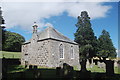
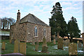
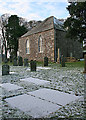
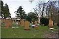
There are two cross-incised stones within 100 yards: one built into the south wall of the kirkyard, the other built into the west-facing wall of the steading immediately west of the kirkyard.
You may be viewing yesterday's version of this page. To see the most up to date information please register for a free account.
")
")
")
Do not use the above information on other web sites or publications without permission of the contributor.
Nearby Images from Geograph Britain and Ireland:
©2015(licence)
©2016(licence)
©2016(licence)
©2021(licence)
©2016(licence)
The above images may not be of the site on this page, they are loaded from Geograph.
Please Submit an Image of this site or go out and take one for us!
Click here to see more info for this site
Nearby sites
Key: Red: member's photo, Blue: 3rd party photo, Yellow: other image, Green: no photo - please go there and take one, Grey: site destroyed
Download sites to:
KML (Google Earth)
GPX (GPS waypoints)
CSV (Garmin/Navman)
CSV (Excel)
To unlock full downloads you need to sign up as a Contributory Member. Otherwise downloads are limited to 50 sites.
Turn off the page maps and other distractions
Nearby sites listing. In the following links * = Image available
370m W 274° Kirkton Of Bourtie* Stone Circle (NJ80092488)
864m N 349° Hill of Barra* Hillfort (NJ803257)
1.8km E 87° Sheldon (Aberdeenshire)* Stone Circle (NJ82292494)
3.9km SSW 205° Keith Hall* Class I Pictish Symbol Stone (NJ78802136)
4.5km WSW 256° East Balhalgardy* Class I Pictish Symbol Stone (NJ76082379)
4.5km SW 224° Carnegie Museum (Inverurie)* Museum (NJ773216)
4.6km W 263° Balhalgardy Stone Circle* Stone Circle (NJ759243)
4.9km SSW 210° Inverurie 1* Class I Pictish Symbol Stone (NJ78022063)
5.0km SW 218° Conyng Hillock Artificial Mound (NJ773209)
5.1km WSW 241° Brandsbutt stone circle* Stone Circle (NJ76012240)
5.1km WSW 241° Brandsbutt* Class I Pictish Symbol Stone (NJ7599222403)
5.3km NW 314° Daviot Symbol Stone* Class I Pictish Symbol Stone (NJ76652862)
5.5km SW 233° Blackhall Roundabout* Modern Stone Circle etc (NJ76072155)
5.7km SSW 207° Broomend of Crichie North circle Stone Circle (NJ779198)
5.7km W 270° Liggar's Stane* Standing Stone (Menhir) (NJ74702488)
5.8km SSW 206° Broomend Of Crichie Stone Circle / Henge* Henge (NJ77911968)
5.8km SSW 206° Broomend of Crichie Pictish Symbol Stone* Class I Pictish Symbol Stone (NJ77921967)
5.8km WSW 237° Blackhall Stones* Modern Stone Circle etc (NJ75602173)
5.8km SSW 206° Broomend of Crichie Avenue* Multiple Stone Rows / Avenue (NJ7791419653)
5.8km SSW 205° Broomend of Crichie Stone Row / Alignment (NJ7792119591)
5.9km SSW 205° Broomend of Crichie Row Mid Stone Row / Alignment (NJ7792919479)
6.0km SSE 164° Peathill* Standing Stone (Menhir) (NJ8210419068)
6.2km SSW 204° Gardeners House Standing Stone Standing Stone (Menhir) (NJ7794919226)
6.2km SSW 204° Broomend Stone Seat / Cists* Cist (NJ77871917)
6.3km WSW 257° Drimmies* Class I Pictish Symbol Stone (NJ74262350)
View more nearby sites and additional images


 We would like to know more about this location. Please feel free to add a brief description and any relevant information in your own language.
 Wir möchten mehr über diese Stätte erfahren. Bitte zögern Sie nicht, eine kurze Beschreibung und relevante Informationen in Deutsch hinzuzufügen.
 Nous aimerions en savoir encore un peu sur les lieux. S'il vous plaît n'hesitez pas à ajouter une courte description et tous les renseignements pertinents dans votre propre langue.
 Quisieramos informarnos un poco más de las lugares. No dude en añadir una breve descripción y otros datos relevantes en su propio idioma.