<< Our Photo Pages >> Maumbury Rings - Henge in England in Dorset
Submitted by JimChampion on Thursday, 13 July 2023 Page Views: 24575
Neolithic and Bronze AgeSite Name: Maumbury RingsCountry: England County: Dorset Type: Henge
Nearest Town: Dorchester
Map Ref: SY69018992 Landranger Map Number: 194
Latitude: 50.708083N Longitude: 2.440248W
Condition:
| 5 | Perfect |
| 4 | Almost Perfect |
| 3 | Reasonable but with some damage |
| 2 | Ruined but still recognisable as an ancient site |
| 1 | Pretty much destroyed, possibly visible as crop marks |
| 0 | No data. |
| -1 | Completely destroyed |
| 5 | Superb |
| 4 | Good |
| 3 | Ordinary |
| 2 | Not Good |
| 1 | Awful |
| 0 | No data. |
| 5 | Can be driven to, probably with disabled access |
| 4 | Short walk on a footpath |
| 3 | Requiring a bit more of a walk |
| 2 | A long walk |
| 1 | In the middle of nowhere, a nightmare to find |
| 0 | No data. |
| 5 | co-ordinates taken by GPS or official recorded co-ordinates |
| 4 | co-ordinates scaled from a detailed map |
| 3 | co-ordinates scaled from a bad map |
| 2 | co-ordinates of the nearest village |
| 1 | co-ordinates of the nearest town |
| 0 | no data |
Internal Links:
External Links:
I have visited· I would like to visit
rowan1970 elad13 would like to visit
Upozi visited on 1st Apr 2024 - their rating: Cond: 5 Amb: 5 Access: 5 In continuous use right up to recent years. Henge, ampitheatre, market, artillery fort, execution place, protest demonstrations etc.
DougJ visited on 20th Feb 2024 - their rating: Cond: 4 Amb: 4 Access: 5 Still in great shape!
RedKite1985 visited on 25th Jan 2023 - their rating: Cond: 3 Amb: 3 Access: 5
SolarMegalith visited on 22nd Oct 2011 - their rating: Cond: 3 Amb: 3 Access: 5
ForestDaughter visited on 1st Nov 1995 - their rating: Amb: 5 Access: 5
JohnLindsay visited Rather tucked away in the Pastscape text is the reference to Archaeologia 105. This is 99 pages of material.
Search on Archaeologia web site takes you to Cambridge Journals which has a search and Maumbury is an uncomplicated term story.
I remembered to type in the 5+1 = 6, though the six was already there, so let's see what happens, perhaps I should have done it as a word.
maddy AngieLake JimChampion rldixon TimPrevett NickyD have visited here
Average ratings for this site from all visit loggers: Condition: 3.75 Ambience: 4 Access: 5

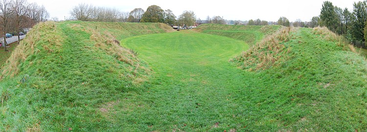
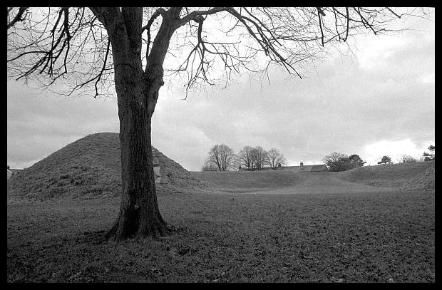
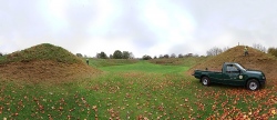
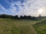
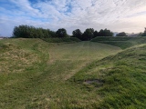
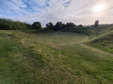
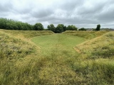
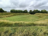
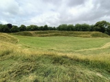
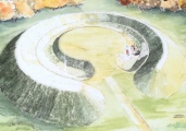
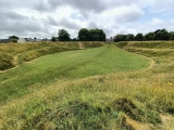
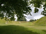
The henge bank is nearly circular, with a diameter of over 100 metres. Its single entrance is to the northeast. An upright stone stood at the henge entrance (recorded in the 18th century).
Like many other ancient sites it was later adapted, first by the Romans to form an amphitheatre. It underwent further remodelling during the English civil war when it was used as an artillery fort, guarding the southern approach to Dorchester.
Access The earthwork and its surroudings are a scheduled ancient monument and public open space, next to Dorchester police station. Only a short walk (signposted) from Dorchester town centre, and both Dorchester railway stations are nearby.
Note: HengeFest 2023 at Maumbury Rings, Sun, 30th July all day
You may be viewing yesterday's version of this page. To see the most up to date information please register for a free account.









These are just the first 25 photos of Maumbury Rings. If you log in with a free user account you will be able to see our entire collection.
Do not use the above information on other web sites or publications without permission of the contributor.
Click here to see more info for this site
Nearby sites
Key: Red: member's photo, Blue: 3rd party photo, Yellow: other image, Green: no photo - please go there and take one, Grey: site destroyed
Download sites to:
KML (Google Earth)
GPX (GPS waypoints)
CSV (Garmin/Navman)
CSV (Excel)
To unlock full downloads you need to sign up as a Contributory Member. Otherwise downloads are limited to 50 sites.
Turn off the page maps and other distractions
Nearby sites listing. In the following links * = Image available
739m NNE 23° Dorchester, Tudor Arcade* Timber Circle (SY693906)
785m N 6° Dorset County Museum* Museum (SY691907)
869m E 93° Fordington (Two Barrows) Barrow* Barrow Cemetery (SY69888987)
1.0km N 357° Dorchester Roman Town House* Ancient Village or Settlement (SY68969095)
1.2km SE 146° Conygar Hill Barrows* Barrow Cemetery (SY697889)
1.4km E 90° Flagstones Enclosure* Causewayed Enclosure (SY704899)
1.5km NW 326° Poundbury* Hillfort (SY68199113)
1.6km SSW 197° Herringston Long Barrow* Long Barrow (SY68548844)
1.6km SSW 199° Herringston Bowl Barrow* Round Barrow(s) (SY68478842)
2.0km E 87° Mount Pleasant (Dorset)* Henge (SY710900)
2.4km WSW 248° Maiden Castle Linear Earthwork Misc. Earthwork (SY66798902)
2.4km WSW 254° Maiden Castle Barrow Cemetery* Barrow Cemetery (SY66698927)
2.5km WSW 253° Lanceborough Enclosure Misc. Earthwork (SY66658920)
2.5km WSW 257° Maiden Castle Long Barrow 2 Long Barrow (SY66578938)
2.5km SW 235° Maiden Castle Bank Barrow* Long Barrow (SY66928850)
2.5km SW 235° Maiden Castle Causewayed Enclosure* Causewayed Enclosure (SY66938848)
2.6km SW 235° Maiden Castle (Dorset)* Hillfort (SY66908846)
2.7km WSW 245° Maiden Castle Long Barrow 1 Long Barrow (SY66518879)
2.9km NW 313° Bradford Peverell 2* Long Barrow (SY669919)
3.1km ESE 121° Whitcombe* Standing Stone (Menhir) (SY717883)
3.5km WSW 254° Clandon Barrow* Round Barrow(s) (SY65638900)
3.6km S 185° Came Down* Barrow Cemetery (SY687863)
4.0km SW 226° Ashton Farm Bowl Barrows Barrow Cemetery (SY66088717)
4.0km SSW 194° Winterborne Came 18b (Bincombe) Cairn (SY680860)
4.1km W 275° Bridport Road Barrow Cemetery Barrow Cemetery (SY649903)
View more nearby sites and additional images


 We would like to know more about this location. Please feel free to add a brief description and any relevant information in your own language.
 Wir möchten mehr über diese Stätte erfahren. Bitte zögern Sie nicht, eine kurze Beschreibung und relevante Informationen in Deutsch hinzuzufügen.
 Nous aimerions en savoir encore un peu sur les lieux. S'il vous plaît n'hesitez pas à ajouter une courte description et tous les renseignements pertinents dans votre propre langue.
 Quisieramos informarnos un poco más de las lugares. No dude en añadir una breve descripción y otros datos relevantes en su propio idioma.