Featured: Friendly specialist tours to ancient, mystical and historical sites in the UK and beyond

Friendly specialist tours to ancient, mystical and historical sites in the UK and beyond

Singing Up the Country: The Songlines of Avebury and Beyond

Singing Up the Country: The Songlines of Avebury and Beyond

Who's Online

There are currently, 290 guests and 1 members online.

You are a guest. To join in, please register for free by clicking here

Sponsors

<< Our Photo Pages >> Poundbury - Hillfort in England in Dorset

Submitted by vicky on Monday, 03 November 2003  Page Views: 20489

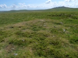
Iron Age and Later PrehistorySite Name: Poundbury
Country: England County: Dorset Type: Hillfort
Nearest Town: Dorchester  Nearest Village: Bradford Peverell
Map Ref: SY68199113  Landranger Map Number: 194
Latitude: 50.718919N  Longitude: 2.451965W
Condition:
5Perfect
4Almost Perfect
3Reasonable but with some damage
2Ruined but still recognisable as an ancient site
1Pretty much destroyed, possibly visible as crop marks
0No data.
-1Completely destroyed
4 Ambience:
5Superb
4Good
3Ordinary
2Not Good
1Awful
0No data.
4 Access:
5Can be driven to, probably with disabled access
4Short walk on a footpath
3Requiring a bit more of a walk
2A long walk
1In the middle of nowhere, a nightmare to find
0No data.
3 Accuracy:
5co-ordinates taken by GPS or official recorded co-ordinates
4co-ordinates scaled from a detailed map
3co-ordinates scaled from a bad map
2co-ordinates of the nearest village
1co-ordinates of the nearest town
0no data
4

Internal Links:
External Links:

I have visited· I would like to visit

hevveh saw from a distance on 24th Sep 2022

maddy JimChampion TimPrevett have visited here

Poundbury
Poundbury submitted by JimChampion : Looking south across the Frome valley at the ramparts of Poundbury hillfort. You can see its rectangular perimeter in this composite picture - no wonder the Romans liked the site. Parts of modern Dorchester can be seen poking out e.g. the keep-like military museum is on the left. (The line in the sky is a power cable that I couldn't get away from). (Vote or comment on this photo)
Hillfort in Dorset

The history of the site begins with a neolithic enclosure, at least one bronze-age round barrow, and the hillfort was constructed in various stages. Below the northern rampart ran the seven-mile Roman aqueduct. The site was very nearly lost completely in the 1850's as the course of the Weymouth - Bristol railway proposed a giant cutting through it. Thankfully a tunnel was eventually built. To the east a large graveyard has been excavated, uncovering burials from late iron-age to late Roman, both pagan and early Christian.
You may be viewing yesterday's version of this page. To see the most up to date information please register for a free account.


Poundbury
Poundbury submitted by JimChampion : June 2005. A view of the NW corner of Poundbury's ramparts. The northern side of the hill drops very steeply down into the Frome valley. On the other side of the fence is the railway line which passes beneath the hillfort in a tunnel. Brunel originally wanted to put his railway in a cutting through the site, but local outrage at the plan meant that the more expensive option was chosen. (Incidental... (Vote or comment on this photo)

Poundbury barrow
Poundbury barrow submitted by JimChampion : Silhouette of the Bronze Age bowl barrow within Poundbury's ramparts (at grid ref SY681911) with stormy rainclouds in the distance. There were originally three round barrows on the hilltop, but only this one has survived the millenia of human activity at Poundsbury. (Vote or comment on this photo)

Poundbury
Poundbury submitted by JimChampion : A view of the SW rampart of Poundbury hillfort. The slumped outer rampart can be seen in the foreground. These ramparts were faced with timber as an additional defence. The site has been used for military purposes from the Iron Age up to World War II. It now seems to be used mostly by Dorchestonians walking their dogs. (Vote or comment on this photo)

Poundbury
Poundbury submitted by TimPrevett : A distant view of Poundbury Hill Fort SY683912, from the car park next to the Dorset & Devon military museum (imposing castle next to the road on the E side of Dorchester centre) , about 5 minutes walk from the County Museum. Time did not permit me to visit this fort in person, but I was well chuffed when I got out the car to see some embankments to my NW. Finds and details of what is at Pou... (1 comment - Vote or comment on this photo)

Do not use the above information on other web sites or publications without permission of the contributor.

Nearby Images from Geograph Britain and Ireland:
SY6891 : Poundbury Hill Fort by Nigel Mykura
by Nigel Mykura
©2008(licence)
SY6891 : Poundbury, barrow by Mike Faherty
by Mike Faherty
©2009(licence)
SY6891 : Poundbury Hill Fort, western edge of Dorchester by Colin Park
by Colin Park
©2011(licence)
SY6891 : Poundbury Hill Fort, Dorchester by Becky Williamson
by Becky Williamson
©2016(licence)
SY6891 : Poundbury Hill Fort Southern Ramparts by Nigel Mykura
by Nigel Mykura
©2008(licence)

The above images may not be of the site on this page, they are loaded from Geograph.
Please Submit an Image of this site or go out and take one for us!


Click here to see more info for this site

Nearby sites

Click here to view sites on an interactive OS map

Key: Red: member's photo, Blue: 3rd party photo, Yellow: other image, Green: no photo - please go there and take one, Grey: site destroyed

Download sites to:
KML (Google Earth)
GPX (GPS waypoints)
CSV (Garmin/Navman)
CSV (Excel)

To unlock full downloads you need to sign up as a Contributory Member. Otherwise downloads are limited to 50 sites.


Turn off the page maps and other distractions

Nearby sites listing. In the following links * = Image available
 789m ESE 103° Dorchester Roman Town House* Ancient Village or Settlement (SY68969095)
 1.0km ESE 115° Dorset County Museum* Museum (SY691907)
 1.2km ESE 115° Dorchester, Tudor Arcade* Timber Circle (SY693906)
 1.5km SE 146° Maumbury Rings* Henge (SY69018992)
 1.5km WNW 301° Bradford Peverell 2* Long Barrow (SY669919)
 2.1km SE 126° Fordington (Two Barrows) Barrow* Barrow Cemetery (SY69888987)
 2.4km SW 222° Maiden Castle Long Barrow 2 Long Barrow (SY66578938)
 2.5km SW 218° Lanceborough Enclosure Misc. Earthwork (SY66658920)
 2.5km SW 219° Maiden Castle Barrow Cemetery* Barrow Cemetery (SY666892)
 2.5km ESE 119° Flagstones Enclosure* Causewayed Enclosure (SY704899)
 2.5km SSW 213° Maiden Castle Linear Earthwork Misc. Earthwork (SY66798902)
 2.7km SE 146° Conygar Hill Barrows* Barrow Cemetery (SY697889)
 2.7km S 172° Herringston Long Barrow* Long Barrow (SY68548844)
 2.7km S 174° Herringston Bowl Barrow* Round Barrow(s) (SY68478842)
 2.9km SW 215° Maiden Castle Long Barrow 1 Long Barrow (SY66518879)
 2.9km SSW 205° Maiden Castle Bank Barrow* Long Barrow (SY66928850)
 2.9km SSW 205° Maiden Castle Causewayed Enclosure* Causewayed Enclosure (SY66938848)
 3.0km SSW 205° Maiden Castle (Dorset)* Hillfort (SY66908846)
 3.0km ESE 112° Mount Pleasant (Dorset)* Henge (SY710900)
 3.3km SW 230° Clandon Barrow* Round Barrow(s) (SY65638900)
 3.4km WSW 255° Bridport Road Barrow Cemetery Barrow Cemetery (SY649903)
 3.7km WNW 290° Seven Barrow Plantation* Barrow Cemetery (SY647924)
 4.1km NW 311° Stratton Churchyard Cross* Ancient Cross (SY6510893793)
 4.2km NNE 23° Culliford Tree* Barrow Cemetery (SY699950)
 4.4km SW 224° Four Barrow Hill* Round Barrow(s) (SY651880)
View more nearby sites and additional images

<< Loughton Camp

Strathhendry >>

Please add your thoughts on this site

Prehistoric Dorset

Prehistoric Dorset

Sponsors

Auto-Translation (Google)

Translate from English into:

"Poundbury" | Login/Create an Account | 4 News and Comments
  
Go back to top of page    Comments are owned by the poster. We aren't responsible for their content.
Neolithic, BA, IA, and Roman news from Poundbury development by TimPrevett on Wednesday, 05 September 2007
(User Info | Send a Message)
Delight at discovery of Roman artefacts
By Dee Ad*****

ARCHAEOLOGISTS have turned up a major new find in advance of building work at Poundbury - a Roman stone coffin and skeletons.

The dig also sheds light on the area from Neolithic times and through the Bronze Age and Iron Age eras.

http://www.thisisdorset.net/news/tidnews/display.var.1662186.0.delight_at_discovery_of_roman_artefacts.php
[ Reply to This ]

Re: Poundbury Hillfort by formicaant on Tuesday, 24 April 2007
(User Info | Send a Message)
I have visited this site many times , I grew up a hundred yards away from it. It's fairly small as Dorset hilforts go. The history of the site begins with a neolithic enclosure , at least one bronze age round barrow and the hillfort was constructed in various stages. Below the northern rampart ran the seven mile Roman aqueduct. The site was very nearly lost completely in the 1850's as the course of the Weymouth - Bristol railway proposed a giant cutting through it. Thankfully a tunnel was eventually built.To the east a large graveyard has been excavated , uncovering burials from late iron age to late Roman , both pagan and early christian.
[ Reply to This ]

Re: Poundbury Hillfort by TimPrevett on Thursday, 14 July 2005
(User Info | Send a Message)
For more pictures & plans of Poundbury Hill Fort and the Roman Aqueduct take a look at the Poundbury Community website at
http://www.poundbury.info/416778.html
[ Reply to This ]

Re: Poundbury Hillfort by Anonymous on Sunday, 13 March 2005
A fSCINATING PLACE IN USE FOR THOUSANDS OF YEARS FROM THE IRON AGE TO THE SECOND WORLD WAR. aDJACENT TO THE ROMAN AQUEDUCT. ALTHOUIGH HEMMED IN BY AN INDUSTRIAL ESTAE AND THE EVER ENCROACHING pOUNDBURY DEVELOPMENT IT IS STILL POSSIBLE TO SEE WHY IT WAS BUILT HER NO DOUBT GLOWERING AT THE NEARBY mAIDEN CASTLE.
[ Reply to This ]

Your Name: Anonymous [ Register Now ]
Subject:


Add your comment or contribution to this page. Spam or offensive posts are deleted immediately, don't even bother

<<< What is five plus one as a number? (Please type the answer to this question in the little box on the left)
You can also embed videos and other things. For Youtube please copy and paste the 'embed code'.
For Google Street View please include Street View in the text.
Create a web link like this: <a href="https://www.megalithic.co.uk">This is a link</a>  

Allowed HTML is:
<p> <b> <i> <a> <img> <em> <br> <strong> <blockquote> <tt> <li> <ol> <ul> <object> <param> <embed> <iframe>

We would like to know more about this location. Please feel free to add a brief description and any relevant information in your own language.
Wir möchten mehr über diese Stätte erfahren. Bitte zögern Sie nicht, eine kurze Beschreibung und relevante Informationen in Deutsch hinzuzufügen.
Nous aimerions en savoir encore un peu sur les lieux. S'il vous plaît n'hesitez pas à ajouter une courte description et tous les renseignements pertinents dans votre propre langue.
Quisieramos informarnos un poco más de las lugares. No dude en añadir una breve descripción y otros datos relevantes en su propio idioma.