<< Our Photo Pages >> Gleneagles B - Standing Stone (Menhir) in Scotland in Perth and Kinross
Submitted by Anonymous on Thursday, 15 February 2001 Page Views: 6574
Neolithic and Bronze AgeSite Name: Gleneagles B Alternative Name: The Blackford Stone; Peterhead Farm B (Gleneagles); Loaninghead B; Blackford BCountry: Scotland County: Perth and Kinross Type: Standing Stone (Menhir)
Nearest Town: Auchterarder Nearest Village: Gleneagles
Map Ref: NN92430981 Landranger Map Number: 58
Latitude: 56.268545N Longitude: 3.738473W
Condition:
| 5 | Perfect |
| 4 | Almost Perfect |
| 3 | Reasonable but with some damage |
| 2 | Ruined but still recognisable as an ancient site |
| 1 | Pretty much destroyed, possibly visible as crop marks |
| 0 | No data. |
| -1 | Completely destroyed |
| 5 | Superb |
| 4 | Good |
| 3 | Ordinary |
| 2 | Not Good |
| 1 | Awful |
| 0 | No data. |
| 5 | Can be driven to, probably with disabled access |
| 4 | Short walk on a footpath |
| 3 | Requiring a bit more of a walk |
| 2 | A long walk |
| 1 | In the middle of nowhere, a nightmare to find |
| 0 | No data. |
| 5 | co-ordinates taken by GPS or official recorded co-ordinates |
| 4 | co-ordinates scaled from a detailed map |
| 3 | co-ordinates scaled from a bad map |
| 2 | co-ordinates of the nearest village |
| 1 | co-ordinates of the nearest town |
| 0 | no data |
Internal Links:
External Links:
I have visited· I would like to visit
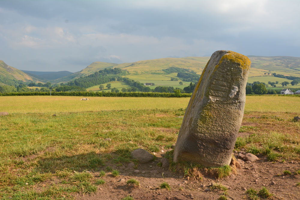
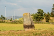
Anne T visited on 13th Jul 2018 - their rating: Cond: 3 Amb: 3 Access: 4 Peterhead Farm Pictish Symbol Stone: Right next to the A9, so the atmosphere wasn’t brilliant, but ignoring the traffic, looking east, this was a glorious setting.
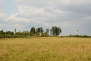
There was a gate into this field full of sheep, so we let ourselves in and walked over to the stone, which now sits within 30m of a slip road leading to the A9. The Gleneagles roundabout with its golf club ‘sculpture’ provide a strange backdrop.
The views to the east are somewhat different, and facing this way, you could almost believe you were in the country. Whilst the black clouds were gathering to the north and east, there was no rain.
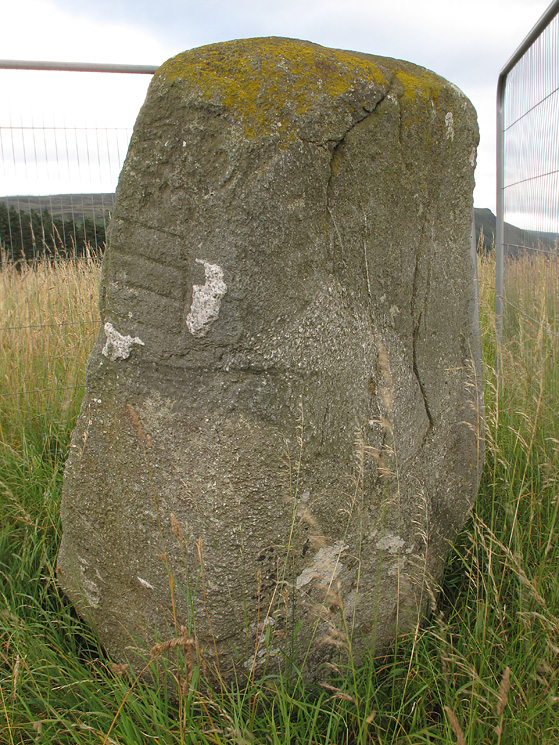
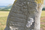
I was fascinated by the two quartz inclusions underneath the symbols.
Klingon visited on 4th Oct 2017 - their rating: Cond: 4 Amb: 3 Access: 4
Average ratings for this site from all visit loggers: Condition: 3.5 Ambience: 3 Access: 4
For more information on this Pictish Symbol stone see Canmore ID 25924, which gives details for both Gleneagles A and Gleneagles B stones. They describe Gleneagles B, to be found at NN 9243 0980, as: "('B') Two symbols have been incised on the north side of what was very probably a pre-existing standing stone."
The Northern Antiquarian (TNA) also features a page for this site - see their entry for Gleneagles ‘B’, Blackford, Perthshire, which gives directions for finding this stone together with photographs, a 19th century drawing of the stone, a drawing of the carvings and a brief archaeology & history.
TNA add a description from 1893, which reads: “On the south side of the road from Blackford to Auchterarder, about 150 yards west from Loaninghead where the line of the road is crossed by that from Gleneagles to Crieff, stands a fine stone of Highland grit. It measures 4ft. 10in. in height above ground, 10ft. in girth at the base, and 6ft. 9in. in circumference at top. It shows four sides of nearly equal measurement:— that facing north being 2ft 4in., south 2ft. 8in., west 2ft 5in., and east 3ft. On the north is an incised figure in the form of an parallelogram, 10in. broad by 9in. high, divided into three equal portions by two horizontal lines.”
You may be viewing yesterday's version of this page. To see the most up to date information please register for a free account.

Do not use the above information on other web sites or publications without permission of the contributor.
Click here to see more info for this site
Nearby sites
Key: Red: member's photo, Blue: 3rd party photo, Yellow: other image, Green: no photo - please go there and take one, Grey: site destroyed
Download sites to:
KML (Google Earth)
GPX (GPS waypoints)
CSV (Garmin/Navman)
CSV (Excel)
To unlock full downloads you need to sign up as a Contributory Member. Otherwise downloads are limited to 50 sites.
Turn off the page maps and other distractions
Nearby sites listing. In the following links * = Image available
364m WSW 238° Gleneagles A* Standing Stone (Menhir) (NN9211509625)
1.9km SSE 161° Parks of Gleneagles Stone Circle (NN9308)
2.2km W 270° Cecilmount Stone Circle (NN90200985)
2.7km N 8° Auchterarder* Standing Stones (NN929125)
4.7km NNE 32° St Mackessog’s Well* Holy Well or Sacred Spring (NN950137)
4.8km ENE 68° Ogle Hill Hillfort (NN96941148)
5.4km SSE 147° Four Stanes (Glendevon) Stone Circle (NN9529405196)
5.7km N 6° Belted Stane, Calfward Standing Stone (Menhir) (NN93181548)
5.8km WSW 243° The Boat Stone* Standing Stone (Menhir) (NN8720207286)
6.4km N 0° North Mains Strathallan round barrow* Round Barrow(s) (NN92621621)
6.5km N 2° North Mains A Timber Circle (NN928163)
6.6km N 2° North Mains B Timber Circle (NN928164)
7.2km WSW 237° Wester Biggs (Dunblane)* Stone Circle (NN86270608)
7.4km NE 50° Westerton Timber Hall Ancient Village or Settlement (NN9821414444)
7.8km NE 38° Loanhead (Aberuthven) Stone Circle (NN974158)
7.8km ESE 109° Borland Glen* Stone Circle (NN9976607093)
8.5km NE 37° Haugh Of Aberuthven* Standing Stone (Menhir) (NN97711643)
9.2km NNE 24° Trinity Well (Trinity Gask) Holy Well or Sacred Spring (NN96311812)
9.2km SSE 149° Garchel Burn (Glendevon) Ancient Village or Settlement (NN96960182)
9.6km SSE 150° Maiden's Well (Glendevon) Holy Well or Sacred Spring (NN97030139)
9.8km WNW 286° Cairn Wochel Long Barrow (NN83011276)
9.9km ENE 77° Gray Stone (Dunning)* Standing Stone (Menhir) (NO02191180)
10.3km SSE 158° Butter Well (Dollar) Holy Well or Sacred Spring (NN96100018)
10.5km ENE 62° Dupplin Cross* Ancient Cross (NO01901448)
10.6km S 180° Eliston West (Tilicoultry) Cairn (NS92209924)
View more nearby sites and additional images


 We would like to know more about this location. Please feel free to add a brief description and any relevant information in your own language.
 Wir möchten mehr über diese Stätte erfahren. Bitte zögern Sie nicht, eine kurze Beschreibung und relevante Informationen in Deutsch hinzuzufügen.
 Nous aimerions en savoir encore un peu sur les lieux. S'il vous plaît n'hesitez pas à ajouter une courte description et tous les renseignements pertinents dans votre propre langue.
 Quisieramos informarnos un poco más de las lugares. No dude en añadir una breve descripción y otros datos relevantes en su propio idioma.