<< Text Pages >> Westerton Timber Hall - Ancient Village or Settlement in Scotland in Perth and Kinross
Submitted by Andy B on Friday, 03 November 2017 Page Views: 941
Multi-periodSite Name: Westerton Timber Hall Alternative Name: Westerton IICountry: Scotland County: Perth and Kinross Type: Ancient Village or Settlement
Map Ref: NN9821414444
Latitude: 56.311437N Longitude: 3.646915W
Condition:
| 5 | Perfect |
| 4 | Almost Perfect |
| 3 | Reasonable but with some damage |
| 2 | Ruined but still recognisable as an ancient site |
| 1 | Pretty much destroyed, possibly visible as crop marks |
| 0 | No data. |
| -1 | Completely destroyed |
| 5 | Superb |
| 4 | Good |
| 3 | Ordinary |
| 2 | Not Good |
| 1 | Awful |
| 0 | No data. |
| 5 | Can be driven to, probably with disabled access |
| 4 | Short walk on a footpath |
| 3 | Requiring a bit more of a walk |
| 2 | A long walk |
| 1 | In the middle of nowhere, a nightmare to find |
| 0 | No data. |
| 5 | co-ordinates taken by GPS or official recorded co-ordinates |
| 4 | co-ordinates scaled from a detailed map |
| 3 | co-ordinates scaled from a bad map |
| 2 | co-ordinates of the nearest village |
| 1 | co-ordinates of the nearest town |
| 0 | no data |
Internal Links:
External Links:
Timber hall (although categorised as a 'timber hall' it does not seem to have been designed to support a roof ) Cropmark. The timber hall at Westerton is defined by five pits on either side with one centrally placed pit at each end and measures around 29m by 9m.
A large circular mark, which probably represents a tree throw, partly obscures one of the pits on the south side, while pits lying immediately outside the hall may represent additional posts or associated structures.
This site lies in a distinctive location, on the very edge of a flat terrace close to the break of slope. The ground slopes sharply away to the north and northwest to a small stream valley, beyond which the ground begins to rise again. This timber hall, seems to be located on a slight promontory with the ground falling away in most directions and is positioned on a very narrow and constrained section of land between the sharply falling terrace edge to the northwest and north and wet ground to the south.
The topography therefore effectively defines the location of the hall quite closely on three sides, and may have restricted or controlled access. Such a location may have made it rather awkward to construct and use this timber hall, and surely reflects a deliberate decision to position it in such a location, particularly as there were many other locations in the immediate vicinity which would have been eminently more suited to the construction of such a structure. This suggests a desire to restrict and constrain access to the hall and clearly define this place and perhaps the area in which associated activity took place. The surrounding topography could be considered an extension of the monument and the proximity of what may have been rather wet locations, the damp dip to the south and stream valley to the north, may have been of importance.
See p.79 of Vol 1. below for more details on unroofable timber enclosures and that section more generally for the Neolithic timber monuments of Scotland.
Source:
Contextualising the cropmark record: the timber monuments of the Neolithic of Scotland. Volume 1: Kirsty Millican 2009
p.209 onwards
https://hcommons.org/deposits/item/hc:15969/
Contextualising the cropmark record: the timber monuments of the Neolithic of Scotland. Volume 2: Gazetteer Kirsty Millican 2009
https://hcommons.org/deposits/item/hc:15971/
You may be viewing yesterday's version of this page. To see the most up to date information please register for a free account.
Do not use the above information on other web sites or publications without permission of the contributor.
Nearby Images from Geograph Britain and Ireland:
©2019(licence)
©2008(licence)
©2008(licence)
©2020(licence)
©2020(licence)
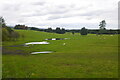
The above images may not be of the site on this page, they are loaded from Geograph.
Please Submit an Image of this site or go out and take one for us!
Click here to see more info for this site
Nearby sites
Key: Red: member's photo, Blue: 3rd party photo, Yellow: other image, Green: no photo - please go there and take one, Grey: site destroyed
Download sites to:
KML (Google Earth)
GPX (GPS waypoints)
CSV (Garmin/Navman)
CSV (Excel)
To unlock full downloads you need to sign up as a Contributory Member. Otherwise downloads are limited to 50 sites.
Turn off the page maps and other distractions
Nearby sites listing. In the following links * = Image available
1.6km NNW 328° Loanhead (Aberuthven) Stone Circle (NN974158)
2.0km NNW 344° Haugh Of Aberuthven* Standing Stone (Menhir) (NN97711643)
3.2km SSW 202° Ogle Hill Hillfort (NN96941148)
3.3km WSW 256° St Mackessog’s Well* Holy Well or Sacred Spring (NN950137)
3.6km E 85° Dunning* Standing Stone (Menhir) (NO01851469)
3.7km E 88° Dupplin Cross* Ancient Cross (NO01901448)
3.9km ENE 68° Leadketty Stone Circle (NO01921581)
4.1km E 90° Dun Knock (Dunning)* Hillfort (NO0230914317)
4.1km NNW 331° Trinity Well (Trinity Gask) Holy Well or Sacred Spring (NN96311812)
4.2km ENE 64° Leadketty Stone Circle (NO020162)
4.8km ESE 122° Gray Stone (Dunning)* Standing Stone (Menhir) (NO02191180)
5.1km W 280° Belted Stane, Calfward Standing Stone (Menhir) (NN93181548)
5.6km WSW 248° Auchterarder* Standing Stones (NN929125)
5.7km WNW 288° North Mains A Timber Circle (NN928163)
5.7km WNW 289° North Mains B Timber Circle (NN928164)
5.8km WNW 286° North Mains Strathallan round barrow* Round Barrow(s) (NN92621621)
7.4km SW 230° Gleneagles B* Standing Stone (Menhir) (NN92430981)
7.5km ENE 69° Forteviot Timber Circle (NO053169)
7.5km SSE 167° Borland Glen* Stone Circle (NN9976607093)
7.6km ENE 65° Forteviot Cross* Sculptured Stone (NO0518017527)
7.6km ENE 65° St Andrew's Church (Forteviot) Class III Pictish Cross Slab (NO052175)
7.8km SW 230° Gleneagles A* Standing Stone (Menhir) (NN9211509625)
7.9km ENE 66° Forteviot Dagger Burial* Cist (NO055175)
8.3km SW 218° Parks of Gleneagles Stone Circle (NN9308)
9.2km WSW 239° Cecilmount Stone Circle (NN90200985)
View more nearby sites and additional images


 We would like to know more about this location. Please feel free to add a brief description and any relevant information in your own language.
 Wir möchten mehr über diese Stätte erfahren. Bitte zögern Sie nicht, eine kurze Beschreibung und relevante Informationen in Deutsch hinzuzufügen.
 Nous aimerions en savoir encore un peu sur les lieux. S'il vous plaît n'hesitez pas à ajouter une courte description et tous les renseignements pertinents dans votre propre langue.
 Quisieramos informarnos un poco más de las lugares. No dude en añadir una breve descripción y otros datos relevantes en su propio idioma.