<< Text Pages >> Trinity Well (Trinity Gask) - Holy Well or Sacred Spring in Scotland in Perth and Kinross
Submitted by Anne T on Thursday, 11 January 2018 Page Views: 1335
Springs and Holy WellsSite Name: Trinity Well (Trinity Gask)Country: Scotland County: Perth and Kinross Type: Holy Well or Sacred Spring
Nearest Town: Auchterarder Nearest Village: Trinity Gask
Map Ref: NN96311812
Latitude: 56.344036N Longitude: 3.679127W
Condition:
| 5 | Perfect |
| 4 | Almost Perfect |
| 3 | Reasonable but with some damage |
| 2 | Ruined but still recognisable as an ancient site |
| 1 | Pretty much destroyed, possibly visible as crop marks |
| 0 | No data. |
| -1 | Completely destroyed |
| 5 | Superb |
| 4 | Good |
| 3 | Ordinary |
| 2 | Not Good |
| 1 | Awful |
| 0 | No data. |
| 5 | Can be driven to, probably with disabled access |
| 4 | Short walk on a footpath |
| 3 | Requiring a bit more of a walk |
| 2 | A long walk |
| 1 | In the middle of nowhere, a nightmare to find |
| 0 | No data. |
| 5 | co-ordinates taken by GPS or official recorded co-ordinates |
| 4 | co-ordinates scaled from a detailed map |
| 3 | co-ordinates scaled from a bad map |
| 2 | co-ordinates of the nearest village |
| 1 | co-ordinates of the nearest town |
| 0 | no data |
Be the first person to rate this site - see the 'Contribute!' box in the right hand menu.
Internal Links:
External Links:
Holy Well or Sacred Spring in Perth and Kinross
This well is recorded as Canmore ID 25993 which says: "(1845) Trinity Well is a spring renowned before the Reformation for miraculous cures", adding in 1967: "Trinity Well is now dry and all that remains is an overgrown hollow. A manhole cover nearby suggests that the spring is now piped."
The Northern Antiquarian (TNA) features a page for this site - see their entry for Trinity Well, Trinity Gask, Perthshire, which gives directions for finding this site together with photographs and a brief archaeology & history. TNA notes: "On the day of my 2014 visit, the water was flowing from an issue on the field side of the woodland. There was some low walling on the field side of the enclosure, otherwise no masonry or paving was visible. Any there may have been is now either buried or robbed for building material."
Note: Has anyone visited this site? Do you have any photographs or information to add?
You may be viewing yesterday's version of this page. To see the most up to date information please register for a free account.
Do not use the above information on other web sites or publications without permission of the contributor.
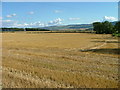
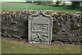
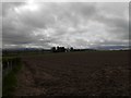
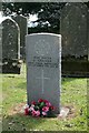
Nearby Images from Geograph Britain and Ireland:
©2011(licence)
©2018(licence)
©2017(licence)
©2018(licence)
©2011(licence)
The above images may not be of the site on this page, they are loaded from Geograph.
Please Submit an Image of this site or go out and take one for us!
Click here to see more info for this site
Nearby sites
Key: Red: member's photo, Blue: 3rd party photo, Yellow: other image, Green: no photo - please go there and take one, Grey: site destroyed
Download sites to:
KML (Google Earth)
GPX (GPS waypoints)
CSV (Garmin/Navman)
CSV (Excel)
To unlock full downloads you need to sign up as a Contributory Member. Otherwise downloads are limited to 50 sites.
Turn off the page maps and other distractions
Nearby sites listing. In the following links * = Image available
2.2km SE 139° Haugh Of Aberuthven* Standing Stone (Menhir) (NN97711643)
2.6km SSE 153° Loanhead (Aberuthven) Stone Circle (NN974158)
3.9km WSW 242° North Mains B Timber Circle (NN928164)
3.9km WSW 241° North Mains A Timber Circle (NN928163)
4.1km SW 228° Belted Stane, Calfward Standing Stone (Menhir) (NN93181548)
4.1km SSE 151° Westerton Timber Hall Ancient Village or Settlement (NN9821414444)
4.1km WSW 241° North Mains Strathallan round barrow* Round Barrow(s) (NN92621621)
4.6km SSW 195° St Mackessog’s Well* Holy Well or Sacred Spring (NN950137)
6.0km ESE 107° Leadketty Stone Circle (NO020162)
6.0km ESE 111° Leadketty Stone Circle (NO01921581)
6.3km NW 324° New Fowlis* Stone Circle (NN92712329)
6.5km ESE 120° Dunning* Standing Stone (Menhir) (NO01851469)
6.6km SSW 210° Auchterarder* Standing Stones (NN929125)
6.7km ESE 122° Dupplin Cross* Ancient Cross (NO01901448)
6.7km S 173° Ogle Hill Hillfort (NN96941148)
6.9km NNW 328° Fowlis Wester 1* Class II Pictish Symbol Stone (NN92772404)
6.9km NNW 328° Fowlis Wester 2* Class III Pictish Cross Slab (NN92812408)
7.1km ESE 121° Dun Knock (Dunning)* Hillfort (NO0230914317)
7.2km NW 323° Thorn Recumbent Stones* Standing Stones (NN92042397)
7.3km NNE 34° Bachilton Stone Circle (NO005241)
7.3km NW 323° Thorn Stone Pair* Standing Stones (NN92032404)
7.7km WNW 281° Millhills Stone Circle (NN88801981)
7.8km NNW 329° Fowlis Wester East* Stone Circle (NN9242624917)
7.8km NNW 329° Fowlis Wester West* Stone Circle (NN9240124916)
8.6km SE 136° Gray Stone (Dunning)* Standing Stone (Menhir) (NO02191180)
View more nearby sites and additional images


 We would like to know more about this location. Please feel free to add a brief description and any relevant information in your own language.
 Wir möchten mehr über diese Stätte erfahren. Bitte zögern Sie nicht, eine kurze Beschreibung und relevante Informationen in Deutsch hinzuzufügen.
 Nous aimerions en savoir encore un peu sur les lieux. S'il vous plaît n'hesitez pas à ajouter une courte description et tous les renseignements pertinents dans votre propre langue.
 Quisieramos informarnos un poco más de las lugares. No dude en añadir una breve descripción y otros datos relevantes en su propio idioma.