 with our Megalithic Portal iPhone app")


<< Our Photo Pages >> Tomen y Rhos Round Barrow - Barrow Cemetery in Wales in Carmarthenshire (Sir Caerfyrddin)
Submitted by geoffstickland on Thursday, 17 November 2022 Page Views: 751
Neolithic and Bronze AgeSite Name: Tomen y Rhos Round BarrowCountry: Wales County: Carmarthenshire (Sir Caerfyrddin) Type: Barrow Cemetery
Nearest Town: Llandovery Nearest Village: Myddfai
Map Ref: SN8084929847
Latitude: 51.954307N Longitude: 3.735273W
Condition:
| 5 | Perfect |
| 4 | Almost Perfect |
| 3 | Reasonable but with some damage |
| 2 | Ruined but still recognisable as an ancient site |
| 1 | Pretty much destroyed, possibly visible as crop marks |
| 0 | No data. |
| -1 | Completely destroyed |
| 5 | Superb |
| 4 | Good |
| 3 | Ordinary |
| 2 | Not Good |
| 1 | Awful |
| 0 | No data. |
| 5 | Can be driven to, probably with disabled access |
| 4 | Short walk on a footpath |
| 3 | Requiring a bit more of a walk |
| 2 | A long walk |
| 1 | In the middle of nowhere, a nightmare to find |
| 0 | No data. |
| 5 | co-ordinates taken by GPS or official recorded co-ordinates |
| 4 | co-ordinates scaled from a detailed map |
| 3 | co-ordinates scaled from a bad map |
| 2 | co-ordinates of the nearest village |
| 1 | co-ordinates of the nearest town |
| 0 | no data |
Internal Links:
External Links:
I have visited· I would like to visit
geoffstickland has visited here
")
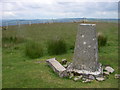
A Bronze Age round barrow, completley excavated in the 19th. Century. What remains is a deep pit about 12' across, surrounded by a steep bank 3' high and 35' in diameter. Lying in the bottom of the pit are some stoney remains from the excavation. What remains now is actually the inversion of a barrow. It is a curious but impressive site. No evidence of the cyst remains and the remains were removed and later lost.
You may be viewing yesterday's version of this page. To see the most up to date information please register for a free account.
Do not use the above information on other web sites or publications without permission of the contributor.
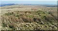
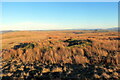
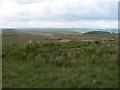
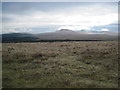
Nearby Images from Geograph Britain and Ireland:
©2020(licence)
©2022(licence)
©2008(licence)
©2011(licence)
©2008(licence)
The above images may not be of the site on this page, they are loaded from Geograph.
Please Submit an Image of this site or go out and take one for us!
Click here to see more info for this site
Nearby sites
Key: Red: member's photo, Blue: 3rd party photo, Yellow: other image, Green: no photo - please go there and take one, Grey: site destroyed
Download sites to:
KML (Google Earth)
GPX (GPS waypoints)
CSV (Garmin/Navman)
CSV (Excel)
To unlock full downloads you need to sign up as a Contributory Member. Otherwise downloads are limited to 50 sites.
Turn off the page maps and other distractions
Nearby sites listing. In the following links * = Image available
368m NE 53° Pen y Bylchau Bronze Age Enclosure* Hillfort (SN81153006)
415m ESE 112° Pant-y-Ddwyros Cairn* Round Barrow(s) (SN81232968)
419m ESE 112° Mynydd Myddfai Round Barrow* Barrow Cemetery (SN8123429678)
1.1km NNE 27° Cwm y Cadno Standing Stone* Standing Stone (Menhir) (SN81393084)
1.2km NE 54° Mynydd Myddfai Barrow* Round Barrow(s) (SN818305)
1.3km NE 50° Pen y Bylchau Round Barrow Barrow Cemetery (SN81853065)
1.4km S 190° Mynydd Myddfai Stones* Standing Stones (SN80562843)
1.5km SSW 210° Carn Pant Meddygon* Round Barrow(s) (SN80062855)
1.5km SSW 211° Pen Caenewydd Cairn* Cairn (SN80042856)
1.7km SW 233° Pen Caenewydd Cairn (1 & 2)* Cairn (SN79492888)
1.7km NE 44° Waun Ddu Roman Fortlet* Hillfort (SN82063104)
1.7km NE 36° Trecastle Hill Mile stone* Standing Stones (SN8190631211)
1.8km SW 233° Pen Cae Newydd Standing Stone (possible)* Standing Stone (Menhir) (SN7934328782)
1.9km WSW 241° Pen Cae Newydd Ring Barrow* Round Barrow(s) (SN79172898)
2.2km ESE 103° Cwm Henwen* Standing Stone (Menhir) (SN82962929)
2.3km E 100° Cwm Henwen Cairn* Cairn (SN83082939)
2.5km SSE 166° Bryn Pwllgerwyn Cairn* Cairn (SN81412738)
2.5km ENE 62° Y Pigwn cairn 2* Cairn (SN83143098)
2.6km ENE 57° Y Pigwn cairn 1* Cairn (SN83063119)
2.7km ENE 59° Pigwn Stone Circle 3* Stone Circle (SN83203117)
2.7km ENE 62° Trecastle Mountain Row* Stone Row / Alignment (SN8327331053)
2.7km ENE 62° Trecastle Mountain WSW* Stone Circle (SN83313107)
2.8km ENE 62° Trecastle Mountain ENE* Stone Circle (SN83343109)
2.8km ENE 64° Y Pigwn standing stone* Standing Stone (Menhir) (SN83423103)
2.9km ESE 121° Gwern-Wyddog* Standing Stone (Menhir) (SN833283)
View more nearby sites and additional images


 We would like to know more about this location. Please feel free to add a brief description and any relevant information in your own language.
 Wir möchten mehr über diese Stätte erfahren. Bitte zögern Sie nicht, eine kurze Beschreibung und relevante Informationen in Deutsch hinzuzufügen.
 Nous aimerions en savoir encore un peu sur les lieux. S'il vous plaît n'hesitez pas à ajouter une courte description et tous les renseignements pertinents dans votre propre langue.
 Quisieramos informarnos un poco más de las lugares. No dude en añadir una breve descripción y otros datos relevantes en su propio idioma.