<< Our Photo Pages >> Trecastle Hill Mile stone - Standing Stones in Wales in Carmarthenshire
Submitted by geoffstickland on Thursday, 10 November 2022 Page Views: 496
Neolithic and Bronze AgeSite Name: Trecastle Hill Mile stoneCountry: Wales County: Carmarthenshire Type: Standing Stones
Nearest Town: Llandovery Nearest Village: Myddfai
Map Ref: SN8190631211
Latitude: 51.966791N Longitude: 3.720368W
Condition:
| 5 | Perfect |
| 4 | Almost Perfect |
| 3 | Reasonable but with some damage |
| 2 | Ruined but still recognisable as an ancient site |
| 1 | Pretty much destroyed, possibly visible as crop marks |
| 0 | No data. |
| -1 | Completely destroyed |
| 5 | Superb |
| 4 | Good |
| 3 | Ordinary |
| 2 | Not Good |
| 1 | Awful |
| 0 | No data. |
| 5 | Can be driven to, probably with disabled access |
| 4 | Short walk on a footpath |
| 3 | Requiring a bit more of a walk |
| 2 | A long walk |
| 1 | In the middle of nowhere, a nightmare to find |
| 0 | No data. |
| 5 | co-ordinates taken by GPS or official recorded co-ordinates |
| 4 | co-ordinates scaled from a detailed map |
| 3 | co-ordinates scaled from a bad map |
| 2 | co-ordinates of the nearest village |
| 1 | co-ordinates of the nearest town |
| 0 | no data |
Internal Links:
External Links:
I have visited· I would like to visit
geoffstickland has visited here
")
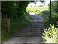
A small, rounded stone about 2' high (above ground level) and bearing an indecipherable inscription, set beside the Roman Road leading to the major Roman encampment of Y Pigwn.
You may be viewing yesterday's version of this page. To see the most up to date information please register for a free account.
Do not use the above information on other web sites or publications without permission of the contributor.
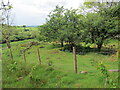
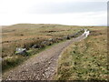
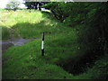
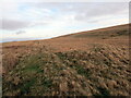
Nearby Images from Geograph Britain and Ireland:
©2022(licence)
©2021(licence)
©2009(licence)
©2021(licence)
©2007(licence)
The above images may not be of the site on this page, they are loaded from Geograph.
Please Submit an Image of this site or go out and take one for us!
Click here to see more info for this site
Nearby sites
Key: Red: member's photo, Blue: 3rd party photo, Yellow: other image, Green: no photo - please go there and take one, Grey: site destroyed
Download sites to:
KML (Google Earth)
GPX (GPS waypoints)
CSV (Garmin/Navman)
CSV (Excel)
To unlock full downloads you need to sign up as a Contributory Member. Otherwise downloads are limited to 50 sites.
Turn off the page maps and other distractions
Nearby sites listing. In the following links * = Image available
230m SE 137° Waun Ddu Roman Fortlet* Hillfort (SN82063104)
564m S 184° Pen y Bylchau Round Barrow Barrow Cemetery (SN81853065)
634m SW 233° Cwm y Cadno Standing Stone* Standing Stone (Menhir) (SN81393084)
719m S 187° Mynydd Myddfai Barrow* Round Barrow(s) (SN818305)
1.2km E 90° Y Pigwn cairn 1* Cairn (SN83063119)
1.3km E 99° Y Pigwn cairn 2* Cairn (SN83143098)
1.3km E 90° Pigwn Stone Circle 3* Stone Circle (SN83203117)
1.4km E 95° Trecastle Mountain Row* Stone Row / Alignment (SN8327331053)
1.4km SSW 212° Pen y Bylchau Bronze Age Enclosure* Hillfort (SN81153006)
1.4km E 94° Trecastle Mountain WSW* Stone Circle (SN83313107)
1.4km E 93° Trecastle Mountain ENE* Stone Circle (SN83343109)
1.5km E 95° Y Pigwn standing stone* Standing Stone (Menhir) (SN83423103)
1.7km SSW 202° Pant-y-Ddwyros Cairn* Round Barrow(s) (SN81232968)
1.7km SSW 202° Mynydd Myddfai Round Barrow* Barrow Cemetery (SN8123429678)
1.7km SW 216° Tomen y Rhos Round Barrow* Barrow Cemetery (SN8084929847)
2.2km SE 146° Cwm Henwen Cairn* Cairn (SN83082939)
2.2km SSE 150° Cwm Henwen* Standing Stone (Menhir) (SN82962929)
3.0km ESE 112° Pant Madog Cairn* Round Barrow(s) (SN84623003)
3.1km SSW 204° Mynydd Myddfai Stones* Standing Stones (SN80562843)
3.2km SSE 153° Gwern-Wyddog* Standing Stone (Menhir) (SN833283)
3.2km SSW 213° Carn Pant Meddygon* Round Barrow(s) (SN80062855)
3.2km SSW 214° Pen Caenewydd Cairn* Cairn (SN80042856)
3.4km SW 225° Pen Caenewydd Cairn (1 & 2)* Cairn (SN79492888)
3.5km SW 229° Pen Cae Newydd Ring Barrow* Round Barrow(s) (SN79172898)
3.5km SW 225° Pen Cae Newydd Standing Stone (possible)* Standing Stone (Menhir) (SN7934328782)
View more nearby sites and additional images


 We would like to know more about this location. Please feel free to add a brief description and any relevant information in your own language.
 Wir möchten mehr über diese Stätte erfahren. Bitte zögern Sie nicht, eine kurze Beschreibung und relevante Informationen in Deutsch hinzuzufügen.
 Nous aimerions en savoir encore un peu sur les lieux. S'il vous plaît n'hesitez pas à ajouter une courte description et tous les renseignements pertinents dans votre propre langue.
 Quisieramos informarnos un poco más de las lugares. No dude en añadir una breve descripción y otros datos relevantes en su propio idioma.