

<< Our Photo Pages >> Chittaford Down Platform Cairn Circle and Cist - Cairn in England in Devon
Submitted by Anne T on Tuesday, 20 August 2019 Page Views: 745
Neolithic and Bronze AgeSite Name: Chittaford Down Platform Cairn Circle and Cist Alternative Name: Turner E28; Grinsell Lydford 39; Chittaford Down 3Country: England County: Devon Type: Cairn
Nearest Town: Princetown Nearest Village: Postbridge
Map Ref: SX6368779463
Latitude: 50.598927N Longitude: 3.927439W
Condition:
| 5 | Perfect |
| 4 | Almost Perfect |
| 3 | Reasonable but with some damage |
| 2 | Ruined but still recognisable as an ancient site |
| 1 | Pretty much destroyed, possibly visible as crop marks |
| 0 | No data. |
| -1 | Completely destroyed |
| 5 | Superb |
| 4 | Good |
| 3 | Ordinary |
| 2 | Not Good |
| 1 | Awful |
| 0 | No data. |
| 5 | Can be driven to, probably with disabled access |
| 4 | Short walk on a footpath |
| 3 | Requiring a bit more of a walk |
| 2 | A long walk |
| 1 | In the middle of nowhere, a nightmare to find |
| 0 | No data. |
| 5 | co-ordinates taken by GPS or official recorded co-ordinates |
| 4 | co-ordinates scaled from a detailed map |
| 3 | co-ordinates scaled from a bad map |
| 2 | co-ordinates of the nearest village |
| 1 | co-ordinates of the nearest town |
| 0 | no data |
Be the first person to rate this site - see the 'Contribute!' box in the right hand menu.
Internal Links:
External Links:
")
This cairn circle and cist is featured on the Prehistoric Dartmoor Walks (PDW) website as the Chittaford Down Platform Cairn Circle and Cist.
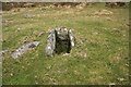
It is also recorded as Pastscape Monument No. 442516, which tells us the cairn is located on a slight plateau on a north east facing slope in an area of grss and boulder strewn grassland. " It is visible as a turf covered stony mound, 7.8m in diameter and 0.5m height and seems only slightly disturbed. A few stones are visible around the periphery but no true kerb."
The cairn is also scheduled as Historic England List ID 1021330 (Cairn and cist on Chittaford Down, 300m north of Archerton).
The Devon & Dartmoor HER also includes and entry for this site - see MDV5932 (Cairn with cist on Chittaford Down).
You may be viewing yesterday's version of this page. To see the most up to date information please register for a free account.
")
")
")
")
Do not use the above information on other web sites or publications without permission of the contributor.
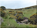
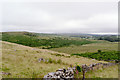
Nearby Images from Geograph Britain and Ireland:
©2009(licence)
©2010(licence)
©2005(licence)
©2019(licence)
©2010(licence)
The above images may not be of the site on this page, they are loaded from Geograph.
Please Submit an Image of this site or go out and take one for us!
Click here to see more info for this site
Nearby sites
Key: Red: member's photo, Blue: 3rd party photo, Yellow: other image, Green: no photo - please go there and take one, Grey: site destroyed
Download sites to:
KML (Google Earth)
GPX (GPS waypoints)
CSV (Garmin/Navman)
CSV (Excel)
To unlock full downloads you need to sign up as a Contributory Member. Otherwise downloads are limited to 50 sites.
Turn off the page maps and other distractions
Nearby sites listing. In the following links * = Image available
310m NE 47° Roundy Park Cairn* Cairn (SX6392079669)
328m SSW 213° Chittaford Down cairn circle and cist* Cist (SX6350179193)
333m ENE 56° Roundy Park settlement* Ancient Village or Settlement (SX63977964)
487m NNW 341° Broadun Settlement* Ancient Village or Settlement (SX6354179928)
622m SSE 164° Archerton Tennis Court cist* Cist (SX63847886)
715m N 359° Broadun Ring* Ancient Village or Settlement (SX6369980178)
779m ESE 116° Archerton Newtake Cist* Cist (SX6438179105)
780m SSE 147° Archerton Settlement* Ancient Village or Settlement (SX6410078800)
1.0km E 88° Ringhill Stone Row / Alignment (SX64737948)
1.1km ESE 122° National Park Visitors Centre Postbridge* Museum (SX6463578836)
1.2km SW 233° Hollowcome Cairn and Cist* Cist (SX62757879)
1.2km SW 231° Hollowcombe Cairns* Barrow Cemetery (SX627787)
1.5km SE 136° Lakehead Newtake Cist* Cairn (SX64687838)
1.5km E 98° Maggie Cross* Ancient Cross (SX6516679216)
1.5km SSE 150° Kraps Ring* Ancient Village or Settlement (SX64427814)
1.7km SSW 196° Arch Tor* Cairn (SX63167784)
1.8km SSE 157° Lakehead Cairn Circle 1* Ring Cairn (SX6435677766)
1.9km SSE 161° Lakehead Hill 2* Cist (SX6425077696)
1.9km SW 214° Stennan Hill 1* Cairn (SX6257377905)
1.9km SSE 158° Lakehead Hill W* Stone Row / Alignment (SX6437977653)
2.0km SSW 212° Stennan Hill 3* Cairn (SX62607783)
2.0km SSE 158° Lakehead Hill* Stone Row / Alignment (SX644776)
2.0km N 5° Lade Hill Brook Beehive Hut* Ancient Mine, Quarry or other Industry (SX63938145)
2.0km SSE 155° Lakehead Hill E* Stone Row / Alignment (SX6449577603)
2.1km WSW 237° Higher White Tor stone row* Multiple Stone Rows / Avenue (SX6191778362)
View more nearby sites and additional images


 We would like to know more about this location. Please feel free to add a brief description and any relevant information in your own language.
 Wir möchten mehr über diese Stätte erfahren. Bitte zögern Sie nicht, eine kurze Beschreibung und relevante Informationen in Deutsch hinzuzufügen.
 Nous aimerions en savoir encore un peu sur les lieux. S'il vous plaît n'hesitez pas à ajouter une courte description et tous les renseignements pertinents dans votre propre langue.
 Quisieramos informarnos un poco más de las lugares. No dude en añadir una breve descripción y otros datos relevantes en su propio idioma.