

<< Our Photo Pages >> White Tor (Peter Tavy) - Ancient Village or Settlement in England in Devon
Submitted by TheCaptain on Tuesday, 09 October 2007 Page Views: 11282
Multi-periodSite Name: White Tor (Peter Tavy) Alternative Name: Whittor; White Tor CampCountry: England County: Devon Type: Ancient Village or Settlement
Nearest Town: Tavistock Nearest Village: Peter Tavy
Map Ref: SX5424078673
Latitude: 50.589542N Longitude: 4.060524W
Condition:
| 5 | Perfect |
| 4 | Almost Perfect |
| 3 | Reasonable but with some damage |
| 2 | Ruined but still recognisable as an ancient site |
| 1 | Pretty much destroyed, possibly visible as crop marks |
| 0 | No data. |
| -1 | Completely destroyed |
| 5 | Superb |
| 4 | Good |
| 3 | Ordinary |
| 2 | Not Good |
| 1 | Awful |
| 0 | No data. |
| 5 | Can be driven to, probably with disabled access |
| 4 | Short walk on a footpath |
| 3 | Requiring a bit more of a walk |
| 2 | A long walk |
| 1 | In the middle of nowhere, a nightmare to find |
| 0 | No data. |
| 5 | co-ordinates taken by GPS or official recorded co-ordinates |
| 4 | co-ordinates scaled from a detailed map |
| 3 | co-ordinates scaled from a bad map |
| 2 | co-ordinates of the nearest village |
| 1 | co-ordinates of the nearest town |
| 0 | no data |
Internal Links:
External Links:
I have visited· I would like to visit
graemefield visited on 4th Jan 2017 - their rating: Cond: 4 Amb: 5 Access: 3
IanP24 TheCaptain have visited here
 (PID:33564)")
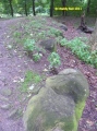
It was once thought to be an iron age hillfort, but study of the structures has shown it to be a Neolithic tor enclosure, adapted over the millennia. This can be seen by the construction of some of the bronze age structures on top of the encircling walls and ditches. Many of the internal cairns and structures are associated with natural rock outcrops on the hilltop, and several of the structures have internal features.
This stone enclosure reminds me of the similar construction on Stowes Pound, at the Cheesewring on nearby Bodmin Moor.
A couple of ancient reaves align themselves to this hilltop site, and there are several ancient settlements and hut circles to be seen on the slopes of the hill.
The views from up here are absolutely superb, with a full 360 degree panorama, spoiled only slightly by the military firing range flagpoles, notice boards and warning posts.
This lovely hill is fairly easy to reach, walking east along the Lich Way from parking at Godsworthy, past Stephen's Grave and you are here.
The site was excavated in 1899 but the finds have since been lost (Silvester 1979, 188). At least eight hut circles and tor-cairns have been identified within the enclosure and both Neolithic and Medieval ceramics have been found (Devon sites & Monuments Record).
Update December 2019: This site is featured on the Prehistoric Dartmoor Walks (PDW) website - see their entries for the White Tor Fort, the White Tor (Whittor) Neolithic Enclosure, and the White Tor Fort. Cox Tor North-east and Roos Tor North-west settlements.
The fort is also recorded as Pastscape Monument No. 439744, as MDV4101 (White Tor Camp, Peter Tavy) on the Devon and Dartmoor HER, and scheduled as Historic England List Entry No. 1004584 (White Tor camp, Cudlipptown Down).
You may be viewing yesterday's version of this page. To see the most up to date information please register for a free account.
 (PID:9790)")
 (PID:240217)")
 (PID:240215)")
 (PID:240206)")
 (PID:33884)")
 (PID:33882)")
 (PID:9930)")
 (PID:296176)")
 (PID:296175)")
 (PID:240220)")
 (PID:240219)")
 (PID:240218)")
 (PID:240216)")
 (PID:240214)")
 (PID:240213)")
 (PID:240212)")
 (PID:240211)")
 (PID:240210)")
 (PID:240209)")
 (PID:240208)")
 (PID:240205)")
 (PID:235458)")
 (PID:235457)")
 (PID:235456)")
 (PID:235455)")
These are just the first 25 photos of White Tor (Peter Tavy). If you log in with a free user account you will be able to see our entire collection.
Do not use the above information on other web sites or publications without permission of the contributor.
Click here to see more info for this site
Nearby sites
Key: Red: member's photo, Blue: 3rd party photo, Yellow: other image, Green: no photo - please go there and take one, Grey: site destroyed
Download sites to:
KML (Google Earth)
GPX (GPS waypoints)
CSV (Garmin/Navman)
CSV (Excel)
To unlock full downloads you need to sign up as a Contributory Member. Otherwise downloads are limited to 50 sites.
Turn off the page maps and other distractions
Nearby sites listing. In the following links * = Image available
279m SSE 166° South of White Tor Cairns* Barrow Cemetery (SX543784)
351m E 90° East of White for cairn 2* Cairn (SX5459278664)
355m E 85° Cairns East of White Tor* Cairn (SX5459578695)
371m E 89° East of White Tor cairn 3* Cairn (SX5461278668)
422m SSW 211° White Tor Long Cairn* Cairn (SX5401478316)
453m E 86° East of White Tor Cairn 4* Cist (SX5469478690)
577m WNW 297° Cudlipptown Down Cairn (SX5373278949)
661m WSW 253° Cudliptown Down Enclosed Settlement* Ancient Village or Settlement (SX536785)
719m ENE 78° Langstone Moor row 2* Stone Row / Alignment (SX54957880)
780m E 84° The Langstone* Standing Stone (Menhir) (SX55027873)
800m ENE 76° Langstone Moor stone row* Stone Row / Alignment (SX5502278851)
867m E 80° Langstone Moor 3 Stone Row / Alignment (SX55107880)
944m SSW 193° Wedlake Settlement Ancient Village or Settlement (SX54007776)
961m SE 140° Langstone Moor Cairn Circle* Ring Cairn (SX54847792)
1.1km SSE 165° Wedlake Cairns* Barrow Cemetery (SX545776)
1.2km SSE 146° Cairns North of Roos Tor* Cairn (SX5488477645)
1.4km S 186° Roos Tor north west* Ancient Village or Settlement (SX5403977254)
1.5km ESE 107° Langstone Moor circle* Stone Circle (SX5563478198)
1.6km ESE 109° Langstone Moor 2* Cairn (SX55737812)
1.6km ESE 117° Langstone Moor settlement* Ancient Village or Settlement (SX55687790)
2.0km ENE 74° Cocks Hill West Cairn* Cairn (SX5618579154)
2.1km S 177° Roos Tor Rocks* Rock Outcrop (SX543766)
2.3km SSW 195° Cox Tor north east* Ancient Village or Settlement (SX536765)
2.6km ENE 75° White Barrow (Cocks Hill) Cairn (SX568793)
2.7km N 9° Standon Hill Cairn Cairn (SX5473781373)
View more nearby sites and additional images


 We would like to know more about this location. Please feel free to add a brief description and any relevant information in your own language.
 Wir möchten mehr über diese Stätte erfahren. Bitte zögern Sie nicht, eine kurze Beschreibung und relevante Informationen in Deutsch hinzuzufügen.
 Nous aimerions en savoir encore un peu sur les lieux. S'il vous plaît n'hesitez pas à ajouter une courte description et tous les renseignements pertinents dans votre propre langue.
 Quisieramos informarnos un poco más de las lugares. No dude en añadir una breve descripción y otros datos relevantes en su propio idioma.