<< Text Pages >> Buaile Nan Aodan - Standing Stones in Scotland in Isle of Skye
Submitted by Andy B on Tuesday, 19 October 2010 Page Views: 3805
Neolithic and Bronze AgeSite Name: Buaile Nan AodanCountry: Scotland County: Isle of Skye Type: Standing Stones
Map Ref: NG61452255
Latitude: 57.231308N Longitude: 5.954257W
Condition:
| 5 | Perfect |
| 4 | Almost Perfect |
| 3 | Reasonable but with some damage |
| 2 | Ruined but still recognisable as an ancient site |
| 1 | Pretty much destroyed, possibly visible as crop marks |
| 0 | No data. |
| -1 | Completely destroyed |
| 5 | Superb |
| 4 | Good |
| 3 | Ordinary |
| 2 | Not Good |
| 1 | Awful |
| 0 | No data. |
| 5 | Can be driven to, probably with disabled access |
| 4 | Short walk on a footpath |
| 3 | Requiring a bit more of a walk |
| 2 | A long walk |
| 1 | In the middle of nowhere, a nightmare to find |
| 0 | No data. |
| 5 | co-ordinates taken by GPS or official recorded co-ordinates |
| 4 | co-ordinates scaled from a detailed map |
| 3 | co-ordinates scaled from a bad map |
| 2 | co-ordinates of the nearest village |
| 1 | co-ordinates of the nearest town |
| 0 | no data |
Be the first person to rate this site - see the 'Contribute!' box in the right hand menu.
Internal Links:
External Links:
I have visited· I would like to visit
SumDoood would like to visit
Lying in a natural hollow on the lower SE flank of Beinn na Caillich about 80m S of the Allt Buaile nan Aodan at 90m OD is a large twin- celled structure. Aligned E-W the structure's smaller, western cell measures 3m in diameter over walls 0.8m wide, the eastern cell measures 4.5m in diameter over walls 0.8m wide. Access between the cells is by a 30cm square creep. The entrance to the structure faces E and is about 1m wide; a small level platform lies just outside the entrance.
About 6m to the W is a setting of stones 1m in diameter which has a flat slab inside it.
A rectangular stone setting which measures 2m by 1m lies 10m to the E, and a similar setting measuring 2m by 2m lies 10m to the NE.
Source: Canmore
You may be viewing yesterday's version of this page. To see the most up to date information please register for a free account.
Do not use the above information on other web sites or publications without permission of the contributor.
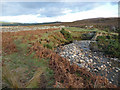
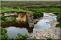
Nearby Images from Geograph Britain and Ireland:

©2011(licence)

©2011(licence)
©2008(licence)
©2011(licence)

©2014(licence)
The above images may not be of the site on this page, they are loaded from Geograph.
Please Submit an Image of this site or go out and take one for us!
Click here to see more info for this site
Nearby sites
Key: Red: member's photo, Blue: 3rd party photo, Yellow: other image, Green: no photo - please go there and take one, Grey: site destroyed
Download sites to:
KML (Google Earth)
GPX (GPS waypoints)
CSV (Garmin/Navman)
CSV (Excel)
To unlock full downloads you need to sign up as a Contributory Member. Otherwise downloads are limited to 50 sites.
Turn off the page maps and other distractions
Nearby sites listing. In the following links * = Image available
1.4km ESE 109° Suardal* Chambered Cairn (NG62722203)
2.3km SSE 164° Kilchrist, Glebe* Stone Circle (NG61972027)
3.0km ENE 62° Corry chambered cairn* Chambered Cairn (NG6416623779)
3.1km NE 55° Corry cist, cairn and souterrain Cist (NG641242)
3.4km SW 225° Clach na h'Annait* Standing Stone (Menhir) (NG58952029)
3.5km SSW 212° High Pasture Cave* Cave or Rock Shelter (NG59431971)
4.7km SW 236° Dun Mor (Torrin)* Broch or Nuraghe (NG57402015)
4.8km SW 232° Dun Beag (Loch Slapin)* Stone Fort or Dun (NG57511984)
5.0km ENE 77° Achadh A'chuirn* Chambered Cairn (NG66422343)
5.4km SSW 197° Dun Kearstack* Hillfort (NG596175)
5.9km SE 139° Heaste Stone Standing Stone (Menhir) (NG6505117847)
6.2km S 172° Dun Boreraig Stone* Standing Stone (Menhir) (NG61951638)
6.3km S 176° Dun Boreraig Fort* Hillfort (NG615162)
7.1km NE 53° Pabay Chapel Ancient Temple (NG67362651)
7.5km WSW 243° Abhainn Cille Mhaire Standing Stones (NG54611952)
7.5km ENE 73° Tobar Ashik* Holy Well or Sacred Spring (NG6873324291)
7.7km SW 221° Dun Ringill* Broch or Nuraghe (NG561170)
8.1km SW 227° Cnocan nan Gobhar* Round Cairn (NG55261735)
8.1km SW 234° Kilmarie Standing Stones (NG54591814)
8.2km SW 226° Kilmarie (Strathaird) Stone Circle (NG552172)
8.6km SW 232° Na Clachan Bhreige* Stone Circle (NG5433817681)
8.8km SW 221° Cadha nan Ingrean* Stone Fort or Dun (NG55331625)
9.1km S 175° Tobar Chaon* Holy Well or Sacred Spring (NG61711340)
9.3km S 174° Teampuill Chaon* Early Christian Sculptured Stone (NG61831321)
9.7km SW 220° An Reidhean* Stone Circle (NG54701548)
View more nearby sites and additional images


 We would like to know more about this location. Please feel free to add a brief description and any relevant information in your own language.
 Wir möchten mehr über diese Stätte erfahren. Bitte zögern Sie nicht, eine kurze Beschreibung und relevante Informationen in Deutsch hinzuzufügen.
 Nous aimerions en savoir encore un peu sur les lieux. S'il vous plaît n'hesitez pas à ajouter une courte description et tous les renseignements pertinents dans votre propre langue.
 Quisieramos informarnos un poco más de las lugares. No dude en añadir una breve descripción y otros datos relevantes en su propio idioma.