<< Text Pages >> Kilmarie (Strathaird) - Stone Circle in Scotland in Isle of Skye
Submitted by Anne T on Sunday, 14 January 2018 Page Views: 3154
Neolithic and Bronze AgeSite Name: Kilmarie (Strathaird)Country: Scotland County: Isle of Skye Type: Stone Circle
Nearest Town: Strathaird Nearest Village: Kilmarie
Map Ref: NG552172
Latitude: 57.180071N Longitude: 6.05226W
Condition:
| 5 | Perfect |
| 4 | Almost Perfect |
| 3 | Reasonable but with some damage |
| 2 | Ruined but still recognisable as an ancient site |
| 1 | Pretty much destroyed, possibly visible as crop marks |
| 0 | No data. |
| -1 | Completely destroyed |
| 5 | Superb |
| 4 | Good |
| 3 | Ordinary |
| 2 | Not Good |
| 1 | Awful |
| 0 | No data. |
| 5 | Can be driven to, probably with disabled access |
| 4 | Short walk on a footpath |
| 3 | Requiring a bit more of a walk |
| 2 | A long walk |
| 1 | In the middle of nowhere, a nightmare to find |
| 0 | No data. |
| 5 | co-ordinates taken by GPS or official recorded co-ordinates |
| 4 | co-ordinates scaled from a detailed map |
| 3 | co-ordinates scaled from a bad map |
| 2 | co-ordinates of the nearest village |
| 1 | co-ordinates of the nearest town |
| 0 | no data |
Internal Links:
External Links:
Stone Circle in Isle of Skye
The Northern Antiquarian (TNA) identified this now destroyed stone circle from a publication by Otta Swire (1961) - see their page for Kilmarie, Kirkibost, Strathaird, Skye.
TNA quotes from Swire's book, saying: "The site of the old church of Kilmarie and of the stone circle whose proximity no doubt originally called it into being are now no longer to be seen. The ruins of the old church, I am told, were swept away by the sea during that great storm in the 1920s which also blew down the Dunvegan woods ... This church is said to have stood on the site of an older church of St. Maelrhuba (Servant of Peace) who was the patron saint of south-eastern Skye."
TNA adds that the circle was omitted from Burl's 2000 book.
Note: Does anyone have any old photographs, illustrations or drawings of this stone circle, swept away by the sea in the 1920s?
You may be viewing yesterday's version of this page. To see the most up to date information please register for a free account.
Do not use the above information on other web sites or publications without permission of the contributor.
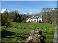
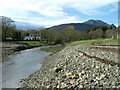
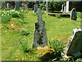
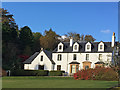
Nearby Images from Geograph Britain and Ireland:
©2006(licence)
©2008(licence)
©2006(licence)
©2016(licence)
©2006(licence)
The above images may not be of the site on this page, they are loaded from Geograph.
Please Submit an Image of this site or go out and take one for us!
Click here to see more info for this site
Nearby sites
Key: Red: member's photo, Blue: 3rd party photo, Yellow: other image, Green: no photo - please go there and take one, Grey: site destroyed
Download sites to:
KML (Google Earth)
GPX (GPS waypoints)
CSV (Garmin/Navman)
CSV (Excel)
To unlock full downloads you need to sign up as a Contributory Member. Otherwise downloads are limited to 50 sites.
Turn off the page maps and other distractions
Nearby sites listing. In the following links * = Image available
161m NNE 18° Cnocan nan Gobhar* Round Cairn (NG55261735)
918m E 99° Dun Ringill* Broch or Nuraghe (NG561170)
957m S 169° Cadha nan Ingrean* Stone Fort or Dun (NG55331625)
984m WNW 296° Na Clachan Bhreige* Stone Circle (NG5433817681)
1.1km NW 324° Kilmarie Standing Stones (NG54591814)
1.8km SSW 193° An Reidhean* Stone Circle (NG54701548)
2.4km NNW 342° Abhainn Cille Mhaire Standing Stones (NG54611952)
3.1km SSW 193° Dun Liath (Elgol)* Broch or Nuraghe (NG54331427)
3.2km SSW 209° Allt Na Cille Standing Stone (Menhir) (NG53501453)
3.4km SSW 199° Allt Na Cille Souterrain (Fogou, Earth House) (NG539141)
3.5km NE 38° Dun Beag (Loch Slapin)* Stone Fort or Dun (NG57511984)
3.7km NNE 33° Dun Mor (Torrin)* Broch or Nuraghe (NG57402015)
4.2km SW 225° Raven's Stone (Elgol) Standing Stone (Menhir) (NG520144)
4.4km E 83° Dun Kearstack* Hillfort (NG596175)
4.8km NE 47° Clach na h'Annait* Standing Stone (Menhir) (NG58952029)
4.9km NE 56° High Pasture Cave* Cave or Rock Shelter (NG59431971)
5.2km SSW 195° Dun Grugaig (Skye)* Stone Fort or Dun (NG53541229)
6.4km E 96° Dun Boreraig Fort* Hillfort (NG615162)
6.8km E 94° Dun Boreraig Stone* Standing Stone (Menhir) (NG61951638)
7.0km SE 128° Inver Aulavaig 1* Cairn (NG60441259)
7.0km SE 127° Inver Aulavaig 2* Cairn (NG6059112629)
7.4km ENE 62° Kilchrist, Glebe* Stone Circle (NG61972027)
7.5km ESE 117° Tobar Chaon* Holy Well or Sacred Spring (NG61711340)
7.7km ESE 118° Teampuill Chaon* Early Christian Sculptured Stone (NG61831321)
7.8km SSE 147° Cnoc an Temple* Burial Chamber or Dolmen (NG591104)
View more nearby sites and additional images


 We would like to know more about this location. Please feel free to add a brief description and any relevant information in your own language.
 Wir möchten mehr über diese Stätte erfahren. Bitte zögern Sie nicht, eine kurze Beschreibung und relevante Informationen in Deutsch hinzuzufügen.
 Nous aimerions en savoir encore un peu sur les lieux. S'il vous plaît n'hesitez pas à ajouter une courte description et tous les renseignements pertinents dans votre propre langue.
 Quisieramos informarnos un poco más de las lugares. No dude en añadir una breve descripción y otros datos relevantes en su propio idioma.