Contributory members are able to log private notes and comments about each site
Sites theCaptain has logged. View this log as a table or view the most recent logs from everyone
Mougau Bihan
Trip No.203 Entry No.542 Date Added: 2nd Jun 2020
Site Type: Passage Grave
Country: France (Bretagne:Finistère (29))
Visited: Yes on 23rd Jun 2005. My rating: Condition 5 Ambience 4 Access 5
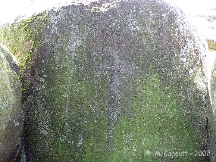
Mougau Bihan submitted by TheCaptain on 1st Dec 2007. The closing stone between the two chambers has a palette and also a wonderful polished axe, contained within its "crosse".
This is one of the least clear engravings, being much more weatherworn than some which have been better protected.
(View photo, vote or add a comment)
Log Text: This is an absolutely splendid allée couverte, which has been dated to 3000BC, found a couple of kilometres to the south of the village of Commana, and signposted from there. It has a little car park and picnic area, as well as a nice and spacious grassy area around it.
The main chamber is 14 metres in length and oriented approximately north to south, with its entrance at the northern end. The southern end has an extra small chamber, the "cella", the two parts being divided by a splendid "chevet" stone. The roof is made of five large capstones, four on the main chamber, and one on the cella. The internal width and height are about 1.5 metres.
But the best thing about this monument is all the ornamental engravings on the internal faces of the stones. About half of the side slabs have engravings on them which are fairly clear to make out. Most of these engravings are what are called "palettes", some stones having several of these of various designs next to each other. One of the stones has two pairs of the double hemispheres on it - these have been largely interpreted as pairs of breasts. The closing stone between the two chambers has a palette and also a wonderful polished axe, contained within its "crosse", but this is one of the least clear engravings, being much more weatherworn than some which have been better protected.
Mougau Bihan translates from the Breton language to "Fairies Cave".
An-Eured-Ven
Trip No.203 Entry No.544 Date Added: 2nd Jun 2020
Site Type: Stone Row / Alignment
Country: France (Bretagne:Finistère (29))
Visited: Yes on 23rd Jun 2005. My rating: Condition 3 Ambience 4 Access 4
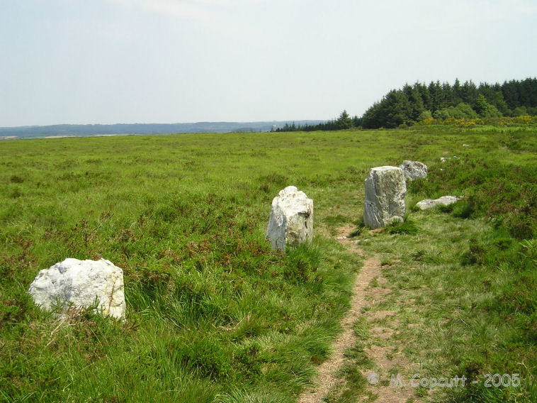
An-Eured-Ven submitted by thecaptain on 13th May 2008. a couple of hundred metre long, slightly curved line of white quartz blocks running along the ridgetop just to the south of the lake.
(View photo, vote or add a comment)
Log Text: On the high moorland to the southwest of the St Michel reservoir, in the bowl below the Montagnes d'Arrée to the southeast of Mont St Michel, can be found some rows of white quartz stones, the name of which, An-Eured-Ven, translates to something approximating the wedding stones dance.
I found a couple of hundred metre long, slightly curved line of white quartz blocks running along the ridgetop just to the south of the lake, the alignment of which varies from 078° to 085° as you go from west to east. Further thoughts on what I found, and I think its perhaps more like two straight rows which converge on a point, or a kinked row, rather than curved. At the kink there is a collection of larger stones which may at one point have been significant. At the eastern end the stones are bigger, and the last stone I found is positioned across the end of the row rather like a Dartmoor blocking stone. The row does not align on St Michel Hill, nor at this eastern end go along the top of the ridge as it runs away at 279°. The western end of the row just seems to fade away into the undergrowth.
Further looking around and I found another line of stones about 100 metres to the north, and which looks to be on an approximately parallel course to the first row. There are lots of other blocks of stone to be seen in amongst the heather, I wonder if a full survey has ever been done here ?
From on top of St Michel Hill, using binoculars, the two rows of stones can clearly be seen, but they form a sort of V shape, with the point towards the east. There is a group of schoolchildren out amongst the rows, with musicians and storytellers. What a great lesson they must be having.
Porz Ar Stréat menhir
Trip No.203 Entry No.531 Date Added: 29th May 2020
Site Type: Standing Stone (Menhir)
Country: France (Bretagne:Finistère (29))
Visited: Yes on 22nd Jun 2005. My rating: Condition 4 Ambience 3 Access 4
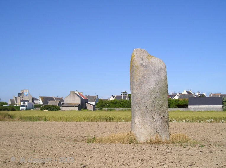
Porz Ar Stréat menhir submitted by thecaptain on 24th Jan 2009. This is a nice menhir in a field not far from the harbour, only a couple of hundred metres from the main village centre.
(View photo, vote or add a comment)
Log Text: This is a nice menhir in a field not far from the harbour, only a couple of hundred metres from the main village centre. Its over 4 metres high and a sort of square section, but tapered at the top, and it has a nice lean.
I cant get right up to it for details though, and its a pity about all the refrigerated lorries at the fish plant nearby making a racket, and a very smelly farmyard.
Créac’h-ar-Vrenn
Trip No.203 Entry No.535 Date Added: 29th May 2020
Site Type: Passage Grave
Country: France (Bretagne:Finistère (29))
Visited: Yes on 22nd Jun 2005. My rating: Condition 3 Ambience 3 Access 4
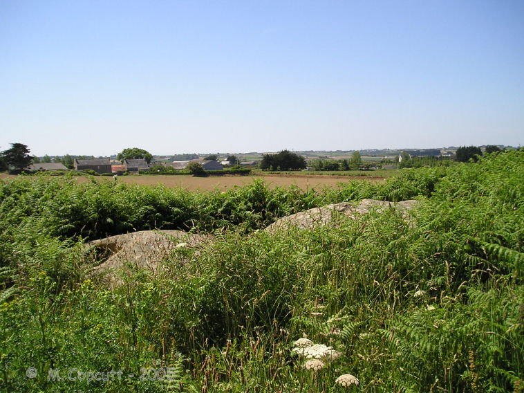
Créac’h-ar-Vrenn submitted by thecaptain on 22nd Jan 2009. What I found in 2005, behind the house at the top of the hill beside the water tower, was two rounded looking granite blocks.
With all the fences and undergrowth it was impossible to see if the stones were resting on any kind of supports, but these stones are certainly in the right position for where it is marked on the map.
(View photo, vote or add a comment)
Log Text: I am not 100% sure that I found this. What I possibly found is just some natural rocks. I looked all over the place and asked a couple of people, who both pointed me in the other direction away from their house towards the others. Despite signposts to it down the same lane as the menhir, there was no further evidence for it down there, but the new house being built is probably where the path went.
What I did find, behind the house at the top of the hill beside the water tower, was two rounded looking granite blocks, but it is possible that they have been placed there. With all the fences and undergrowth it was impossible to see if the stones were resting on any kind of supports, but these stones are certainly in the right position for where it is marked on the map.
Prat Meur menhir
Trip No.203 Entry No.530 Date Added: 29th May 2020
Site Type: Standing Stone (Menhir)
Country: France (Bretagne:Finistère (29))
Visited: Yes on 22nd Jun 2005. My rating: Condition 3 Ambience 3 Access 4

Prat Meur menhir submitted by thecaptain on 24th Jan 2009. This is a pleasant enough menhir, stood in a field beside a trackway at the end of the lane from the port to Prat Meur hamlet.
(View photo, vote or add a comment)
Log Text: This is a pleasant enough menhir, probably 2.8 metres tall and nearly as wide, but less than a metre thick. It is stood in a field beside a trackway at the end of the lane from the port to Prat Meur hamlet. It is nicely weathered at the top.
Somebodies air force is out and about, looks like F.16s so it isn't the French. Probably on holiday at Landivisiau. Suddenly there's a commotion, and a dog barking. A large rabbit or hare flashes past me about 5 metres away, with a dog hotly in chase about 15 metres behind. The rabbit is across a field of artichokes and into a hedge before the dog, and it all goes quiet, before a man is out and whistling to the dog. An interesting little episode.
Pors Poulhan allée couverte
Trip No.203 Entry No.474 Date Added: 25th May 2020
Site Type: Passage Grave
Country: France (Bretagne:Finistère (29))
Visited: Yes on 17th Jun 2005. My rating: Condition 5 Ambience 4 Access 5
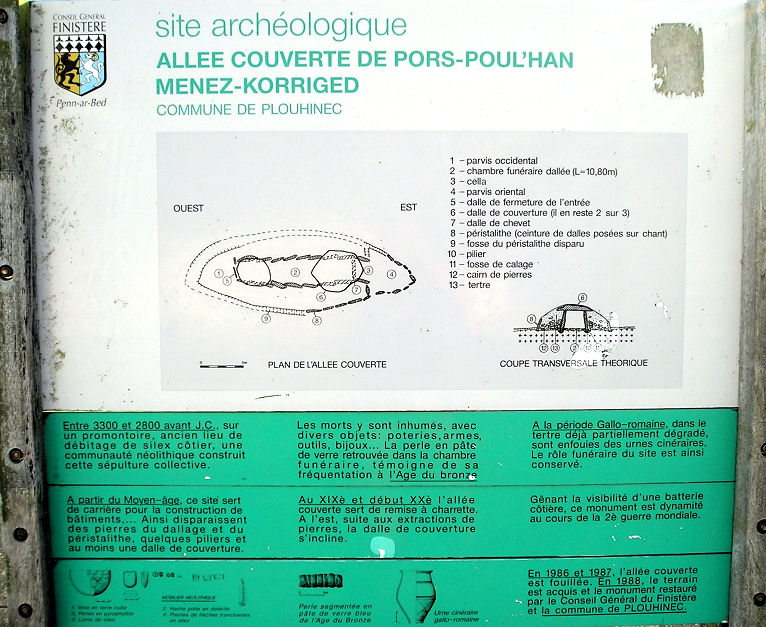
Pors Poulhan allée couverte submitted by thecaptain on 16th May 2009. The information board at Pors Poulhan allée couverte.
(View photo, vote or add a comment)
Log Text: On a headland overlooking the Baie D'Audierne, this allée couverte is in a tremendous position. The 12 metre long passage is quite large and wide at almost 2 metres in width, and almost as high, and lines up to the east at 100°.
Built before the year 3000BC, it has been used almost continually for one purpose or another until the present day. Excavations have shown it to have not only been constructed and used by neolithic flint workers, but also for burials in the bronze age, iron age, and by the Gallo-Romans. In the middle ages it was used as a quarry for building stone, and since then it has been used as a military look out post, and as such was blown up during the second world war.
Restoration was made in about 1990, with it now in a nicely kept little grassy area with benches and an information board. Two capstones are in place, as is a lot of floor paving, but the unusual thing for around here is that it still has many of the stones from its surrounding peristalith. This is a nice place to sit and ponder.
Presqu'île de la Torche
Trip No.203 Entry No.470 Date Added: 25th May 2020
Site Type: Passage Grave
Country: France (Bretagne:Finistère (29))
Visited: Yes on 17th Jun 2005. My rating: Condition 3 Ambience 5 Access 4

Presqu'île de la Torche submitted by thecaptain on 18th May 2009. The remains of what would no doubt have once been a magnificent monument, is positioned on top of this little headland, almost an island, sticking dramatically out into the wild Atlantic Ocean, and surrounded by magnificent surf beaches.
(View photo, vote or add a comment)
Log Text: The remains of what would no doubt have once been a magnificent monument, positioned on top of this little, almost an island, headland, sticking dramatically out into the wild Atlantic Ocean, and surrounded by magnificent surf beaches.
The central passage is still 16 metres in length, running up and over the top of the mound, curving as it goes, and opening to the east. At the west end there is an upright end stone. On the top of the mound, a few metres in from the end stone, are two side chambers each about 3 metres by 1.5 metres, one of which still has capstones in place, although it is all much ruined. Considering the concrete all around, for wartime bunkers and lookout posts, and for tourist paths and observation tables, it is surprising anything has survived here - that so much has is incredible. There is possible some remnants of a second chamber up here too.
The most wonderful thing about this place is the situation. The surf is crashing in all around the end of the point, and the waves rolling by on both sides of the headland in this surfers paradise. Its a fantastic place to sit and watch the waves go by. I love it. It makes me want to go surfing again. I bet I could still do it. They are even playing Camel's "Snow Goose" in the bar at the car park. Now if that isn't meaningful......
Saint-Gonvarc'h menhir
Trip No.203 Entry No.511 Date Added: 27th May 2020
Site Type: Standing Stone (Menhir)
Country: France (Bretagne:Finistère (29))
Visited: Saw from a distance on 20th Jun 2005. My rating: Condition 5 Ambience 3 Access 2

Saint-Gonvarc'h menhir submitted by thecaptain on 24th Jul 2009. The Pierre de St Gonvarc'h, or Mez menhir, can be seen across a couple of fields, and is another of the monster menhirs of the Léon region (Kings of Léon?).
Seen here from road along the "uphill" side.
(View photo, vote or add a comment)
Log Text: The Pierre de St Gonvarc'h, or Mez menhir, can be seen across a couple of fields, and is another of the monster menhirs of this region (Leon). Comparing it to a nearby cow for size, it must be a good 6 metres tall, and has been beautifully shaped.
Menhir de Kerhouézel
Trip No.203 Entry No.509 Date Added: 27th May 2020
Site Type: Standing Stone (Menhir)
Country: France (Bretagne:Finistère (29))
Visited: Yes on 20th Jun 2005. My rating: Condition 5 Ambience 4 Access 4
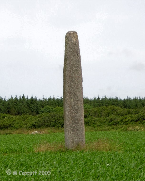
Menhir de Kerhouézel submitted by thecaptain on 24th Jul 2009. One of the Léon giants, the Kerhouézel menhir is a fantastic monster menhir, just inland from Porspoder. It must be nearly seven metres high and is fantastically smoothed and shaped.
Looking at these pictures now, several years after visiting, and they do not show the massive size, no do justice to this magnificent manhir. Truly a King of Léon.
(View photo, vote or add a comment)
Log Text: The Kerhouézel menhir is another fantastic monster menhir, just inland from Porspoder and signposted. It must be eight metres high and is fantastically smoothed and shaped. I just love these massive stones. I've go to give it a hug ! It is possible that there is a carved symbolon the upper part of the southern face.
Île Melon menhirs
Trip No.203 Entry No.502 Date Added: 27th May 2020
Site Type: Standing Stones
Country: France (Bretagne:Finistère (29))
Visited: Yes on 20th Jun 2005. My rating: Condition 2 Ambience 5 Access 2
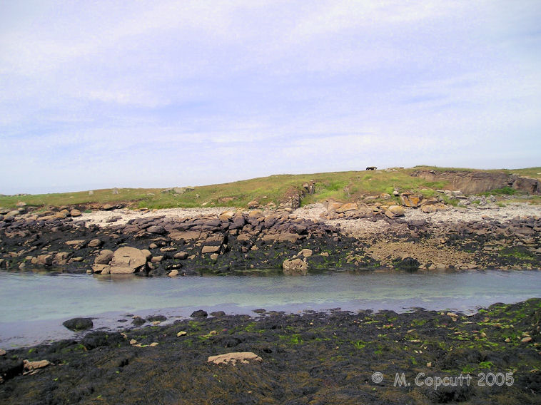
Île Melon menhirs submitted by thecaptain on 25th Jul 2009. View of Ile Melon from the end of the little harbour wall on the mainland.
The remains of two menhirs can be seen to the left of the picture, while the remaining dolmen is at the top of the island.
(View photo, vote or add a comment)
Log Text: This is frustrating. There is only 15 metres of water between me and the island from where I sit, but the tide is coming in and the island is not going to get any nearer. There is a dolmen on top of the island, and there are also at least two menhirs further down to the south of the island, and looking towards the shore. I believe that there was once a large menhir here also, which was blown up during the war. Perhaps a swim is needed !
Traonigou alignement de menhirs
Trip No.203 Entry No.505 Date Added: 27th May 2020
Site Type: Stone Row / Alignment
Country: France (Bretagne:Finistère (29))
Visited: Yes on 20th Jun 2005. My rating: Condition 3 Ambience 3 Access 5
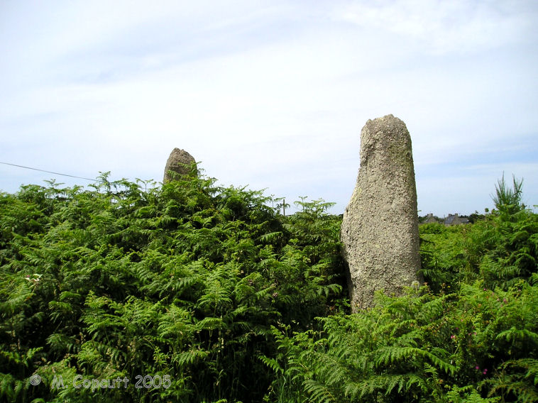
Traonigou alignement de menhirs submitted by thecaptain on 25th Jul 2009. The two standing menhirs are about 4 and 5 metres tall, the two fallen ones becoming lost in the undergrowth.
(View photo, vote or add a comment)
Log Text: Two fallen and two standing menhirs, which are supposedly aligned on the mid summer sunrise. The two standing menhirs are about 4 and 5 metres tall, the two fallen ones becoming lost in the undergrowth. These stones are signposted, and found just beside the road to the east of the hamlet of Traonigou.
Dolmen de Poulliot
Trip No.203 Entry No.506 Date Added: 27th May 2020
Site Type: Burial Chamber or Dolmen
Country: France (Bretagne:Finistère (29))
Visited: Yes on 20th Jun 2005. My rating: Condition 3 Ambience 3 Access 2
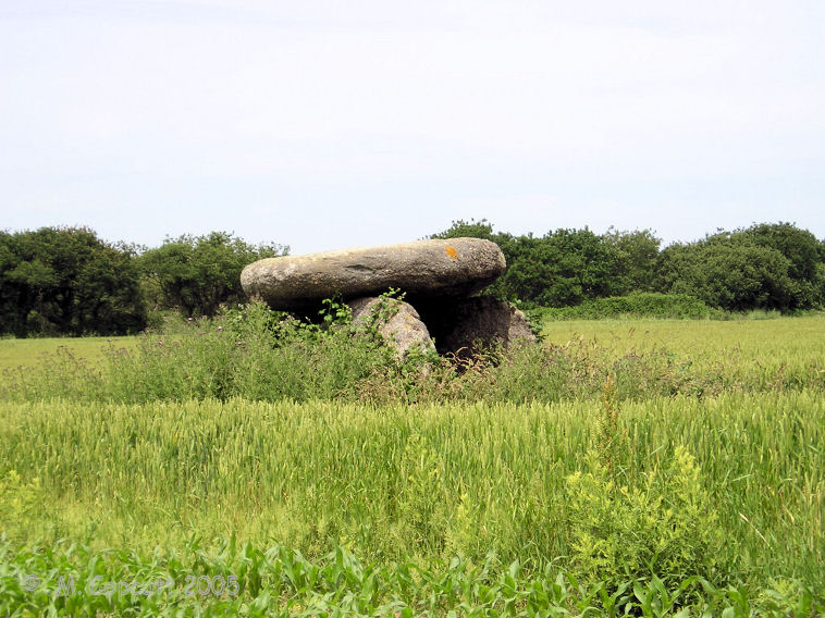
Dolmen de Poulliot submitted by thecaptain on 25th Jul 2009. Pleasant enough little dolmen sitting in a field of crops about 200 metres from the road.
(View photo, vote or add a comment)
Log Text: Pleasant enough little dolmen sitting in a field of crops about 200 metres from the road, but with a signpost. The capstone is sitting on three support stones, but I couldn’t get close enough to note any details.
Dolmen de la Chapelle Sainte-Théodore
Trip No.203 Entry No.476 Date Added: 26th May 2020
Site Type: Burial Chamber or Dolmen
Country: France (Bretagne:Finistère (29))
Visited: Yes on 18th Jun 2005. My rating: Condition 3 Ambience 4 Access 5
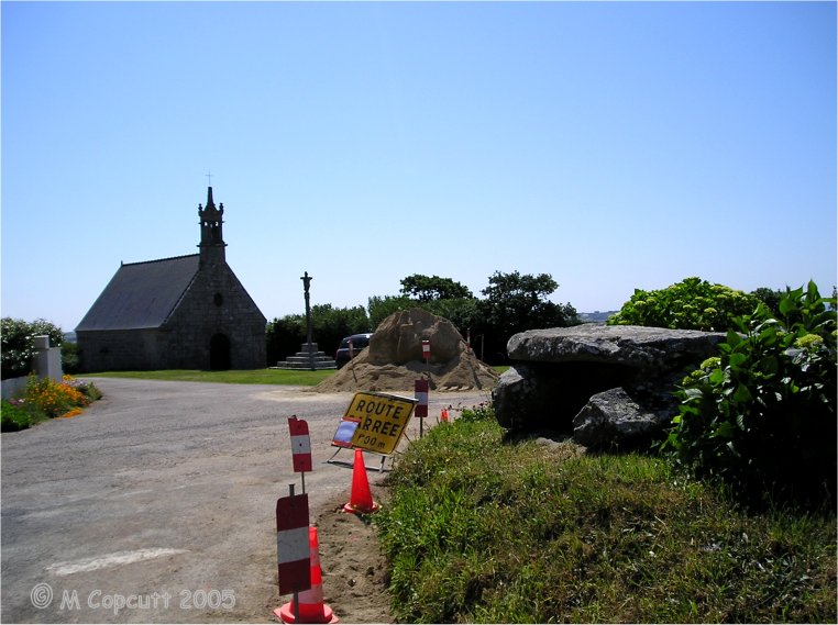
Dolmen de la Chapelle Sainte-Théodore submitted by thecaptain on 31st Jul 2009. Remains of a little Bronze Age dolmen/stone cist (coffre) are found near to the Chapelle St-Theodore, at the road junction just to the west.
(View photo, vote or add a comment)
Log Text: Remains of a little Bronze Age dolmen/stone cist (coffre) are found near to the Chapelle St Theodore, at the road junction just to the west. It's only about 1.5 by 1 metre in size, but the stone cover sits on top of a couple of supports, which in turn are on top of a cist type arrangement in a little mound.
Lostmarc'h menhir
Trip No.203 Entry No.494 Date Added: 27th May 2020
Site Type: Standing Stone (Menhir)
Country: France (Bretagne:Finistère (29))
Visited: Yes on 19th Jun 2005. My rating: Condition 3 Ambience 4 Access 3
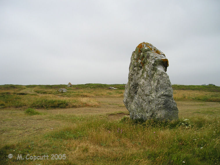
Lostmarc'h menhir submitted by thecaptain on 2nd Aug 2009. Lostmarc'h menhir stands in a commanding position on a headland overlooking the Atlantic Ocean, close to the Lostmarc'h alignments.
(View photo, vote or add a comment)
Log Text: Now, this is better, on top of a headland overlooking the Atlantic Ocean with a fine surf beach below to the south. The menhir is about 2.8 metres tall and in a commanding position, although not at the top, and as a result has a much better view. It can be seen from miles around coming from the south.
Oppidum de la Pointe de Lostmarc'h
Trip No.203 Entry No.496 Date Added: 27th May 2020
Site Type: Promontory Fort / Cliff Castle
Country: France (Bretagne:Finistère (29))
Visited: Yes on 19th Jun 2005. My rating: Condition 3 Ambience 4 Access 3

Oppidum de la Pointe de Lostmarc'h submitted by thecaptain on 1st Aug 2009. Just below the big Lostmarc'h headland with the alignements on top, there is a smaller headland which has been defended from the mainland by the creation of two rows of massive banks and ditches protecting it.
(View photo, vote or add a comment)
Log Text: Just below the big Lostmarc'h headland with the alignements on top, there is a smaller headland which has been defended from the mainland by the creation of two rows of massive banks and ditches protecting it.
On the headland apart from the inevitable remains of a chapel of some sort, there is also what appears to be the remains of some sort of cairn and burial chamber on the top. It wouldn't be unusual for one to be in such a place. There are 6 stones still sticking out of the ground here about 2.5 metres apart from each other, and stumps of others to be seen, which sort of make a rectangle inside a circular cairn.
It is very windblown here today, and misty which is a bit of a shame. The views would be tremendous on a clear day.
Dolmen de la Pointe de Lost Marc'h
Trip No.203 Entry No.497 Date Added: 27th May 2020
Site Type: Chambered Cairn
Country: France (Bretagne:Finistère (29))
Visited: Yes on 19th Jun 2005. My rating: Condition 2 Ambience 4 Access 3
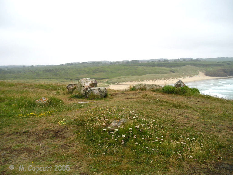
Dolmen de la Pointe de Lost Marc'h submitted by thecaptain on 1st Aug 2009. On the headland there is what appears to be the remains of some sort of cairn and burial chamber on the top. It wouldn't be unusual for one to be in such a place.
There are 6 stones still sticking out of the ground here, and stumps of others to be seen, which sort of make a rectangle inside a circular cairn.
(View photo, vote or add a comment)
Log Text: Just below the big Lostmarc'h headland with the alignements on top, there is a smaller headland which has been defended from the mainland by the creation of two rows of massive banks and ditches protecting it.
On the headland apart from the inevitable remains of a chapel of some sort, there is also what appears to be the remains of some sort of cairn and burial chamber on the top. It wouldnt be unusual for one to be in such a place. There are 6 stones still sticking out of the ground here about 2.5 metres apart from each other, and stumps of others to be seen, which sort of make a rectangle inside a circular cairn.
It is very windblown here today, and misty which is a bit of a shame. The views would be tremendous on a clear day.
Alignement de Lostmarc'h 1
Trip No.203 Entry No.495 Date Added: 27th May 2020
Site Type: Stone Row / Alignment
Country: France (Bretagne:Finistère (29))
Visited: Yes on 19th Jun 2005. My rating: Condition 3 Ambience 4 Access 3
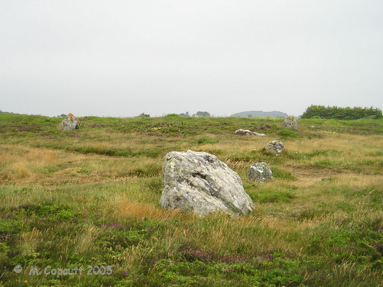
Alignement de Lostmarc'h 1 submitted by thecaptain on 2nd Aug 2009. What I first found of the Lostmarc'h alignements, on top of a headland overlooking the Atlantic Ocean, was a line of stones running across the headland.
There are many other stones laying about, perhaps the remains of other rows.
(View photo, vote or add a comment)
Log Text: What I could find of the Lostmarc'h alignements, on top of a headland overlooking the Atlantic Ocean with a fine surf beach below to the south, was a line of eight stones aligned at an angle of 060°/240° running across the headland. None of the stones are much more than a metre in height, and they are spaced about 6 metres apart from each other. There are several other stones laying about, perhaps the remains of other rows.
Further out on the headland are a lot more stones at N48.2150° W4.5561°. Its hard to make out any clear pattern, but its possibly the remains of at least 4 rows. Further stones can be seen dotted about all over the place. Perhaps this was once a big important centre.
Luguenez menhir
Trip No.203 Entry No.483 Date Added: 26th May 2020
Site Type: Standing Stone (Menhir)
Country: France (Bretagne:Finistère (29))
Visited: Yes on 18th Jun 2005. My rating: Condition 3 Ambience 3 Access 4
Luguenez menhir submitted by theCaptain on 25th Jan 2010. About three metres in height, this nicely shaped menhir is getting lost in the hedges.
(View photo, vote or add a comment)
Log Text: More than three metres in height, this nicely shaped menhir is getting lost in the hedges of the little lane which runs to the coast behind and to the north of the farm. Not far from here are superb views over the Baie de Duarnenez and the wonderful cliffs all around, including the cliff castle of Kastell Koz just to the east.
Kastell Koz
Trip No.203 Entry No.484 Date Added: 26th May 2020
Site Type: Promontory Fort / Cliff Castle
Country: France (Bretagne:Finistère (29))
Visited: Yes on 18th Jun 2005. My rating: Condition 3 Ambience 5 Access 4
Kastell Koz submitted by theCaptain on 25th Jan 2010. This is a superb cliff castle, made on the beautiful headland of the Pointe de Beuzec jutting north into the Baie de Duarnenez
(View photo, vote or add a comment)
Log Text: This is a superb cliff castle, made on the beautiful headland of the Pointe de Beuzec jutting north into the Baie de Duarnenez. It is defended on its southern side from the mainland with several rows of banks and ditches. The views from here are superb.
Fontaine St Jean-du-Doigt
Trip No.193 Entry No.23 Date Added: 13th Jul 2020
Site Type: Holy Well or Sacred Spring
Country: France (Bretagne:Finistère (29))
Visited: Yes on 1st Sep 1992. My rating: Access 5
Log Text: Cycling camping trip of north Brittany, day 3. Breton Corniche, Treburden, Lannion, Corniche Armorique to Primel Tregastel.
Ellie of course wanted to see St John the Baptist's finger, but I think the church was closed and we couldn't see it. Wonderful camp-site right on the Pointe de Primel, and meal round the other side of the bay at Le Diben, where I made the waitress laugh because of my Quebec accent and expressions!
