Contributory members are able to log private notes and comments about each site
Sites theCAptain has logged. View this log as a table or view the most recent logs from everyone
La Loge aux Sarrasins
Trip No.211 Entry No.4 Date Added: 26th Mar 2020
Site Type: Burial Chamber or Dolmen
Country: France (Normandie:Calvados (14))
Visited: Yes on 9th Oct 2011. My rating: Condition 4 Ambience 3 Access 4
la Loge aux Sarrasins submitted by hrun95 on 21st Jun 2011. These photos were taken in 2007, in the garden of the owners. So it's a bit boring because you are in their propriety. I get there by the little path coming by la Chaudronniere.
Site in Normandie:Calvados (14) France
(View photo, vote or add a comment)
Log Text: Having gone to Vire for a Vide Grenier and country show, persuaded Trevor and Sara to visit this stone for another look. Followed the same path as last time, and this time, once at the corner of the garden, the dolmen was clear to be seen in the back garden. At Last!
Its a lovely looking little dolmen. I can only assume that last visit there was a shed in the way, preventing it being seen. To get a better view, went back to the cornfield, and walked along its edge and up along outside the garden. I noticed that a bit further to the west, behind the garage, there was a separate standing stone, a couple of metres tall.
Bons Tassilly polissoirs
Trip No.202 Entry No.14 Date Added: 26th Mar 2020
Site Type: Polissoir
Country: France (Normandie:Calvados (14))
Visited: Yes on 23rd Apr 2005. My rating: Condition 3 Ambience 5 Access 4
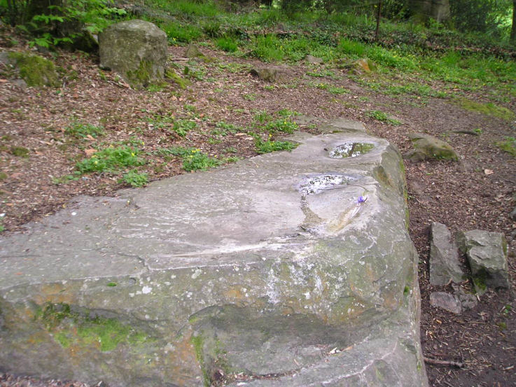
Bons Tassilly polissoirs submitted by TheCaptain on 6th May 2005. Mont Joly polissoirs, Bons Tassilly, Calvados.
The first of two polissoirs beside the river which forms the gorge surrounding the Mont Joly promontory site.
On the top surface of this stone are two large polished bowl areas, and three grooves, made by polishing the hard stone into tools.
(View photo, vote or add a comment)
Log Text: Two polissoirs can be found beside the river which forms the gorge surrounding the Mont Joly promontory site. Follow signs to the Brèche de Diable park the car and then walk along the footpath which follows the river up this splendid rocky gorge. After several hundred metres the path diverges from the river and starts uphill to the left when you come to a fenced area. At this point go down towards the stream and the two polissoir stones can be found one on each side of the river.
The first one on the near side of the river is a block of hard stone sticking out of the hillside about 2 metres long and a metre wide. On the top surface of this stone are two large polished bowl areas and three grooves made by polishing the hard stone into tools. It is wonderful to sit down on one of the ends of this stone and imagine polishing away to make an axe or similar. In fact I was very tempted to just sit there and make one !
The polissoir on the far side of the stream has now been fenced off within private ground and cannot be reached although can clearly be seen.
Mont Joly
Trip No.212 Entry No.8 Date Added: 26th Mar 2020
Site Type: Ancient Village or Settlement
Country: France (Normandie:Calvados (14))
Visited: Yes on 7th May 2012. My rating: Condition 2 Ambience 4 Access 5
Mont Joly submitted by theCaptain on 15th Jan 2014. This promontory site is surrounded on three sides by the steep gorge of the river Laizon, and the eastern end has been defended by ramparts, a little of which can now be seen between the church and water tower.
In this picture a raise in the land can be seen to the left of my Dad.
(View photo, vote or add a comment)
Log Text: What an intriguing place this is, and deserving of much more thorough exploration.
Mont Joly
Trip No.202 Entry No.13 Date Added: 26th Mar 2020
Site Type: Ancient Village or Settlement
Country: France (Normandie:Calvados (14))
Visited: Yes on 23rd Apr 2005. My rating: Condition 2 Ambience 4 Access 5
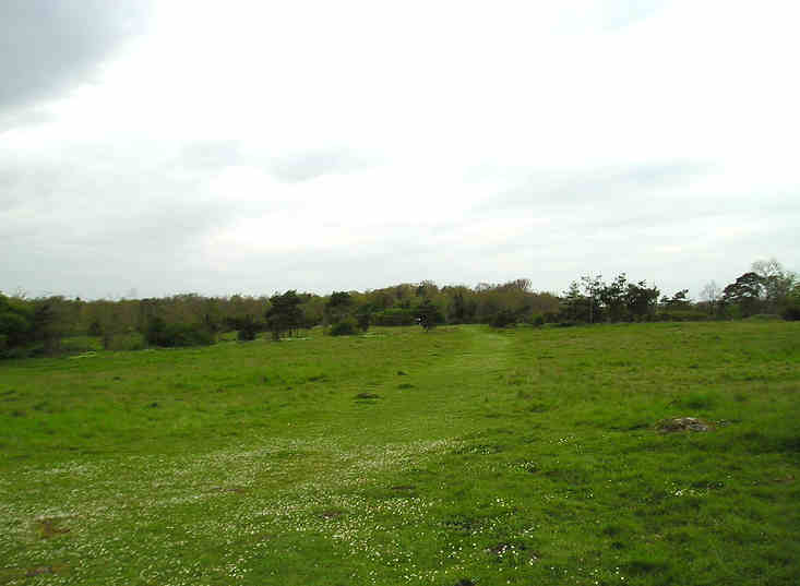
Mont Joly submitted by TheCaptain on 7th May 2005. Mont Joly, Soumont-Saint-Quentin, Calvados.
This is a promontory site surrounded on three sides by the steep gorge of the river Laizon. The site has been inhabited and defended since Paleolithic times, and artefacts have been found from all times since this. It is said that although little ancient remains can be seen, they are everywhere underfoot, and every molehill will contain several flints and pottery sherds.
(View photo, vote or add a comment)
Log Text: This is a promontory site surrounded on three sides by the steep gorge of the river Laizon and the eastern end has been defended by ramparts little of which can now be seen between the church and water tower. The site has been inhabited and defended since Paleolithic times and artefacts have been found from all times since this. It is said that although little ancient remains can be seen they are everywhere underfoot and every molehill will contain several flints and pottery sherds. This region was a major supplier of flint tools in the past and there is much to be found here.
Langrais menhirs
Trip No.212 Entry No.6 Date Added: 26th Mar 2020
Site Type: Standing Stones
Country: France (Normandie:Calvados (14))
Visited: Yes on 7th May 2012. My rating: Condition 4 Ambience 3 Access 4
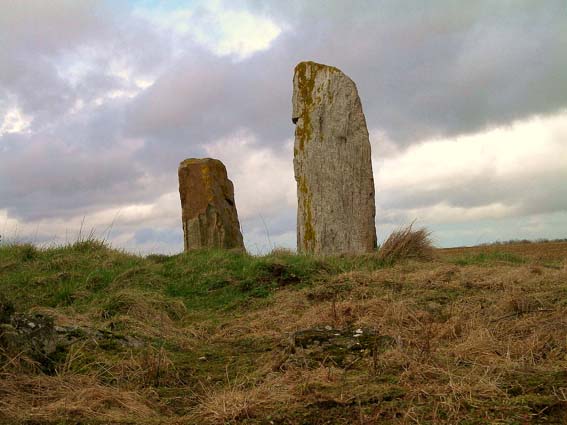
Langrais menhirs submitted by Rida on 27th Feb 2011. Site in Normandie:Calvados (14) France
(View photo, vote or add a comment)
Log Text: Having had a good look at the IGN 1:25000 map, I saw that there is a trackway running east from the road south of Mont Joly, which runs from the bottom of the hill diagonally up to the approximate position of the stones. Even better, when arriving there for a look, the trackway was open and easily driveable, and so I took this option on this showery afternoon, and when emerging from below the wood at the top of the hill, there was plenty of space to park amongst a large composting area! Left Dad in the car while I went out into the wind and drizzle to find the stones, and there they were, just round the back of the big pile of manure!
The two stones stand at the edge of an open rocky outcrop at the top of the hill, covered in wildflowers at this time of year, but I learned that the stones are not in their original positions, having been moved there by the farmer at some point in the past. The two stones are very different, the larger stone being a whitish quartz type stone, between 3.5 nd 4 metres tall, while its shorter neighbour is a reddish colour, and only about 1.6 metres tall. There are plently of other large lumps of stone laying about here, which may have been broken from the two menhirs, or just other examples of field clearance.
On the way down from the stones, through a gateway into the wood I could see another rocky outcrop with various large stones standing around, a couple of them probably at least 2 metres tall. This was all now made into a nice garden feature, but is there any ancient significance to the stones? Back onto the road, and I noticed it was called Route des Menhirs, and up towards the top of the hill there was another garden with some large rocks standing in it.
Onto the top of Mont Joly, and it is clear that there are large rocks all over the place, and it is easy to imagine that thee was once an alignement of large stones running along the top of the hill into the ancient settlement. Walking along the edge of the field, and then the pathway to the end of the promontary, and large stones can be seen laying around everywhere, many clearly not just a local outcropping of rock, but various shapes, sizes and types of stone. Many of these rocks were now incorporated into garden features, but many more are just laying there, slowly getting buried by the undergrowth. It really is a fascinating area, and I do wonder what a proper survey of this ancient hilltop would turn up.
La Longue Pierre (St-Pierre-Eglise)
Trip No.207 Entry No.7 Date Added: 25th Mar 2020
Site Type: Standing Stone (Menhir)
Country: France (Normandie:Manche (50))
Visited: Yes on 5th Apr 2007. My rating: Condition 4 Ambience 3 Access 4
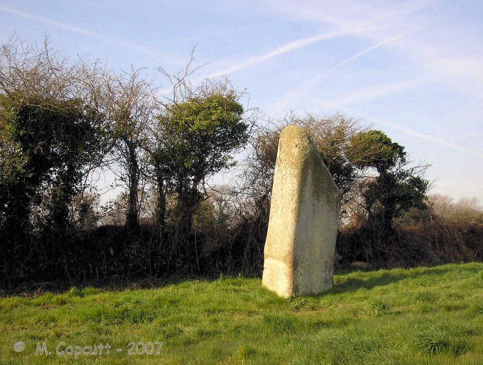
La Longue Pierre (St-Pierre-Eglise) submitted by TheCaptain on 29th Sep 2007. One of the "Three Princesses", this menhir stands 4.2 metres high, perhaps the largest menhir remaining standing in La Manche today.
(View photo, vote or add a comment)
Log Text: I was able to get right to this lovely stone this time, although in a rush as there was nowhere to park and I left the car blocking the little lane. The stone stands about 4 metres tall in a very swampy field, and I got soaking wet feet while walking up to the stone, but at least it washed clean all the mud from La Pierre Plantée. It now has a little information post at the gateway to the field, and is numbered on a marked walk around the village, so I must go and look for more information at St Pierre l'Eglise.
La Pierre Cornue
Trip No.202 Entry No.11 Date Added: 25th Mar 2020
Site Type: Standing Stone (Menhir)
Country: France (Normandie:Calvados (14))
Visited: Yes on 23rd Apr 2005. My rating: Condition 4 Ambience 3 Access 5
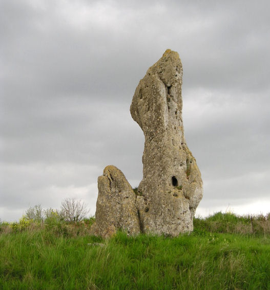
La Pierre Cornue submitted by TheCaptain on 6th May 2005. La Pierre Cornue, a more than 4 metres tall menhir.
(View photo, vote or add a comment)
Log Text: A very large menhir in disturbed ground which looks to be an old stone quarry just behind the Mairie which is just to the west of the main street a few hundred metres south of the church. The menhir is made of a strange sort of stony conglomerate and is a strange shape and contains many holes. It is more than 4 metres high 2.5 metres wide and over a metre thick at the base although the main part of the stone is about half a metre thick.
Bretteville-le-Rabet
Trip No.202 Entry No.9 Date Added: 25th Mar 2020
Site Type: Ancient Mine, Quarry or other Industry
Country: France (Normandie:Calvados (14))
Visited: Yes on 23rd Apr 2005. My rating: Condition 2 Ambience 2 Access 5
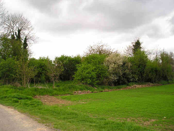
Bretteville-le-Rabet submitted by TheCaptain on 8th May 2005. Bretteville-le-Rabet flint quarries, Calvados.
I spent just 5 minutes looking around the edge of this freshly ploughed field and found four bits of worked flint, including a nice scraper tool.
(View photo, vote or add a comment)
Log Text: Not marked on any map I was told of this place by a man who collects flint artefacts I met at Cairon so I went for a quick look. Nothing much to see but the fields here were freshly ploughed and within 5 minutes of looking along the edges of the fields by the roadside I had found 4 worked flint artefacts.
La Hoguette
Trip No.202 Entry No.7 Date Added: 25th Mar 2020
Site Type: Chambered Tomb
Country: France (Normandie:Calvados (14))
Visited: Yes on 23rd Apr 2005. My rating: Condition 1 Ambience 1 Access 5
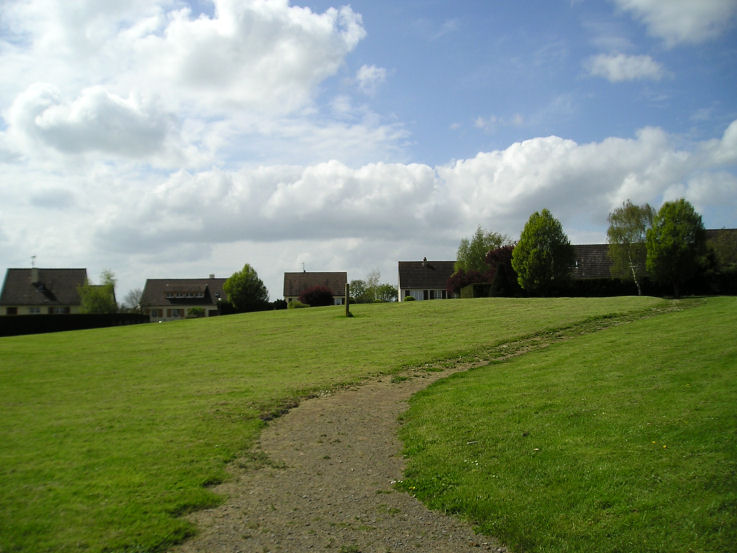
La Hoguette submitted by TheCaptain on 6th May 2005. La Hoguette Tumulus, Fontenay-le Marmion, Calvados.
Despite all my records stating that this large round tumulus with 8 passage graves no longer exists, the remains are quite easy to find within the village. It remains today as a green grassy area within a housing estate, surrounded by roads called something like Rue la Tumulus and Rue La Hoguette. There is a large diameter mound with a slight hollow in the middle, and remains of some form of signpost.
(View photo, vote or add a comment)
Log Text: Despite all records stating that this large round tumulus with 8 passage graves is no longer there the remains are quite easy to find within the village. It remains today as a green grassy area within a housing estate surrounded by roads called something like Rue la Tumulus and Rue La Hoguette. There is a large diameter mound with a slight hollow in the middle and remains of some form of signpost.
Pierre Tourneresse, Cairon
Trip No.202 Entry No.5 Date Added: 25th Mar 2020
Site Type: Chambered Tomb
Country: France (Normandie:Calvados (14))
Visited: Yes on 23rd Apr 2005. My rating: Condition 4 Ambience 4 Access 4
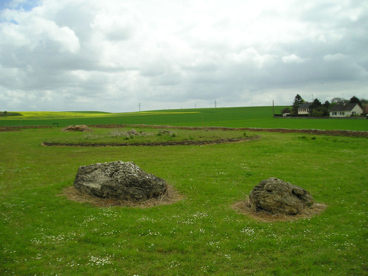
Pierre Tourneresse, Cairon submitted by thecaptain on 28th Apr 2005. Pierre Tourneresse, Cairon. Seen here looking towards the remains of the large round burial mound from beyond the two large stones which are the remains of the capstone from the main chamber - removed and destroyed by the Germans during the '39-45 war.
(View photo, vote or add a comment)
Log Text: I wasn’t expecting to find much here if anything at all as all the information I had of this site was a menhir symbol on my ign map. But as I was passing I decided to have a look anyway and luckily stopped to look at my map right by a little road at the east of the southern end of the village with a sign to “Pierre Tourneresse”. So I followed it down to the end of a little modern housing estate and parked. A further signpost at the end of the road points to Pierre Tourneresse 300 metres distant. Turn left here and stick to the back of the houses rather than go straight on up the hill.
What a lovely site this is. In a little dip down near the stream is a newly made and signposted enclosure which at the time of my visit was still under construction with a ring of trees being planted well around the outside of it. Inside the enclosure is the remains of a large approximately round cairn which has a diameter of about 19 metres and is edged all around with dry stone walling within which are two chambers.
The main chamber is large stone lined chamber in approximately the middle of the cairn which has a seven metre long entrance passage which exits to the east of the cairn at a bearing of 100° magnetic. The chamber is approximately rectangular dimensions about 4 to 5 metres in length by 3 metres in width and is made with large upright slabs with drystone walling between. At various positions around this large chamber there seem to be smaller alcoves or features. The second much smaller chamber opens to the west side and is positioned approximately opposite to the main chamber entrance with an alignment of 269°. It is about 3.5 metres long and opens up to about 2 metres in width at its maximum. It is made with drystone walling only and has a ledge of some sort along its northern side.
Outside the cairn at a distance of about 15 metres in a northwesterly direction are two very large stones. I wondered whether these were once menhirs which marked the position of the cairn (these northern French cairns are often associated with menhirs) and which would explain the marking of menhir on the ign maps. Looking at these stones more closely however suggested that it is much too wide to have been a menhir so I wondered whether the stones were the remains of the chamber capstone. I spent quite a lot of time here the place seemed to give off a nice happy atmosphere which was probably helped by the fact that for once one of these much neglected ancient Normandy monuments is being lovingly cared for and looked after what was probably many years of neglect.
As I was leaving I met a man walking his dog and asked if he knew anything about the site. By an amazing stroke of luck I had met one of the few people in France who has an interest in these ancient sites and who collects flint artefacts ! Despite the language problems we talked for about half an hour about things. He told me that the cairn had been much more complete up until the war during which the Germans had used it as a shelter and gun emplacement. As they were leaving after the D-Day invasion they went about destroying it and the two large stones are indeed the remains of the capstone to the main chamber. He also told me that an excavation of the site was done 5 years ago and the restoration has been going on since then.
We got on to discussing other sites in the region and other than the various sites I knew about (he was surprised indeed to find an Englishman who knew anything about any of these places and seemed very interested when I told him I intended to write a book) and he told me of a menhir nearby he knew which was destroyed only a couple of years ago by a farmer who didn’t want it in the middle of one of his fields. He also showed me on my map a couple of places where he goes to find flint items one of which he called a quarry. He said that if I went to one of these places he showed me then if the fields were recently ploughed I would almost certainly find some worked flint items and that he had a collection of over 700 items. He also then told me in detail how to find the two polisher stones near Mont Joly which was of great interest as I would probably not have even looked if I had no detailed information to go on. It was very nice to meet a man like this particularly on my first real day of French stonehunting and it made me think that the whole trip is going to go well.
Menhir de la Demoiselle de Bracqueville
Trip No.206 Entry No.5 Date Added: 25th Mar 2020
Site Type: Standing Stone (Menhir)
Country: France (Normandie:Calvados (14))
Visited: Yes on 28th Sep 2006. My rating: Condition 3 Ambience 3 Access 4
Menhir de la Demoiselle de Bracqueville submitted by thecaptain on 11th Oct 2006. To visit this stone, find your way from Beny-sur-Mer to the south along small tracks to Bracqueville farm. Park near to the farm, and walk about 500 metres along the track which passes in front of the farm till you get to a junction of trackways. Take the grassy track to the left, and the menhir is a further 500 metres along and just into the field on the left.
(View photo, vote or add a comment)
Log Text: Found this at last, on probably my third attempt. Find your way from Beny-sur-Mer to the south along small tracks to Bracqueville farm. Park near to the farm, and walk about 500 metres along the track which passes in front of the farm till you get to a junction of trackways. Take the grassy track to the left, and the menhir is a further 500 metres along and just into the field on the left.
Its about 1.4 metres tall, 0.7 metres wide and 0.3 metres thick, and leaning towards the north. The farmer has left very little room around it, and it has some very recent scrapes and damage done to it, no doubt from farm machinery. It is likely that this menhir often gets obscured by crops in the summer. Nice to have found it, its a nice stone. Stupidly I forgot to take my gps with me to get a proper position.
Menhir dit Pierre Debout (Reviers)
Trip No.206 Entry No.6 Date Added: 25th Mar 2020
Site Type: Standing Stone (Menhir)
Country: France (Normandie:Calvados (14))
Visited: Yes on 28th Sep 2006. My rating: Condition 2 Ambience 3 Access 4

Menhir dit Pierre Debout (Reviers) submitted by thecaptain on 29th Dec 2005. Reviers menhir.
Just inland from the D-Day beaches can be found (when the crops are down) the sad remains of this menhir.
(View photo, vote or add a comment)
Log Text: As I am right here and passing by, thought I may as well stop and take a look in the daylight. The crops in the field are growing, or more likely its been left fallow, but the ploughs have been right up to the stone and its fairly difficult to spot, even with this small growth. The poor stone is in a very sorry state, and could do with some TLC. Shame its so woefully looked after, so close to the well maintained large barrow.
Colombiers-sur-Seulles tumulus
Trip No.202 Entry No.2 Date Added: 25th Mar 2020
Site Type: Chambered Tomb
Country: France (Normandie:Calvados (14))
Visited: Yes on 23rd Apr 2005. My rating: Condition 4 Ambience 4 Access 5
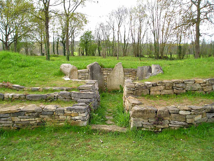
Colombiers-sur-Seulles tumulus submitted by TheCaptain on 7th May 2005. Colombiers-sur-Seulles tumulus, Calvados.
The circular burial chamber in the northern side of the mound.
(View photo, vote or add a comment)
Log Text: A long barrow which has been excavated and destroyed several times in the past but which has recently been restored to some form of its former glory by local enthusiasts. It is situated about half a kilometre east of the village just beyond the menhir signposted in a little copsed area just south of the road.
The barrow is about 50 metres in length and about 9 metres in width at the narrow west end and 18 metres width at the wide eastern end with an orientation of 280°. It is about 5 metres in height at its maximum and has several drystone walled sections running around it. In the middle of the mound is a little circular burial chamber about 2.5 metres in diameter with its entrance chamber running from the north side at an orientation of 010°. The chamber is made using 6 large upright stones with drystone walling between them but how much is now original is not known. The view along the entrance chamber does not see over the local horizon which is just a hundred metres or so distant. At the smaller western end there is a pair of large upright stones set into the external wall and as far as I can find once formed the entrance to another smaller burial chamber.
This is obviously now a well looked after and cared for monument set within a fenced off area using rustic fencing and also within the area are a mock up of an ancient oven and some hearths. with drystone walling between them but how much is now original is not known.
Menhir des Demoiselles (Colombiers-sur-Seulles)
Trip No.202 Entry No.1 Date Added: 25th Mar 2020
Site Type: Standing Stone (Menhir)
Country: France (Normandie:Calvados (14))
Visited: Yes on 23rd Apr 2005. My rating: Condition 3 Ambience 3 Access 5

Menhir des Demoiselles (Colombiers-sur-Seulles) submitted by thecaptain on 28th Apr 2005. Just over 2 metres in height, this menhir is set in its own little grassy area beside the road junction just uphill to the east of the village. It is a square pillar with several holes and indentations, and has been broken in the past at both top and bottom (probably during the war) and is now remounted on a concrete post. While I was here it was sunny between the clouds, there was a bike race going on past the stone, and an old warplane flying above, which all added to a nice French rural scen...
(View photo, vote or add a comment)
Log Text: Just over 2 metres in height this menhir is set in its own little grassy area beside the road junction just uphill to the east of the village. It is a square pillar with several holes and indentations and has been broken in the past at both top and bottom (probably during the war) and is now remounted on a concrete post.
While I was here it was sunny between the clouds there was a bike race going on past the stone and an old warplane flying above which all added to a nice French rural scene
Pierre Dialan
Trip No.201 Entry No.5 Date Added: 25th Mar 2020
Site Type: Burial Chamber or Dolmen
Country: France (Normandie:Calvados (14))
Visited: Yes on 21st Nov 2004
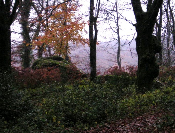
Pierre Dialan submitted by thecaptain on 9th Dec 2004. Dolmen la Pierre Dialan, Jurques, Calvados, France.
Seen on a wet afternoon through the forest, this is the best I got to see this pile of old stones, using a telephoto lens. All the local villagers were out having a hunt through the woods, and straying from the track through the forest was distinctly disencouraged.
(View photo, vote or add a comment)
Log Text: To the south of the village of Jurques the D.577 road curves its way up and over a forested ridge. At the top of this hill to the east of the road is a small picnic site and a signpost to La Pierre Dialan dolmen, highlighted as a tourist place on the IGN maps. Walk about 500 metres along the track through the forest and on the right, just before the woods end, about 40 metres from the path can be seen a pile of large stones, now becoming closely surrounded by a very large gravel quarry cutting its way into the hillside.
Unfortunately I cannot be 100% sure that this is the actual Dolmen, as on the day of my visit, in pouring rain, there was a hunt going on, with many men out with their dogs, rifles and horns. Although the huntsmen would let me walk down the forest track, I was warned not to stray from the path, unless I wanted to be shot, so I couldn’t get to see the Pierre Dialan properly !
It was disappointing to not get to see the stones, but an interesting wet afternoon in the forest nonetheless, which caused much amusement telling the story to my waiting sister and nephew in the car at the picnic site. I have since found some information which says that this is possibly a natural rock outcrop.
Autel des Druides des Moitiers d'Allonne
Trip No.201 Entry No.19 Date Added: 25th Mar 2020
Site Type: Passage Grave
Country: France (Normandie:Manche (50))
Visited: Yes on 22nd Nov 2004. My rating: Condition 3 Ambience 3 Access 4

Autel des Druides des Moitiers d'Allonne submitted by thecaptain on 20th Dec 2004. Autel des Druides des Moitiers d'Allonne Allée Couverte in Manche, Normandy, as seen from the west at the entrance to its field.
(View photo, vote or add a comment)
Log Text: To the east of Moitiers d'Allonne, just a few miles northeast of Barneville-Carteret, can be found “Autel des Druides des Moitiers d'Allonne”, also known as the Allée Couverte de Grand Breuil. Situated near the top of a hill along a small road north of the D.902, this monument can be found signposted down a farm trackway, but finding anywhere to park in the vicinity was not easy. It is also signposted from the village of Les Moitiers d'Allonne.
Approximately 20 metres in length, and on a north – south axis, this Allée Couverte was rebuilt in the 1960’s after having been partially buried and used as a cattle shelter. The width between the two rows of stones is about 1.5 to 2 metres, and there are at least 6 capstones in place with a height of about 1.5 metres underneath. When I was there, the Northern half of the Allée was clear of vegetation and open to get inside, while the southern half was in a very overgrown state. The surrounding field had been ploughed right up to the edges of the monument, and in some places at the south end damage had occurred.
Pierre au Rey
Trip No.201 Entry No.18 Date Added: 25th Mar 2020
Site Type: Burial Chamber or Dolmen
Country: France (Normandie:Manche (50))
Visited: Yes on 22nd Nov 2004. My rating: Condition 3 Ambience 4 Access 5

Pierre au Rey submitted by thecaptain on 6th Dec 2004. La Pierre au Rey dolmen on the clifftops at Flamanville in Normandie, seen in its cafe garden from the southeast. The stones in the foreground are thought to have once been part of an entrance structure.
(View photo, vote or add a comment)
Log Text: Perched high on the cliff top near Cap de Flamanville can be found this strange antiquity, situated in the small garden behind a café, right on the cliff edge. Easily found to the west of Flamanville, just follow signs to “Semaphore” and where the road runs out there is a car park and picnic site as well as the café.
It consists of four large rounded rocks, and doesn’t look like any other dolmen I have ever seen. At first, the rocks look like natural big rounded pebbles, in some kind of pile, but how did they get there like that ? Closer inspection reveals several other stones on the landward side, obviously placed in their position, which would have at one point formed some kind of entranceway to the main chamber, which consists of three large rocks forming a triangular shape, with the fourth rock balanced on top.
A couple of the large rocks have carvings on them, including a human form on the top boulder, but it is unknown as to whether these carvings are ancient or from more modern times, when it was used as a lookout point by the customs men. Some theories suggest that this is not a dolmen in the usual sense of the word, but some kind of ancient seagoing navigational mark.
There were in years gone past, other megalithic monuments in this area, in the form of large menhirs now destroyed, but of which the names and records survive. One of these called La Pierre-aux-Serpents, was 9 metres in height, but was destroyed around 1725 during construction of the chateau. Another, to the southeast at Percaillerie, was 5 metres in height but destroyed in 1890. It is also thought that there may once have been another of these cliff top dolmens at Corb to the north, destroyed before 1880 and of which no trace remains today under the nuclear power station.
Fort Joret allée couverte
Trip No.201 Entry No.16 Date Added: 25th Mar 2020
Site Type: Passage Grave
Country: France (Normandie:Manche (50))
Visited: Yes on 22nd Nov 2004. My rating: Condition 2 Ambience 3 Access 4
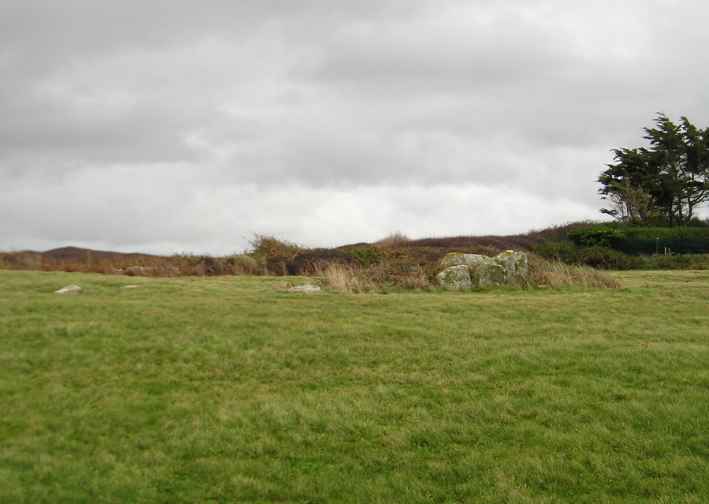
Fort Joret allée couverte submitted by thecaptain on 21st Jan 2005. Allée Couverte de Fort Joret, Fermanville, Manche.
The view from the coastal footpath along the edge of the beach from the south.
(View photo, vote or add a comment)
Log Text: In a field overlooking the sea, with splendid views over the rocky beach, can be found the remains of this very ruinous Allée Couverte. It is about 500 metres along the coast path to the southwest of Fort Joret, in the Commune de Fermanville, just a few miles east of Cherbourg.
Estimated to have originally been about 17 metres in length, it runs in a north to south direction. The northern part of the remains are very ruined, with only a few stones here and there laying on the ground. The southern part of the tomb is in much better, but still very ruined and overgrown condition, and difficult to get to see in detail. The width of this part is much greater than the northern part, of the order 2.5 metres, and several large slabs remain in position.
Pierre Plantée (Cosqueville)
Trip No.201 Entry No.15 Date Added: 25th Mar 2020
Site Type: Standing Stone (Menhir)
Country: France (Normandie:Manche (50))
Visited: Yes on 22nd Nov 2004. My rating: Condition 3 Ambience 3 Access 4
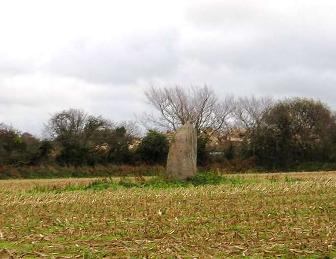
Pierre Plantée (Cosqueville) submitted by thecaptain on 30th Dec 2004. La Pierre Plantée, Cosqueville, Manche.
Side on view of this 3 metre tall stone, looking roughly south, and the quarry workings can be seen behind the hedge.
(View photo, vote or add a comment)
Log Text: In a field to the south of the road running east out of Cosqueville can be seen this large menhir, 3 metres in height. It is possible to park nearby, and I walked round the edge of a field to get a nearer view of the stone which is in the middle of a field beside a quarry. It is a nicely shaped stone, looking to be wider at the top than the bottom, with a sort of nob on the top, and with grooves running down its sides, probably due to rain erosion.
La Haute Pierre (St-Pierre-Eglise)
Trip No.201 Entry No.14 Date Added: 25th Mar 2020
Site Type: Standing Stone (Menhir)
Country: France (Normandie:Manche (50))
Visited: Yes on 22nd Nov 2004. My rating: Condition 3 Ambience 3 Access 3

La Haute Pierre (St-Pierre-Eglise) submitted by thecaptain on 22nd Dec 2004. In a field to the northeast of St-Pierre-Eglise is this large menhir, almost 3 metres in height. Getting closer would have meant walking through an absolute stinking swamp at the field gateway. So I satisfied myself with a long distance view.
(View photo, vote or add a comment)
Log Text: In a field to the northeast of St-Pierre-Eglise can be seen this large menhir, almost 3 metres in height. It is probably possible to get to fairly nearby, but it would have meant walking through an absolute stinking swamp caused by cattle at the field gateway. So I satisfied myself with a long distance view from the higher road beside a small chapel, a distance of about 100 metres for my photograph.
