

<< Our Photo Pages >> La Haute Pierre (St-Pierre-Eglise) - Standing Stone (Menhir) in France in Normandie:Manche (50)
Submitted by TheCaptain on Sunday, 06 January 2008 Page Views: 6326
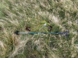
Neolithic and Bronze AgeSite Name: La Haute Pierre (St-Pierre-Eglise) Alternative Name: Mariage des Trois PrincessesCountry: France Département: Normandie:Manche (50) Type: Standing Stone (Menhir)
Nearest Town: Cherbourg Nearest Village: St-Pierre-Eglise
Latitude: 49.680232N Longitude: 1.390534W
Condition:
| 5 | Perfect |
| 4 | Almost Perfect |
| 3 | Reasonable but with some damage |
| 2 | Ruined but still recognisable as an ancient site |
| 1 | Pretty much destroyed, possibly visible as crop marks |
| 0 | No data. |
| -1 | Completely destroyed |
| 5 | Superb |
| 4 | Good |
| 3 | Ordinary |
| 2 | Not Good |
| 1 | Awful |
| 0 | No data. |
| 5 | Can be driven to, probably with disabled access |
| 4 | Short walk on a footpath |
| 3 | Requiring a bit more of a walk |
| 2 | A long walk |
| 1 | In the middle of nowhere, a nightmare to find |
| 0 | No data. |
| 5 | co-ordinates taken by GPS or official recorded co-ordinates |
| 4 | co-ordinates scaled from a detailed map |
| 3 | co-ordinates scaled from a bad map |
| 2 | co-ordinates of the nearest village |
| 1 | co-ordinates of the nearest town |
| 0 | no data |
Internal Links:
External Links:
I have visited· I would like to visit
TheCaptain visited on 22nd Nov 2004 - their rating: Cond: 3 Amb: 3 Access: 3 In a field to the northeast of St-Pierre-Eglise can be seen this large menhir, almost 3 metres in height. It is probably possible to get to fairly nearby, but it would have meant walking through an absolute stinking swamp caused by cattle at the field gateway. So I satisfied myself with a long distance view from the higher road beside a small chapel, a distance of about 100 metres for my photograph.
 (PID:36005)")
It is possible to see across a couple of fields from a parking place near to the little Chapelle Notre Dame at Hacouville, where there is a little noticeboard. Given good dry conditions, and empty fields, an approach right to the stone can be made, but be careful with the dodgy gate !
The legend of the "Three Princesses" states that they were all once about to get married, and that they had a great dowry treasure. The three princesses somehow ended up getting turned to stone, and their dowry is buried somewhere in the middle of the triangle formed by them. At this place there is now a lake, which it is said to have been formed because of all the digging taken place there in search of the treasure !
Wikipedia article
Sites mégalithiques de la Manche
You may be viewing yesterday's version of this page. To see the most up to date information please register for a free account.
 (PID:36004)")
 (PID:36003)")
 (PID:36002)")
 (PID:36001)")
 (PID:191657)")
 (PID:11071)")
Do not use the above information on other web sites or publications without permission of the contributor.
Click here to see more info for this site
Nearby sites
Click here to view sites on an interactive map of the areaKey: Red: member's photo, Blue: 3rd party photo, Yellow: other image, Green: no photo - please go there and take one, Grey: site destroyed
Download sites to:
KML (Google Earth)
GPX (GPS waypoints)
CSV (Garmin/Navman)
CSV (Excel)
To unlock full downloads you need to sign up as a Contributory Member. Otherwise downloads are limited to 50 sites.
Turn off the page maps and other distractions
Nearby sites listing. In the following links * = Image available
1.2km WSW 249° La Longue Pierre (St-Pierre-Eglise)* Standing Stone (Menhir)
1.6km NNW 333° Pierre Plantée (Cosqueville)* Standing Stone (Menhir)
1.7km N 2° Trigalle dolmen* Burial Chamber or Dolmen
1.8km NW 326° Le Cul du Diable* Standing Stone (Menhir)
3.3km ENE 63° Menhir d'Austhot Standing Stone (Menhir)
3.3km WNW 297° Menhir des Casernes Standing Stone (Menhir)
3.6km WSW 247° Divises de Carneville Stone Circle
4.0km W 278° La Pierre aux Magniants Standing Stone (Menhir)
4.0km WNW 298° Fort Joret allée couverte* Passage Grave
4.3km WSW 245° La Longue Pierre (Carneville) Standing Stone (Menhir)
5.1km W 274° La Longue Pierre Ferrant Standing Stone (Menhir)
7.1km WSW 248° Maupertus menhir* Modern Stone Circle etc
7.6km WSW 248° Grande et Petite Pierre* Standing Stones
9.4km WSW 247° Bretteville Allée Couverte* Passage Grave
12.6km WSW 244° Allée Couverte de Tourlaville Passage Grave
12.8km SW 231° Menhirs du Mesnil-Auval Standing Stones
12.9km S 187° Les Grises Pierres* Standing Stones
13.1km S 186° Montaigu-la-Brisette dolmen Burial Chamber or Dolmen
14.7km WSW 242° Truffert Dolmen Burial Chamber or Dolmen
16.0km WSW 250° Maupas menhirs Standing Stones
17.3km WSW 240° Menhirs de la Glacerie* Standing Stones
17.8km WSW 239° Pierre Butée de Tourlaville Standing Stone (Menhir)
18.3km WSW 258° Musée d'Histoire Naturelle Museum
19.5km SSE 161° Menhir de Quinéville Standing Stone (Menhir)
20.7km WSW 245° Roche a Trois Pieds* Burial Chamber or Dolmen
View more nearby sites and additional images


 We would like to know more about this location. Please feel free to add a brief description and any relevant information in your own language.
 Wir möchten mehr über diese Stätte erfahren. Bitte zögern Sie nicht, eine kurze Beschreibung und relevante Informationen in Deutsch hinzuzufügen.
 Nous aimerions en savoir encore un peu sur les lieux. S'il vous plaît n'hesitez pas à ajouter une courte description et tous les renseignements pertinents dans votre propre langue.
 Quisieramos informarnos un poco más de las lugares. No dude en añadir una breve descripción y otros datos relevantes en su propio idioma.