<< Our Photo Pages >> Langrais menhirs - Standing Stones in France in Normandie:Calvados (14)
Submitted by TheCaptain on Tuesday, 14 January 2014 Page Views: 5773
Neolithic and Bronze AgeSite Name: Langrais menhirs Alternative Name: Menhirs des Longrais, Menhirs la Brêche au DiableCountry: France Département: Normandie:Calvados (14) Type: Standing Stones
Nearest Town: Falaise Nearest Village: Soumont-St-Quentin
Latitude: 48.968300N Longitude: 0.2097W
Condition:
| 5 | Perfect |
| 4 | Almost Perfect |
| 3 | Reasonable but with some damage |
| 2 | Ruined but still recognisable as an ancient site |
| 1 | Pretty much destroyed, possibly visible as crop marks |
| 0 | No data. |
| -1 | Completely destroyed |
| 5 | Superb |
| 4 | Good |
| 3 | Ordinary |
| 2 | Not Good |
| 1 | Awful |
| 0 | No data. |
| 5 | Can be driven to, probably with disabled access |
| 4 | Short walk on a footpath |
| 3 | Requiring a bit more of a walk |
| 2 | A long walk |
| 1 | In the middle of nowhere, a nightmare to find |
| 0 | No data. |
| 5 | co-ordinates taken by GPS or official recorded co-ordinates |
| 4 | co-ordinates scaled from a detailed map |
| 3 | co-ordinates scaled from a bad map |
| 2 | co-ordinates of the nearest village |
| 1 | co-ordinates of the nearest town |
| 0 | no data |
Internal Links:
External Links:
I have visited· I would like to visit
TheCaptain visited on 7th May 2012 - their rating: Cond: 4 Amb: 3 Access: 4 Having had a good look at the IGN 1:25000 map, I saw that there is a trackway running east from the road south of Mont Joly, which runs from the bottom of the hill diagonally up to the approximate position of the stones. Even better, when arriving there for a look, the trackway was open and easily driveable, and so I took this option on this showery afternoon, and when emerging from below the wood at the top of the hill, there was plenty of space to park amongst a large composting area! Left Dad in the car while I went out into the wind and drizzle to find the stones, and there they were, just round the back of the big pile of manure!
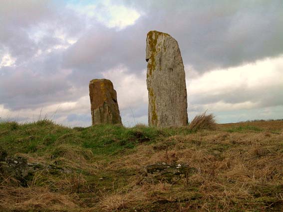
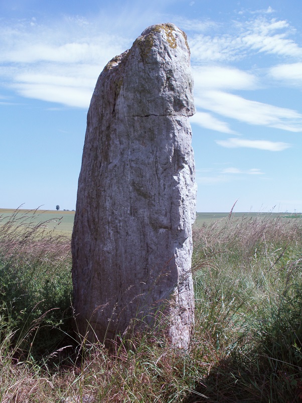
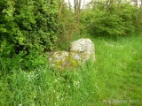
The two stones stand at the edge of an open rocky outcrop at the top of the hill, covered in wildflowers at this time of year, but I learned that the stones are not in their original positions, having been moved there by the farmer at some point in the past. The two stones are very different, the larger stone being a whitish quartz type stone, between 3.5 nd 4 metres tall, while its shorter neighbour is a reddish colour, and only about 1.6 metres tall. There are plently of other large lumps of stone laying about here, which may have been broken from the two menhirs, or just other examples of field clearance.
On the way down from the stones, through a gateway into the wood I could see another rocky outcrop with various large stones standing around, a couple of them probably at least 2 metres tall. This was all now made into a nice garden feature, but is there any ancient significance to the stones? Back onto the road, and I noticed it was called Route des Menhirs, and up towards the top of the hill there was another garden with some large rocks standing in it.
Onto the top of Mont Joly, and it is clear that there are large rocks all over the place, and it is easy to imagine that thee was once an alignement of large stones running along the top of the hill into the ancient settlement. Walking along the edge of the field, and then the pathway to the end of the promontary, and large stones can be seen laying around everywhere, many clearly not just a local outcropping of rock, but various shapes, sizes and types of stone. Many of these rocks were now incorporated into garden features, but many more are just laying there, slowly getting buried by the undergrowth. It really is a fascinating area, and I do wonder what a proper survey of this ancient hilltop would turn up.
johnstone visited on 24th Jun 2009 - their rating: Cond: 4 Amb: 3 Access: 4
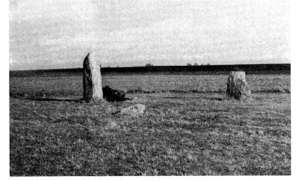
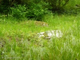
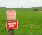
TheCaptain saw from a distance on 23rd Apr 2005 Two large menhirs in a field to the east of the village near Mont Joly but which are 500 metres from the road across a field surrounded by barbed wire and with very clear keep out signs. One of the two menhirs stands 3.6 metres high while the other is fallen.
In the region around here are many other large stones some of which may well be fallen menhirs and indeed perhaps a row can be determined in the lane called “Route des Menhirs”.
Average ratings for this site from all visit loggers: Condition: 4 Ambience: 3 Access: 4
Having had a good look at the IGN 1:25000 map, I saw that there is a trackway running east from the road south of Mont Joly, which runs from the bottom of the hill diagonally up to the approximate position of the stones. Even better, when arriving there for a look, the trackway was open and easily driveable, and so I took this option on this showery afternoon, and when emerging from below the wood at the top of the hill, there was plenty of space to park amongst a large composting area!
Left Dad in the car while I went out into the wind and drizzle to find the stones, and there they were, just round the back of the big pile of manure! The two stones stand at the edge of an open rocky outcrop at the top of the hill, covered in wildflowers at this time of year, but I learned that the stones are not in their original positions, having been moved there by the farmer at some point in the past.
The two stones are very different, the larger stone being a whitish quartz type stone, between 3.5 and 4 metres tall, while its shorter neighbour is a reddish colour, and only about 1.6 metres tall. There are plently of other large lumps of stone laying about here, which may have been broken from the two menhirs, or just other examples of field clearance.
On the way down from the stones, through a gateway into the wood I could see another rocky outcrop with various large stones standing around, a couple of them probably at least 2 metres tall. This was all now made into a nice garden feature, but is there any ancient significance to the stones? Back onto the road, and I noticed it was called Route des Menhirs, and up towards the top of the hill there was another garden with some large rocks standing in it.
Onto the top of Mont Joly, and it is clear that there are large rocks all over the place, and it is easy to imagine that there was once an alignement of large stones running along the top of the hill into the ancient settlement. Walking along the edge of the field, and then the pathway to the end of the promontary, and large stones can be seen laying around everywhere, many clearly not just a local outcropping of rock, but various shapes, sizes and types of stone. Many of these rocks were now incorporated into garden features, but many more are just laying there, slowly gettng buried by the undergrowth.
It really is a fascinating area, nearby are fields/lieu-dits with names "les menhirs" to the east and "La Pierre" to the south. I do wonder what a proper survey of this ancient hilltop and surrounds would turn up.
Base Mérimée (Historic Monument)
You may be viewing yesterday's version of this page. To see the most up to date information please register for a free account.


Do not use the above information on other web sites or publications without permission of the contributor.
Click here to see more info for this site
Nearby sites
Click here to view sites on an interactive map of the areaKey: Red: member's photo, Blue: 3rd party photo, Yellow: other image, Green: no photo - please go there and take one, Grey: site destroyed
Download sites to:
KML (Google Earth)
GPX (GPS waypoints)
CSV (Garmin/Navman)
CSV (Excel)
To unlock full downloads you need to sign up as a Contributory Member. Otherwise downloads are limited to 50 sites.
Turn off the page maps and other distractions
Nearby sites listing. In the following links * = Image available
875m WNW 285° Mont Joly* Ancient Village or Settlement
942m W 277° Bons Tassilly polissoirs* Polissoir
2.7km E 89° Menhir d'Olendon* Standing Stone (Menhir)
3.6km S 180° Menhir de Soulangy* Standing Stone (Menhir)
6.0km SW 230° Menhir de la Grurie* Standing Stone (Menhir)
6.0km WSW 249° Pierre du Pôt* Standing Stone (Menhir)
7.3km NNW 331° Bretteville-le-Rabet* Ancient Mine, Quarry or other Industry
8.1km WSW 240° Menhir dit Pierre de la Hoberie* Standing Stone (Menhir)
8.7km WNW 291° La Roche Piquée (St-Germain-le-Vasson)* Standing Stone (Menhir)
8.8km NE 42° La Butte du Hu* Chambered Cairn
8.8km NE 43° Tumuli de Condé-sur-Ifs* Chambered Cairn
10.2km NE 36° La Pierre Cornue* Standing Stone (Menhir)
10.6km NW 308° Pierre Tourneresse (Gouvix)* Standing Stone (Menhir)
14.9km NW 311° Pierre Tournante (Fresnay-le-Puceux)* Standing Stone (Menhir)
16.9km WSW 255° Mégalithe du Pré-du-Vivret* Burial Chamber or Dolmen
17.7km NW 324° La Hoguette* Chambered Tomb
18.0km NW 322° La Hogue* Chambered Tomb
18.3km S 170° Dolmen dit Pierre-aux-Bignes* Burial Chamber or Dolmen
18.3km S 170° Tumulus des Hogues* Round Barrow(s)
18.8km SE 143° Camp Celtique de Bière* Ancient Village or Settlement
18.9km SSW 207° Val d'Orne menhir Standing Stone (Menhir)
18.9km SSW 207° Pierre de la Roussellière* Standing Stone (Menhir)
19.8km SE 130° Dolmen dit Pierre-Levée (Fontaine)* Burial Chamber or Dolmen
21.8km SW 226° La Demoiselle de Roufit Standing Stone (Menhir)
22.5km SE 129° Trun menhir Standing Stone (Menhir)
View more nearby sites and additional images


 We would like to know more about this location. Please feel free to add a brief description and any relevant information in your own language.
 Wir möchten mehr über diese Stätte erfahren. Bitte zögern Sie nicht, eine kurze Beschreibung und relevante Informationen in Deutsch hinzuzufügen.
 Nous aimerions en savoir encore un peu sur les lieux. S'il vous plaît n'hesitez pas à ajouter une courte description et tous les renseignements pertinents dans votre propre langue.
 Quisieramos informarnos un poco más de las lugares. No dude en añadir una breve descripción y otros datos relevantes en su propio idioma.