Contributory members are able to log private notes and comments about each site
Sites SandyG has logged. View this log as a table or view the most recent logs from everyone
South Yarrows Long Cairn
Date Added: 2nd Feb 2019
Site Type: Chambered Cairn
Country: Scotland (Caithness)
Visited: Yes on 10th Aug 2014. My rating: Condition 3 Ambience 5 Access 3
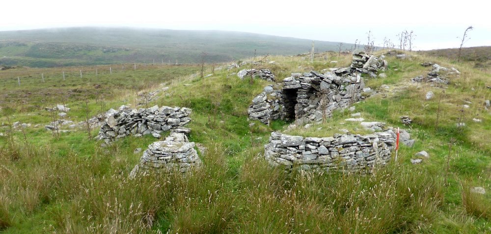
South Yarrows Long Cairn submitted by SandyG on 25th Aug 2014. The eastern horns and entrance. View from above and east. (10th August 2014).
(View photo, vote or add a comment)
Log Text: None
South Yarrows round house
Date Added: 2nd Feb 2019
Site Type: Ancient Village or Settlement
Country: Scotland (Caithness)
Visited: Yes on 10th Aug 2014. My rating: Condition 2 Ambience 5 Access 3
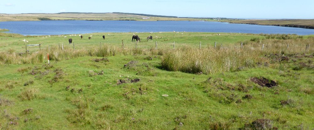
South Yarrows round house submitted by SandyG on 27th Aug 2014. View from south of the round houses. The smaller later house is filled with rushes.
(View photo, vote or add a comment)
Log Text: None
South Ythsie
Date Added: 30th Jan 2019
Site Type: Stone Circle
Country: Scotland (Aberdeenshire)
Visited: Yes on 21st Sep 2014. My rating: Condition 4 Ambience 3 Access 4
South Ythsie submitted by SandyG on 2nd Jan 2015. View from west (21st September 2014).
(View photo, vote or add a comment)
Log Text: None
Spurrell's Cross
Date Added: 14th Feb 2020
Site Type: Ancient Cross
Country: England (Devon)
Visited: Yes on 9th Mar 2013. My rating: Condition 3 Ambience 5 Access 3
Spurrell's Cross submitted by cazzyjane on 8th Aug 2012. Spurrell's Cross, Ugborough Moor, Dartmoor.
(View photo, vote or add a comment)
Log Text: None
Spurrells Cross Row
Date Added: 29th Jan 2019
Site Type: Multiple Stone Rows / Avenue
Country: England (Devon)
Visited: Yes on 9th Mar 2013. My rating: Condition 2 Ambience 4 Access 3
Spurrells Cross Row submitted by SandyG on 28th Feb 2015. This row is being enveloped by encroaching moorland grass and gorse. At this rate within a few years it will not longer be visible (9th March 2013).
(View photo, vote or add a comment)
Log Text: Car parking is available at SX 64338 59550. Follow the bridleway heading east for 1.4km. The row is on the southern side of the bridleway.
Squallacombe Centre
Date Added: 23rd Jan 2019
Site Type: Multiple Stone Rows / Avenue
Country: England (Somerset)
Visited: Yes on 26th Apr 2018. My rating: Condition 3 Ambience 4 Access 2
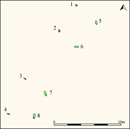
Squallacombe Centre submitted by SandyG on 23rd Jan 2019. Plan of Squallacombe stone row showing the position of the numbered stones. Recumbent stones shown green (Source: 1:200 survey by Sandy Gerrard).
(View photo, vote or add a comment)
Log Text: Car parking is available at SS 73232 37261. From here head north east towards a gateway at SS 73624 37656. Head north to the stones taking care when descending and ascending the steep hillslopes.
St Blane's Chapel (Isle of Bute)
Date Added: 16th Feb 2020
Site Type: Ancient Cross
Country: Scotland (Isle of Bute)
Visited: Yes on 25th Aug 2017. My rating: Condition 3 Ambience 4 Access 4
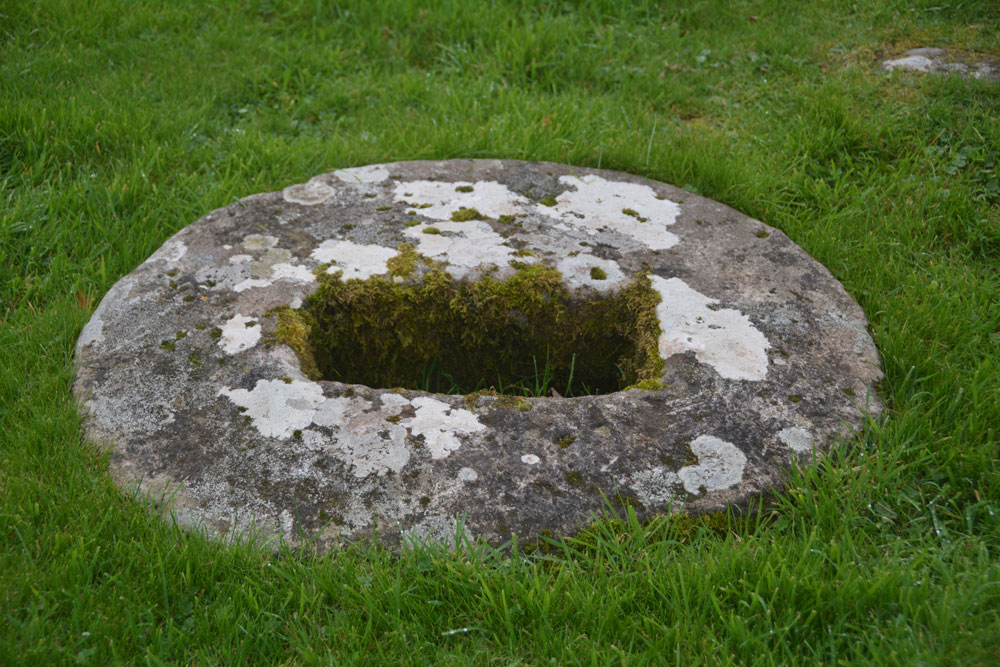
St Blane's Chapel (Isle of Bute) submitted by Anne T on 8th Oct 2017. This cross-base/socket stone is embedded within the ground in the lower (southern part) of the graveyard. There is apparently another cross base 70m north of the chancel, although we were unable to find this.
(View photo, vote or add a comment)
Log Text: None
St Elvis Farm
Date Added: 9th Dec 2021
Site Type: Chambered Tomb
Country: Wales (Pembrokeshire)
Visited: Yes on 18th Jun 2021. My rating: Condition 3 Ambience 2 Access 3
St Elvis Farm submitted by Adam Stanford on 18th Nov 2004. Located on a N-W facing slope, the tomb is one of three coastal burial sites in south-west Wales which appear to have been purposely concealed from the sea. A ‘double cromlech’ with 2 capstones is supported by two uprights. There are traces of a mound between both chambers and on the western side of the western chamber. However, both structures are today badly damaged. During the latter years of the 19th century, a tenant farmer from nearby St Elvis Farm was asked to stop ‘blasting’ bits...
(View photo, vote or add a comment)
Log Text: Looking rather overgrown compared to the other photographs on here.
St Ninian's Isle
Date Added: 9th Feb 2020
Site Type: Ancient Village or Settlement
Country: Scotland (Shetland)
Visited: Yes on 11th Jun 2019. My rating: Condition 3 Ambience 5 Access 3
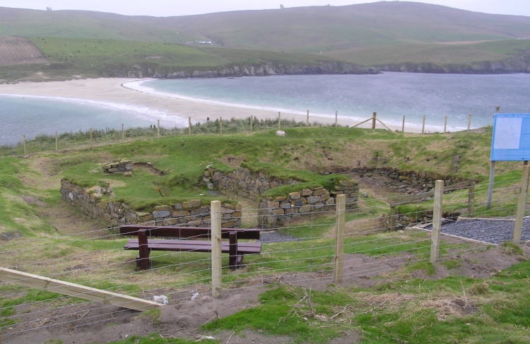
St Ninian's Isle submitted by pab on 17th Nov 2006. St Ninian’s Isle lies off the western coast of the most southerly part of the Shetland Mainland. It is linked to the mainland by a beautiful stretch of sand (called a tombola), which locals advised us would only be covered by the sea in extreme storms every decade or so. It is an absolutely wonderful place.
St Ninian’s Isle was the site of a valuable find of a hoard of ecclesiastical silver-ware in July 1958, and it was also found to have been in use through the Iron and Bronze ages.
...
(View photo, vote or add a comment)
Log Text: The site is not sign-posted from the adjacent footpath.
St Piran's Cross
Date Added: 13th Feb 2020
Site Type: Ancient Cross
Country: England (Cornwall)
Visited: Yes on 13th Sep 2019. My rating: Condition 4 Ambience 5 Access 2
St Piran's Cross submitted by Thorgrim on 10th Dec 2003. Difficult to find amid the dunes of Penhale Sands, this 8 foot cross stands close to the sand-buried church of St Piran's Oratory. This is the earliest recorded stone cross in Cornwall and is dedicated to its patron saint and that of tinners and miners.
Near Perranporth at SW7720 5646
(View photo, vote or add a comment)
Log Text: None
St. Piran's Lost Oratory
Date Added: 13th Feb 2020
Site Type: Early Christian Sculptured Stone
Country: England (Cornwall)
Visited: Yes on 13th Sep 2019. My rating: Condition 2 Ambience 4 Access 2
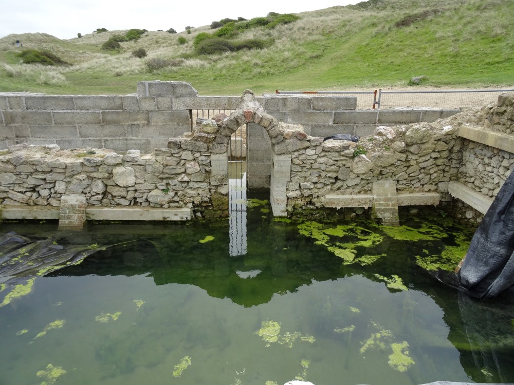
St. Piran's Lost Oratory submitted by AngieLake on 9th May 2019. A sad sight these days, but good to have a record of the tiny Oratory as it was on 3rd May 2019.
(View photo, vote or add a comment)
Log Text: None
Stalldon Row
Date Added: 27th Jan 2019
Site Type: Stone Row / Alignment
Country: England (Devon)
Visited: Yes on 6th Apr 2013. My rating: Condition 4 Ambience 5 Access 3
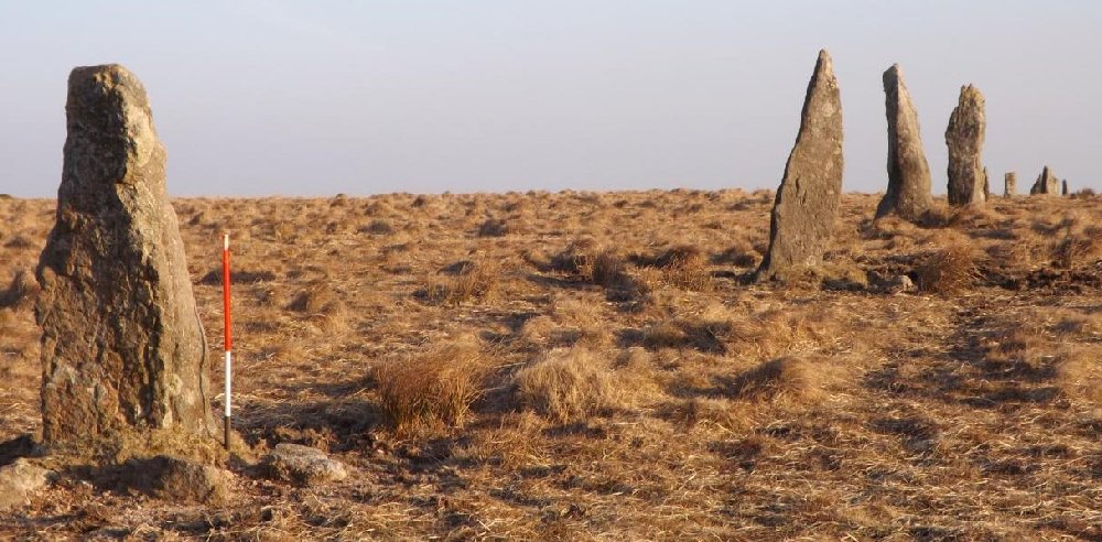
Stalldon Row submitted by SandyG on 11th Sep 2014. The northern length of the stone row. View from north west.
(View photo, vote or add a comment)
Log Text: When visited in 2013 car parking was available at SX 62524 61120. Recently (2016) this car parking area has been closed making it much more difficult to access this part of the moor. The alternative car parking location is at SX 64342 59548. From here the easiest way to reach the row is probably to head north alongside the River Erme which will need to be crossed at some point. A decent map and reliable GPS will be essential.
Stalldown South East
Date Added: 28th Jan 2019
Site Type: Stone Row / Alignment
Country: England (Devon)
Visited: Yes on 2nd May 2018. My rating: Condition 3 Ambience 4 Access 3
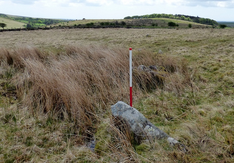
Stalldown South East submitted by SandyG on 29th Jan 2019. View from north of Stone 1 (Scale 1m).
(View photo, vote or add a comment)
Log Text: Following closure of the New Waste car park very limited parking is available at SX 62100 60913. From here walk up the road to SX 62784 61273 and follow the footpath to the right to SX 63560 61141. From here it is a short walk downslope to the row.
Standing Stone Near Cairn at Head of Drizzlecombe Row 4
Date Added: 5th Feb 2020
Site Type: Standing Stone (Menhir)
Country: England (Devon)
Visited: Yes on 7th Sep 2019. My rating: Condition 4 Ambience 4 Access 3
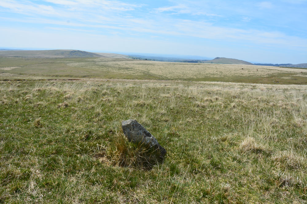
Standing Stone Near Cairn at Head of Drizzlecombe Row 4 submitted by Anne T on 1st Jun 2019. This photo is taken just from the SSW of the stone, showing its north-north-eastern face.
(View photo, vote or add a comment)
Log Text: Car parking is available at SX 57887 67306. The stone stands near to the cairn at the top of the row which is about 1400m east of the car park across open moorland.
Standingstone Rigg
Date Added: 29th Jan 2019
Site Type: Stone Row / Alignment
Country: England (Northumberland)
Visited: Yes on 23rd Jun 2018. My rating: Condition 2 Ambience 4 Access 2
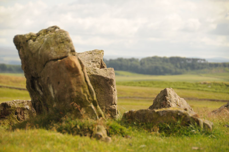
Standingstone Rigg submitted by Anne T on 15th Jul 2014. This photograph is taken from the top of Standingstone Rigg looking south east. The pairing of the stones is identifiable.
(View photo, vote or add a comment)
Log Text: Limited car parking is available at NY 83118 75082. From here follow the track south looking out for the small four-stone circle at NY 82942 74717. Follow the track past Great Lonbrough and onto the access land at NY 81612 73313. From here it is a short walk west to the stones.
There are a number of separate and connected reasons for doubting the prehistoric stone row interpretation of this site:-
In places there seems to be a rubble bank between the upright stones.
At one point near to the sheep fold there is a clear lynchet along the orientation of the feature
At the northern end, the feature descends a very steep slope. No other row is known to do this.
A line of lines at NY 81514 73328 suggests that the feature turns at a right angle and heads east from NY 81499 73317. Severe shifts of alignment such as this are not a characteristic of stone rows but are common in field boundaries
The spacing between the rows is inconsistent
The form of the feature is similar to prehistoric boundary walls
The southern part of the feature is orientated on a pronounced kink in a boundary bank.
On the basis of the available evidence it would therefore appear unlikely that this feature represents the remains of a prehistoric stone row and instead is more likely to be the partly robbed remains of a field boundary, probably of prehistoric date because historic boundaries in the vicinity appear to be of the ditch and bank type.
Stanesland standing stone
Date Added: 9th Feb 2020
Site Type: Standing Stone (Menhir)
Country: Scotland (Shetland)
Visited: Saw from a distance on 14th Jun 2019. My rating: Condition 5 Ambience 4 Access 4

Stanesland standing stone submitted by Jackanol on 11th Oct 2018. Stanesland standing stone Image copyright: jackanol, hosted on Flickr and displayed under the terms of their API.
(View photo, vote or add a comment)
Log Text: None
Stanlake Cist
Date Added: 14th Feb 2020
Site Type: Cist
Country: England (Devon)
Visited: Yes on 23rd Mar 2013. My rating: Condition 3 Ambience 5 Access 4
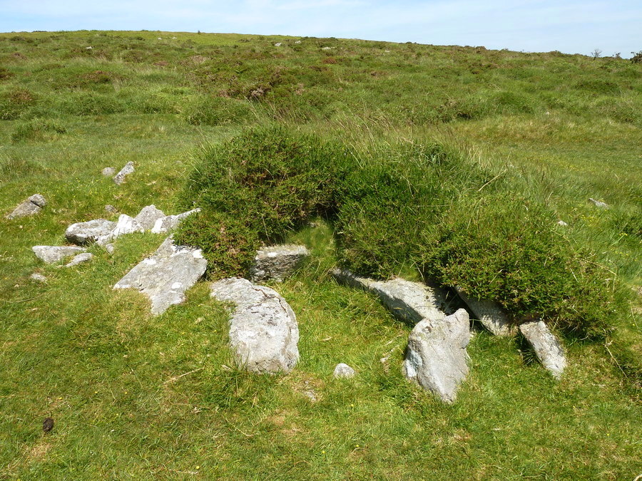
Stanlake Cist submitted by Bladup on 29th Jul 2017. Stanlake Cairn and Cist [SX56427085].
(View photo, vote or add a comment)
Log Text: None
Stanlake Settlement
Date Added: 14th Feb 2020
Site Type: Ancient Village or Settlement
Country: England (Devon)
Visited: Yes on 23rd Mar 2013. My rating: Condition 4 Ambience 5 Access 4

Stanlake Settlement submitted by AngieLake on 29th May 2019. With the men out of the way we can see the abundance of lovely bluebells inside the hut circle on this sunny, but very windy, 14 May!
(View photo, vote or add a comment)
Log Text: A true palimpsest with remains of different periods all jumbled up together. At one point a prehistoric round house wall is overlain by a medieval field boundary which in turn underlies a post-medieval wall. Truly amazing. This is the sort of thing that you usually only see on excavations.
Stannon stone setting
Date Added: 25th Jan 2019
Site Type: Standing Stones
Country: England (Cornwall)
Visited: Yes on 31st Jul 2018. My rating: Condition 3 Ambience 4 Access 5

Stannon stone setting submitted by TheCaptain on 28th Mar 2005. Stannon stone circle seen looking southeastwards from the strange little row of four outliers at SX12518007.
(View photo, vote or add a comment)
Log Text: Car parking is available at SX 12330 80127. From here it is a short walk to the row and adjacent stone circle.
Stanton Drew
Date Added: 16th Feb 2020
Site Type: Stone Circle
Country: England (Somerset)
Visited: Yes on 2nd Mar 2016. My rating: Condition 3 Ambience 5 Access 4
Stanton Drew Great Circle submitted by JJ on 6th Oct 2003. Aerial photo copyright JJ Evendon
(View photo, vote or add a comment)
Log Text: None
