<< Our Photo Pages >> Walkhampton Enclosed Settlement - Ancient Village or Settlement in England in Devon
Submitted by davep on Wednesday, 27 July 2016 Page Views: 2299
Multi-periodSite Name: Walkhampton Enclosed SettlementCountry: England County: Devon Type: Ancient Village or Settlement
Nearest Town: Princetown
Map Ref: SX56747286
Latitude: 50.537919N Longitude: 4.022991W
Condition:
| 5 | Perfect |
| 4 | Almost Perfect |
| 3 | Reasonable but with some damage |
| 2 | Ruined but still recognisable as an ancient site |
| 1 | Pretty much destroyed, possibly visible as crop marks |
| 0 | No data. |
| -1 | Completely destroyed |
| 5 | Superb |
| 4 | Good |
| 3 | Ordinary |
| 2 | Not Good |
| 1 | Awful |
| 0 | No data. |
| 5 | Can be driven to, probably with disabled access |
| 4 | Short walk on a footpath |
| 3 | Requiring a bit more of a walk |
| 2 | A long walk |
| 1 | In the middle of nowhere, a nightmare to find |
| 0 | No data. |
| 5 | co-ordinates taken by GPS or official recorded co-ordinates |
| 4 | co-ordinates scaled from a detailed map |
| 3 | co-ordinates scaled from a bad map |
| 2 | co-ordinates of the nearest village |
| 1 | co-ordinates of the nearest town |
| 0 | no data |
Internal Links:
External Links:
I have visited· I would like to visit
SandyG visited on 2nd Apr 2013 - their rating: Cond: 3 Amb: 5 Access: 3
")
Outside the enclosure to the west are five further huts of similar dimensions - again one of these shows sign of alteration. Under moorland grass. The site was excavated in 1897 by Burnard and Baring-Gould.
See also NMR record: SX 57 SE 41(Pastscape Monument No. 440143) and HER record: 4964.
Update December 2019: This site is featured on the Prehistoric Dartmoor Walks (PDW) website - see their entries for the Walkhampton Enclosed Settlement and the Walkhampton and Yes Tor Bottom Settlements.
In addition to the links for Pastscape and the Devon and Dartmoor HER given above, this site is also scheduled as Historic England List ID 1019587 (Partially enclosed stone hut circle settlement south of Foggintor Quarries, 1140m ENE of Criptor).
You may be viewing yesterday's version of this page. To see the most up to date information please register for a free account.
")
Do not use the above information on other web sites or publications without permission of the contributor.
Nearby Images from Geograph Britain and Ireland:

©2022(licence)
©2021(licence)
©2021(licence)

©2014(licence)
©2008(licence)
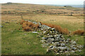
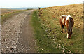
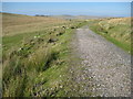
The above images may not be of the site on this page, they are loaded from Geograph.
Please Submit an Image of this site or go out and take one for us!
Click here to see more info for this site
Nearby sites
Key: Red: member's photo, Blue: 3rd party photo, Yellow: other image, Green: no photo - please go there and take one, Grey: site destroyed
Download sites to:
KML (Google Earth)
GPX (GPS waypoints)
CSV (Garmin/Navman)
CSV (Excel)
To unlock full downloads you need to sign up as a Contributory Member. Otherwise downloads are limited to 50 sites.
Turn off the page maps and other distractions
Nearby sites listing. In the following links * = Image available
987m ENE 74° Meavy Head Settlement Ancient Village or Settlement (SX577731)
1.2km SW 227° Ingra Tor Cist* Cairn (SX5587272083)
1.2km SSE 150° Black Tor Outcrop* Rock Outcrop (SX57337177)
1.4km NW 311° King's Tor* Rock Outcrop (SX557738)
1.4km S 187° Leeden Tor* Stone Row / Alignment (SX5652271474)
1.4km SSE 164° Black Tor (Meavy)* Multiple Stone Rows / Avenue (SX5710271463)
1.5km E 95° Hart Tor North ring cairn* Ring Cairn (SX5819872694)
1.5km SE 141° Hart Tor north rows* Multiple Stone Rows / Avenue (SX57637169)
1.5km SE 145° Hart Tor SW Cairn* Cairn (SX57567164)
1.5km ESE 104° Hart Tor North prehistoric settlement* Ancient Village or Settlement (SX5818572466)
1.5km SE 138° Hart Tor North circle* Stone Circle (SX57717171)
1.5km SE 140° Hart Tor south row* Stone Row / Alignment (SX57687168)
1.5km S 169° Black Tor Stone Row Cairns (Stanlake)* Cairn (SX5699071370)
1.5km SE 138° Hart Tor South Terminal Cairn* Cairn (SX57727170)
1.6km ESE 121° Hart Tor.* Rock Outcrop (SX58107200)
1.6km NNW 345° Yellowmeade Farm* Cairn (SX56357446)
1.7km SE 145° Raddick Hill North* Ancient Village or Settlement (SX57657147)
1.7km SW 232° Routrundle North* Ancient Village or Settlement (SX55387185)
1.7km SSE 168° Stanlake Settlement* Ancient Village or Settlement (SX57057115)
1.7km SSW 203° Leeden Hill* Standing Stone (Menhir) (SX56017128)
1.9km SW 231° Routrundle South* Ancient Village or Settlement (SX55257172)
2.0km S 190° Leeden Tor South Cairn* Cairn (SX56327089)
2.0km S 188° Stanlake Cist* Cist (SX5641670852)
2.1km SE 138° Cramber Cairn* Cairn (SX58087130)
2.1km SE 144° Raddick Hill Cist* Cist (SX57937116)
View more nearby sites and additional images


 We would like to know more about this location. Please feel free to add a brief description and any relevant information in your own language.
 Wir möchten mehr über diese Stätte erfahren. Bitte zögern Sie nicht, eine kurze Beschreibung und relevante Informationen in Deutsch hinzuzufügen.
 Nous aimerions en savoir encore un peu sur les lieux. S'il vous plaît n'hesitez pas à ajouter une courte description et tous les renseignements pertinents dans votre propre langue.
 Quisieramos informarnos un poco más de las lugares. No dude en añadir una breve descripción y otros datos relevantes en su propio idioma.