<< Text Pages >> Brookhouse Farm - Ancient Village or Settlement in England in Cheshire
Submitted by vicky on Monday, 23 February 2004 Page Views: 8014
Multi-periodSite Name: Brookhouse FarmCountry: England
NOTE: This site is 2.85 km away from the location you searched for.
County: Cheshire Type: Ancient Village or Settlement
Nearest Town: Tarvin Nearest Village: Bruen Stapleford
Map Ref: SJ497639 Landranger Map Number: 117
Latitude: 53.169824N Longitude: 2.753907W
Condition:
| 5 | Perfect |
| 4 | Almost Perfect |
| 3 | Reasonable but with some damage |
| 2 | Ruined but still recognisable as an ancient site |
| 1 | Pretty much destroyed, possibly visible as crop marks |
| 0 | No data. |
| -1 | Completely destroyed |
| 5 | Superb |
| 4 | Good |
| 3 | Ordinary |
| 2 | Not Good |
| 1 | Awful |
| 0 | No data. |
| 5 | Can be driven to, probably with disabled access |
| 4 | Short walk on a footpath |
| 3 | Requiring a bit more of a walk |
| 2 | A long walk |
| 1 | In the middle of nowhere, a nightmare to find |
| 0 | No data. |
| 5 | co-ordinates taken by GPS or official recorded co-ordinates |
| 4 | co-ordinates scaled from a detailed map |
| 3 | co-ordinates scaled from a bad map |
| 2 | co-ordinates of the nearest village |
| 1 | co-ordinates of the nearest town |
| 0 | no data |
Internal Links:
External Links:
Ancient Settlement in Cheshire
During the construction of a gas pipeline by Transco from Birch Heath to Mickle Trafford in the west of Cheshire, this prehistoric settlement dating from the Middle Bronze Age to Late Iron Age (circa 1000BC to 50BC) was uncovered in the parish of Bruen Stapleford, near Brook House Farm. Subsequent excavations were carried out by Network Archaeology and funded by Transco.
Further details can be found in Fairburn, N., Bonner, D., Carruthers, W.J., Gale, G.R., Matthews, K.J., Morris, E. and Ward, M. “Brook House Farm, Bruen Stapleford – Excavation of a First Millennium BC Settlement”, Journal of the Chester Archaeological Society volume 77 (2002) and 'Prehistoric Cheshire' by V & P Morgan, Landmark Publishing (2004).
You may be viewing yesterday's version of this page. To see the most up to date information please register for a free account.
Do not use the above information on other web sites or publications without permission of the contributor.
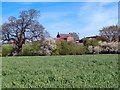
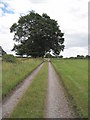
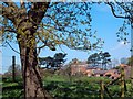
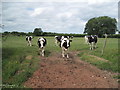
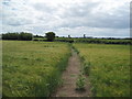
Nearby Images from Geograph Britain and Ireland:
©2006(licence)
©2010(licence)
©2006(licence)
©2010(licence)
©2010(licence)
The above images may not be of the site on this page, they are loaded from Geograph.
Please Submit an Image of this site or go out and take one for us!
Click here to see more info for this site
Nearby sites
Key: Red: member's photo, Blue: 3rd party photo, Yellow: other image, Green: no photo - please go there and take one, Grey: site destroyed
Download sites to:
KML (Google Earth)
GPX (GPS waypoints)
CSV (Garmin/Navman)
CSV (Excel)
To unlock full downloads you need to sign up as a Contributory Member. Otherwise downloads are limited to 50 sites.
Turn off the page maps and other distractions
Nearby sites listing. In the following links * = Image available
5.0km NE 43° Kelsborrow Castle* Hillfort (SJ5315567509)
5.5km E 97° Salterswell* Holy Well or Sacred Spring (SJ552632)
5.9km ENE 59° Whistlebitch Well* Holy Well or Sacred Spring (SJ548669)
6.2km ENE 67° High Billinge* Round Barrow(s) (SJ5548066242)
6.2km SE 138° Beeston Castle* Hillfort (SJ538592)
6.3km NE 38° Delamere Stone Circle (SJ536688)
7.3km ENE 64° Seven Lows Round Barrow(s) (SJ56336703)
7.4km NNW 327° St Plegmund's Well* Holy Well or Sacred Spring (SJ457701)
7.7km ENE 65° Seven Lows* Round Barrow(s) (SJ567671)
7.7km SE 143° Peckforton Mere* Ancient Village or Settlement (SJ543577)
7.8km NE 45° Castle Ditch Eddisbury* Hillfort (SJ553694)
8.7km W 269° Heronbridge Roman Strip Settlement Ancient Village or Settlement (SJ410639)
8.7km WNW 285° Billy Hobby's Well* Holy Well or Sacred Spring (SJ4127766202)
8.7km ESE 117° Robin Hood's Tump* Round Barrow(s) (SJ575599)
8.8km ENE 63° Oakmere* Ancient Village or Settlement (SJ576678)
9.0km SSW 194° St Winefride's (Clutton)* Holy Well or Sacred Spring (SJ47395524)
9.0km WNW 284° St John the Baptist Church, Chester* Ancient Cross (SJ40916613)
9.1km WNW 284° Roman Amphitheatre (Chester)* Ancient Temple (SJ40836616)
9.2km WNW 283° Roman Garden & Hypocaust (Chester)* Ancient Village or Settlement (SJ40786607)
9.2km W 280° Chester Minerva shrine* Ancient Temple (SJ40676561)
9.4km WNW 282° Grosvenor Museum* Museum (SJ40466595)
9.5km WNW 284° Dewa Roman Experience* Museum (SJ405663)
9.6km NNE 25° Glead Hill Cob Round Barrow(s) (SJ538726)
10.2km NNE 21° Castle Cob* Round Barrow(s) (SJ535734)
10.4km NE 44° Gallowsclough Cob* Round Barrow(s) (SJ570713)
View more nearby sites and additional images


 We would like to know more about this location. Please feel free to add a brief description and any relevant information in your own language.
 Wir möchten mehr über diese Stätte erfahren. Bitte zögern Sie nicht, eine kurze Beschreibung und relevante Informationen in Deutsch hinzuzufügen.
 Nous aimerions en savoir encore un peu sur les lieux. S'il vous plaît n'hesitez pas à ajouter une courte description et tous les renseignements pertinents dans votre propre langue.
 Quisieramos informarnos un poco más de las lugares. No dude en añadir una breve descripción y otros datos relevantes en su propio idioma.